

Striking example of this American Airlines promotional map, introducing the upcoming launch of Stage II of the 707 Astrojet. First introduced in 1959, the Boeing 707 "Astrojet" would become the backbone of commercial aviation. The present map was...
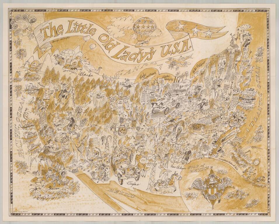
Marvelous whimsical map of the United States. Includes a charming and equally whimsical colored folder. The maps were part of the original publications of the Pisani Press of San Francisco (a division of Pisani Printing Company, then of 485 Brannan...
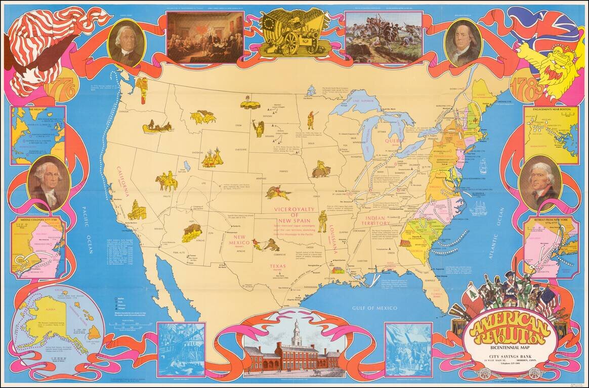
Fine large format map of the United States, featuring vignettes of historical events during the American Revolution and a 1970s style art motif. In addition to Revolutionary War related facts, the map shows information on the California Missions, the...
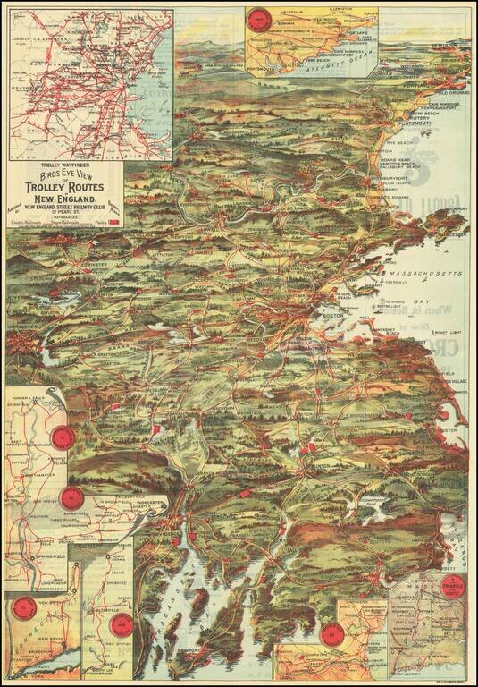
Attractive color-lithographed bird's-eye view of the eastern part of New England, showing the trolley routes in the area roughly bounded by New Bedford, Providence, Worcester, Concord, and Portland. The map is an impressive work of popular color...
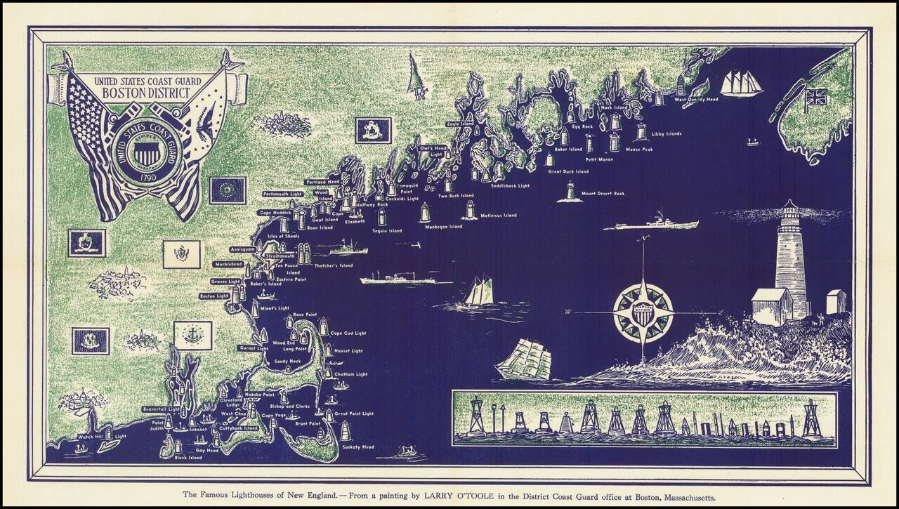
Interesting pictorial map of the coast of New England. Includes an image of "The Famous Lighthouses of New England. From a painting by Larry O'Toole."
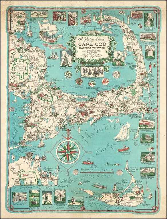
Fascinating pictorial map of Cape Cod, Martha's Vineyard and Nantucket, attributed to Ernest Dudly Chase and first issued in 1949, which would later be revised by his wife, Clara Chase in 1956 and circa 1960. Fine pictographic map of the Cape Cod...
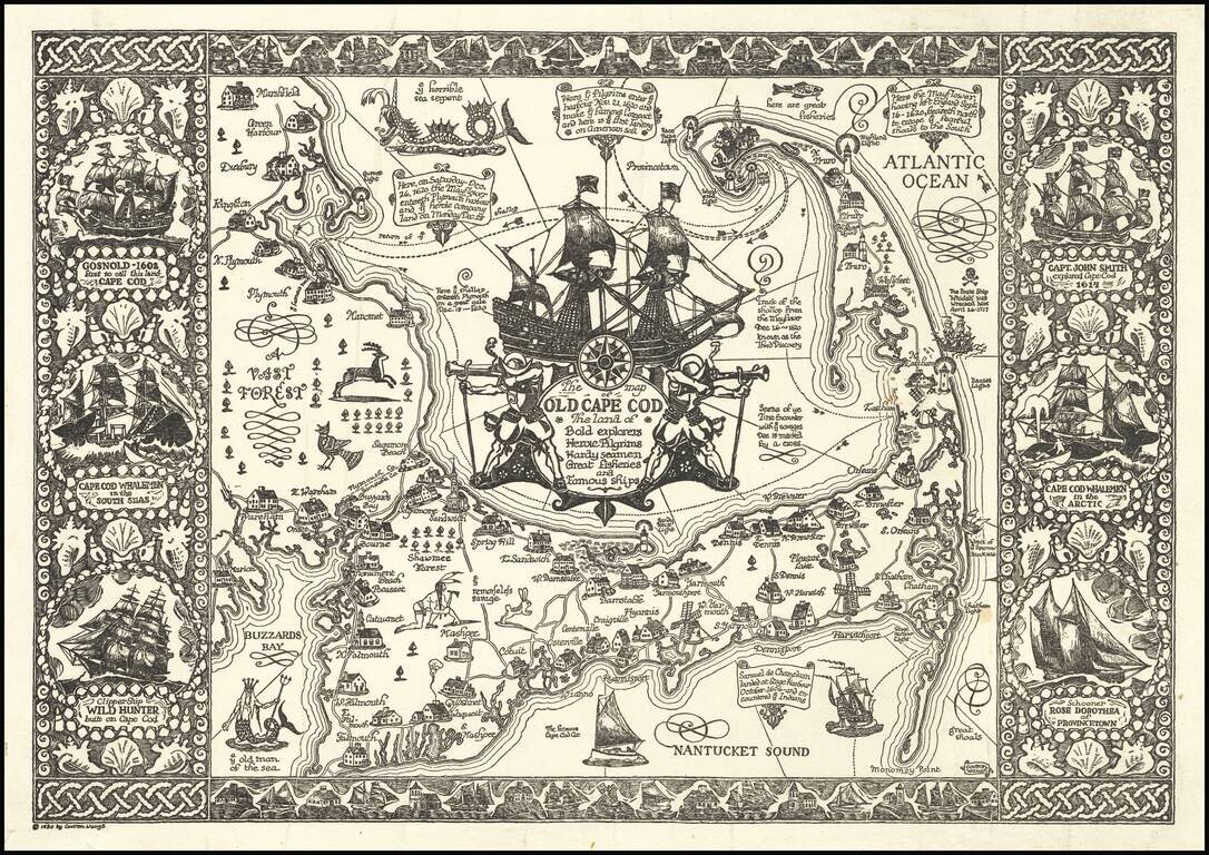
Fine example of Waugh's 1930 pictorial map of Cape Cod and part of the South Shore of Massachusetts including Plymouth, Buzzard Bay, and Duxbury. Waugh elegantly illustrate important towns and roads, while integrating a host of historical vignettes,...
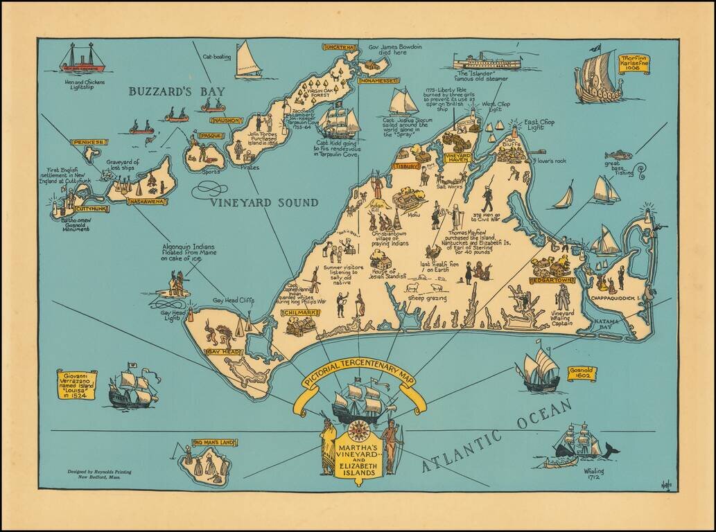
Decorative map of Martha's Vineyard and the Elizabeth Islands, celebrating is 300 year anniversary in 1630. Includes a number of lively historical vignettes and drawings and explanatory text. The maker is listed as Noble. We note several...
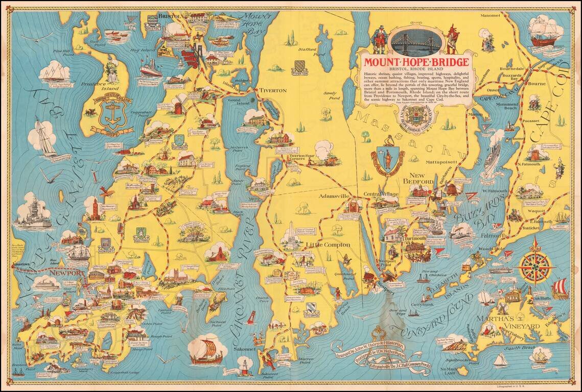
Scarce pictorial map of Mount Hope Bridge and vicinity, published in Bristol, Rhode Island by the Mount Hope Bridge Corporation. The map is "Arranged" by John W. Haley, Rhode Island Historian, designed by H.W. Hetherington and lithographed by the J.C....
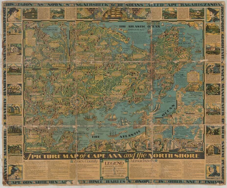
Finely illustrated pictorial map of Cape Ann area of northern coastal area of Massachusetts. Timelines and noteworthy feature descriptions border the map.
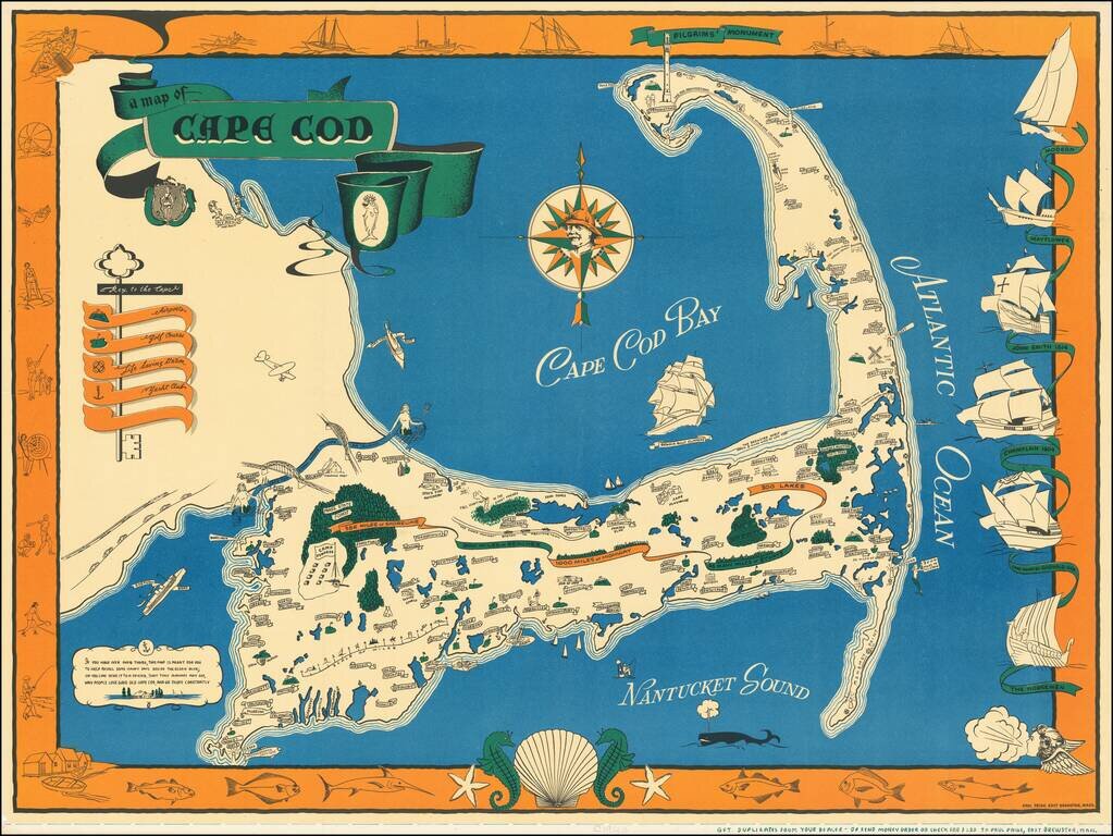
One of the best vintage pictorial maps of Cape Cod, printed in black, blue, green, and orange. The mapmaker is Paul Paige of East Brewster, Mass. The "Key to the Cape" incorporates an actual key and illustrates Airports, Golf Courses, Life Saving...
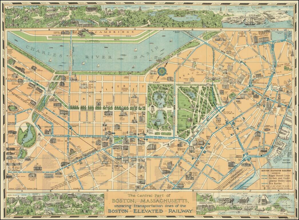
Decorative pictorial map of Boston, with 3 large inset views of various parts of the City. The map shows streets, parks, city blocks, Rapid Transit Lines, surface and underground trolley lines and bus routes, city landmarks, including hotels, Fenway...
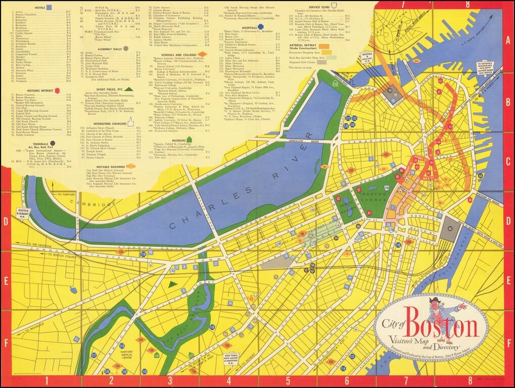
Lively tourist map of Boston, published by Zorigian Studios in Boston. The map was published under the direction of then Mayor, John B. Hynes, who served as mayor of Boston from 1950 to 1960.
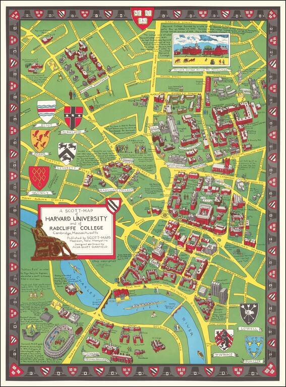
Decorative vintage pictorial birdseye view of the campus and grounds at Harvard, made by Alva Scott Garfield in 1959. The buildings on the Harvard campus at the time are pictured in a bird's eye view style. Note that Leverett Towers at the lower right...
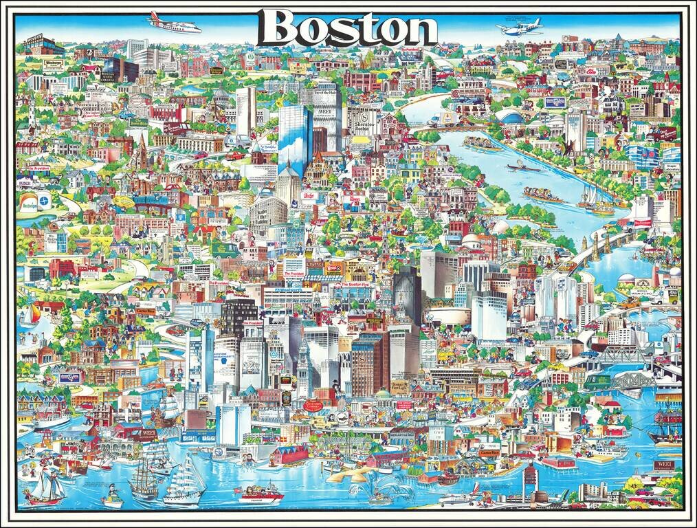
Richly embellished advertising oriented pictorial map / birdseye view of the Boston area, published by Archar Inc. of Canada. Packed with advertising for local businesses, the images shows buildings, tourism and other landmarks, recreational...
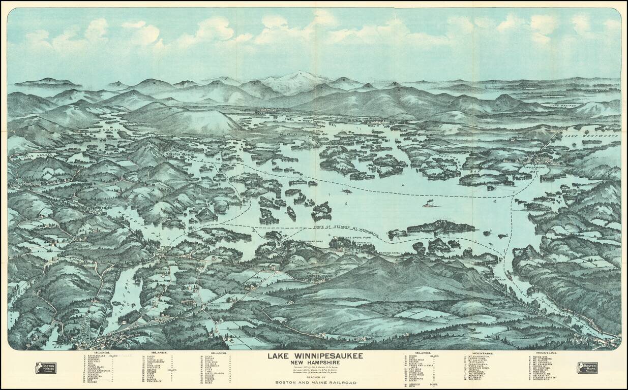
Fine birdseye view style map of Lake Winnipesaukee, published by George Walker & Co, for the Boston & Maine Railroad. The map provides a striking view of the Lake, with major islands, bays and other features named. The key at the bottom of...