logo

1953. (Korea) Stars & Stripes Map of The War

  • (Korea)  Stars & Stripes Map of The War

(Korea) Stars & Stripes Map of The War information:

Year of creation: 
Resolution size (pixels): 
 2266x3104 px
Disk Size: 
 1.3959MiB
Number of pages: 
 1
Place: 
 Tokyo

Print information. Print size (Width x height in inches):
Printing at 72 dpi 
  31.47 х 43.11
Printing at 150 dpi 
 15.11 х 20.69
Printing at 300 dpi 
 7.55 х 10.35

An example of detailing the file of this map of in a printable high-resolution:

Click to open in high resolution (open in new tab).
Attention! this is just the central piece (central area 960x960 px) of the map file!
This is an example, so that you can see and study the level of detail of a given map. The entire Map will be fully available after payment!

(Korea)  Stars & Stripes Map of The War

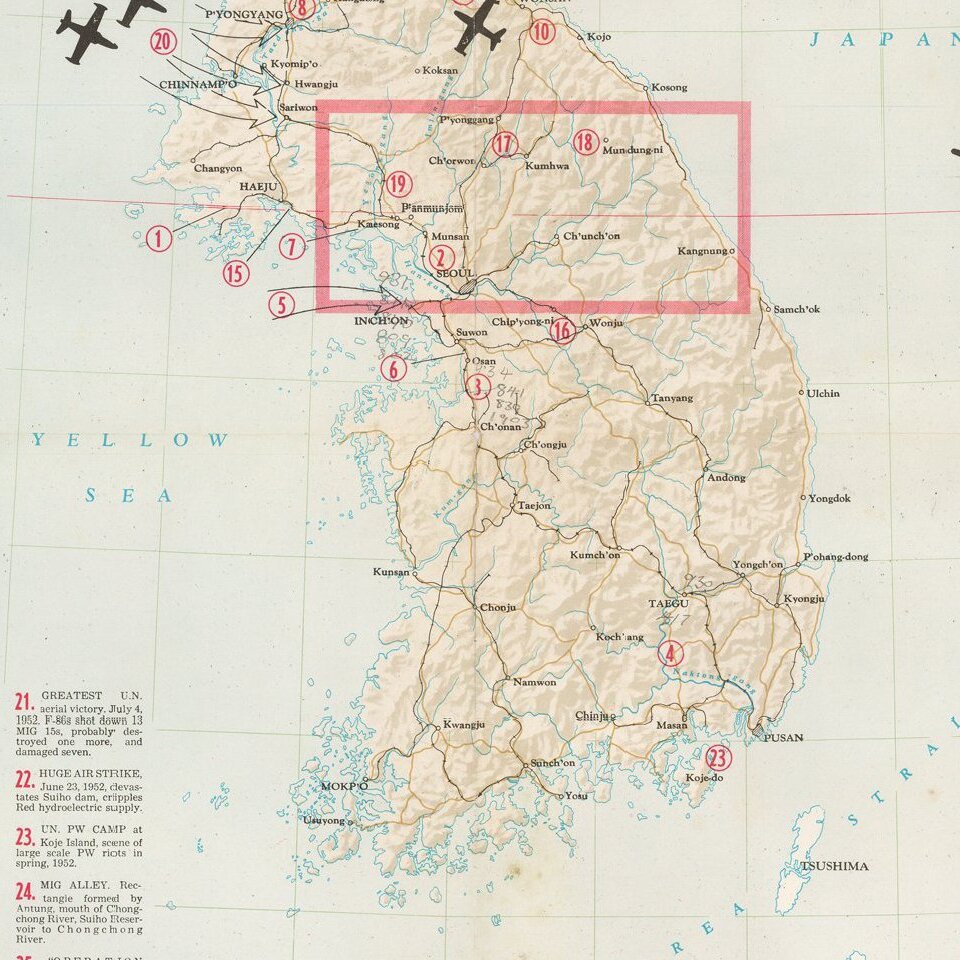
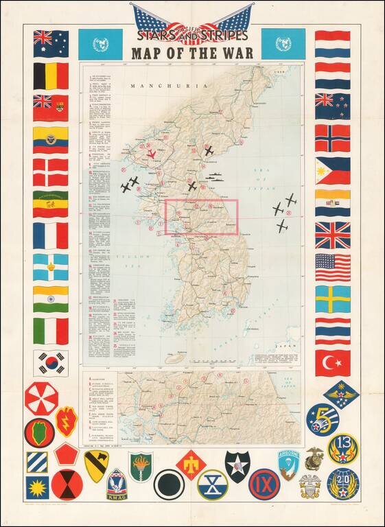
Decorative map of Korea, intended for distribution to soldiers stationed in Korea in the 1950s.

Shaded relief with key military features locations marked and described.

Includes a decorative border of flags of allies and insignia of military units.


Special conditions for students!

If you are a student, write to us in telegram: @antiquemaps and indicate what material you need and for what work you need a map in high detail. We are ready to provide material on special terms. For students only!

Item information:

Year of creation:
Size:
2266x3104 px
Disk:
1.3959MiB
Number of pages:
1
Place:
Tokyo
Author:
Pacific Stars & Stripes.
$14.99

Related item