logo

1935. The Hawaiian Islands

  • The Hawaiian Islands

Map size in jpg-format: 45.7045MiB

Download "The Hawaiian Islands", in high resolution.

The Hawaiian Islands information:

Year of creation: 
Resolution size (pixels): 
 14157x5483 px
Disk Size: 
 45.7045MiB
Number of pages: 
 1
Place: 
 New York
Author: 

Print information. Print size (Width x height in inches):
Printing at 72 dpi 
  196.63 х 76.15
Printing at 150 dpi 
 94.38 х 36.55
Printing at 300 dpi 
 47.19 х 18.28

An example of detailing the file of this map of in a printable high-resolution:

Click to open in high resolution (open in new tab).
Attention! this is just the central piece (central area 960x960 px) of the map file!
This is an example, so that you can see and study the level of detail of a given map. The entire Map will be fully available after payment!

The Hawaiian Islands

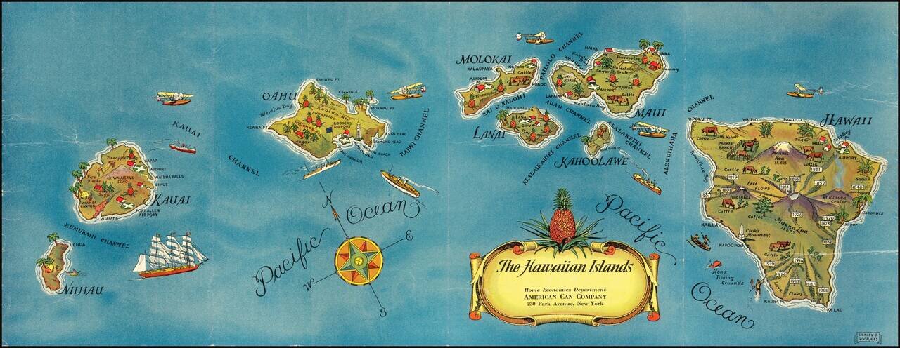
Pictorial map of Hawaii, published for the American Can Company.

Each of the Hawaiian Islands includes monuments illustrating indigenous crops (lots of pineapples!), live stock, volcanoes, airports and other points of local interest.

This is the separately published artwork, which was also used for a book on Hawaii.


Special conditions for students!

If you are a student, write to us in telegram: @antiquemaps and indicate what material you need and for what work you need a map in high detail. We are ready to provide material on special terms. For students only!

Item information:

Year of creation:
Size:
14157x5483 px
Disk:
45.7045MiB
Number of pages:
1
Place:
New York
Author:
Stephen J. Voorhies.
$14.99

Related item