
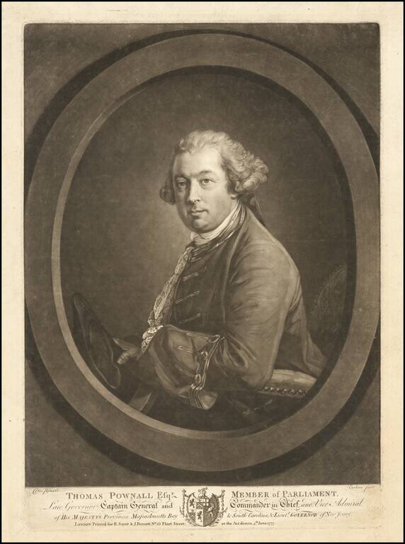
Rare mezzotint portrait of Thomas Pownall, one of the most important figures in the later Colonial history of the British Colonies in North America. Mezzotint portrait engraved by Richard Earlom after a painting by Francis Cotes. Thomas Pownall was...
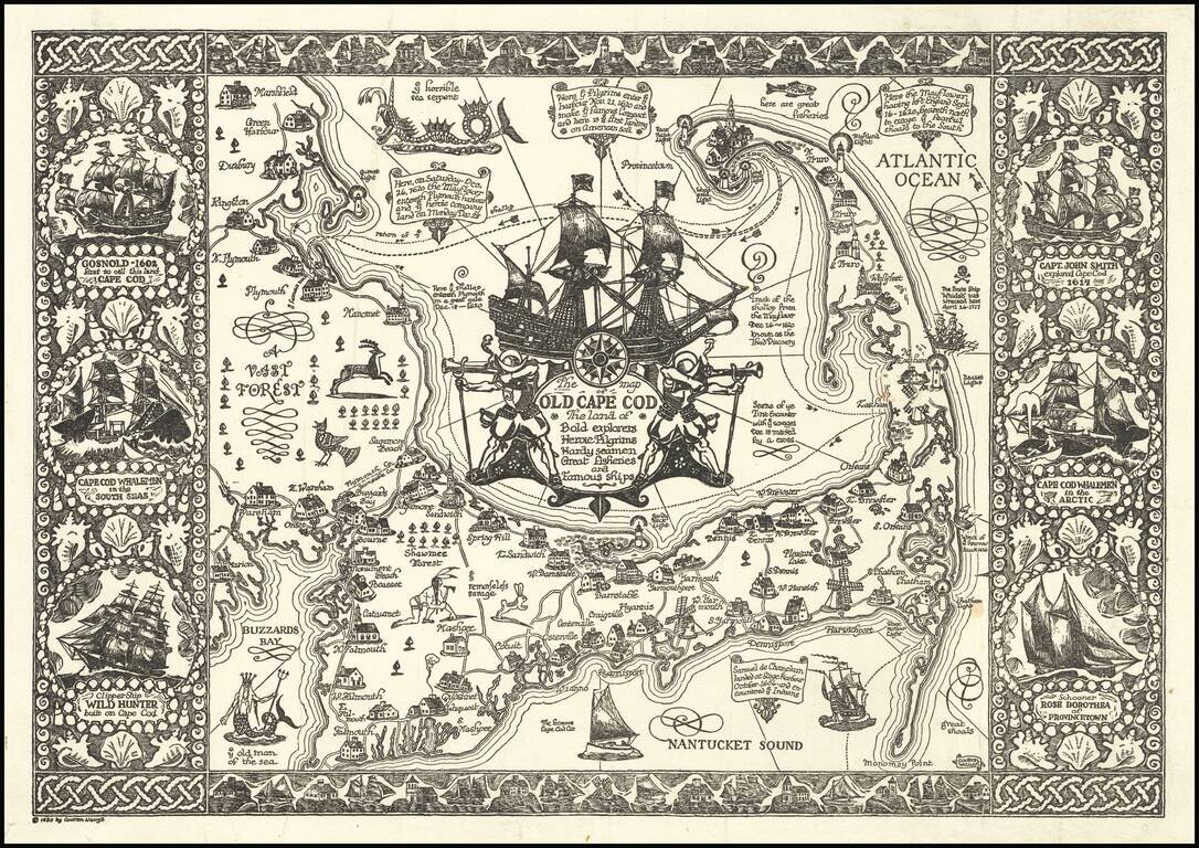
Fine example of Waugh's 1930 pictorial map of Cape Cod and part of the South Shore of Massachusetts including Plymouth, Buzzard Bay, and Duxbury. Waugh elegantly illustrate important towns and roads, while integrating a host of historical vignettes,...
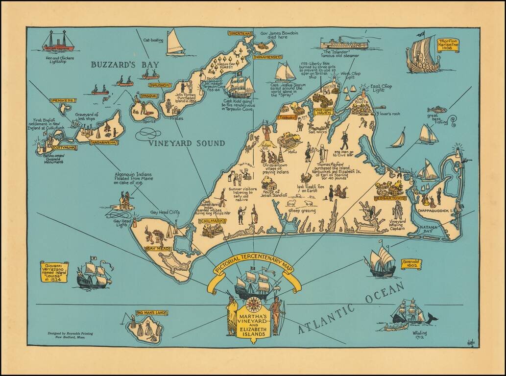
Decorative map of Martha's Vineyard and the Elizabeth Islands, celebrating is 300 year anniversary in 1630. Includes a number of lively historical vignettes and drawings and explanatory text. The maker is listed as Noble. We note several...
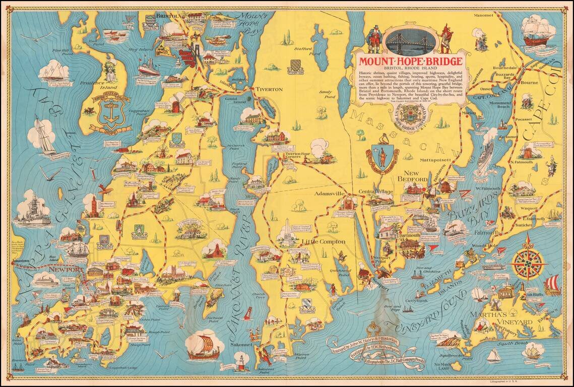
Scarce pictorial map of Mount Hope Bridge and vicinity, published in Bristol, Rhode Island by the Mount Hope Bridge Corporation. The map is "Arranged" by John W. Haley, Rhode Island Historian, designed by H.W. Hetherington and lithographed by the J.C....
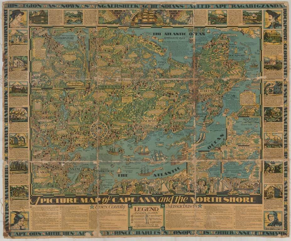
Finely illustrated pictorial map of Cape Ann area of northern coastal area of Massachusetts. Timelines and noteworthy feature descriptions border the map.
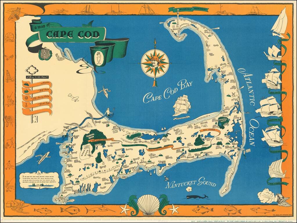
One of the best vintage pictorial maps of Cape Cod, printed in black, blue, green, and orange. The mapmaker is Paul Paige of East Brewster, Mass. The "Key to the Cape" incorporates an actual key and illustrates Airports, Golf Courses, Life Saving...
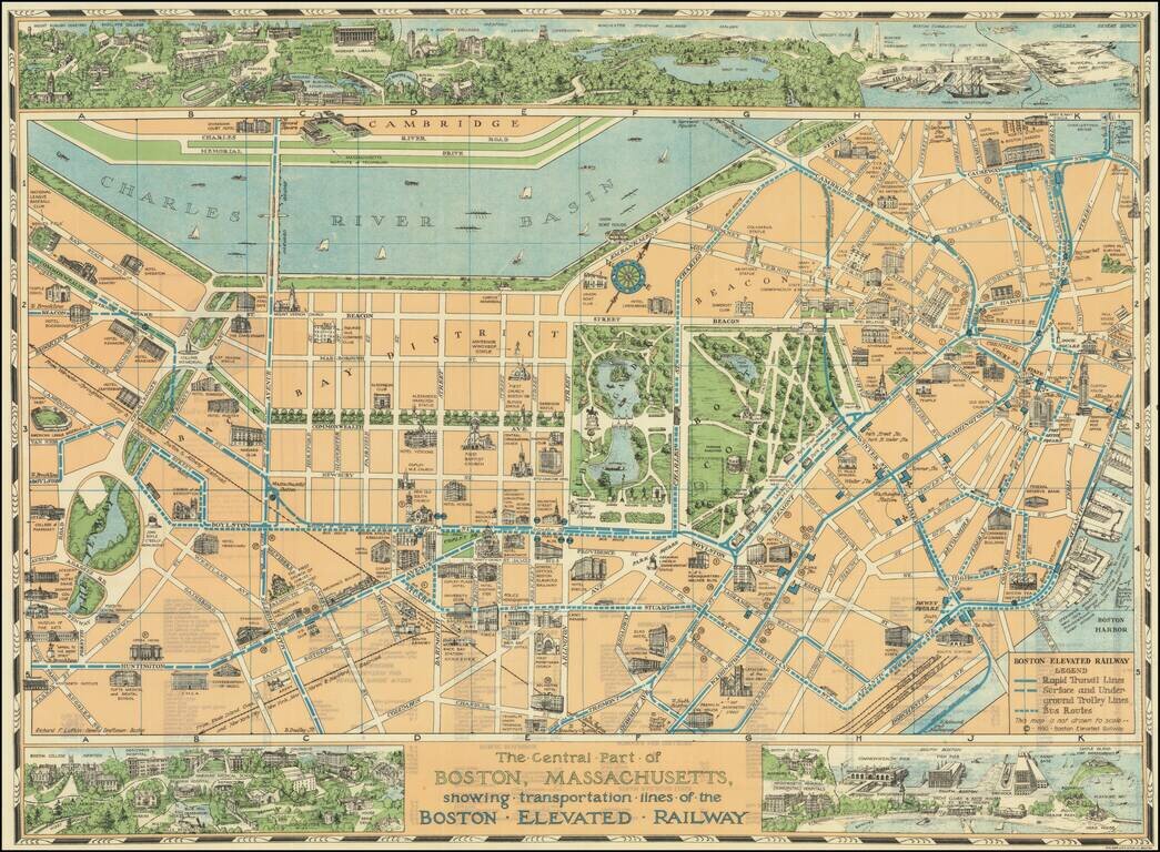
Decorative pictorial map of Boston, with 3 large inset views of various parts of the City. The map shows streets, parks, city blocks, Rapid Transit Lines, surface and underground trolley lines and bus routes, city landmarks, including hotels, Fenway...
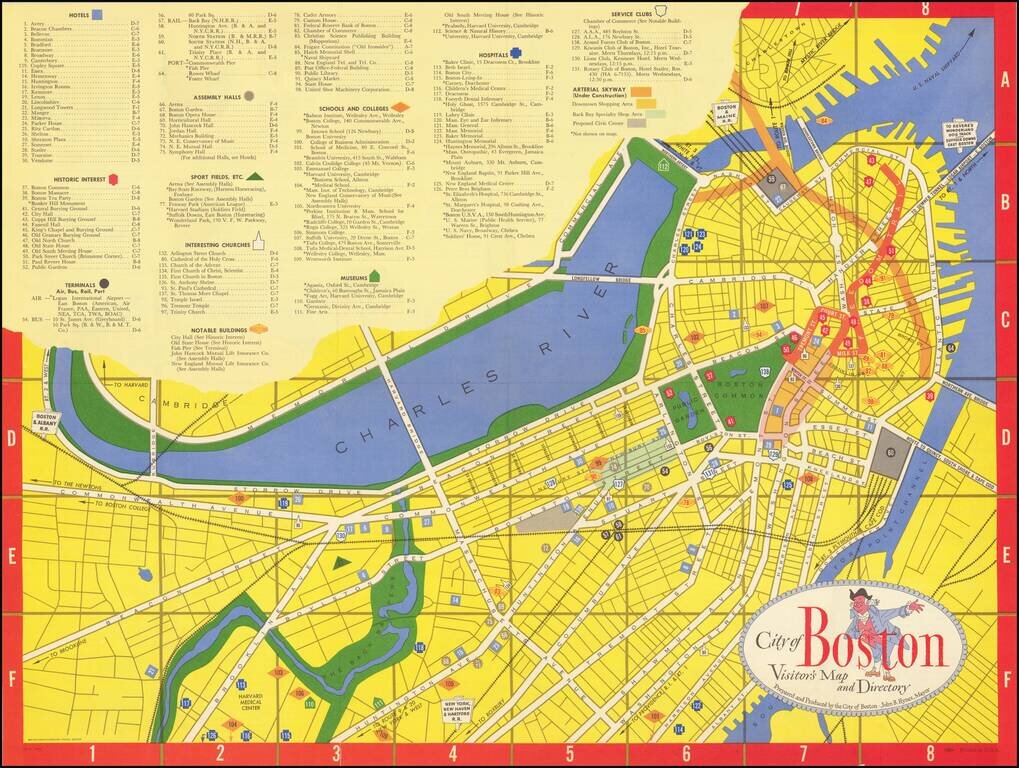
Lively tourist map of Boston, published by Zorigian Studios in Boston. The map was published under the direction of then Mayor, John B. Hynes, who served as mayor of Boston from 1950 to 1960.
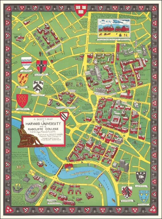
Decorative vintage pictorial birdseye view of the campus and grounds at Harvard, made by Alva Scott Garfield in 1959. The buildings on the Harvard campus at the time are pictured in a bird's eye view style. Note that Leverett Towers at the lower right...
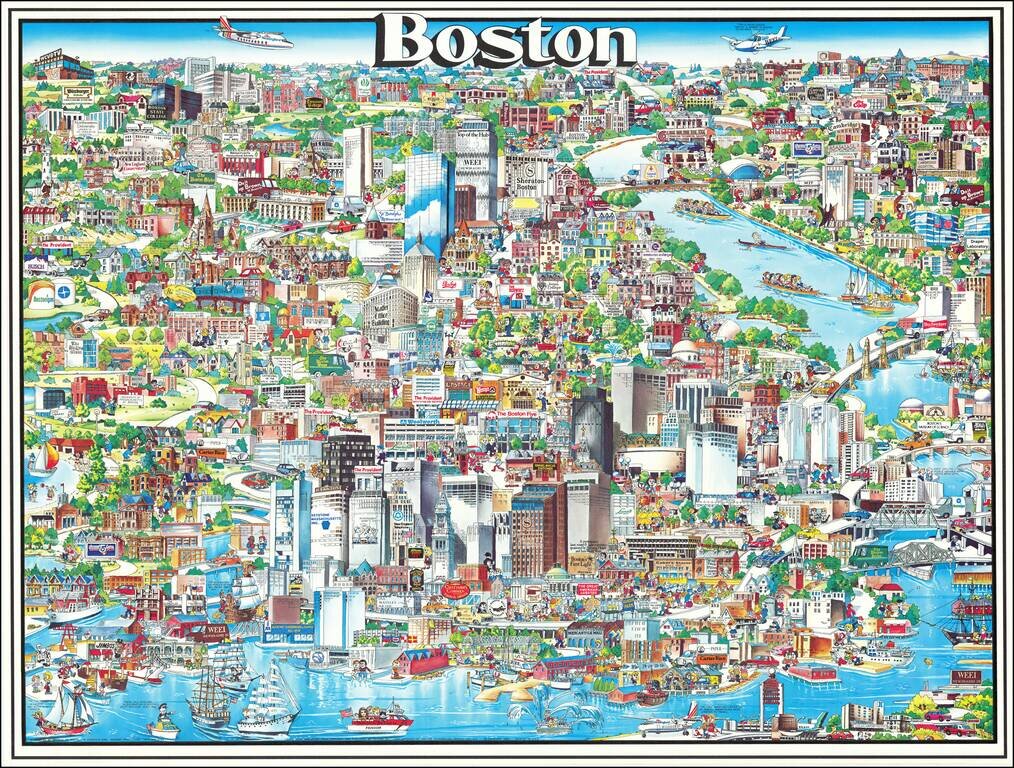
Richly embellished advertising oriented pictorial map / birdseye view of the Boston area, published by Archar Inc. of Canada. Packed with advertising for local businesses, the images shows buildings, tourism and other landmarks, recreational...
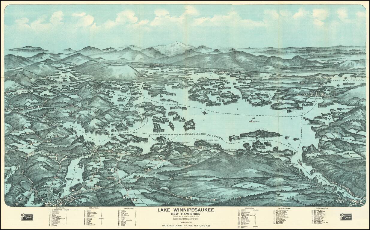
Fine birdseye view style map of Lake Winnipesaukee, published by George Walker & Co, for the Boston & Maine Railroad. The map provides a striking view of the Lake, with major islands, bays and other features named. The key at the bottom of...
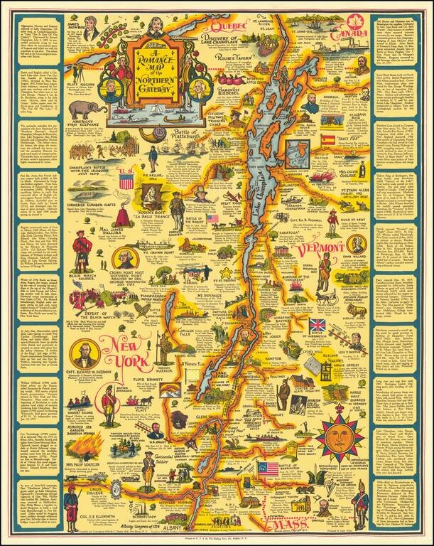
This is the second state of Eleanor Hall's map of the area centered on Lake Champlain, showing the region from northwesternmost Massachussetts to Quebec. The map abounds with pictographs representing historical events, famous figures, industries, and...
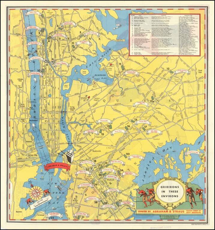
Rare pictorial map of New York showing all of the football stadiums in the city in 1931. The map was published by Brooklyn-based clothier Abraham & Straus to advertise their lines of goods that could be used in the football stands. Key in the...
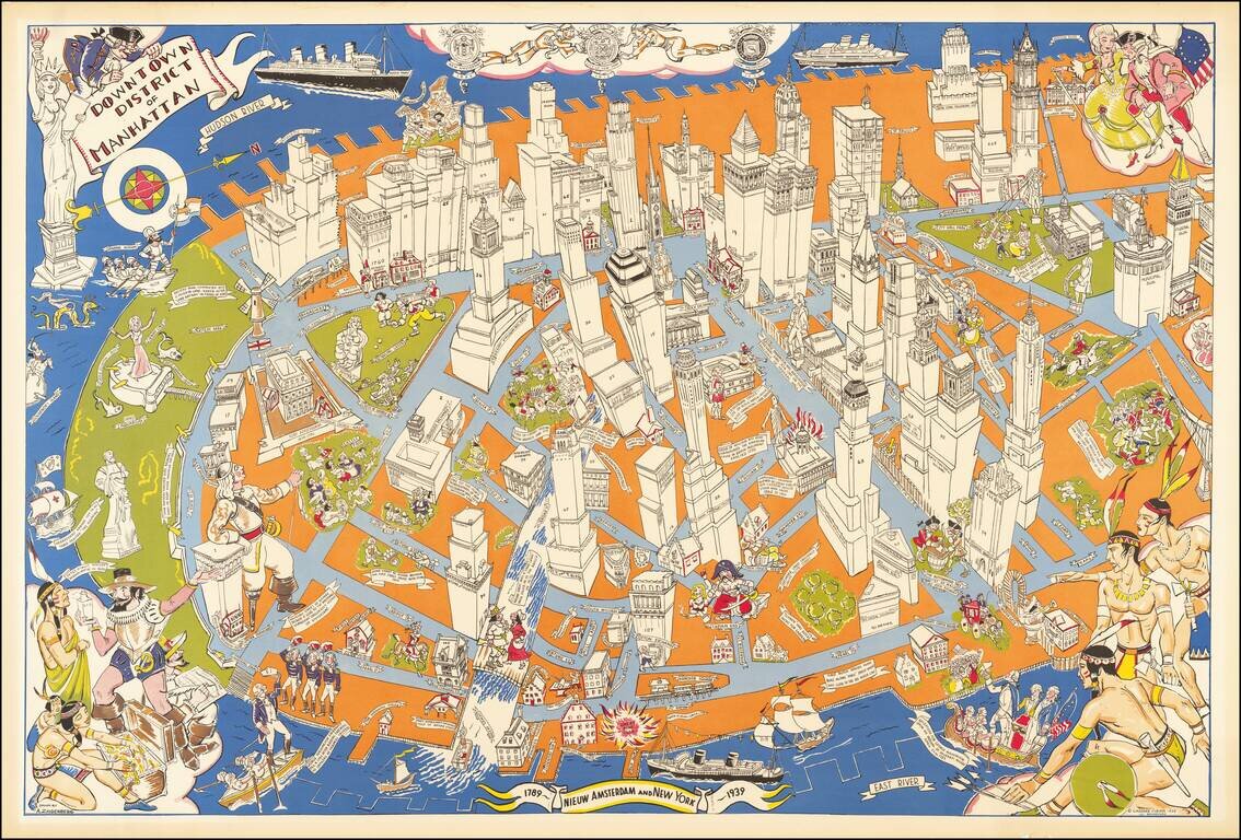
An exceptional example of Arthur Zaidenburg's 1939 map of Lower Manhattan, focusing on the Colonial, Revolutionary, and 19-century history of New York City. Arthur Zaidenburg (1903-1990) worked with Gardner Osborn, the New York historian, to publish...
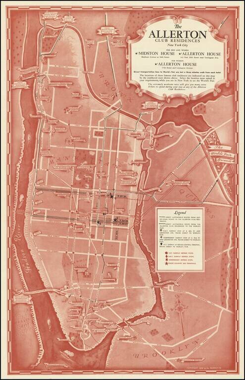
Vintage 1938 pictorial map of Manhattan featuring the hotels of the Allerton Club group. The map's main function is to show people coming from out of town how to reach the hotels through various means. The Allerton Group was founded in the 1920s and...
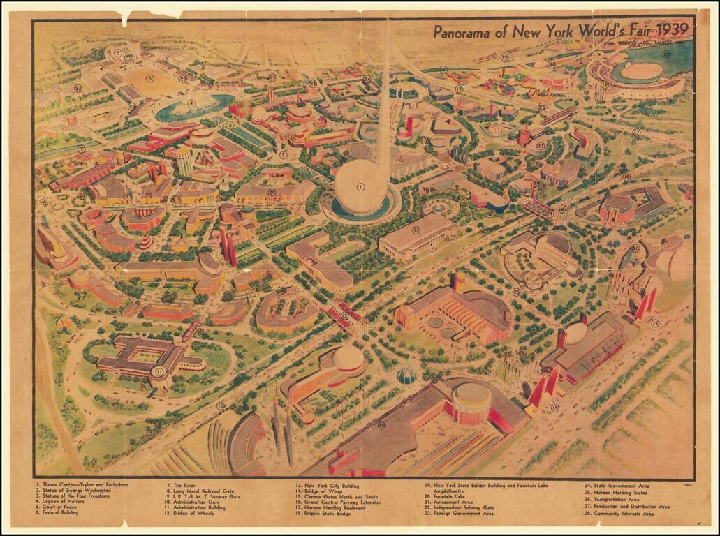
Rare pictorial map of the 1939 New York World's Fair, drawn by John Wenrich. Includes key with 28 points of interest. Rarity This is the first time we've ever seen the map.