
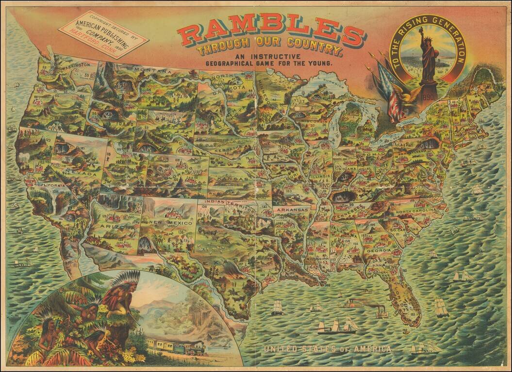
A bright, whimsical chromolithographed map of the United States, designed for a children's game, but wonderful in its own right. The principal cities of the US are depicted, as are natural resources or landmarks. Texas is shown with Indians chasing a...
![[United States] Across the Continent](/map/small/63859.jpg)
Fine example of this early example of Parker Brothers game board, "Across the Continent." This is one of a few color lithographic game boards produced in the 1880s and early 1890s. Includes several railroad routes illustrating the major railroad...
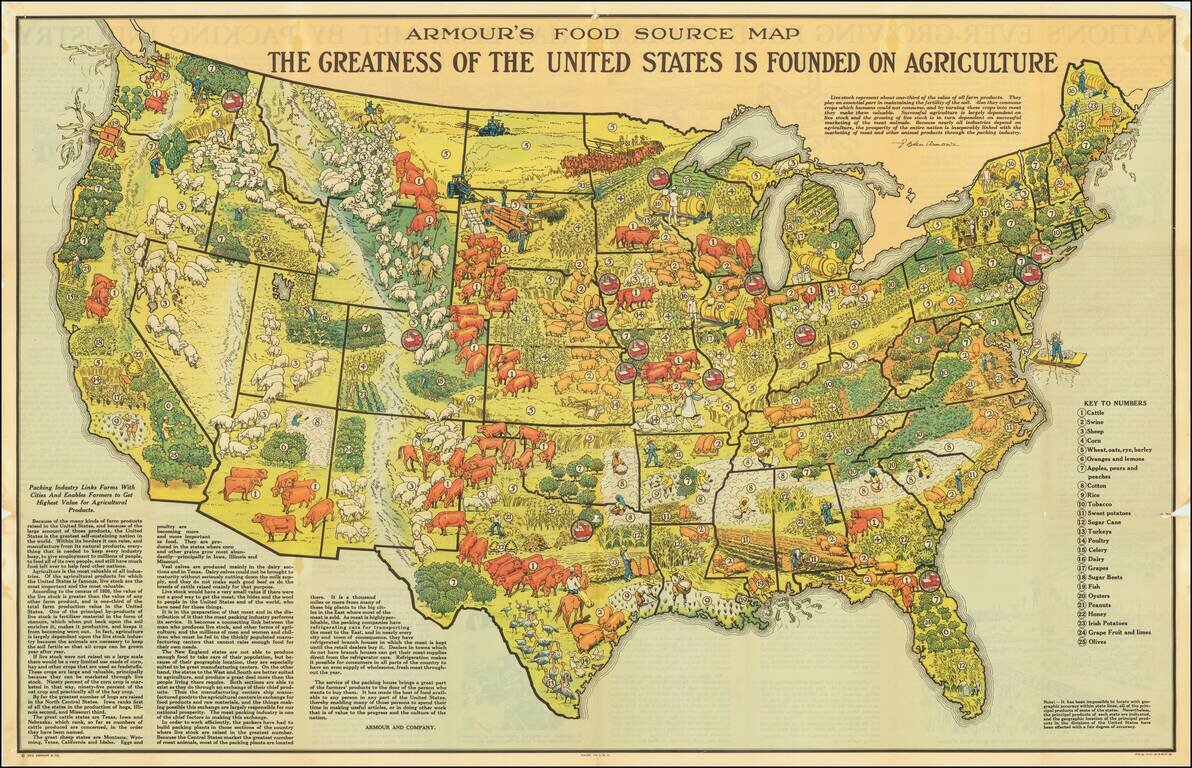
Scarce promotional map published by Armour & Company, displaying and illustrating the agricultural regions of the United States. Includes a marvelous quote from L. Ogden Armour describing the importance of livestock in American Agricultural...

This is an attractive pictorial map of the United States published by the Ford Motor Company as an advertisement for air routes that were supplied in part by their Ford Trimotor aircraft. The map is fascinating, showing domestic and international air...
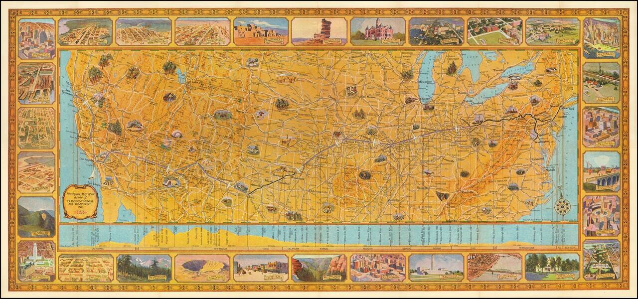
Rare Early Flight Planning Map Finely executed pictorial map of the United States showing the route of Transcontinental Air Transport, embellished by 30 decorative vignettes showing major American cities and points of interest. On the verso is flight...
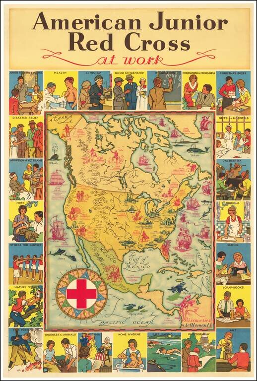
Attractive vintage pictorial map of North America, published by the American Junior Red Cross and with art by H.M. Leslie Rundle. The central map of North America shows early European Settlements (in blue) and Discoveries (in pink) including "Norsemen...

Striking large pictorial map of the United States, produced for the Chicago World's Fair of 1933. The map was executed by Louis Delton Fancher, a well regarded graphic artist for the Great Atlantic & Pacific Tea Company (A & P), as a...
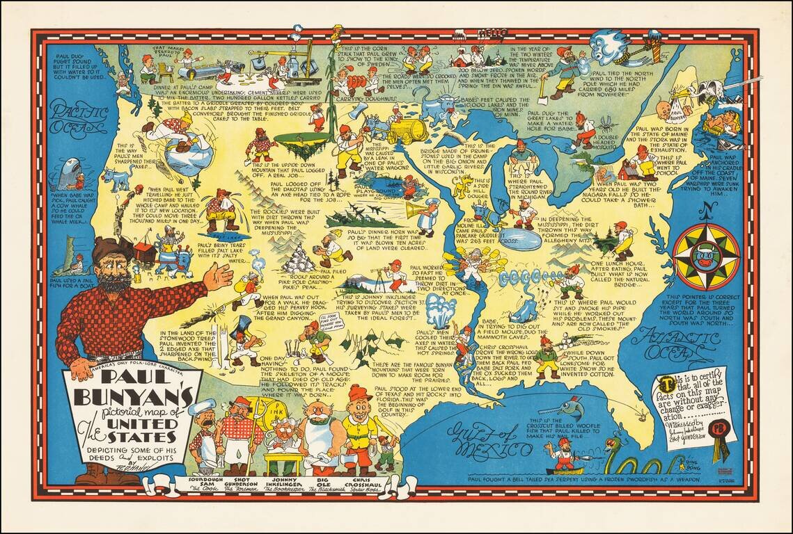
Rare pictorial map of the United States, celebrating the legend of Paul Bunyan. As noted by David Rumsey: Humorous pictorial map by R. D. Handy showing the adventures [of Paul Bunyan] across the United States, with illustrations and descriptive...
![[Come To Dallas] Easy To Reach -- Hard To Leave](/map/small/63387.jpg)
Pictorial map of the United States, focusing on Dallas as the center of the country. The map shows distances from Dallas to many other major cities in the United States. The map was published as part of the centennial of the Republic of Texas...
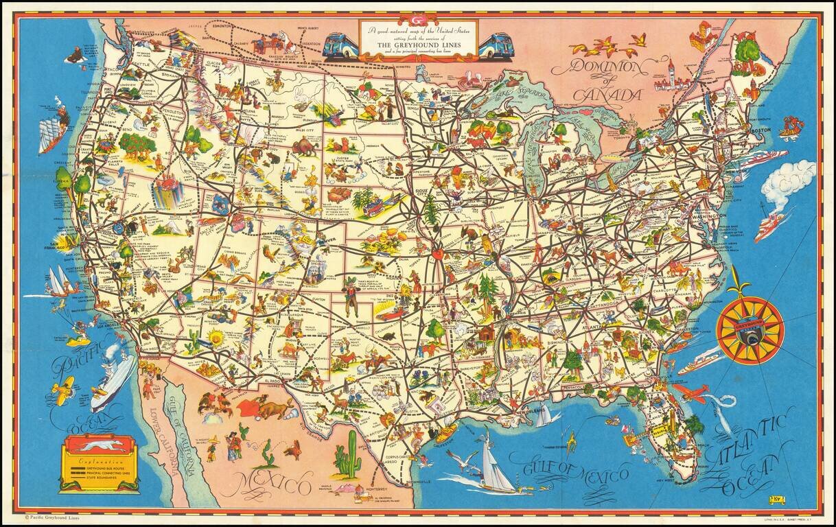
A fine example of this decorative pictorial map of the United States, promoting Greyhound bus lines. The caricatures of the various regions run from charming to very politically incorrect and provide a marvelous look at American's ethnic and regional...
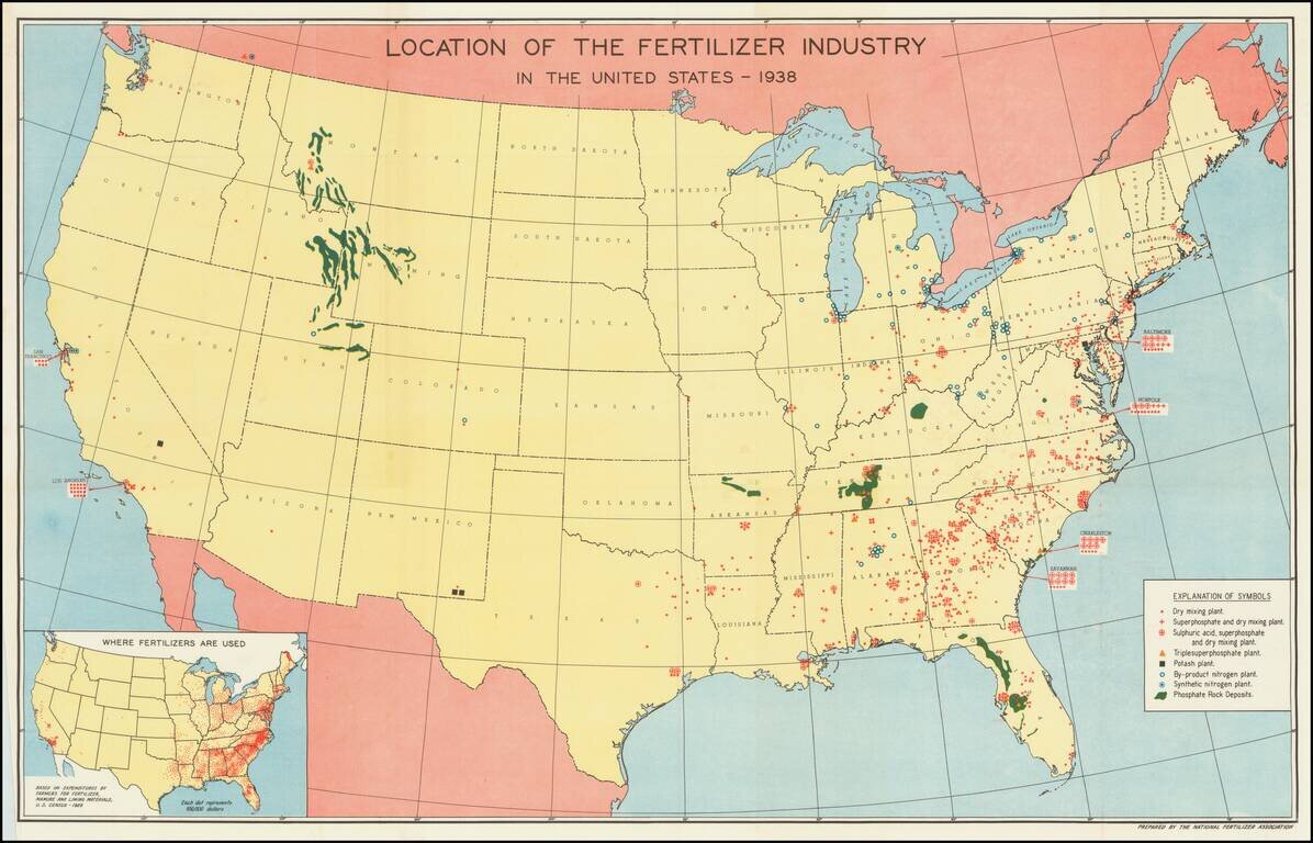
Mapping America's Fertilizer Production and Use During World War II Large map of the United States, illustrating the places and means of production of Fertilizer in the United States. The key locates 8 different important locations of different types...
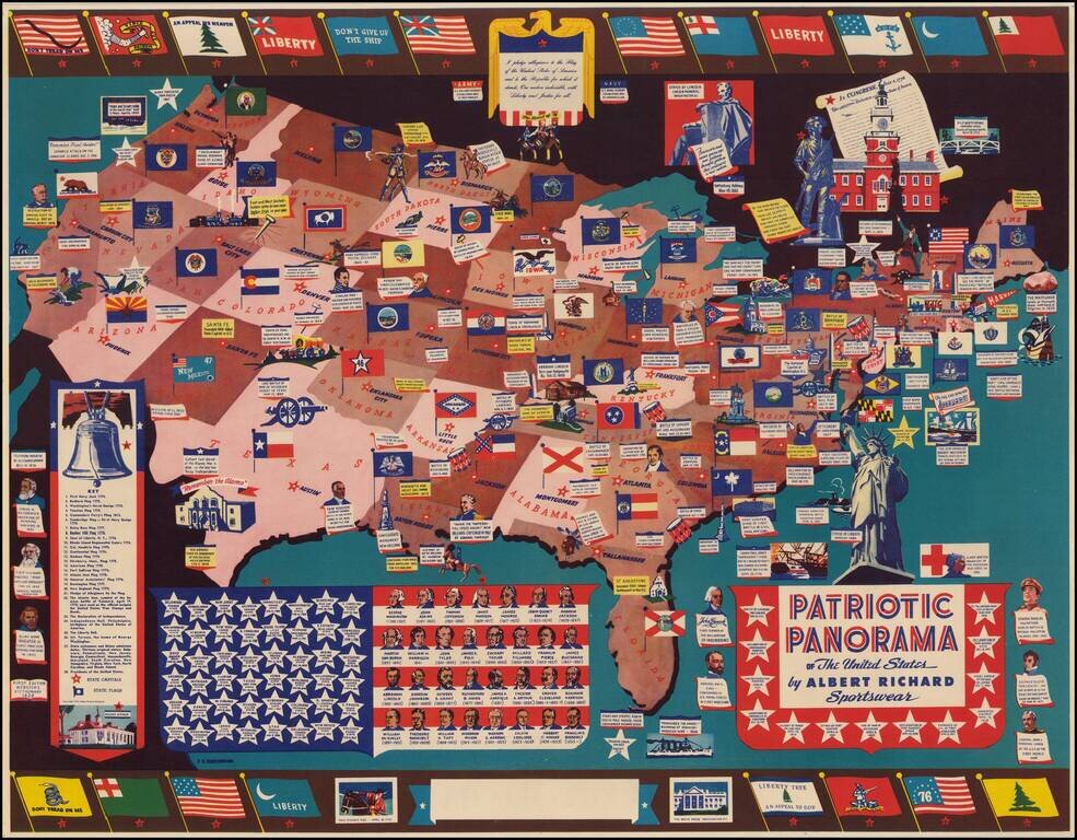
The Albert Richmond Patriotic Panorama Map Detailed patriotic map of the United States drawn by F. E. Cheeseman, published for Albert Richard. The map was issued by Albert Richard, a manufacturer of mens and boys coats. The posters were promotional...
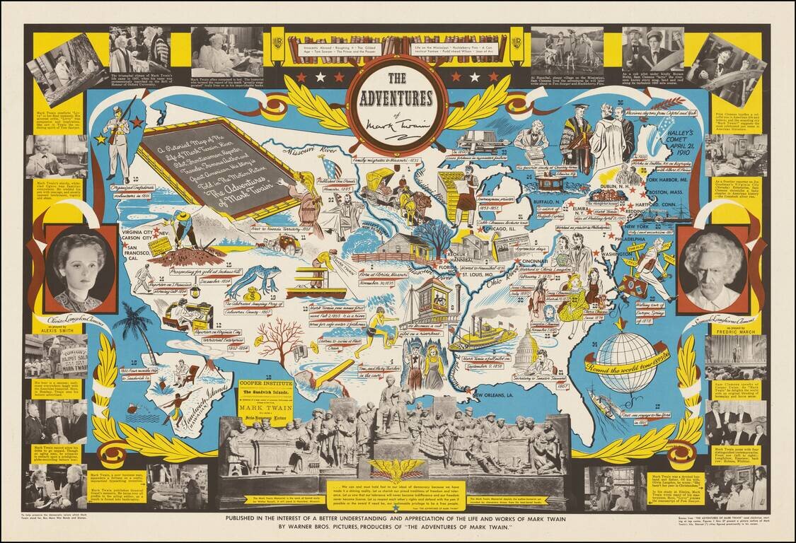
Decorative pictorial map telling the story of Mark Twain, published by Warner Brothers, in conjunction with its release of the movie of the same title. "The Adventures of Mark Twain" was a 1944 biographical film produced by Warner Brothers. The text...

Rare vintage pictorial map of the United States, by Edward McCandish, published by Hagstrom Company under the Bill Whiffletree trademark. An earlier edition of the map was published in 1926; this edition, easily differentiated by the inclusion of the...
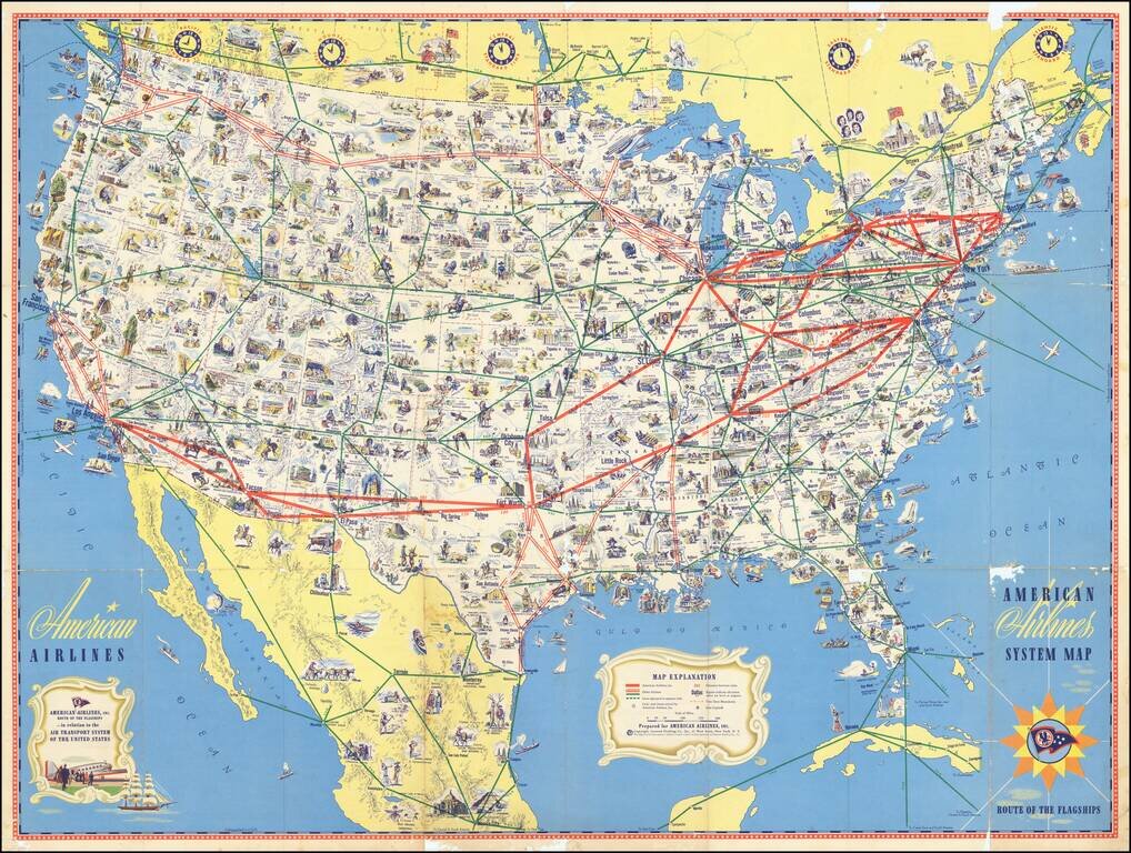
Richly illustrate pictorial map highlighting the flagship routes of American Airlines. The American Airlines system is shown "in relation to the Air Transport System of the United States", with other airlines marked in green, but identified. The map...
![Trails: [1595-1945]: Land, Sea, and Air of The American Adventure Series](/map/small/70672.jpg)
Attractive vintage pictorial map of the United States, featuring a quintessentially Mid-Century outlook on the country's history. The map focuses on "Trails in American Adventure" (Oregon, California, Santa Fe, Chisholm, Wilderness Road, Pony Express,...