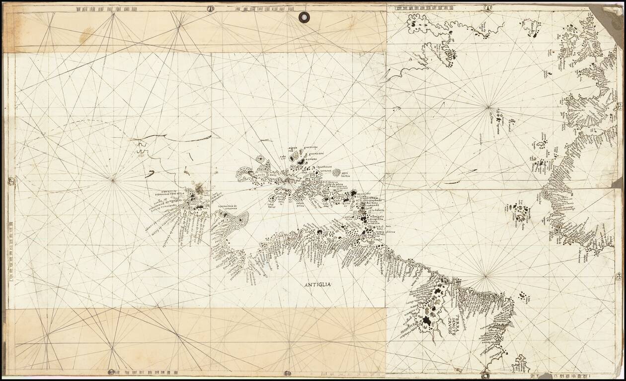
Rare and antique old maps of the Caribbean & Central_America
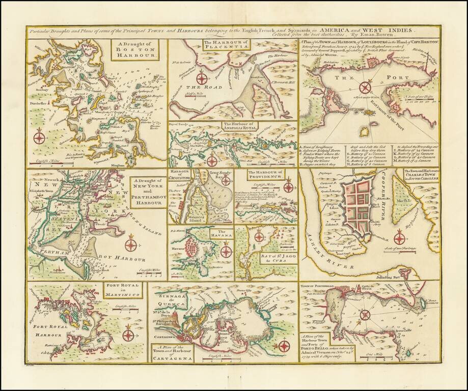
Nice set of harbor and town plans, showing the major trading cities and ports in North America and the Caribbean. The maps include: Boston New York Charleston Martinico Placentia Anapolis St. Augustine Havana St. Jago (San Juan) Providence...
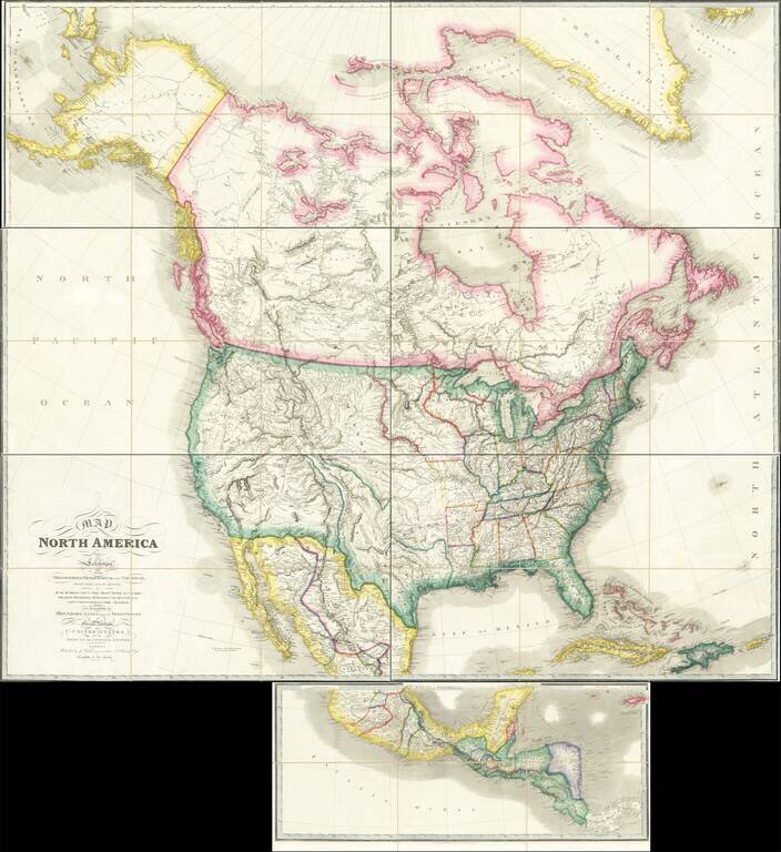
Rare Large Map of North America from a Royal Library Fine example of the circa 1850 (our dating) edition of Wyld's massive map of North America, which includes the extra panel at the bottom, adding Central America, first issued in 1824. John Wyld was...
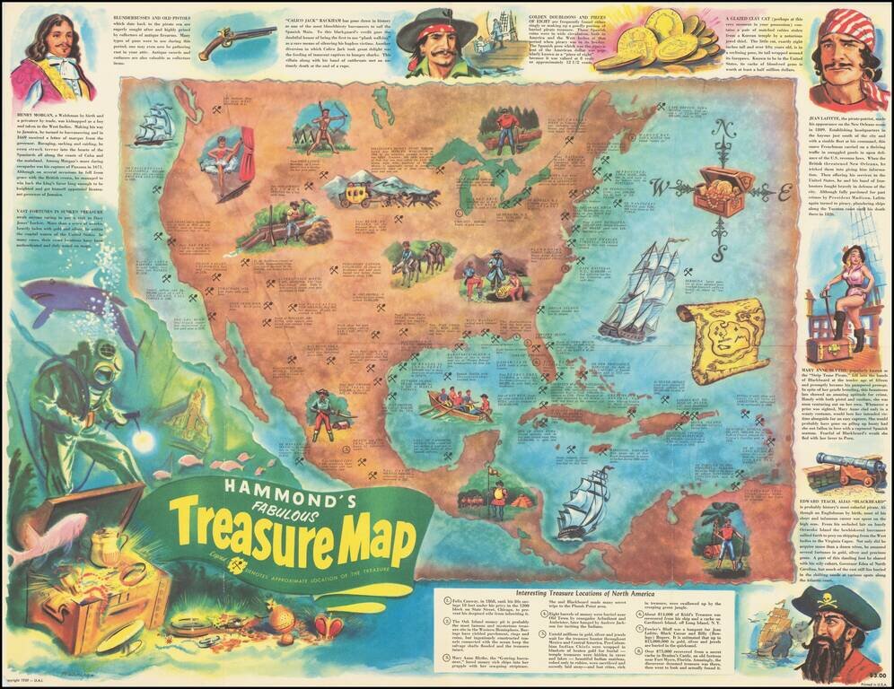
Pirates and Treasure! Lively pictorial map of North America, providing the locations of famous treasures, real and mythical, disbursed throughout the region. From the Lost Dutchman mine to John Dillinger's stash near Mercer Wisconsin, The map details...
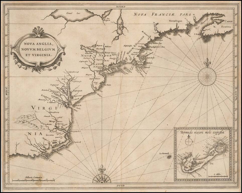
Quite Possibly The Most Important Map of the Northeast & Mid-Atlantic Published in the First Half of the 17th Century. Johannes De Laet's highly influential map of the East Coast of North America is a cartographic landmark, depicting the region...
![[British Colonies in North America] Carte Qui Contient Une Description Des Iles & Terres Que Les Anglois . . .[Chesapeake, Carolinas, New England, Bermuda, Gulf Coast, Jamaica, Barbadoes & Canada]](/map/small/46200.jpg)
Highly sought after group of maps from Chatelain's 7 Volume Atlas Historique. Includes 8 maps, each of which would be highly coveted as a separate map. The maps include 1) a map of the Carolinas, 2) a map of the Chesapeake, 3) Canada and New England,...

A highly decorative and important sea chart showing Florida, the Gulf Coast, Caribbean, Central America and the region from south of the mouth of the Delaware River. This fine separately published map was first engraved around 1650, but is based...
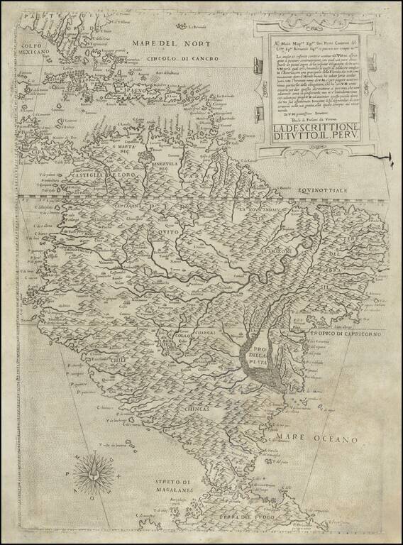
Forlani’s Map of South America—The Only Lafreri School Map of The Continent Rare map of South America by Paolo Forlani. It was the first map of South America to show the interior in considerable detail and is the only map of the continent produced...

Jacques Le Moyne's Landmark Map of Florida & The Southeast, Based On The Expedition of Laudonniere to Florida in 1564 Jacques Le Moyne's map of Florida and the Southeastern portion of the United States is one of the most important 16th Century...

Nice example of the second edition of Herrera's map of Florida and the Caribbean, which first appeared in Herrera's Descripcion de las Indias Ocidentales, first published in Madrid in 1601. In describing the map, Burden notes: Of interest to us on...
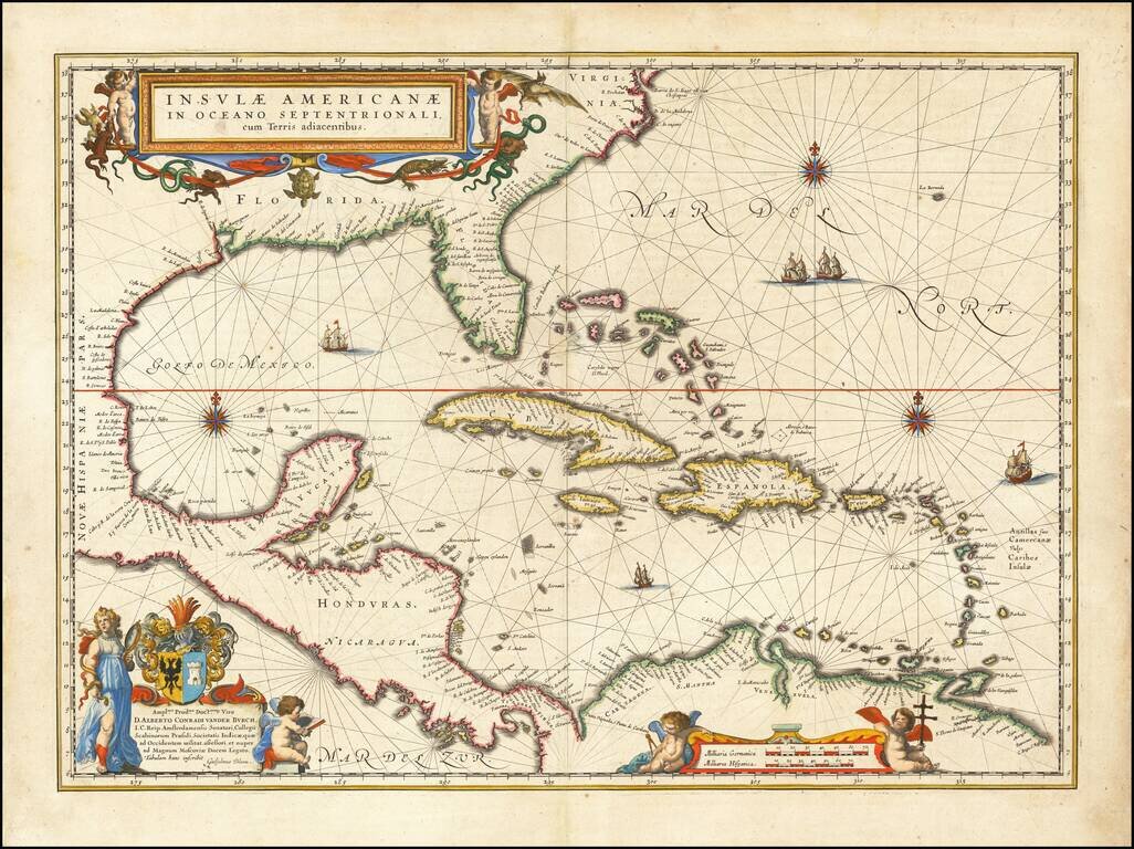
Blaeu's Chart of the Caribbean Nice example of Blaeu's chart of the Caribbean, based on a section of Blaeu's own West Indische Paskaert (ca. 1630) and Hessel Gerritsz' rare chart of 1631. The chart was the most accurate for its time and was used...

The First Sea Chart Focused on the Coast of California Rare first edition of the earliest map to focus on the California Coast, published in Florence by Robert Dudley. The map appeared in Dudley's landmark sea atlas, the Arcana del mare, the first...
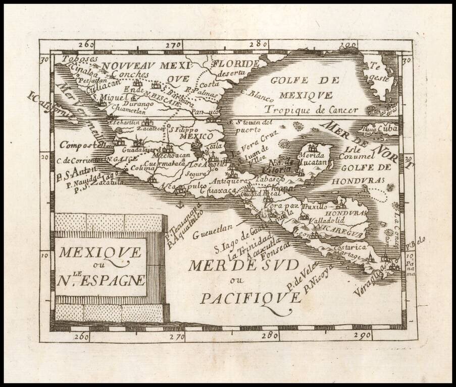
Nice example of Du Val's map of New Spain, extending from the American Southwest and Florida to Costa Rica and Panama.

Scarce chart of the Caribbean, Florida, Gulf Coast and Southeastern part of North America, with inset of the north coast of Cuba. Goos based his general chart of the West Indies, Gulf Coast and Southeast on the manuscript maps of Hessel Gerritsz,...
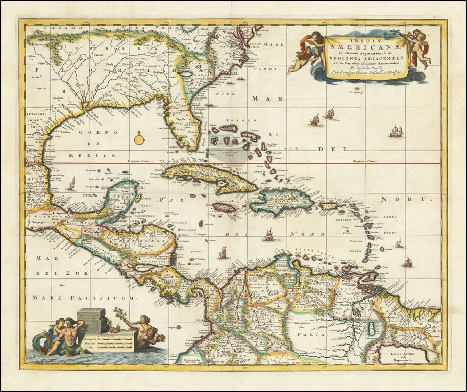
Nice example of Nicholas Visscher's map of the Caribbean, Florida, Southern US, Central America and part of South America. A number of cartographic myths appear on the map, including the large lake which appears in Georgia, a non-existent mountain...
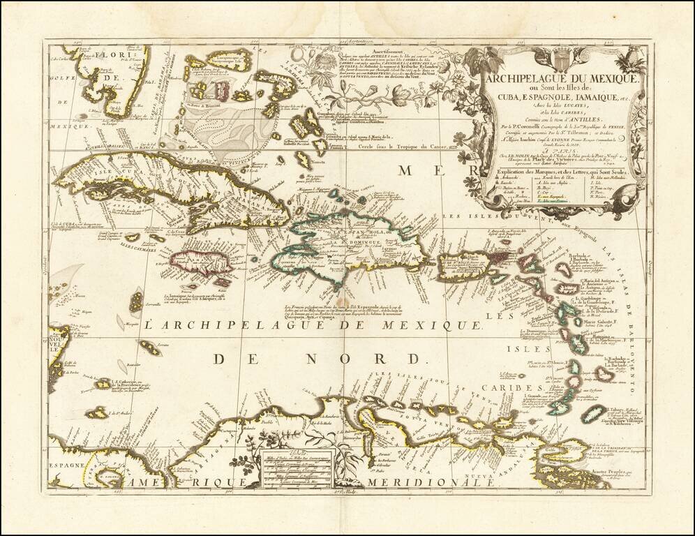
Nice example of the final edition of the Nolin-Coronelli map of the Caribbean. The map presents a marvelous large format look at the region, as it was known to Coronelli and Nolin at the end of the 17th century. Florida's southern coastline is...
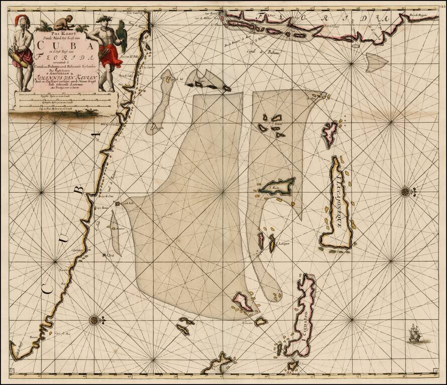
Southeastern Florida, Cuba and the Bahama Channel Fine old color example of Van Keulen's sea chart of Southeastern Florida, the Bahamas and Northeastern Cuba, first issued in the fourth part of the 1684 edition of his Zee-Fakkel, published in...