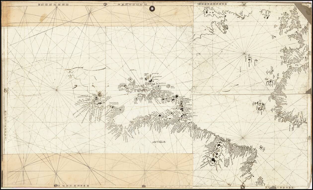
Rare and antique old maps of the Caribbean & Central_America
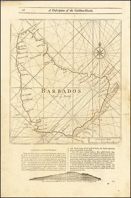
Detailed coastal map of the Island of Barbados, from Mount & Page's English Pilot, Fourth Book. The map includes a number of bays, harbors and other coastal feature, with sailing directions and a profile view below and on the verso.
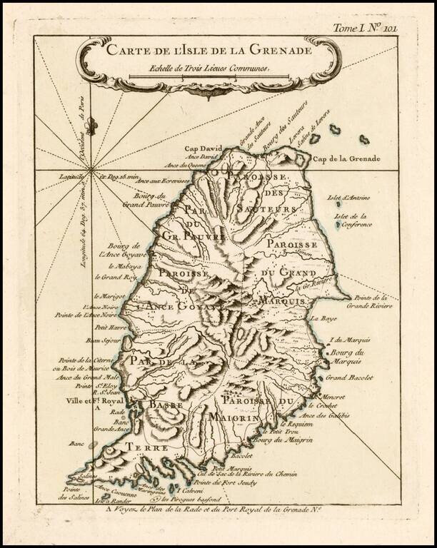
Antique Map of Grenada Detailed map of the Island of Grenada, showing remarkable detail for the period. Includes a large decorative title cartouche. From Bellin's Petit Atlas Maritime.
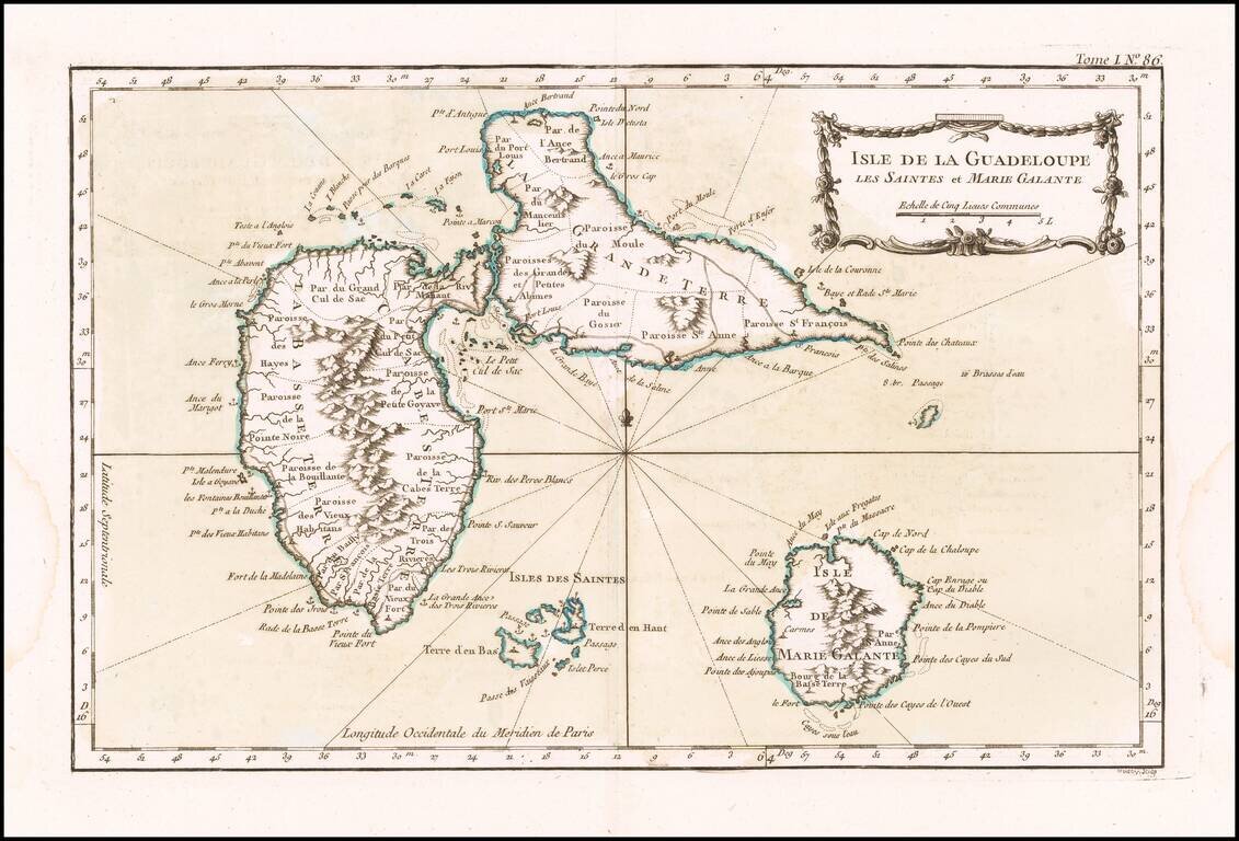
Detailed map of Guadalupe, Mari-Galante and the Isles de Saintes. Includes a decorative title cartouche, smaller cartouche and Rhumb lines. One of the maps produced by Nichlas Bellin for the Petit Atlas Maritime.
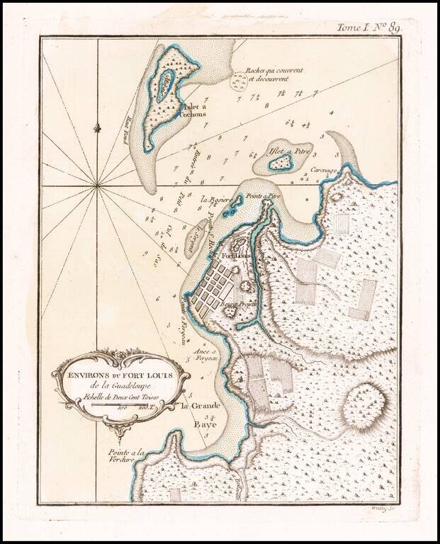
Detailed map of the environs of Fort Louis on the island of Guadalupe. Includes a decorative title cartouche and Rhumb lines. One of the maps produced by Nichlas Bellin for the Petit Atlas Maritime.
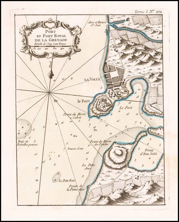
Antique Map of St. George's / Port Royal, Grenada Excellent map of the area around Port Royal, in Grenada. Includes marvelous geographical and topographical detail, the fortifications of the Fort, a town plan, etc. Includes a large decorative title...
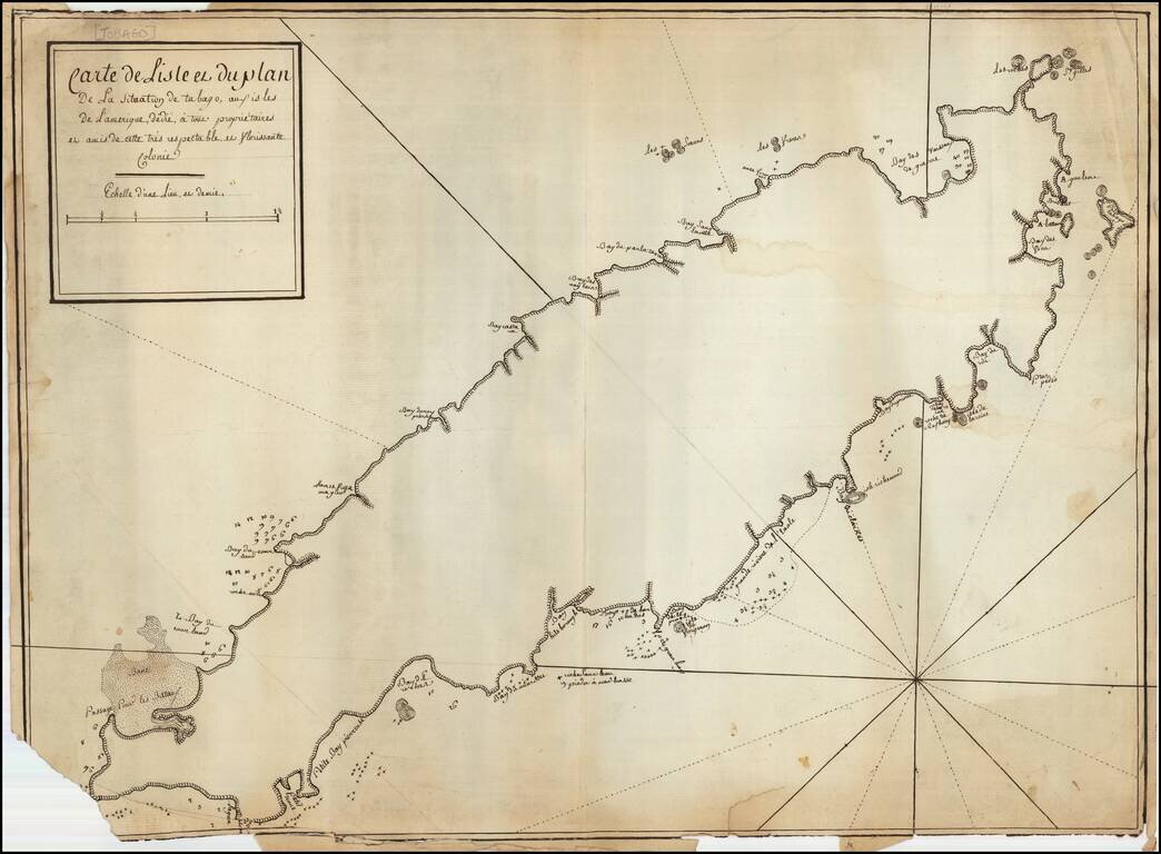
French Manuscript Map of Tobago Revealing its Complex Colonial History Manuscript map showing the island of Tobago and revealing its complicated history of European settlement. The map shows continued interest in Tobago across Europe and could have...
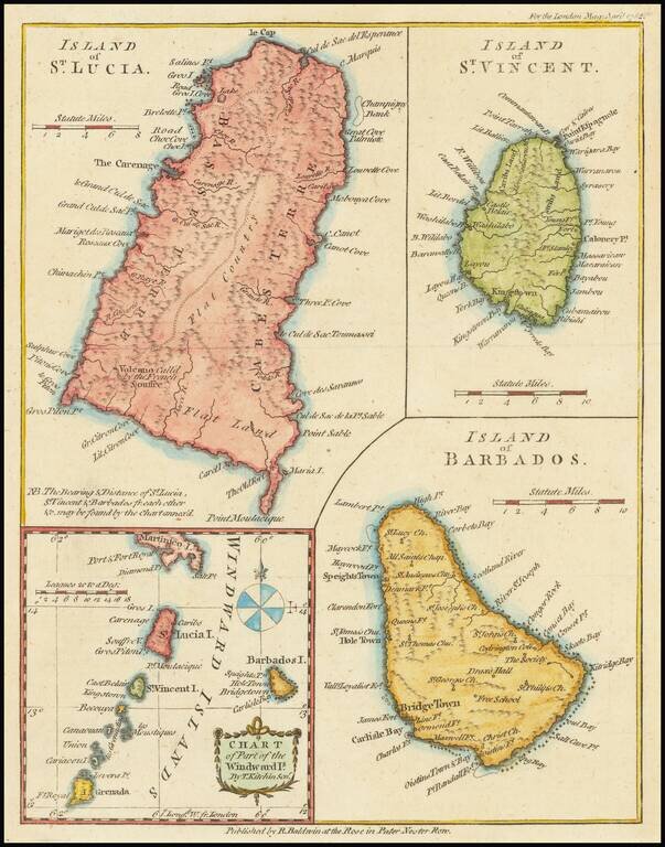
Interesting map of St. Lucia, St. Vincent, Barbados and the Windward Islands, published in the London Magazine.

The Return of the First Fleet -- Fundamental Map for Australian Collectors A highly important map in the history of settling Australia, with the present example including annotations in pencil noting a ship wreck and other details. The track of the...
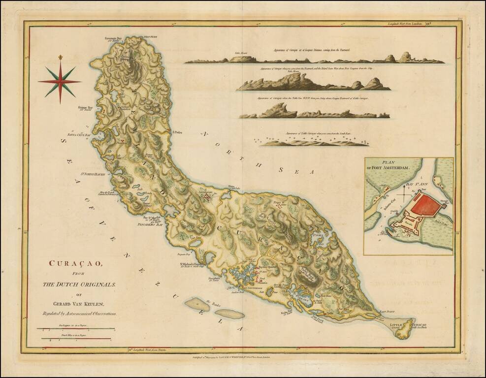
Nice example of Laurie & Whittle's map of Curacao. Includes numerous profile views and a large inset of Fort Amsterdam.
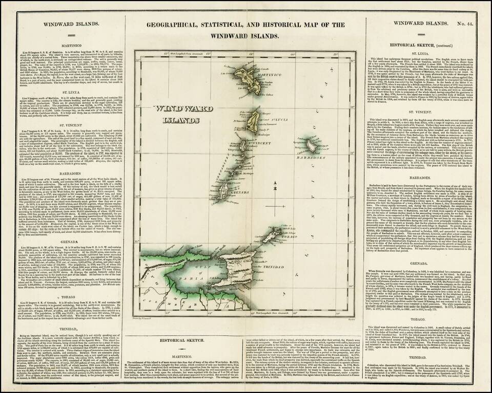
Detailed map of the Windward Islands, from Carey & Lea's rare American Atlas. The text surrounding the map is of particular note. Includes the region from Martinique to Trinidad & Tobago. Carey & Lea's Atlas is highly prized not only for...
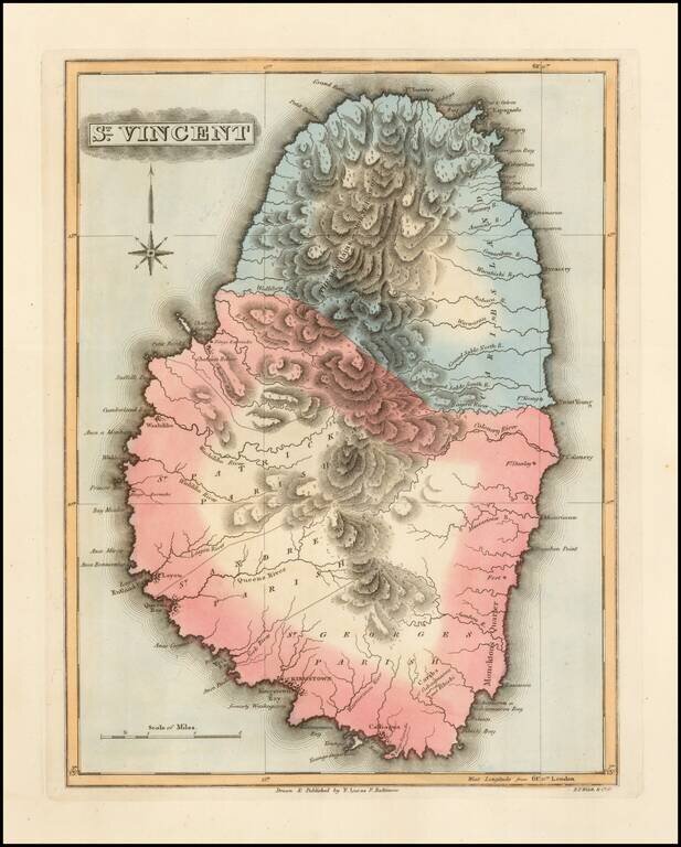
Scarce map of St. Vincent by Fielding Lucas Jr., which appeared in his General Atlas, as well as his A New General Atlas of the West India Islands. Lucas's map is the first detailed commercial map of St. Vincent published in America. The map depicts...
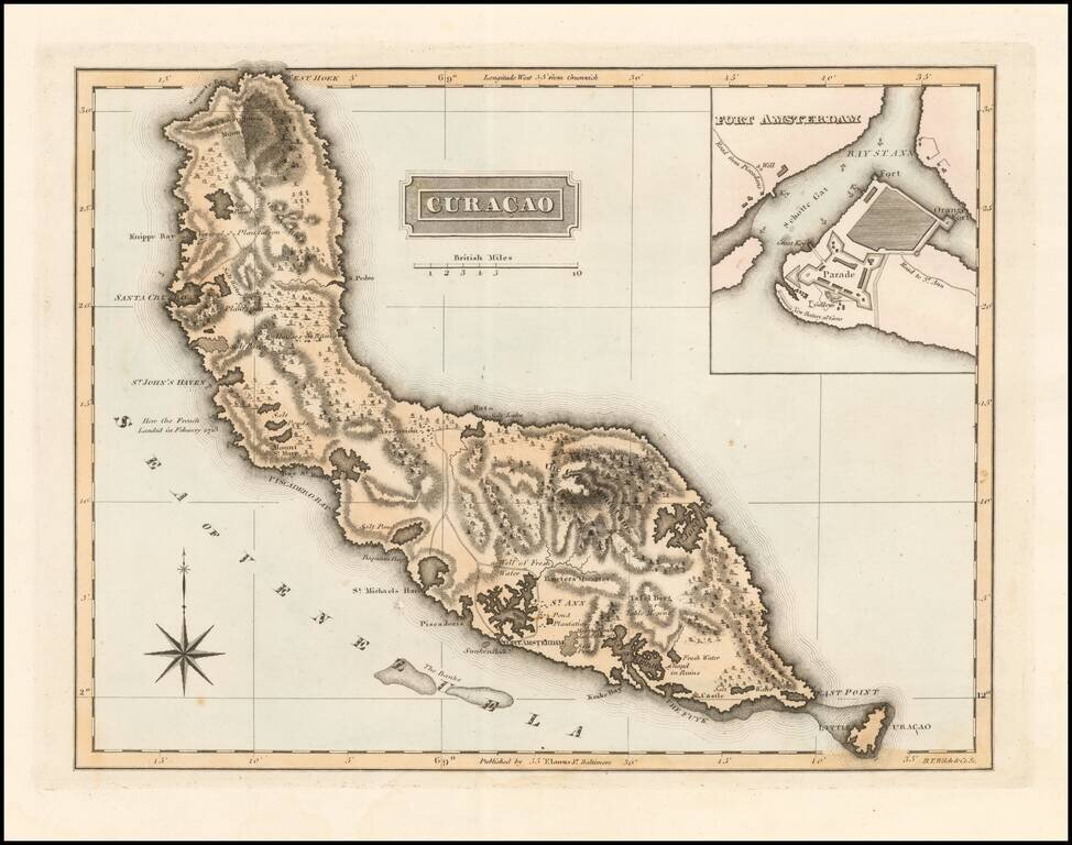
With Gallows Shown in Fort Amsterdam! Scarce map of Curacao with a large inset of Fort Amsterdam by Fielding Lucas Jr., which appeared in his General Atlas, as well as his A New General Atlas of the West India Islands. Lucas's map is the first...
![[Windward & Leeward Islands -- Puerto Rico to Trinidad]](/map/small/36239mb.jpg)
Interesting untitled sea chart of the Windward and Leeward Islands, extending from Puerto Rico to Trinidad. The chart shows signs of use around the Virgin Islands, with navigational lines apparently shown for transit thorough the islands from St....
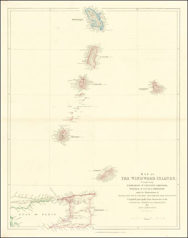
Scarce map of the Windward Islands, published by John Arrowsmith.
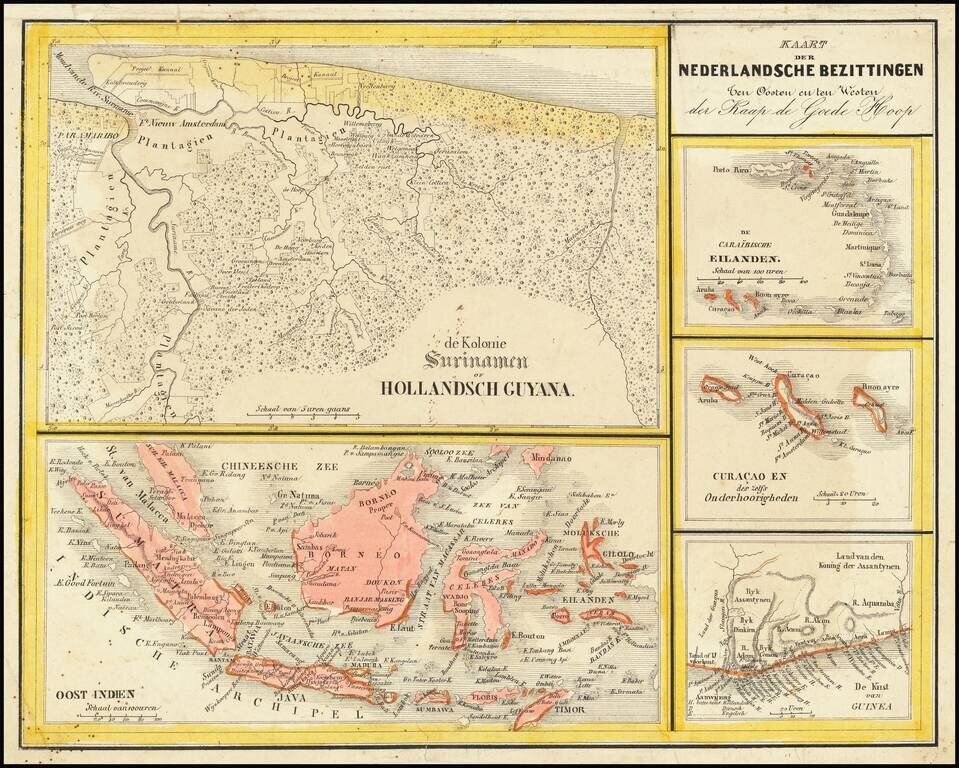
Interesting Map of the Dutch Colonies. The map consists of 5 separate maps, entitled: The Caribbean Islands Curacao and Dependencies The Suriname Colony The Coast of Guinea in Africa East Indies The map appeared in Nieuwe Atlas van het...
![[St. Barths / St. Martin / Anguilla / Antilles ] -- Plans of Ports Surveyed by Captain Edward Barnett R.N. 1846](/map/small/70950.jpg)
Scarce British Admiralty sea chart, showing the major harbors and ports in St. Barths, St. Martin and Anguilla, with small corrections up to 1886. The following harbors are shown: Gustaf Harbor, St. Barths Marigot Bay, St. Martin Crocus Bay,...