logo

1854. Porto Rico and The Virgin Islands / St. Domingo Independent

  • Porto Rico and The Virgin Islands / St. Domingo Independent

Porto Rico and The Virgin Islands / St. Domingo Independent information:

Year of creation: 
Resolution size (pixels): 
 15078x12938 px
Disk Size: 
 45.7609MiB
Number of pages: 
 1
Place: 
 Liverpool
Author: 

Print information. Print size (Width x height in inches):
Printing at 72 dpi 
  209.42 х 179.69
Printing at 150 dpi 
 100.52 х 86.25
Printing at 300 dpi 
 50.26 х 43.13

An example of detailing the file of this map of in a printable high-resolution:

Click to open in high resolution (open in new tab).
Attention! this is just the central piece (central area 960x960 px) of the map file!
This is an example, so that you can see and study the level of detail of a given map. The entire Map will be fully available after payment!

Porto Rico and The Virgin Islands / St. Domingo Independent

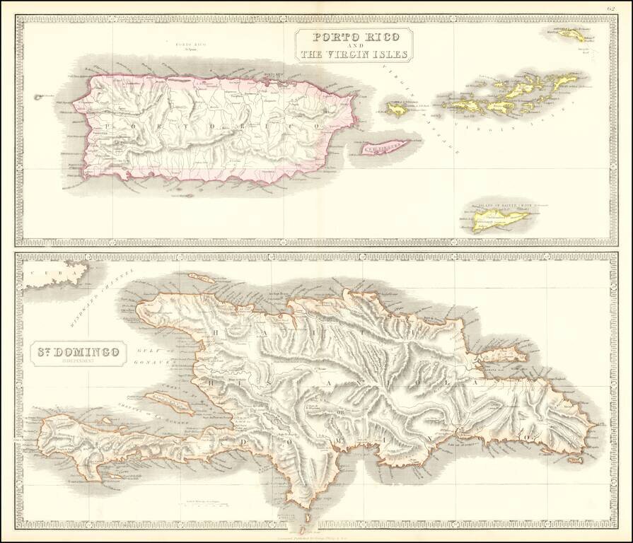
Scarce pair of maps of the Virgin Islands, Puerto Rico and Hispaniola.

The top map extends to St. Croix, Anegada and Virgin Gorda.


Special conditions for students!

If you are a student, write to us in telegram: @antiquemaps and indicate what material you need and for what work you need a map in high detail. We are ready to provide material on special terms. For students only!

Item information:

Year of creation:
Size:
15078x12938 px
Disk:
45.7609MiB
Number of pages:
1
Place:
Liverpool
Author:
George Philip & Son.
$14.99

Related item