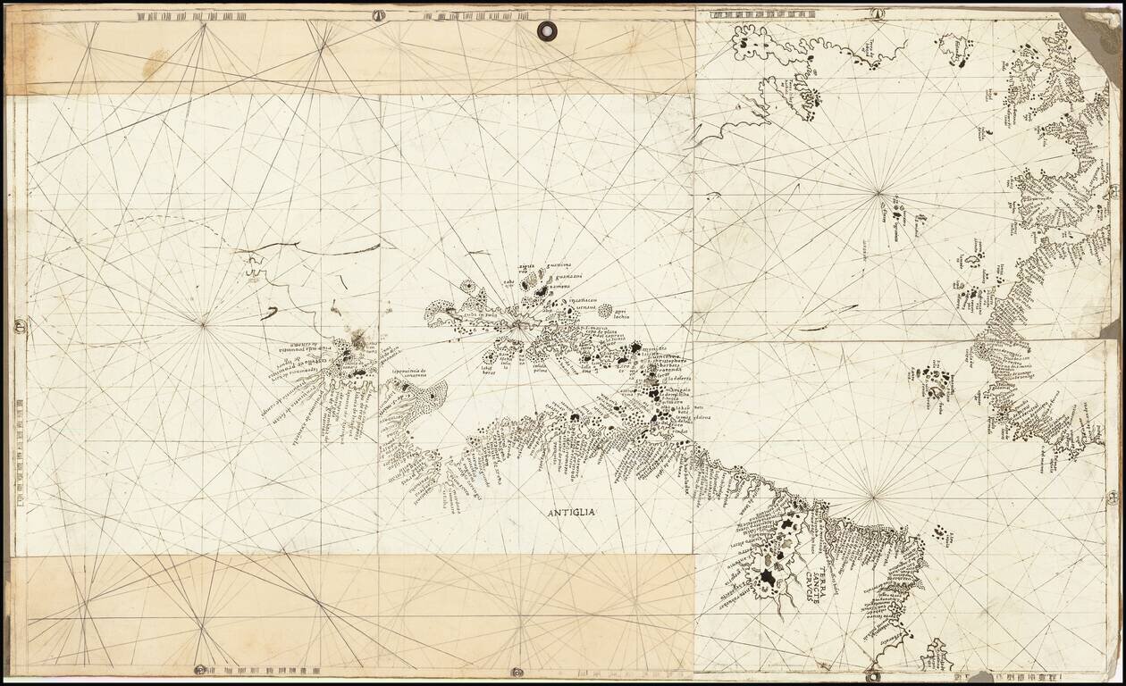
Rare and antique old maps of the Caribbean & Central_America
![[St. Barths] Charta ofver On St. Barthelemy -- Konungen af Sverige Gustaf den IV. Adolph . . .](/map/small/46387.jpg)
Rare Sea Chart of the Island of St. Barts Rare chart of the island of St. Barts, one of only 3 printed maps to focus on St. Barts prior to modern times. The map is divided into Quartiers and then further sub-divided. Bays are noted, pathways and the...
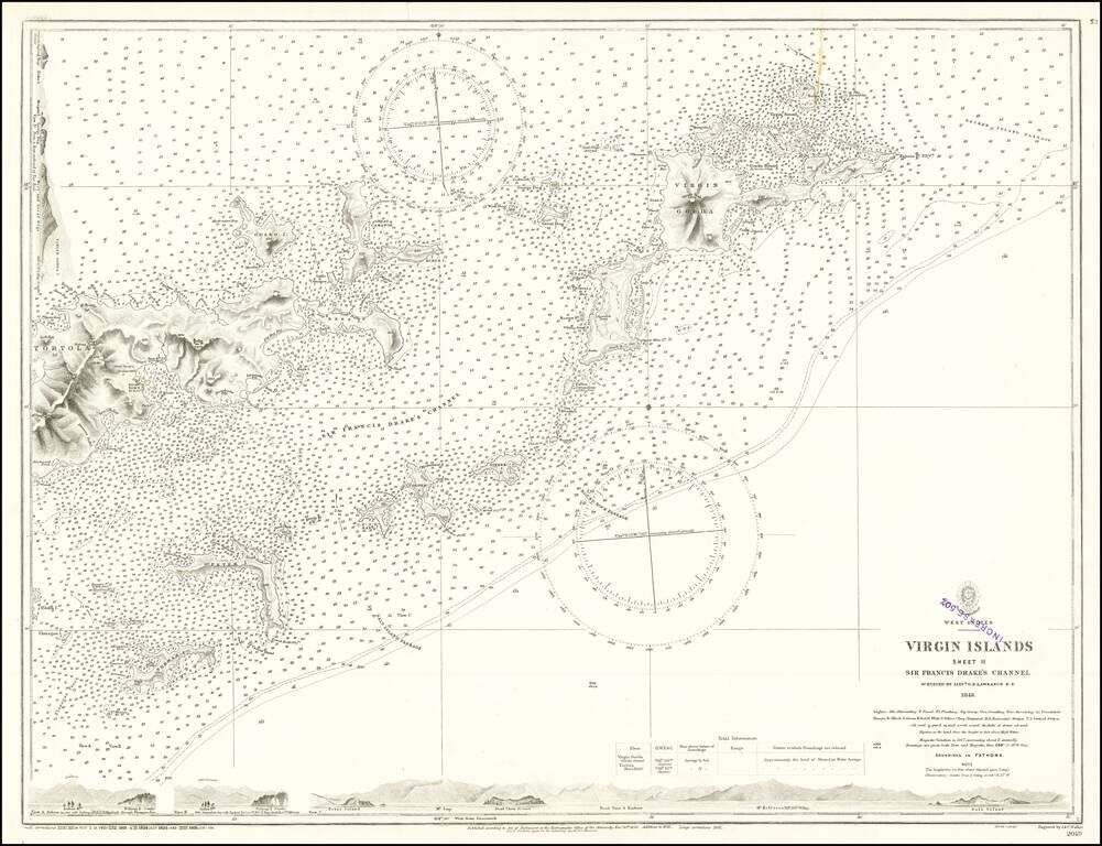
Finely detailed map, extending from Virgin Gorda and Necker Island in the northeast to Tortola and Norman Island in the west, centered on Sir Francis Drake's Channel. Includes profile views across the bottom and the top left. This is one of the...
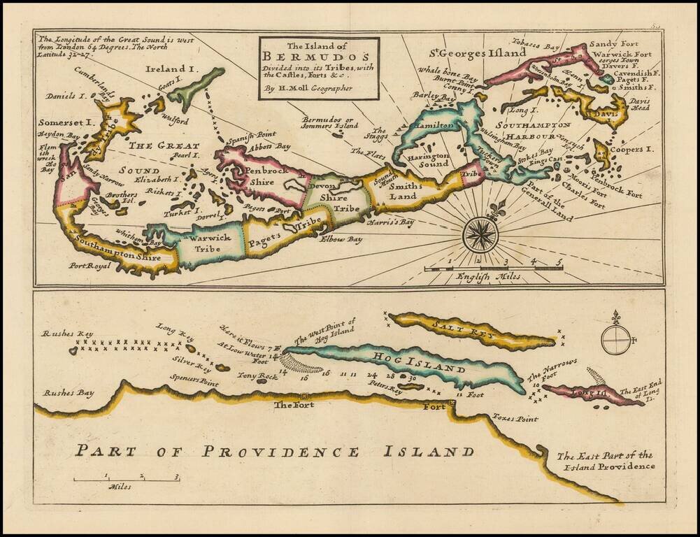
Striking full color example of this Moll's map of Bermuda and the North Coast of Providence Island, with Hog Island, Long Island, Salt Key, etc. The Bermuda map includes significant details, including Tribes, towns, bays, islands, sounds, and other...
![Carte Reduite Des Iles Antilles . . . [and] Carte reduite des debouquements de St. Domingue . . . . 1775 [Includes Bahamas]](/map/small/58201.jpg)
A magnificent two-in-one map of the Lesser Antilles (from the eastern tip of Puerto Rico to St. Vincent and Barbados) and of the Turks and Caicos (including part of the Bahamas and the northern coast of Hispaniola). A later reissue and compilation of...
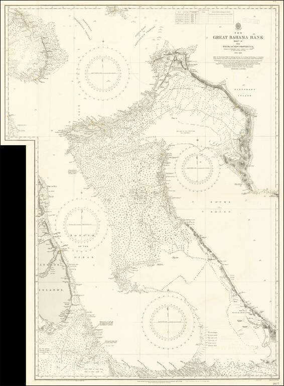
Large engraved sea chart of the Bahamas, issued by the British Admiralty first in 1851, and with numerous corrections over the years to this edition in 1921. The map shows parts of the Andros Islands, New Providence Island with Nassau (Lyford Cay is...
![Canal De La Providence (Bancs De Bahama) . . . 1857 [with] Mouillage De La Point Du Trou Dans Mur (Ile Abaco) . . . [with] Cay Gun (Grand Banc De Bahama)](/map/small/63072.jpg)
Rare set of 3 regional charts of the Bahamas. The largest map shows Little Bahama Bank, Little Abaco, Grand Abaco, Bahama Island, and the region extending southward to New Providence and Andros Island. The Second map shows the southern part of Grand...
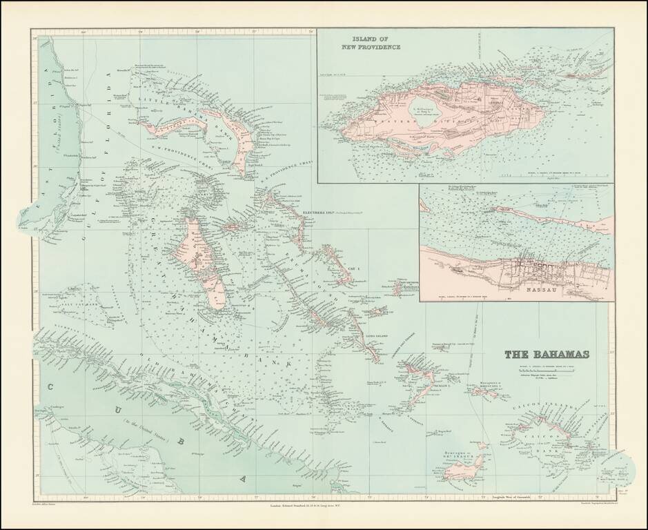
Fine and highly detailed map of the Bahamas from Stanford's London Atlas. Includes an inset map of Nassau and an inset map of the Island of New Providence.
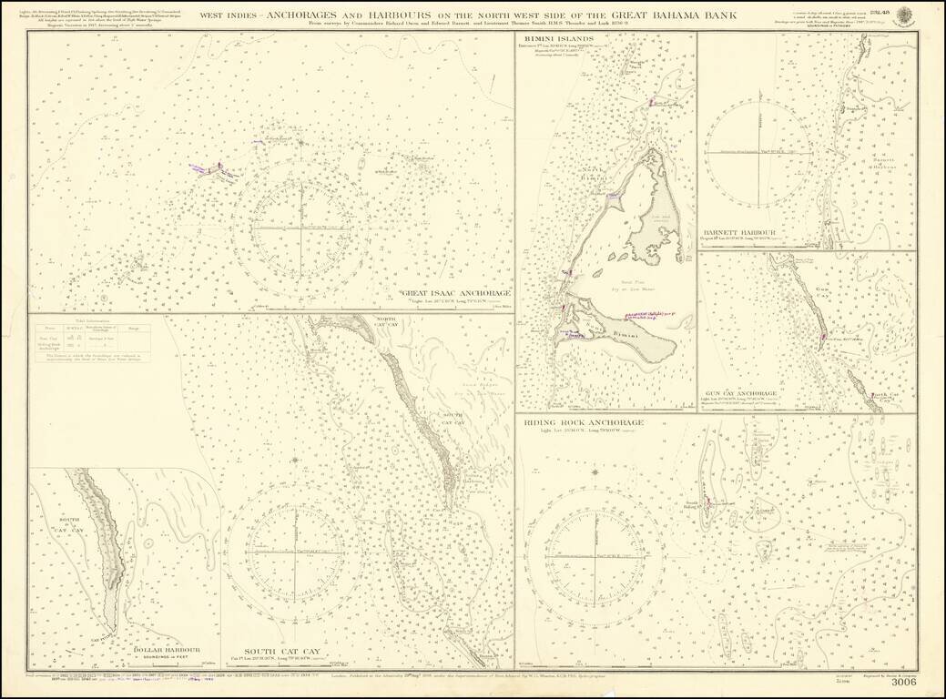
A detailed map showing several harbors in the Bahamas, first published by the British Admiralty in 1898. Seven separate maps show different anchorages, covering most of the islands in the northwesternmost part of the Great Bahama Bank. The charts show...
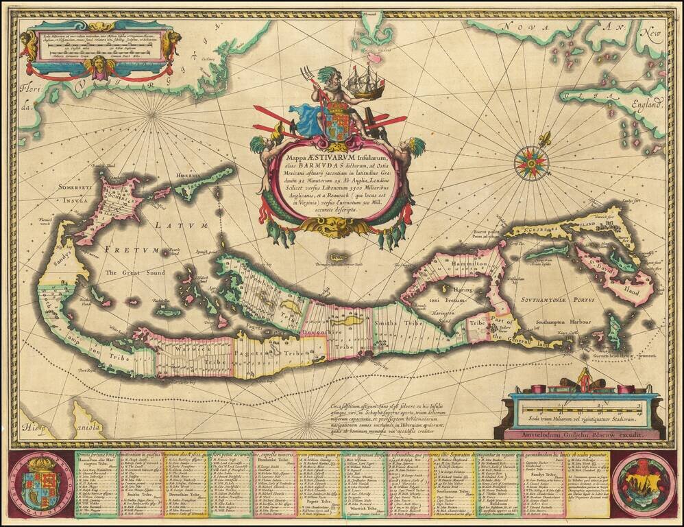
Blaeu’s Fine Double Map of Bermuda Fine example of Blaeu's highly sought-after map of Bermuda. It is actually a double map, as it shows a detailed survey of the islands, as well as a map relating Bermuda to mainland North America. The map includes...
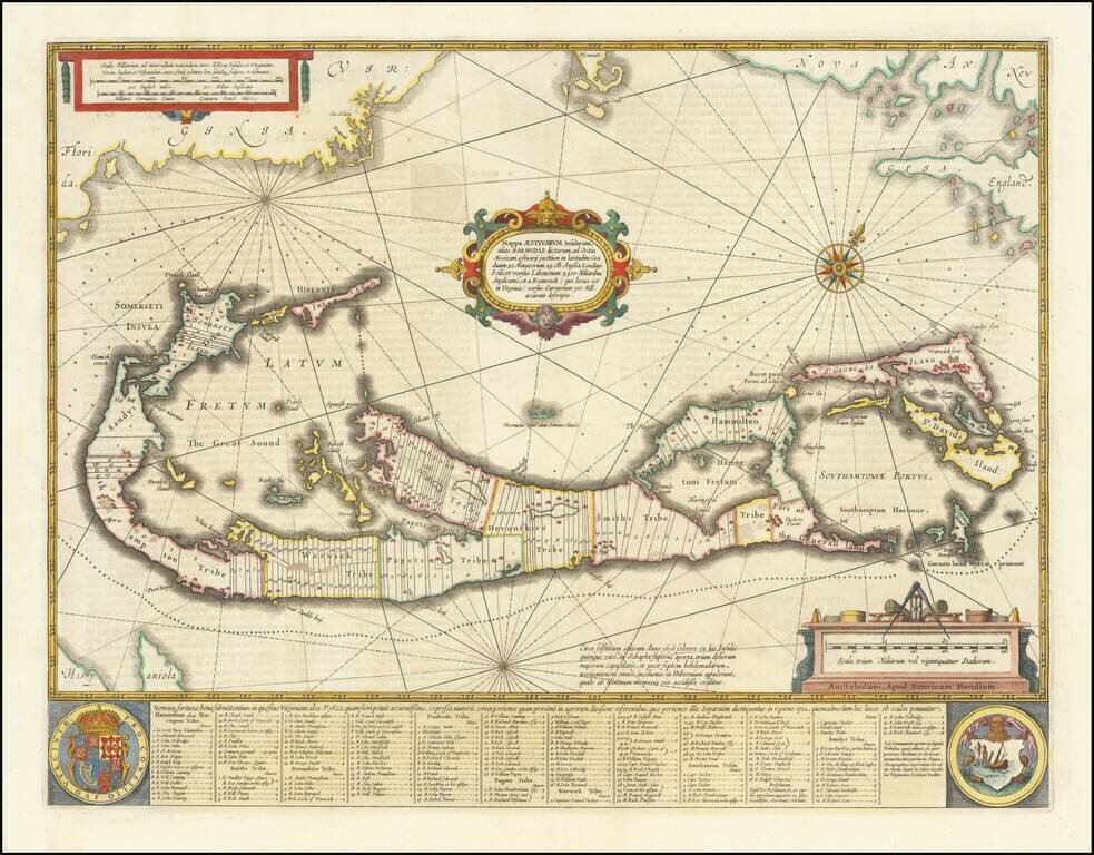
Nice example of Hondius' map of Bermuda, with decorative cartouche, compass rose, and other embellishments. The map is based upon John Norwood's survey of 1618, as first published by John Speed in 1626-27. The text at the bottom includes a division...
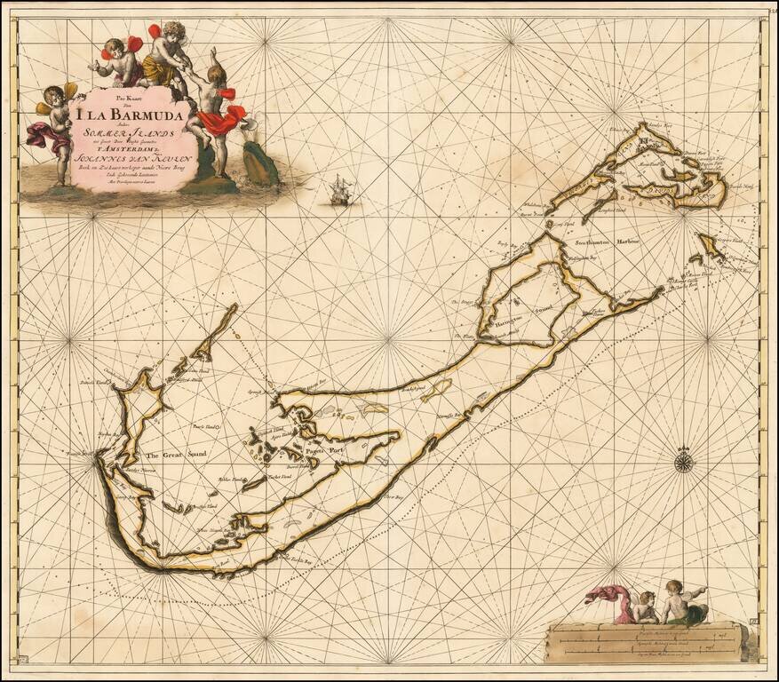
The Most Decorative Sea Chart of Bermuda published in the 17th Century. Striking early sea chart of Bermuda, published by Johannes Van Keulen. The chart includes remarkable early detail, including the fortifications in Southampton Harbor. As noted...
![[Bermuda]](/map/small/62893.jpg)
Scarce map of Bermuda from the English Pilot, Fourth Book. Shows islands, bays and inlets, forts, navigational hazards, and a "Flemish Wreck." Includes wonderful text in English on the front and back, which includes a description of Bermudas or the...
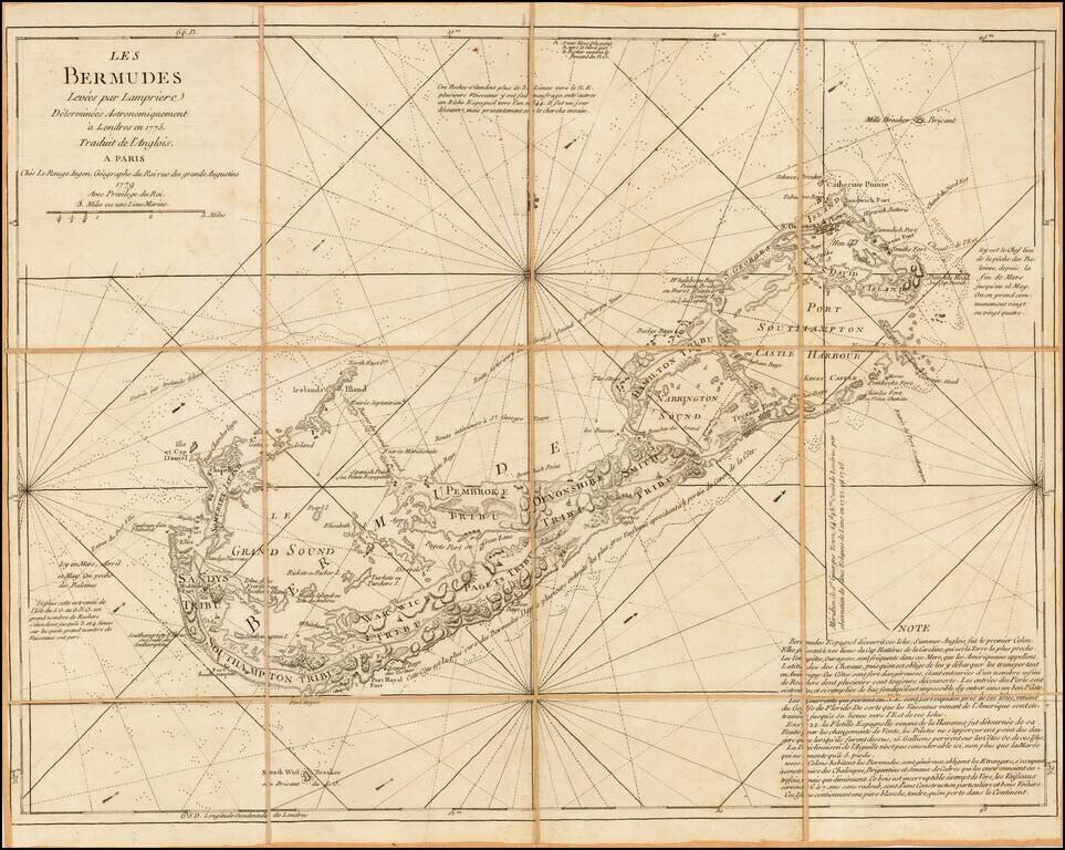
Rare French map of Bermuda, incorporating the surveys of Captain Clement Lempriere (Lempriere's name being spelled incorrectly in the title). Clement Lempriere (1683-1746) published his map of Bermuda in 1738, the first significant cartographic...
![Islands in the Atlantic [Bermuda, Madeira, Canaries, Azores and Cape Verde Islands]](/map/small/48484.jpg)
Terrific map of the various islands in the Atlantic, including Bermuda, the Azores, Madeira, the Canaries and Cape Verde Islands, with 5 large profile views. Engraved for R. Montgomery Martin's Illustrated Atlas. Tallis was one of the last great...
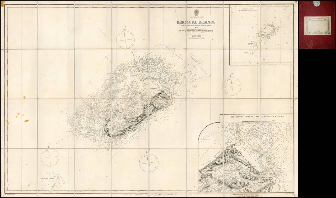
Finely detailed separately issued sea chart of Bermuda, with a large inset plan of St. George Harbour, first published by the British Admiralty in London in 1877. The inset of St. George's Harbour is of particular note, one of the largest and most...
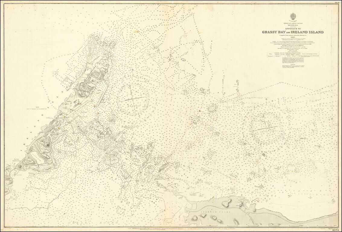
Detailed sea chart showing the approaches to Grassy Bay, Spanish Point, and Ireland Island in the Great Sound of Bermuda. The chart covers what is essentially the entrance to the "hook" of Bermuda, the Great Sound. Considerable detail is shown around...