Map size in jpg-format: 103.845MiB
Click to open in high resolution (open in new tab).

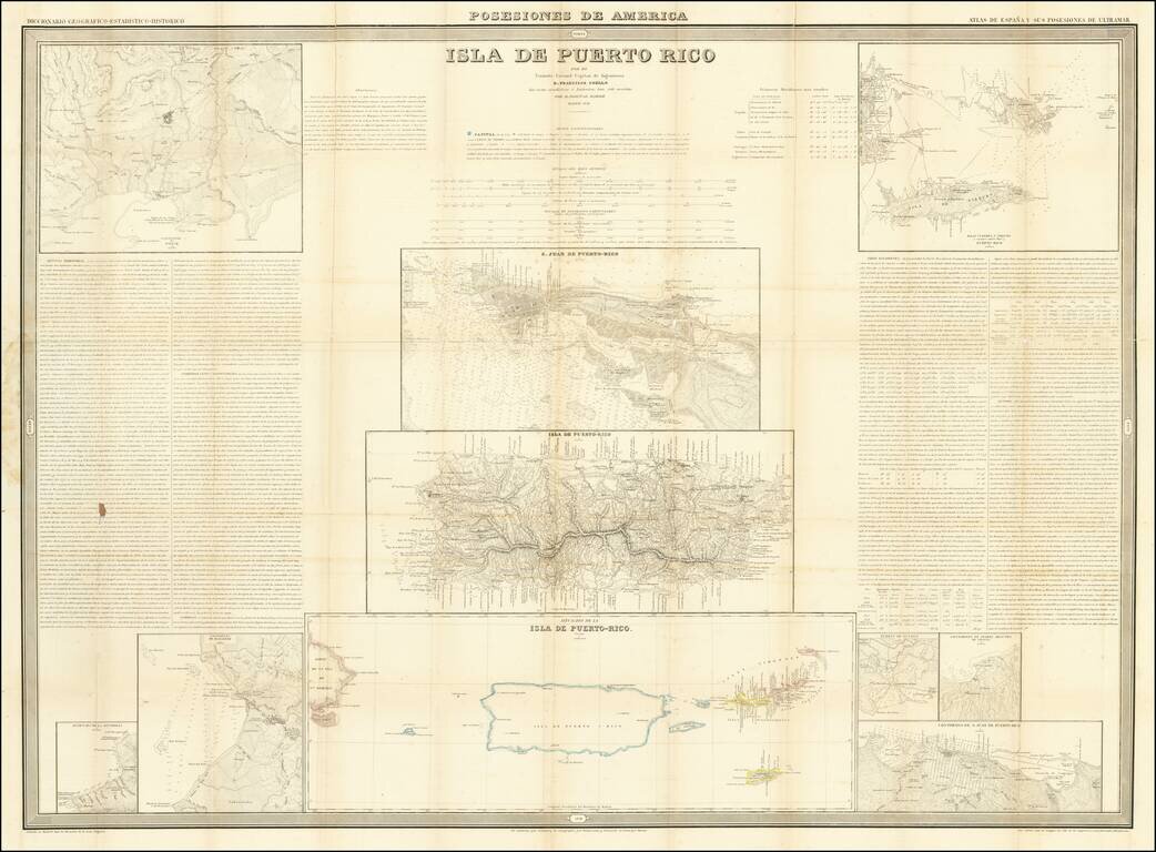
Detailed set of maps of Puerto Rico on a single sheet, published in Madrid.
At the center is a large map of Puerto Rico, with a large map of San Juan above and a regional map of the islands below, including the Virgin Islands and the eastern tip of Hispaniola. Other smaller maps in the corners include:
Includes text on a number of topics of interest, including the climate and regional economy, history and statistical information.
If you are a student, write to us in telegram: @antiquemaps and indicate what material you need and for what work you need a map in high detail. We are ready to provide material on special terms. For students only!
![Cuba Insula [with] Hispaniola Insula [with] Insula Jamaica [with] Ins. S. Ioannis [with] I.S. Margareta Cum Confiniis](/map/small/70194.jpg)
![Amer. Sep. No. 69. Porto-Rico [and the Virgin Islands]](/map/small/42102.jpg)