
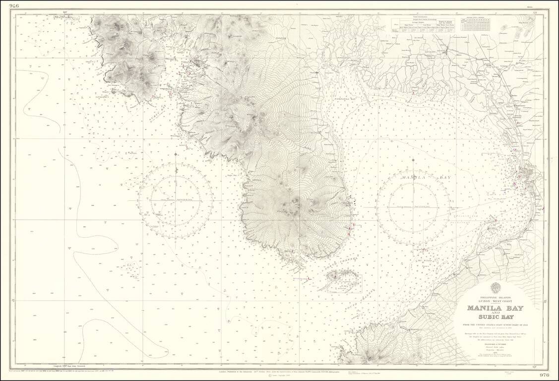
Finely detailed chart showing the approaches to Manila Bay, published by the US Commerce Department. The map extends to Botolan Point and Mt. Botolan in the northwest and Pamanga Bay, covering all of Subic Bay and the westernmost coastline of Manila...
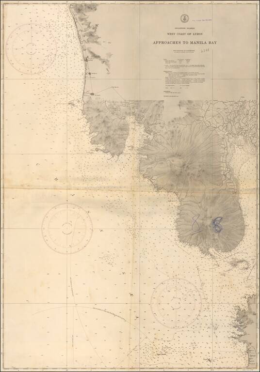
Scarce British Admiralty chart covering a large part of Luzon, including Manila Bay.
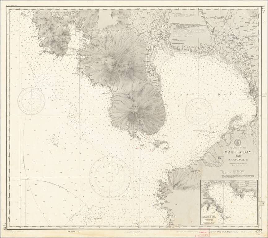
"RESTRICTED" World War II Map of Manila. Detailed chart U.S. Coast and Geodetic Survey (Philippine Divison) of Manila Bay, including Corregidor Island, originally published before the Japanese takeover during the early stages of the Second World War...
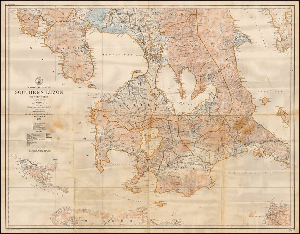
Highly detailed map of the southern part of Luzon Island in the Philippines, published by the US Coast and Geodetic Survey. The map shows topographical features, roads, towns, rivers, trails, lighthouses and many other details.
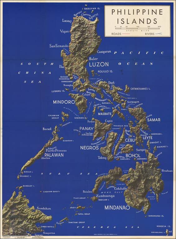
Fine large map of the Philippine Islands, published to provide information during World War II. Newsmap was a production of the Special Service Division Army Service Forces, War Department. Color map on one side, two color maps and text on verso....
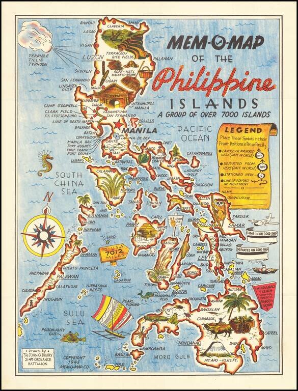
Lively pictorial map of the Philippines, drawn by John G. Drury of the 2145th Ordnance Battalion. This is one in a series of Mem-o-Maps published at the end of World War II. The maps were intended as souvenirs for the military. Military personnel...
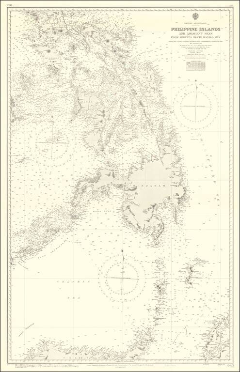
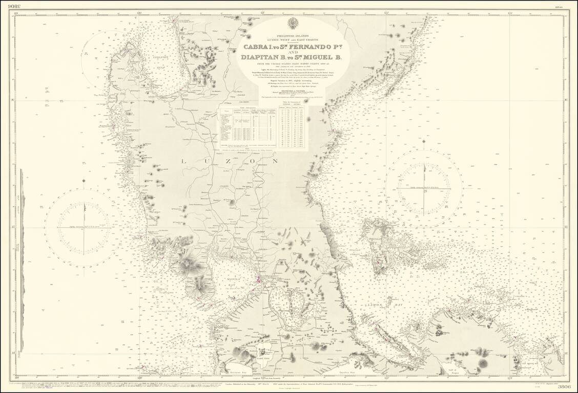
Finely executed British Admiralty Chart of a large portion of the Philippine Islands and regions to the south. The map includes extensive soundings, coastal details, light houses, etc.
Highly detailed chart of the Bay of Manila, published by the British Hydrographical Survey. The map is a remarkably detailed work, based upon the US Coast Survey Hydgrographical surveys of 1920.
![[Philippines] Pictorial Tour Map To The Scenic Wonders of the Mountain Province](/map/small/59513.jpg)
Rare promotional tour map of the Mountain Province, published by Capitol Publishing House. The map is centered on Mt. Data and the area around Bontoc and Baguio City. Points of interest include: Philippines Military Academy Baguio Cathedral...
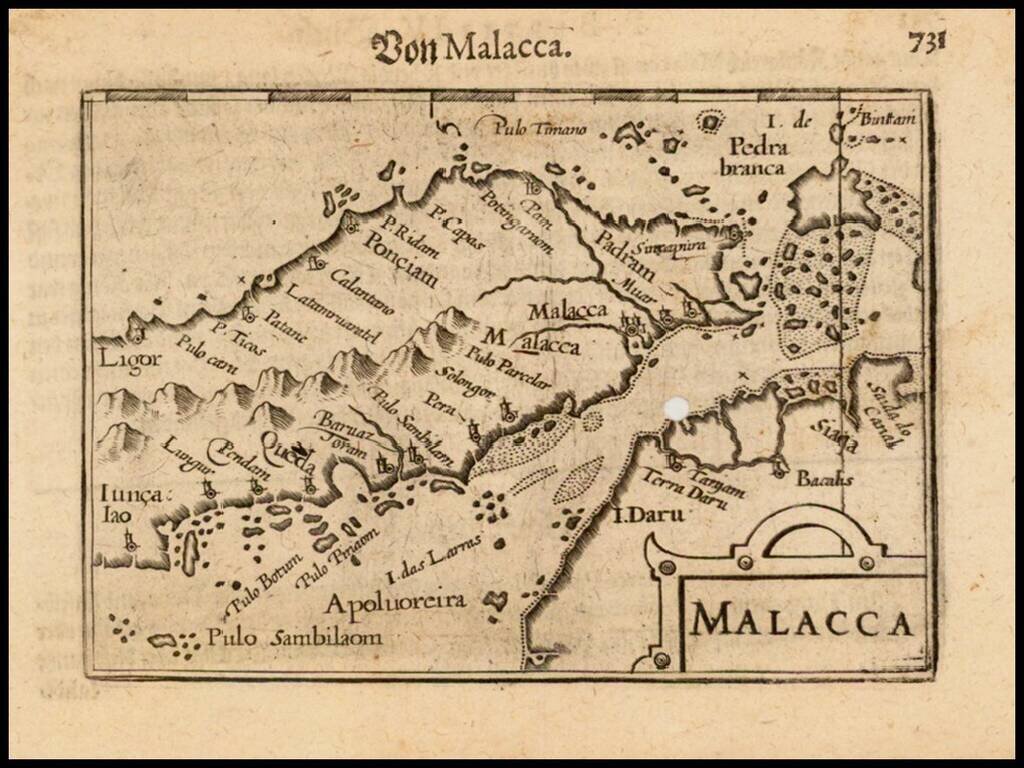
Nice example of this early state of Barent Langenes's, map of Malacca (including Singapore), which first appeared in the 1598 edition of Langenes's Caert-Thresoor, published in Middelburg. The present map is one of the earliest obtainable maps to...
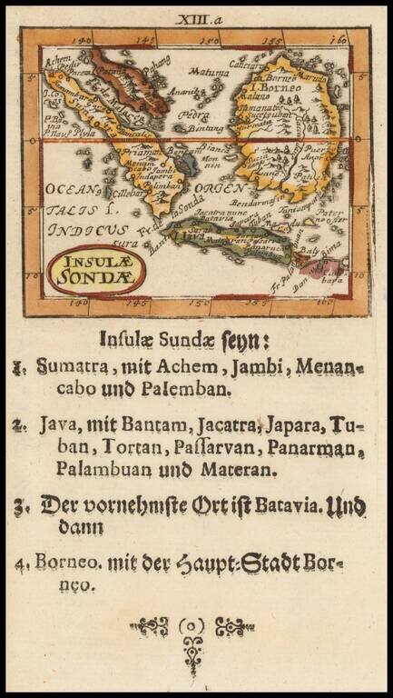
Scarce map of Malaysia, Sumatra, Singapore, Java and Borneo, published by Muller. The maps are based upon a series of miniature maps first published in Paris, by Du Val. Many other interesting features. From one of the rarest and most coveted of all...
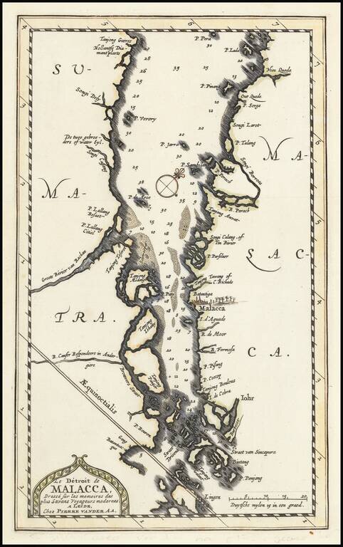
Finely executed map of the Straits of Singapore and the Straits of Malacca, which appeared in Pierre Vander Aa's monumental La Galerie agreable du Monde . . ., published in Leiden. The map shows Sumatra from Tanjong Goeree to Pulau Singkep and P. Lada...
![l'Ile de Sumatra . . . [shows Singapore]](/map/small/68965.jpg)
Detailed map of Sumatra, Singapore Straits (Straet van Sincapura), Bintan Island (P. Panjang) and the contiguous coastline of Malaysia. Malacca is named, with some coastal and river details around Kuala Lumpur (P. Perach, R. Perang, Songi Borros)....
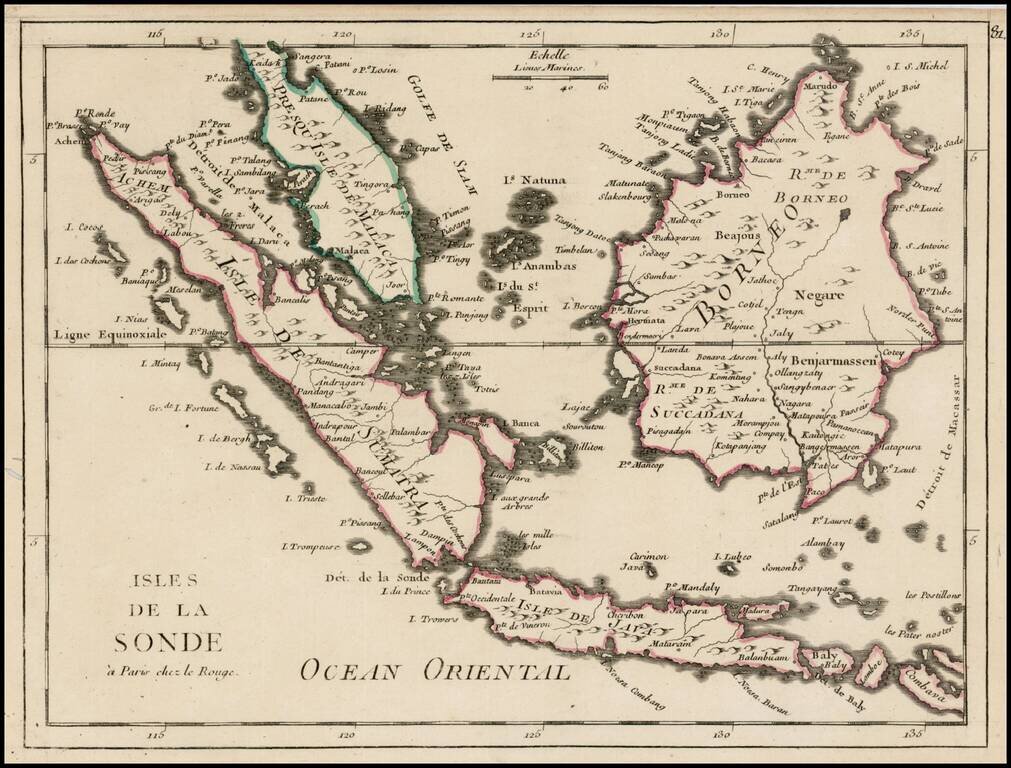
Interesting map of Singapore, Malaca, Java and Borneo from Le Rouge's Nouvel Atlas Portatif.
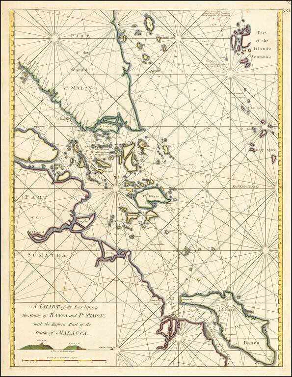
Extremely rare English sea chart centered on Singapore nd the Straits of Malacca. First state of the William Herbert’s chart of the Malacca-Singapore navigation, the first broadly accurate British sea chart of Asia’s busiest shipping lane,...
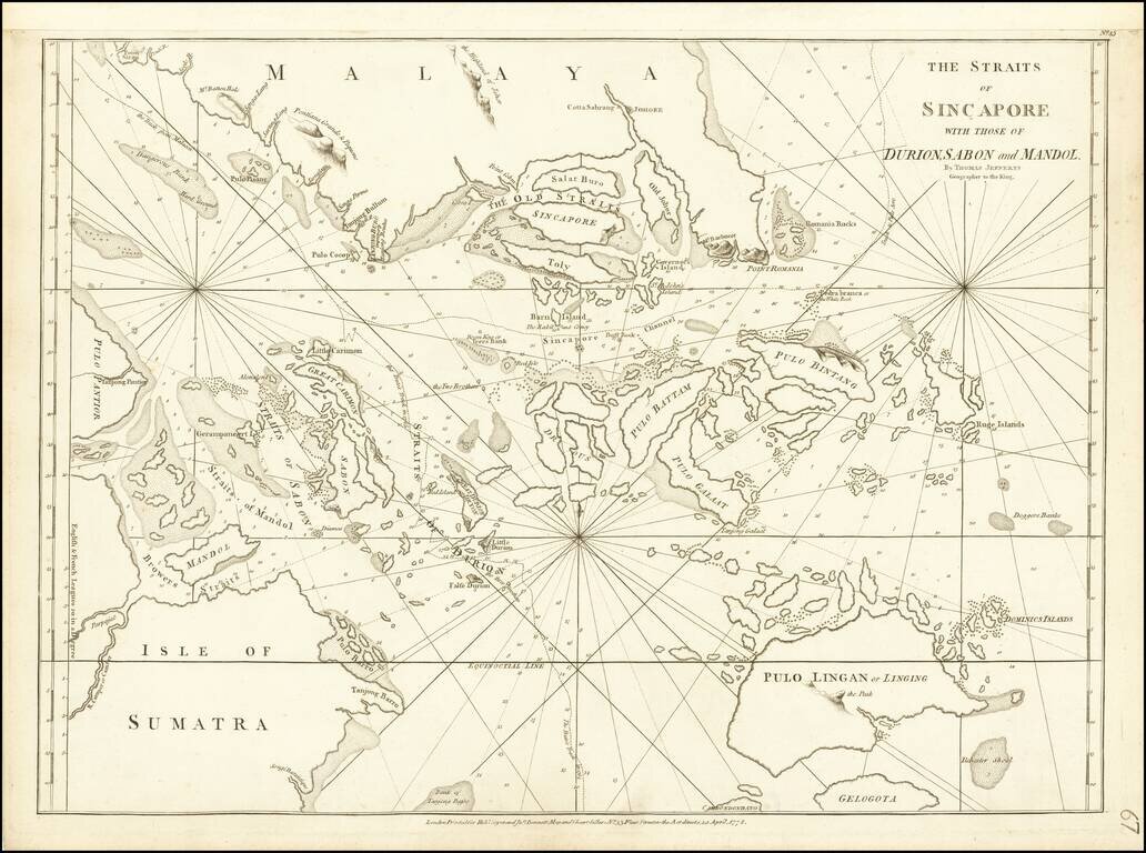
Extremely rare chart of Singapore and the surrounding region, compiled by Thomas Jefferys, and published by Sayer & Bennett in London in 1778. The map extends from Sumatra in the southwest to just north of Singapore in the north. Numerous islands...