
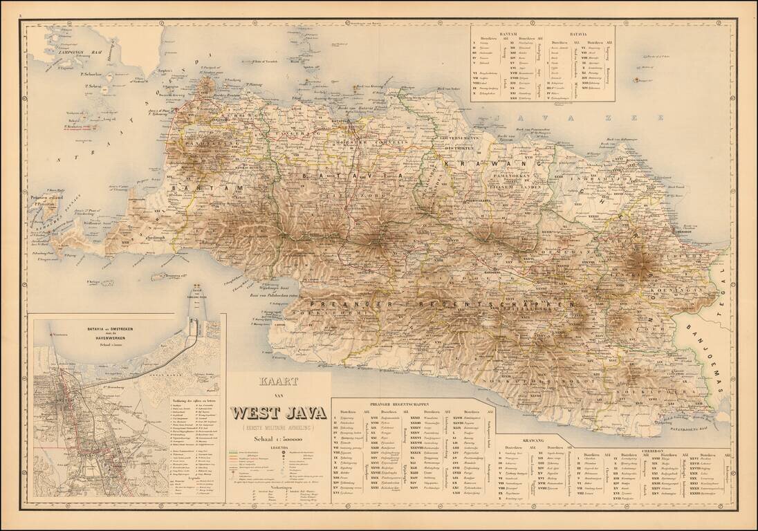
West Java Attractively color-printed map of Western Java, with a large inset of the Harbor of Batavia and environs, from Stemfoort's Atlas der Nederlandsche bezittingen in Oost-Indië naar de nieuwste bronnen samengesteld en aan de regering...
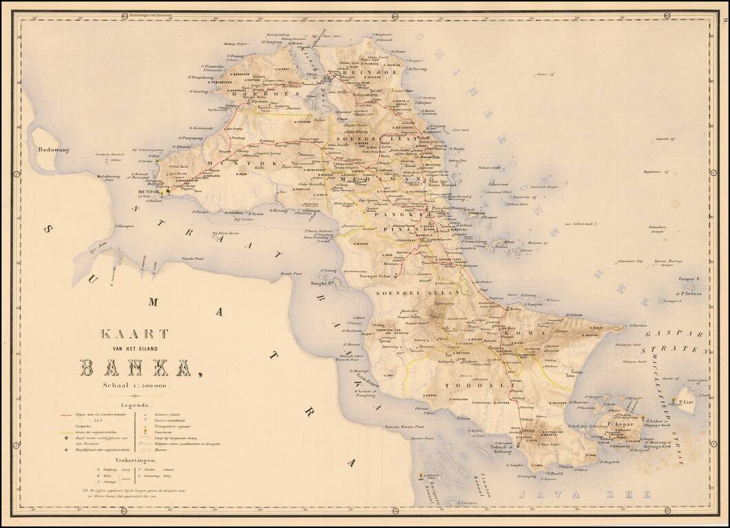
The Island of Banka Attractively color-printed map of Banka from Stemfoort's Atlas der Nederlandsche bezittingen in Oost-Indië naar de nieuwste bronnen samengesteld en aan de regering opgedragen. A fine, highly detailed map, with topographical...
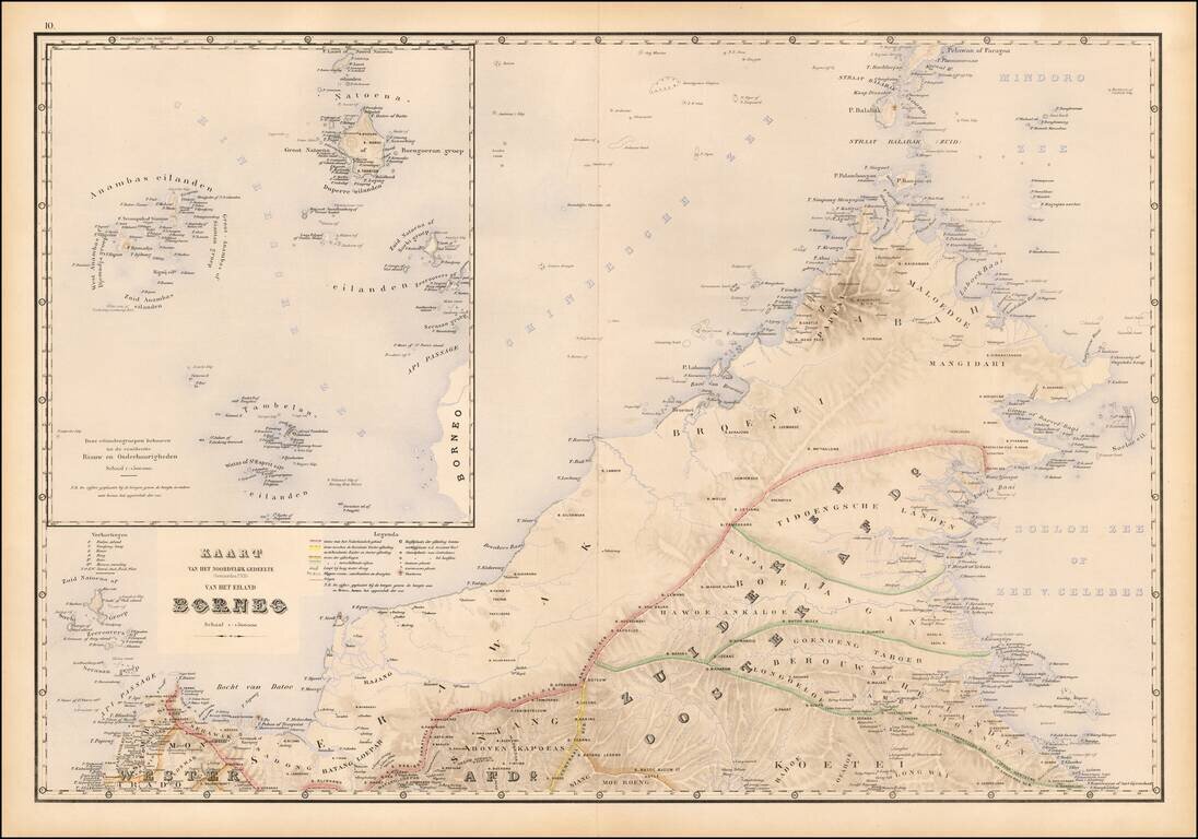
Fine map of northwestern Borneo, from Stemfoort's Atlas der Nederlandsche bezittingen in Oost-Indië naar de nieuwste bronnen samengesteld en aan de regering opgedragen. The map extends from the Api Passage and Sambas to Berouwsche Landen and north to...
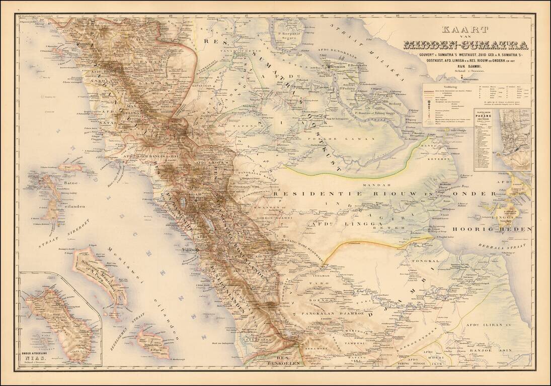
Detailed map of the central part of the Island of Sumatra, Stemfoort's Atlas der Nederlandsche bezittingen in Oost-Indië naar de nieuwste bronnen samengesteld en aan de regering opgedragen. The map extends from Sibolga on the west coast of Sumatra in...
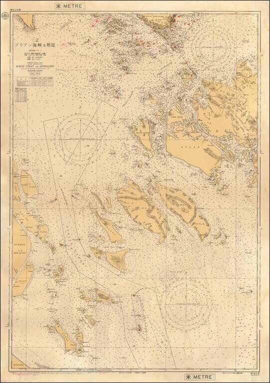
Rare separately issued sea chart of a part of the areas between Singapore Island and the coast of Sumatra, published by the Maritime Safety Agency of Japan shortly after the end of the Second World War. Major islands shown including Batam, Bulan,...
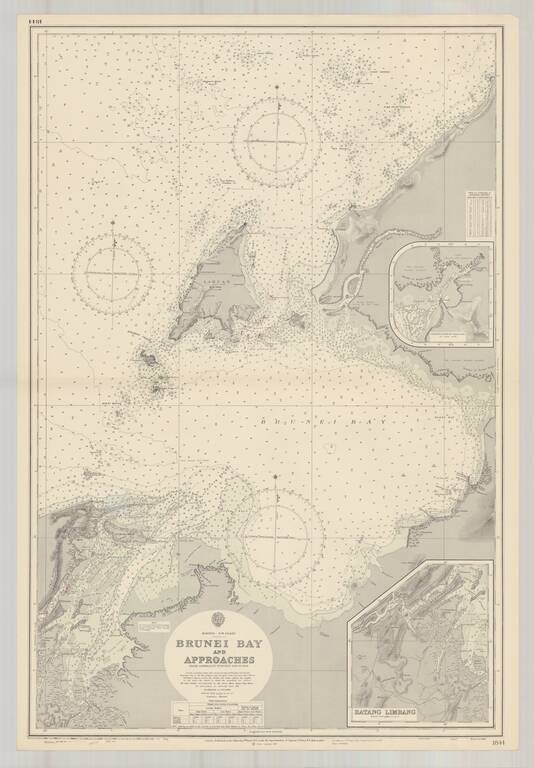
Finely executed harbor chart of the Bay of Brunei, published by the British Admiralty. Includes inset maps of Batang Limbang and the continuation of Padas Bay,
![[Manila - Luzon] Typus Freti Manilensis. Die Straet vande Manilles](/map/small/61346op.jpg)
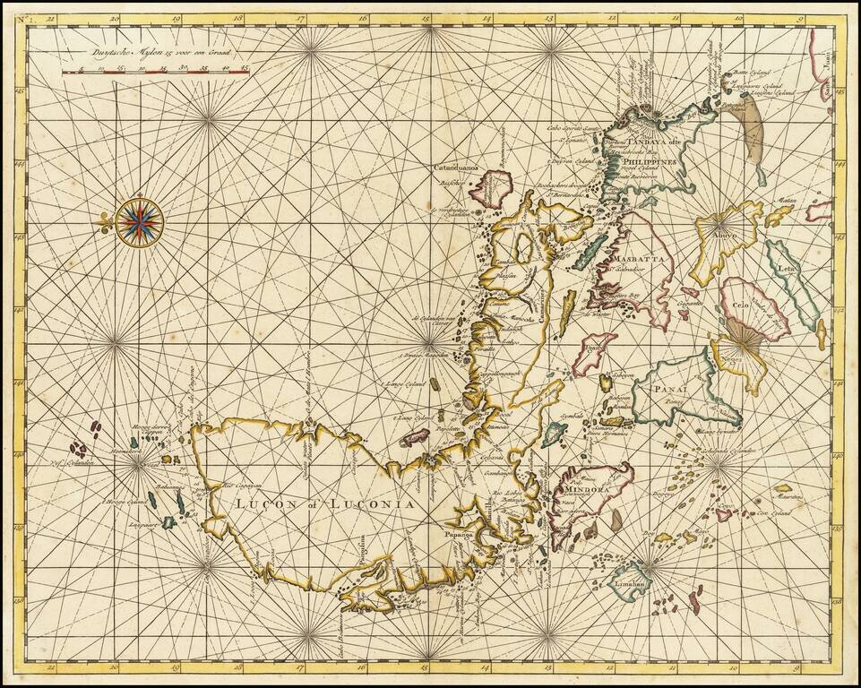
One of the Earliest Obtainable Maps of Manila / Luzon / Northern Philippines Nice example of Joris van Spilbergen's rare regional map / sea chart of Southern Luzon, Mindoro and Samar Islands, published in Amsterdam in 1619. The map provides a...
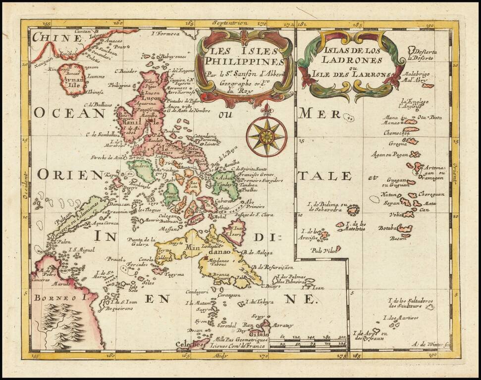
Highly detailed map of the Philippines on the left side, with a map of the Ladrones on the right side of the map, from Sanson's L'Asie en plusieurs cartes nouvelles, et exactes & en divers traittés de Géographie, et d'Histoire, first published in...
A Philippine Islands Rarity Detailed map of the Philippines, published in Paris by Du Val. An uncommon map of the Philippines, including parts of China and Borneo, depicting major towns and topographical features. The fictitious island of San Juan...
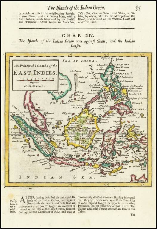
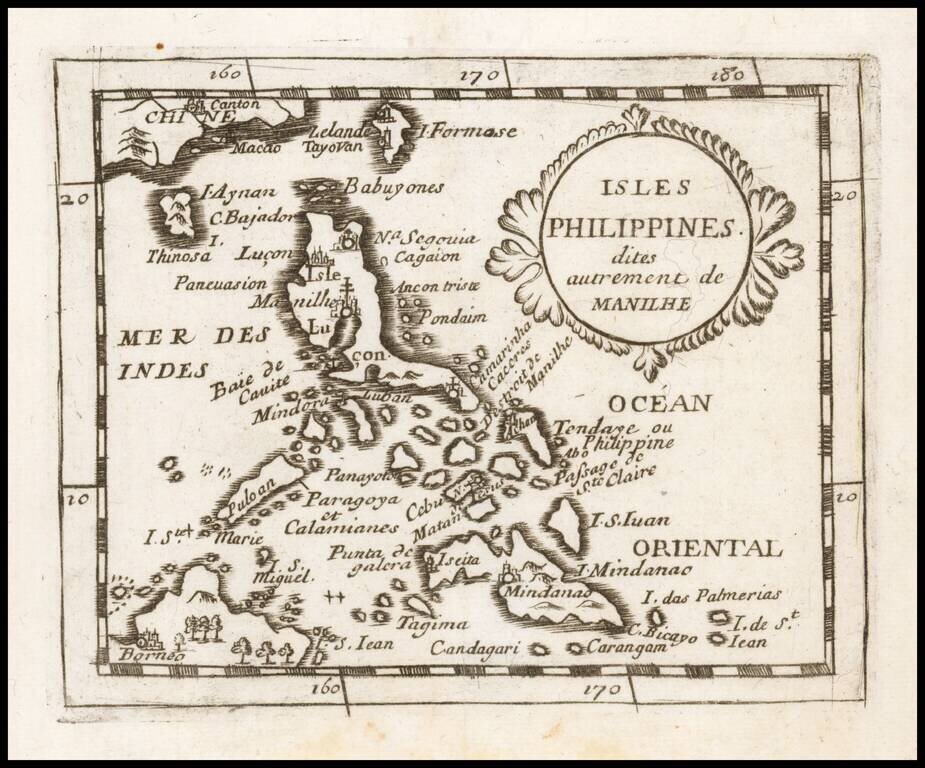
Detailed map of South East Asia and the Philippines, with explanatory text. First published in 1695, this map is from one of the subsequent editions of Abell Swall's and Tim Child's Thesaurus Geographicus issued in 1700, 1701 and 1709.
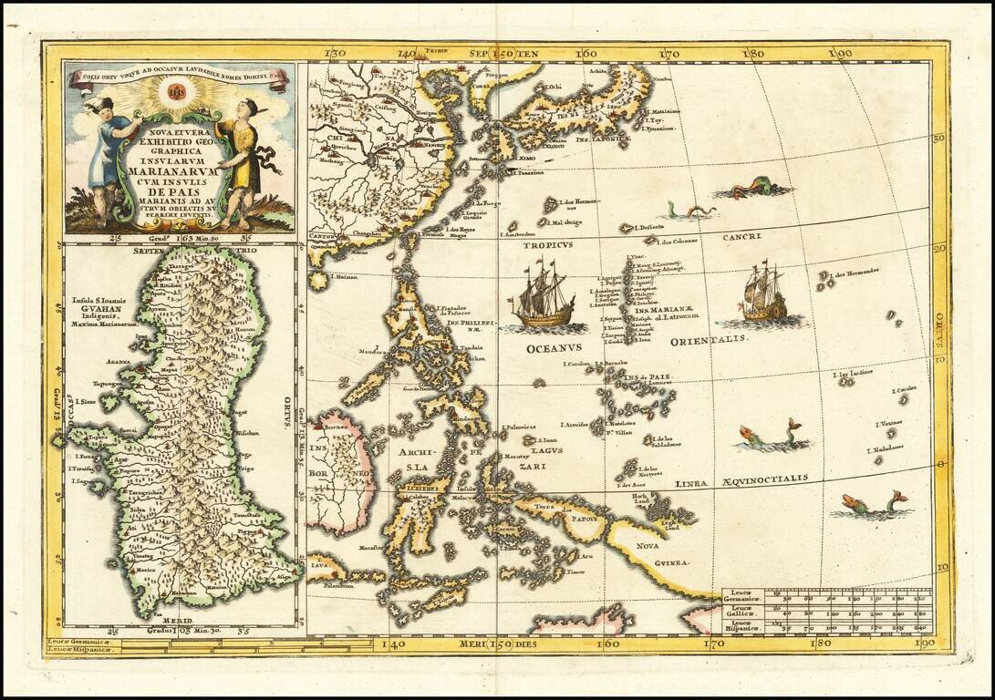
Fascinating map of the the Philippines, China, Japan and Korea, with a large inset of Guam, from Heinrich Scherer's monumental work. Includes a large inset of Guam. Heinrich Scherer (1628-1704) was a Professor of Hebrew, Mathematics and Ethics at the...
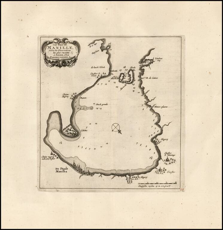
Rare Variant / Manilla Rarity! Rare early map of Manilla Bay, which appeared in Vander Aa's La galerie agréable du monde. The map is oriented with southwest at the top and includes a small town plan for Manilla and other places. Soundings are also...
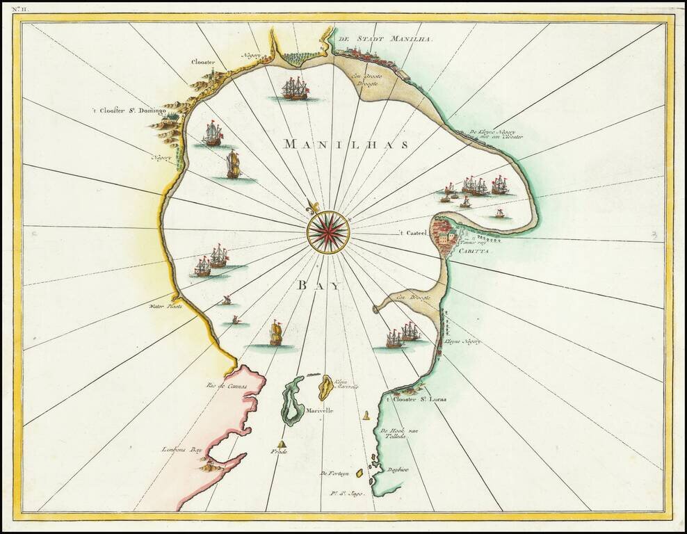
The Earliest Obtainable Large-Format Chart of Manila Bay Fine dark impression of Francois Valentijn's chart of Manila Bay, from his important Oud en Nieuw Oost-Indien. The striking chart is the earliest obtainable chart to show Manila Bay in such...
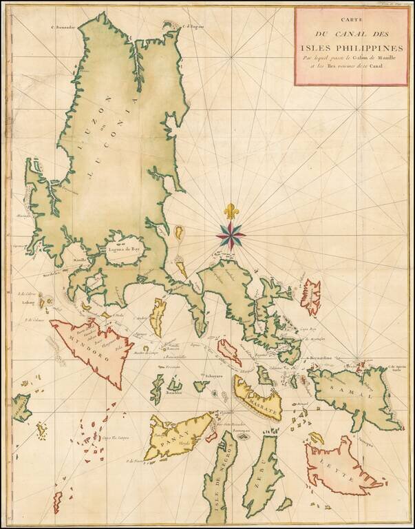
The Earliest Obtainable Large-Format Chart of the Philippines. Rare chart of the Philippine Islands from Valentijn's important Oud en Nieuw Oost-Indien. A striking, large-format map, it is the earliest obtainable map of this size and detail to focus...
Large detailed chart of the Islands of the Philippines from the French edition of Anson's Voyages. One of the most detailed charts of the Philippines of the era. Shows Islands, bays, reefs, soundings tracks of the Manila Galleon route, etc. Includes a...
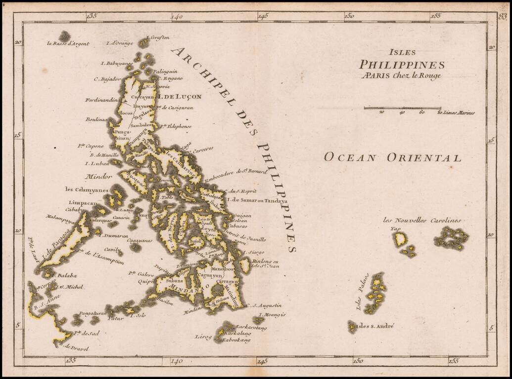
Detailed map the Philippines, from Le Rouge's scarce Atlas Nouveau Portatif, published in Paris in 1748. One of the earliest obtainable separately published maps of the Philippines.