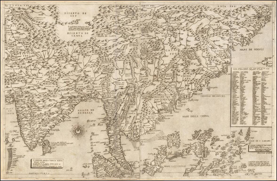
![l'Ile de Sumatra . . . [shows Singapore]](/map/small/68965.jpg)
Map size in jpg-format: 6.36061MiB
Click to open in high resolution (open in new tab).
![l'Ile de Sumatra . . . [shows Singapore]](/prevmap/prev_68965/68965.jpg)
Detailed map of Sumatra, Singapore Straits (Straet van Sincapura), Bintan Island (P. Panjang) and the contiguous coastline of Malaysia.
Malacca is named, with some coastal and river details around Kuala Lumpur (P. Perach, R. Perang, Songi Borros).
The map is oriented with northwest at the top.
Pieter van der Aa (1659-1733) was a Dutch mapmaker and publisher who printed pirated editions of foreign bestsellers and illustrated books, but is best known for his voluminous output of maps and atlases. Van der Aa was born to a German stonecutter from Holstein. Interestingly, all three van der Aa sons came to be involved in the printing business. Hildebrand was a copper engraver and Boudewyn was a printer.
If you are a student, write to us in telegram: @antiquemaps and indicate what material you need and for what work you need a map in high detail. We are ready to provide material on special terms. For students only!