
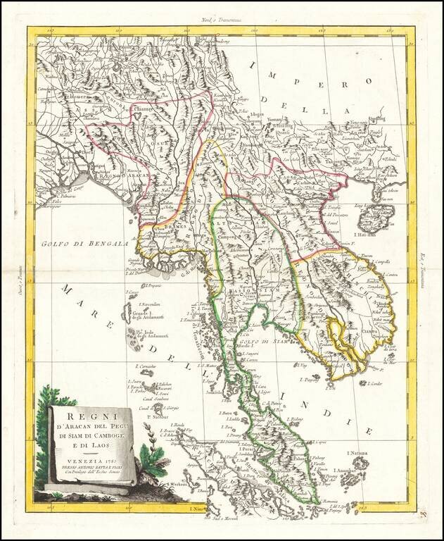
Striking map of the region from the Gulf of Bengal to Hainan, centered on the Malay Peninsula, Straits of Malacca and most of Sumatra. The map was issued in Zatta's Atlante Novissimo, a monumental 4 volume work and one of the last great decorative...
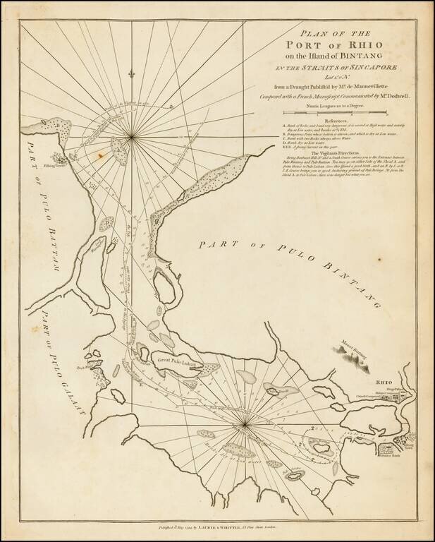
A fine large format 18th-century sea chart of Bintan and Batam Islands, Indonesia, located on the Singapore Straits, published by the firm of Laurie & Whittle. Bintan Island (formerly known as Bintang) and the adjacent island of Batam (Bataam) are...
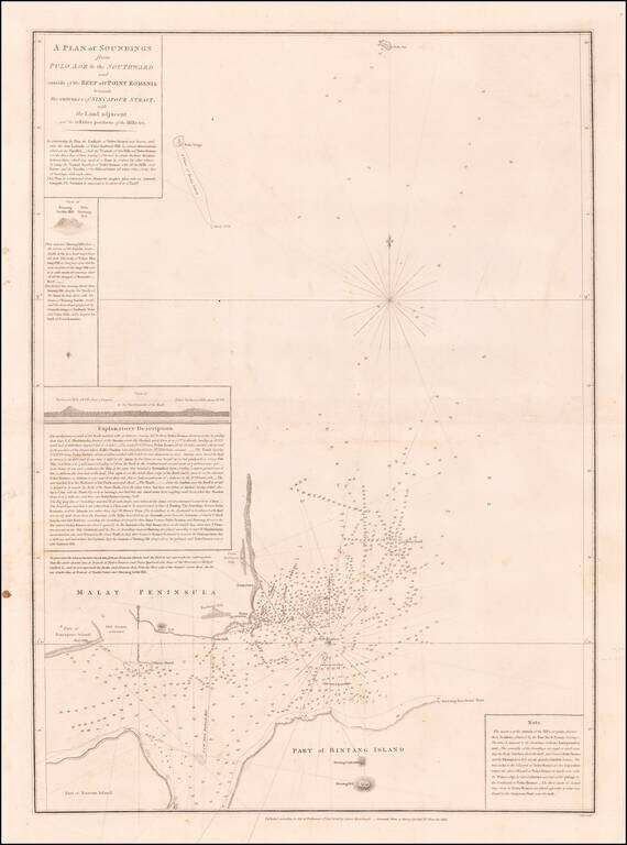
Horsburgh & Ross's Chart of Eastern Part of Singapore Strait Rare early sea chart of the Easternmost part of Singapore Strait, showing the area between Singapore, the southwestern tip of Malaysia, Bintan Island and Batam Island, published in...
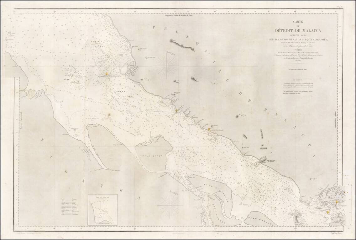
A rare large-format 1860s sea chart of the southern part of the Straits of Malacca, including Singapore Island, published by the French Dépôt de la Marine. This highly detailed sea chart embraces the Straits of Malacca from a point just north of...
![[Singapore & Malaca Strait] Carta Esferica Del Mar de China Comprendido Entre La Isla De Borneo y La Peninsula De Malaca, segun os trabajos mas modernos ingelese y holandeses . . . 1864](/map/small/62184.jpg)
Spanish Sea Chart of the Malacca Strait and Environs -- Singapore Fine Spanish nautical chart, illustrating the Straits of Malacca and northwestern Borneo, published by the Spanish Hydrographical Office in 1864. The map credits the work of modern...
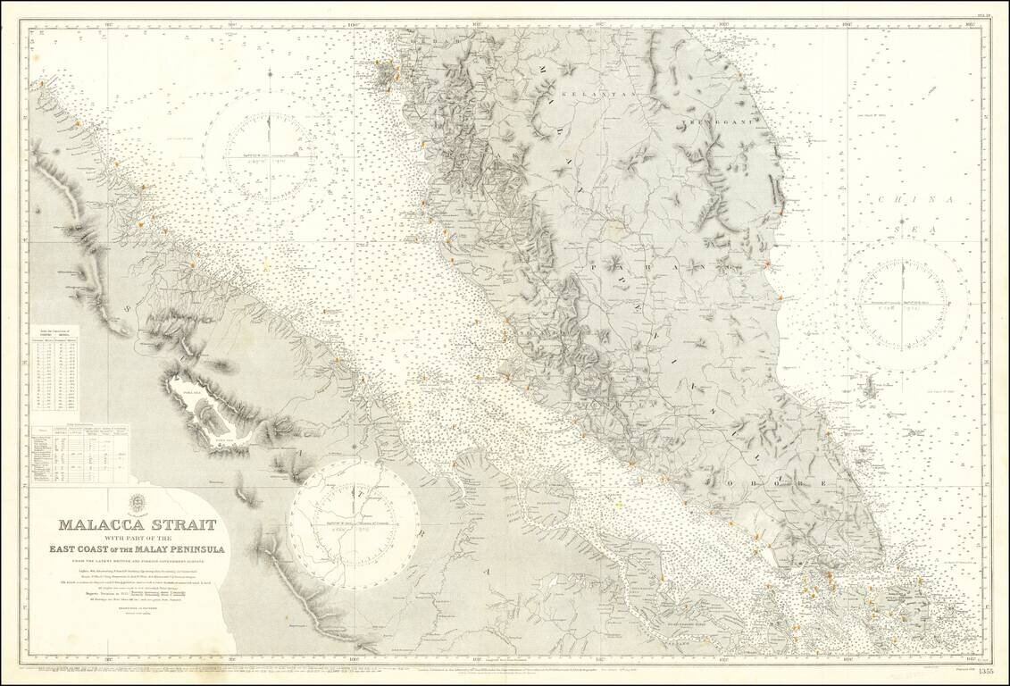
Detailed sea chart of the Malaya Peninsula and the northeast coast of Sumatra, featuring Singapore and the surrounding area. The chart was published by the British Admiralty first in 1898, and then as a new edition in 1922. This example has been...
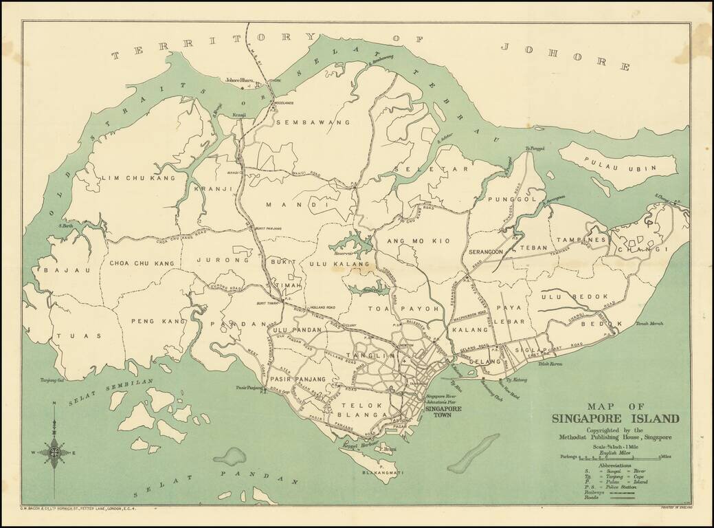
Rare variant edition of this scarce map of Singapore, published by the Methodist Publishing House, Singapore. The map would seem to pre-date the appearance of this map as a two sided promotional guide map, with advertising printed around the outside...
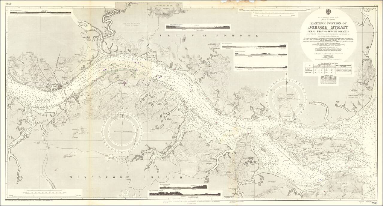
Fine large sea chart centered on the Johor Strait, published in London by the British Admiralty. Drafted from surveys by the H.M.S. Merlin conducted in 1921, the map includes hundreds of soundings and an exceptionally detailed treatment of the...
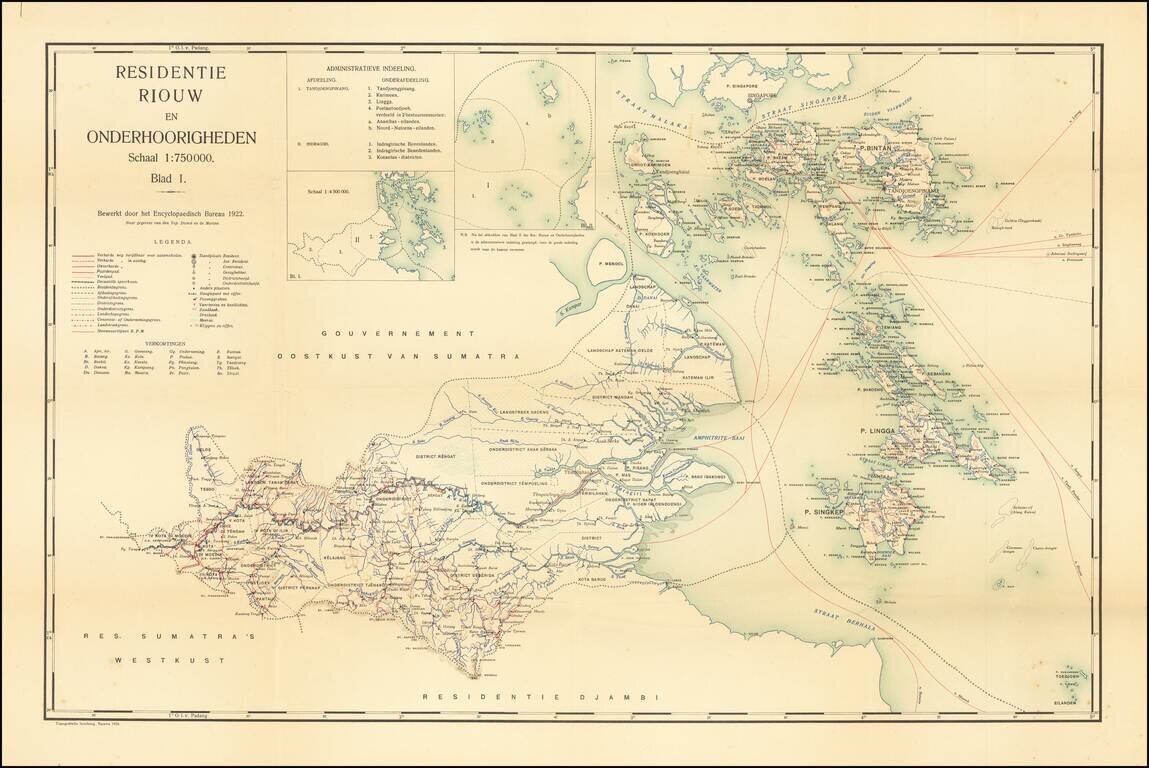
Jakarta Imprint -- Residency of Riau and Dependencies Rare map of the the Riau Residency of Indonesia, extending north to Singapore, published in Batavia (Jakarta). The map covers the area south of Singapore and the Malacca and Singapore Strait,...
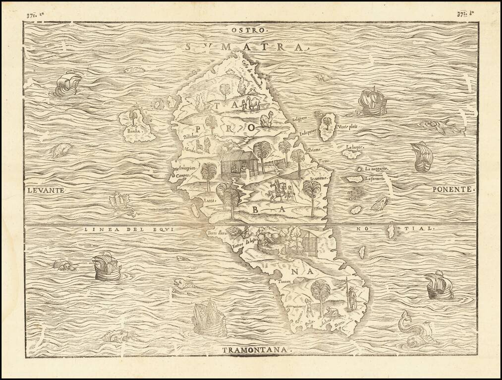
Fine Map of Sumatra, the First to be Based on Actual Observations Nice example of Giovanni Battista Ramusio's important early map of Sumatra, from his famed Navigationi et Viaggi. This is the first map focused solely on an Indonesian island to be...
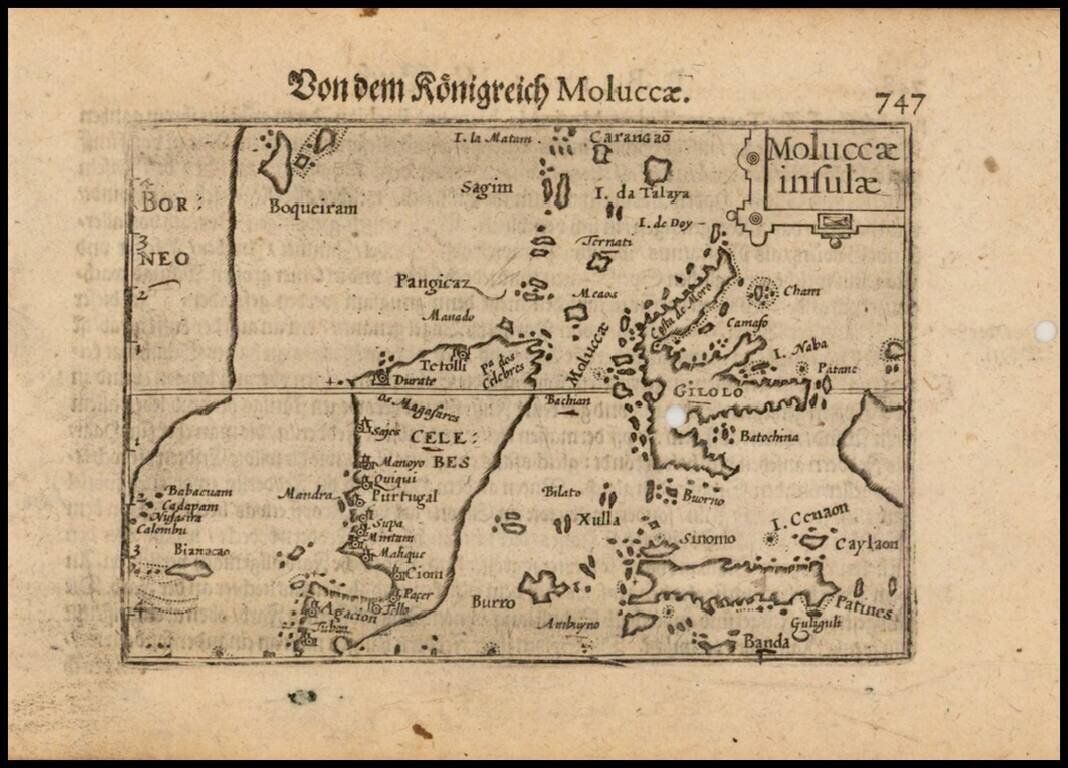
Nice example of this early state of Barent Langenes, map of the Moluccas, which first appeared in the 1598 edition of Langenes Caert-Thresoor, published in Middelburg. The present map is one of the earliest obtainable maps of the Moluccas. Langenes's...
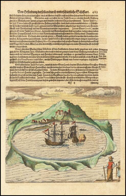
Early view of the Island of Solor in the Sunda Islands of Indonesia, from De Bry's Grand Voyages, an illustrated collection of accounts of the Americas which defined the early European picture of the New World. Around 1570, Theodorus de Bry, a...
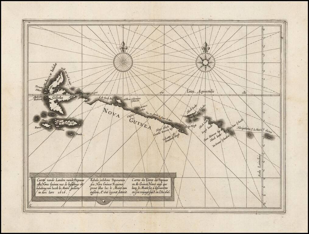
Nice example of this rare chart showing the route of Schoten and Le Maire north of New Guinea and the Moluccas. Willem Cornelisz Schouten (1567-1625) was a navigator for the Dutch East India Company. He was the first to sail the Cape Horn route to the...
![(V.O.C. Forts) Amboyna [and] I. Nera](/map/small/48714.jpg)
Antique engraving of two Dutch East India Company settlements in the Spice Islands: Ambon and Fort Belgica on Banda Neira. Fort Belgica was an important fort in the area for centuries, originally starting as a Portuguese installation in the 16th...
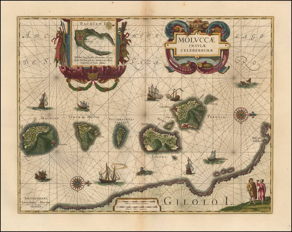
Finely colored example of Blaeu's important and highly decorative map of the Spice Islands. Wonderful, highly decorative cartouche, which many collectors will recognize as the thematic logo for the Miami International Map Fair. The map features a...
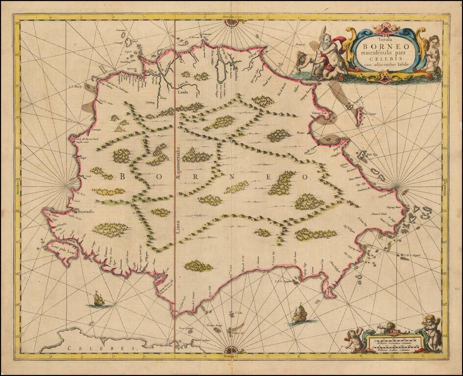
Nice example of Jansson's chart of Borneo, the earliest large format map to focus on the Island.