
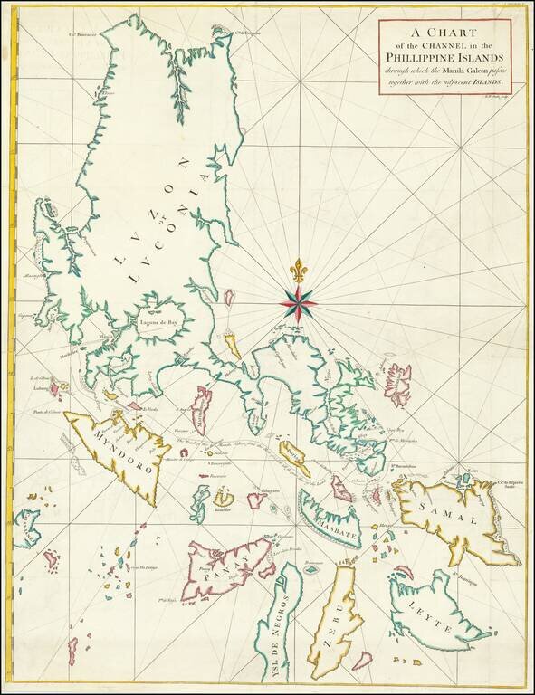
Chart of Philippines from Anson’s Voyage round the World, Part of His Plan to Capture a Spanish Treasure Galleon Nicely colored example of George Anson's chart of the Philippine Islands, showing the area from Luzon to Leyte, Zebu and Ysle De...
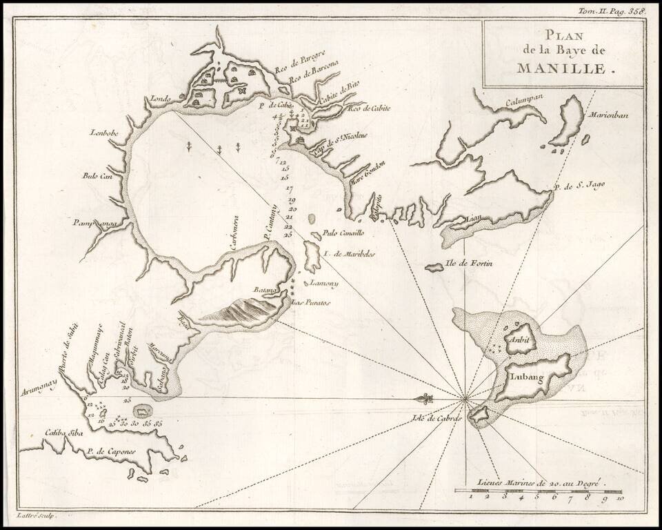
One of the Earliest Obtainable Plans of Manilla Bay. Detailed chart of Manilla Bay and environs, including placenames, soundings, etc. From a French edition of Anson's Voyages. One of the best maps of Manilla Bay from the period.
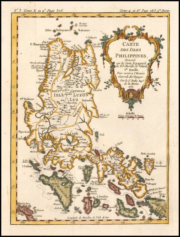
Detailed map of the Northern portion of the Philippines, extending from Batanes and Babuyans to Mindoro and Masbate, and centered on Luzon. One of the most detailed maps of the period. Includes a large decorative title cartouche. One of the maps...
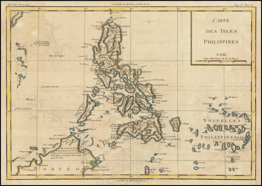
Finely engraved map of the Philippines, from Jacques Nicolas Bellin's Le Petit Atlas Maritime Recueti de Cartes et Plans des Quatre Parlies du Monde en Cinq Volumes, first published in Paris in 1764. Jacques Nicolas Bellin Jacques Nicolas Bellin...
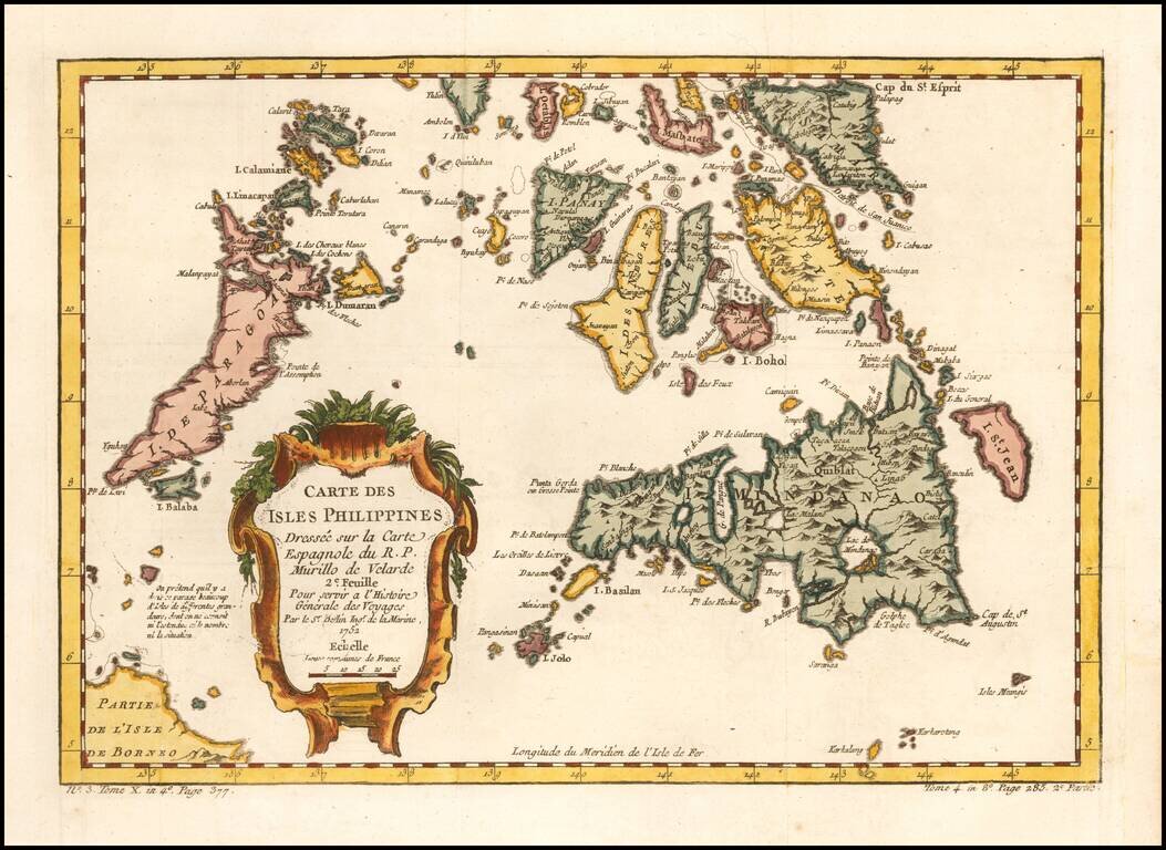
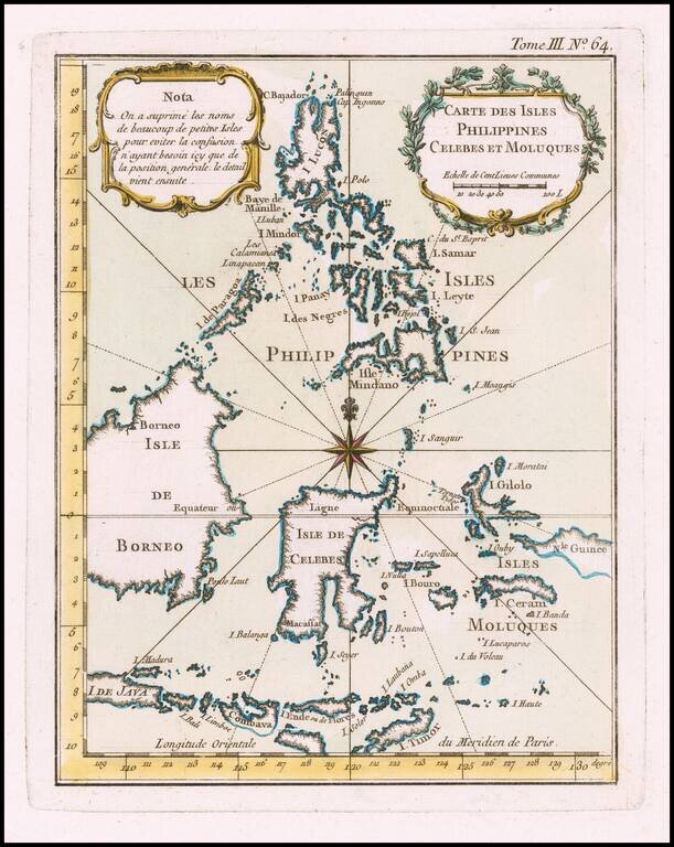
Finely engraved map of the southern portion of the Philippines, from Jacques Nicolas Bellin's Le Petit Atlas Maritime Recueti de Cartes et Plans des Quatre Parlies du Monde en Cinq Volumes, first published in Paris in 1764. As noted in the title, the...
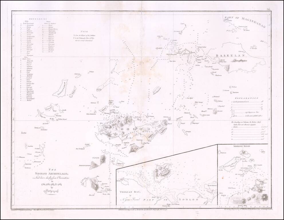
A detailed map of the Sulu Archipelago, Basilan and part of Mindanao and neighboring islands, published by Alexander Dalrymple. Includes two large insets of Toolyan Bay by James Rennel and Sooloo Road. The chart includes a pronunciation guide at...
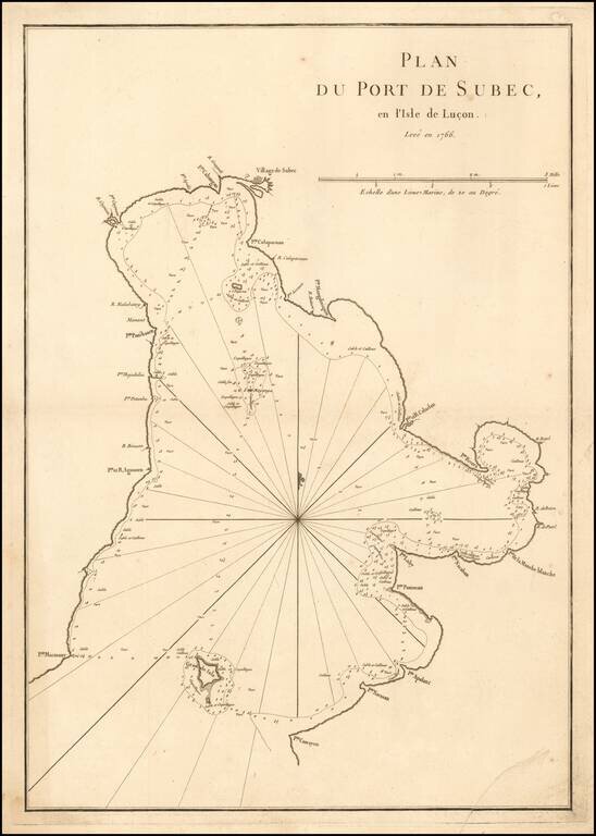
A rare sea chart of Subic Bay in the Philippines, which appeared in the second edition of Mannetvillette's Le Neptune Oriental, published in 1775. The chart is one of the earliest obtainable detail charts of Subic Bay. Subic Bay was discovered by the...
![[Philippines, Borneo, Java, etc] La Presqu'Isle De L'Inde Au Dela du Gange, avec L'Arcihpel Des Indes. Partie Orientale](/map/small/46196.jpg)
Fine example of Rigobert Bonne's map of the Philippines, Java, Borneo, Formosa, the Moluques, etc. Very detailed and interesting.
Detailed, scarce map of the Philippines published in Louis Brion de la Tour's Histoire Universel, circa 1780. The map names dozens of cities, shows Manila as the capital, and even includes an illustration of an erupting volcano. Scarborough Shoal and...
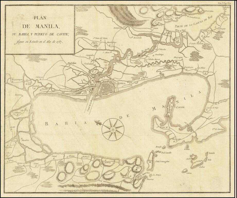
The Duque de Almodovar's Map of Manila Bay Rare large map of the Bay of Manila, by the Duque de Almodovar, published in Manila. The map is based upon the cartography of Father Pedro Murillo Velarde's Carta Hydrographica y Chorographica de las Islas...
![[Philippines, Indonesia, Brunei, Malaysia, Singapore]](/map/small/68224.jpg)
Decorative map of the Southern Philippines, Indonesia, southern Malaysia, Singapore, Brunei, etc, published by Zatta. The map is bottom left sheet of a 4 sheet map of the region, but was issued as a separate sheet in Zatta's atlas. Antonio Zatta was...
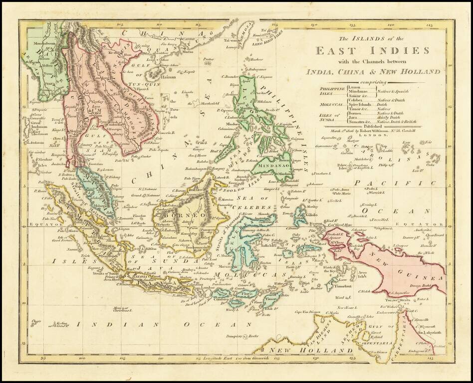
Highly detailed map of Southeast Asia, covering the region between Formosa and Hainan islands in the North and Australia in the South. Excellent detail in the Philippines, Indonesia and Southeast Asia. Johor is named, but not Singapore. Robert...
![[Manila] Baie de Manille par M. de Malespina](/map/small/61646.jpg)
A Diplomatic Exchange of Cartographic Information in the Far East Rare map of Manilla Bay, based upon the work of Alessandro Malapina, perhaps earliest example of Malaspina's mapping of Philippines to appear in print. The map is drawn from...

First State! Detailed sea chart of the region extending from Singapore, Gulf of Siam, Cambodia, Vietnam, Mindanao and Borneo, first published by the East India Company in 1821. Extremely detailed chart of the region, with a number of coastal...
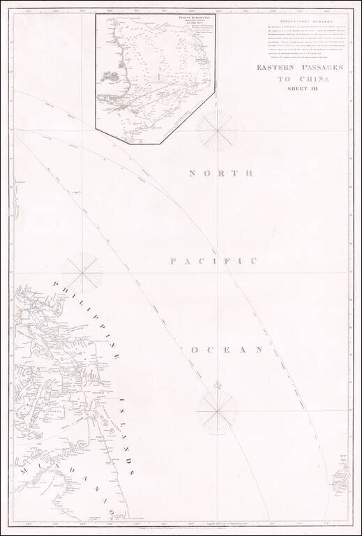
Rare Early Philippine Sea Chart Detailed sea chart showing most of the Philippines, with a large inset map of Manila Bay, including an extensive set of Explanatory Remarks. The need for more accurate charts was forcibly brought home to James...
![[3 Part Map of the Philippines]: Islas Filipinas Primera Hoja Central [and] Islas Filipinas Segunda Hoja Central [and] Islas Filipinas Posesiones de Oceania. Media Hoja Superior. Media Hoya Inferior](/map/small/61939.jpg)
Good example of Francisco Coello's Islas Filipinas, the most important general map of the Philippines of the 19th-century and the first modern topographical map of the Philippines based on Scientific Surveys. The present map is the most important...