
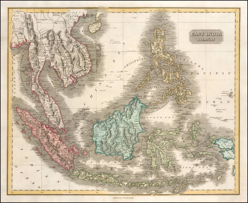
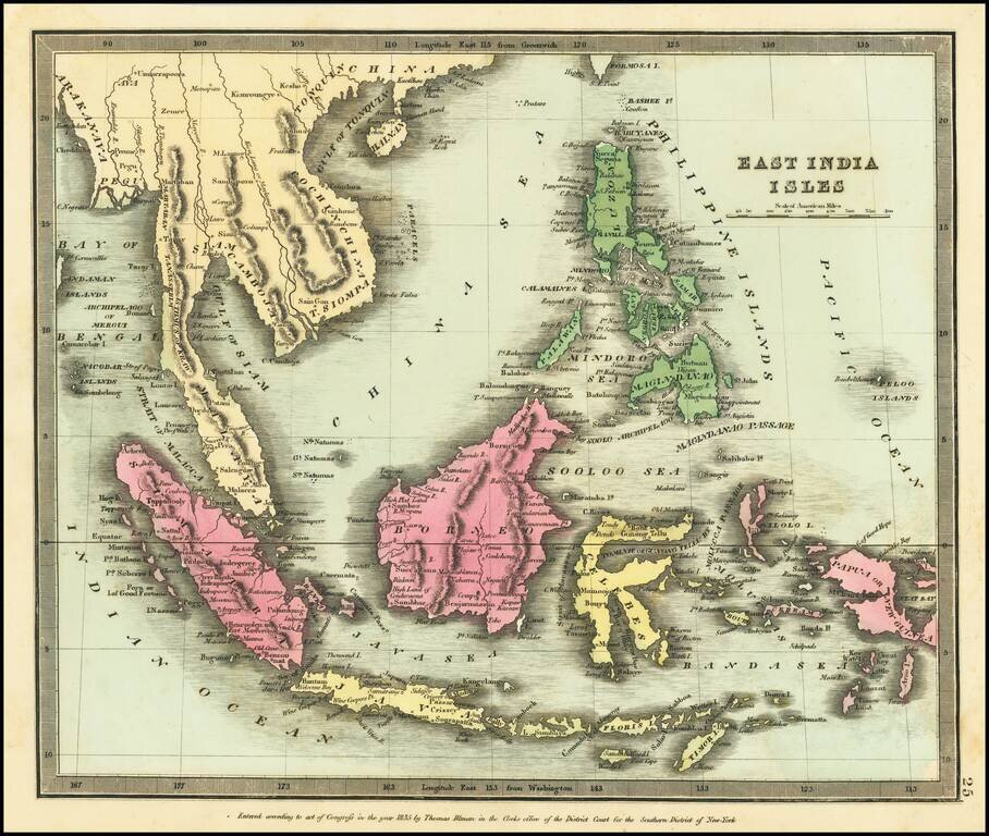
Scarce and highly detailed map of Southeast Asia and the Philippines, published by Lizars. The map extends from Hainan and the Gulf of Tonkin to Pegu and the Bay of Bengal, in the North and showing all of the Philippines, Papual New Guinea, Timor,...
Scarce and highly detailed map of Southeast Asia, including southern China, the Philippines, the Malaysian Peninsula and extending south to Java, Timor and the northern tip of Australia. Includes rivers, some early roads, towns, topographical details,...
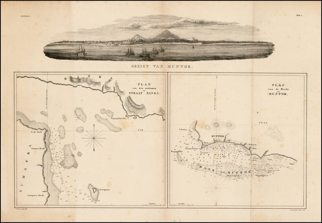
Fine panoramic view of Muntok in the top and two charts of Strait Bangka and offshore of Muntok on Bangka, drawn by Pistorius and I.W.Burslen. This group is of considerable historical importance as the first published maps focusing on Palembang,...
![Asiatic Archipelago [Early Singapore Inset]](/map/small/66879.jpg)
First State! Nice example of John Arrowsmith's map of the Asiatic Archipelago, including a large inset map of Singapore. Centered on the Philippines and Borneo, the map shows a number of different seasonal passages through the region to Hong Kong and...
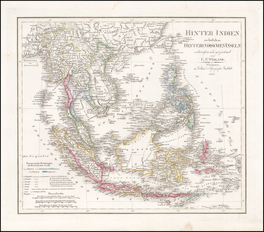
Interesting, detailed antique map of Southeast Asia published by John Arrowsmith in London in 1832. The map is noteworthy for its political delineations, including the following states: Empire of Anam Camboja Siam Lao Burmah
Nice wash color example of David Burr's map of Southeast Asia and the Philippines Burr's Atlas was perhaps the most elegant American commercially published atlas of its time, utilizing wonderful wash colors and elegant engraving style. Burr studied...

Scarce French sea chart of Sumatra, Java, Borneo, Celebes and environs, published by the Depot General de la Marine. The map extends from the Straits of Malacca in the West to Borneo and south to Sandal Wood (Pulau Sumba), southwest of Java and Bali....
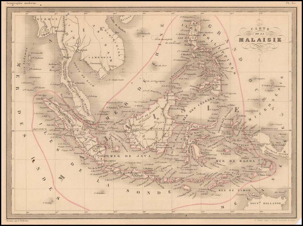
Fine lithographed map of South East Asia by A Vuillemin. Includes Malaysia, the Philippines, Indonesia, Singapore and Java.
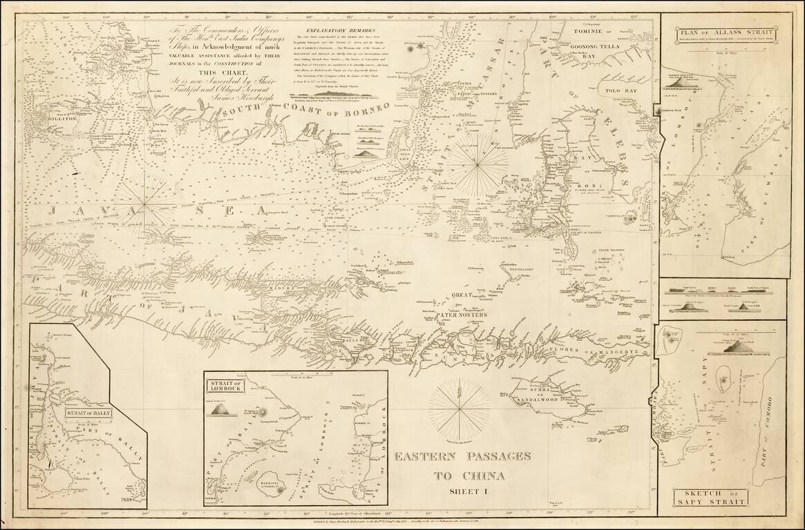
Detailed sea chart of the region extending from Southern Borneo and Java to the Celebes and Borneo, with 2 large insets, published by the East India Company in 1848. The need for more accurate charts was forcibly brought home to James Horsburgh on May...
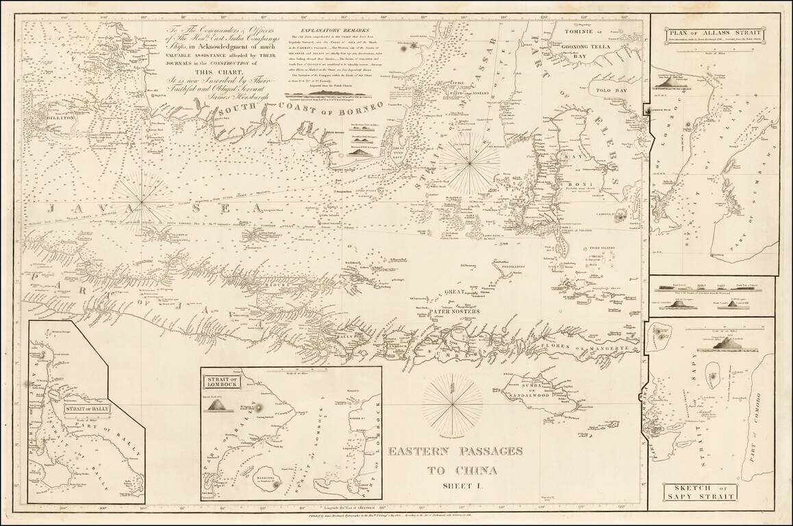
Detailed sea chart of the region extending from Southern Borneo and Java to the Celebes and Borneo, with 2 large insets, published by the East India Company in 1848. The need for more accurate charts was forcibly brought home to James Horsburgh on...
![Asiatic Archipelago [Early Singapore Inset]](/map/small/64854.jpg)
Nice example of John Arrowsmith's map of the Asiatic Archipelago, including a large inset map of Singapore. Centered on the Philippines and Borneo, the map shows a number of different seasonal passages through the region to Hong Kong and Macao. The...
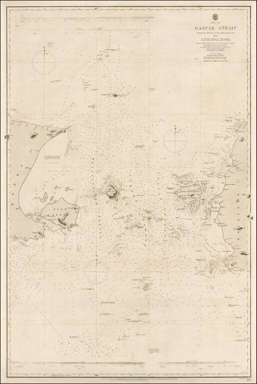
Rare example of this authoritative sea chart of the Gaspar Strait, Indonesia, a critical point of passage for navigation en route from Singapore to the Sunda Strait. This fine sea chart details the Gaspar Strait that runs between the islands of Bangka...
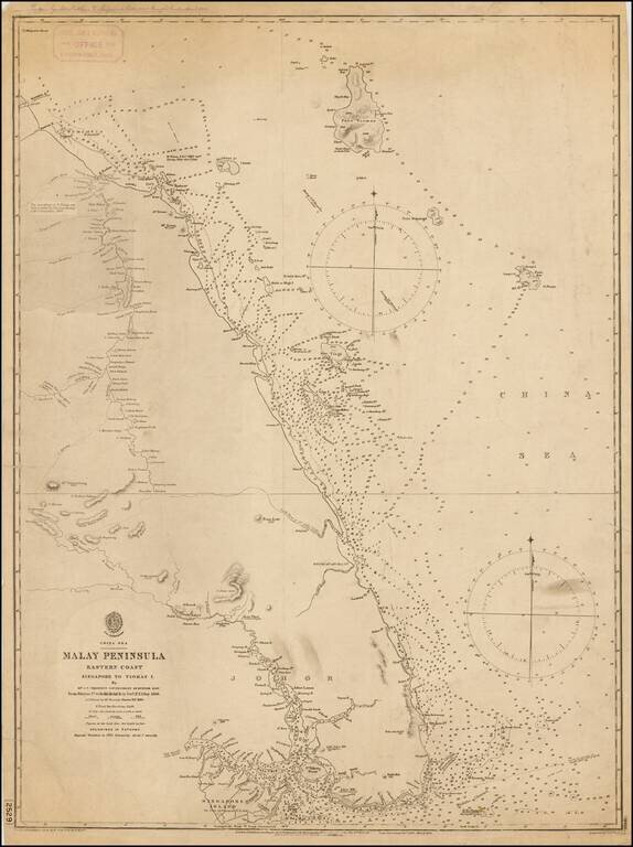
A rare British Admiralty sea, depicting southeastern Malaysia and the eastern part of the island of Singapore. This fine chart details the eastern parts of what is now the mainland Malayisian State of Johor, from the site of Jahor Bahru eastwards,...
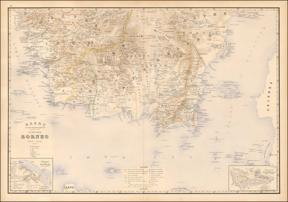
Fine map of southern Borneo, from Stemfoort's Atlas der Nederlandsche bezittingen in Oost-Indië naar de nieuwste bronnen samengesteld en aan de regering opgedragen. A fine highly detailed map, with topographical details, plance names and regional...
![[Sumatra] Kaart van Zuid Sumatra Residentien Benkoelen, Lampongsche Distrikten en Palembang.](/map/small/51736.jpg)
Attractively color-printed map of the southern tip of Sumatra, from Stemfoort's Atlas der Nederlandsche bezittingen in Oost-Indië naar de nieuwste bronnen samengesteld en aan de regering opgedragen. A fine, highly detailed map, with topographical...
![[Sulawesi] Kaart van Zuid West Celebes bevattende deGouvernemts. de Leenroerige en Een Gedeelte der Bondgenootschappelijke Landen behoorende tot het Gouvernements van Celebes en Onderh . . .](/map/small/51902.jpg)
Southwestern Sulawesi Attractively color-printed map of the southern tip of the southwestern part of Sulawesi, from Stemfoort's Atlas der Nederlandsche bezittingen in Oost-Indië naar de nieuwste bronnen samengesteld en aan de regering opgedragen....