
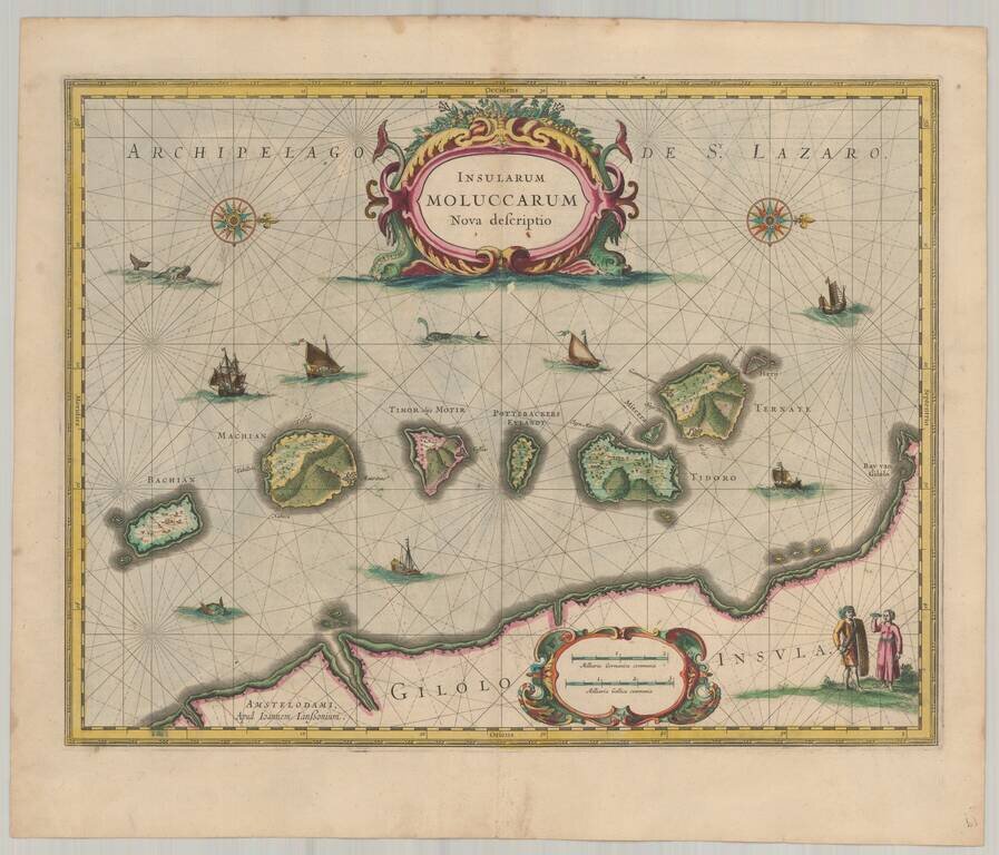
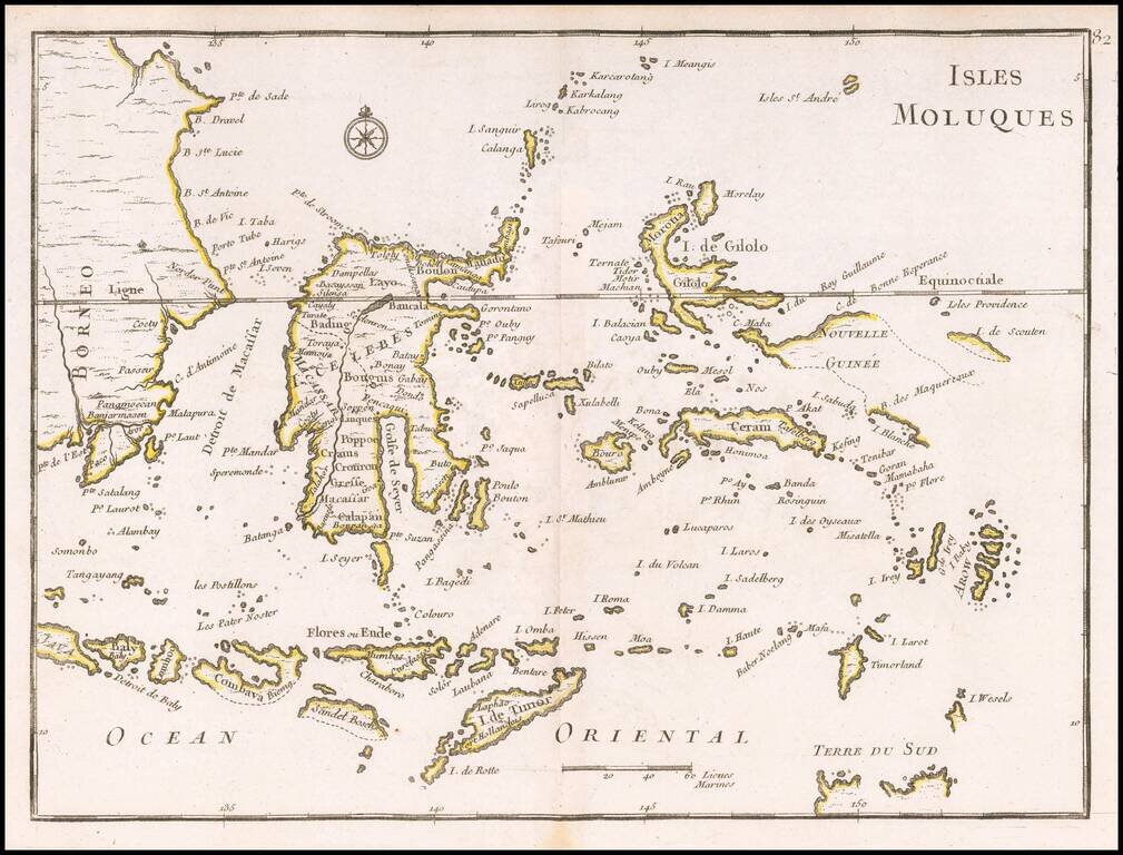
Old color example of Jansson's important and highly decorative map of the Spice Islands. The map features a Moluccan couple in the lower right corner in Europeanized native dress. Indicative of the area's commercial importance, Jansson has filled the...
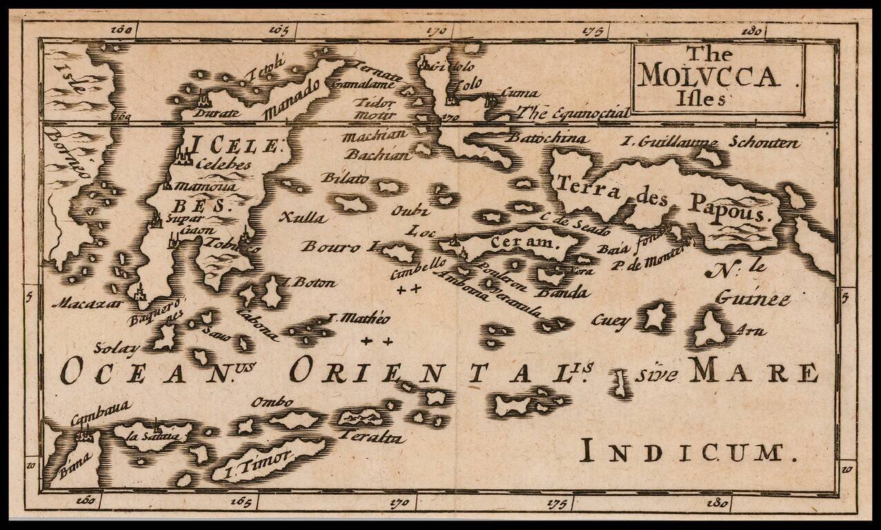
The First English Map of the the Moluccas Rare English map of the Moluccas, published by Jonas Moore in London. The map appeared in Moore's A New Geography. Many of the plates in the work were engraved by Herman Moll, who had moved to London in 1678...

Rare early English map of Malacca, Sumatra, Java, Borneo and the tip of Cambodia. One of the earliest obtainable English maps of the region. Centered on Singapore. A fascinating early English map of the region. This map first appeared in Modern's...
![The Molucca Ilands &c. [shows part of Australia]](/map/small/37298.jpg)
Rare early English map of the islands from the Celebes and Nova Guinea to the North Coast of Australia and Timor. A fascinating early English map of the region. This map first appeared in Modern's rare Atlas Terestris, first published in 1687.
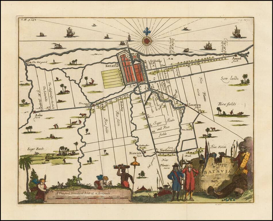
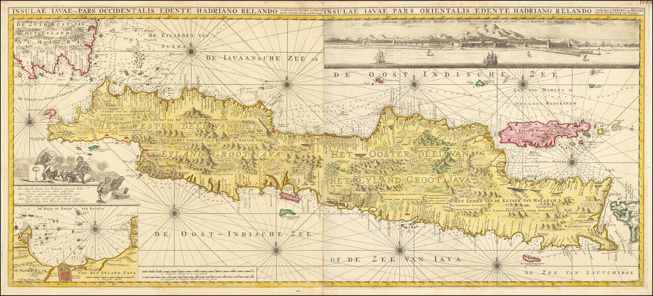
Fine map of Batavia (Jakarta) and its environs, which appeared in "A Collection of Voyages and Travels" by Churchill. The map provides a decorative and detailed look at the area around Jakarta, noting Fort Northerwick, Anke, Riswick Fort, Five Anguler...
A fascinating map of part of the Moluccas, published by Valentijn. Francois Valentijn was an prominent historian of the Dutch East India Company (VOC) who is best known for Oud en Nieuw Oost Indien, which was published by Joannes van Braam and Gerard...
An Exceptional Sea Chart of Java Rare and highly decorative sea chart of the island of Java and contiguous islands, published by Gerard Van Keulen. The chart covers Java and immediate islands from the tip of Sumatra to Bali, along with ten decorated...
![[Part of Sumatra]](/map/small/66388.jpg)
The First Accurate English Sea Chart of Western Sumatra Finely detailed sea chart of the Southwestern Coast of Sumatra. The chart extends from Pulau Tanahmasa and the area north of Panang to the Straits of Sunda and Panaitan Island. Includes a large...
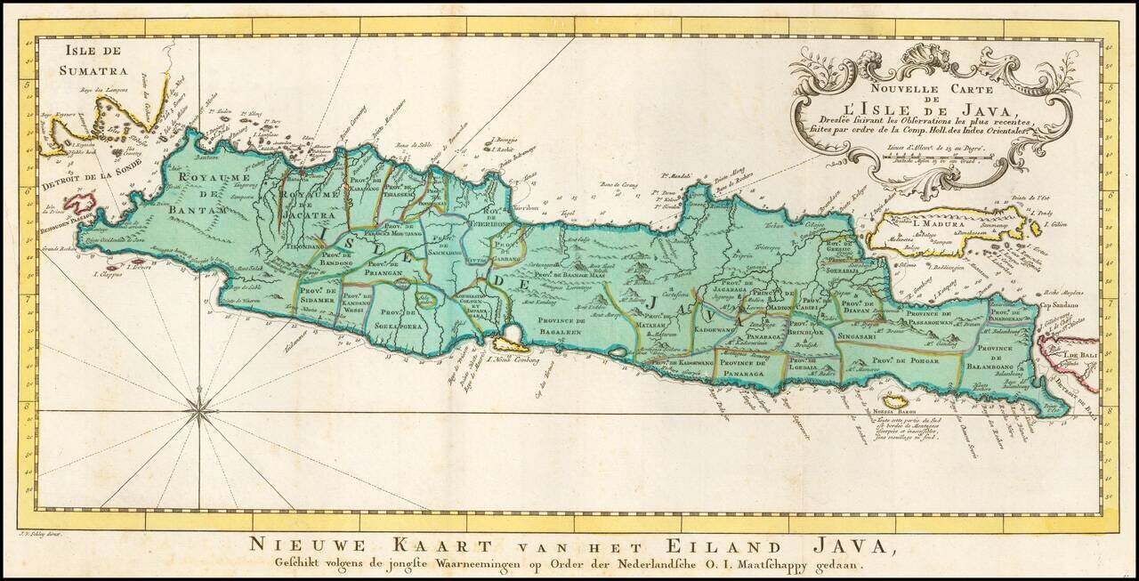
Detailed map of Java and Madura, with outline color showing the provinces on Java and a host of other details. Decorative cartouche and compass rose.
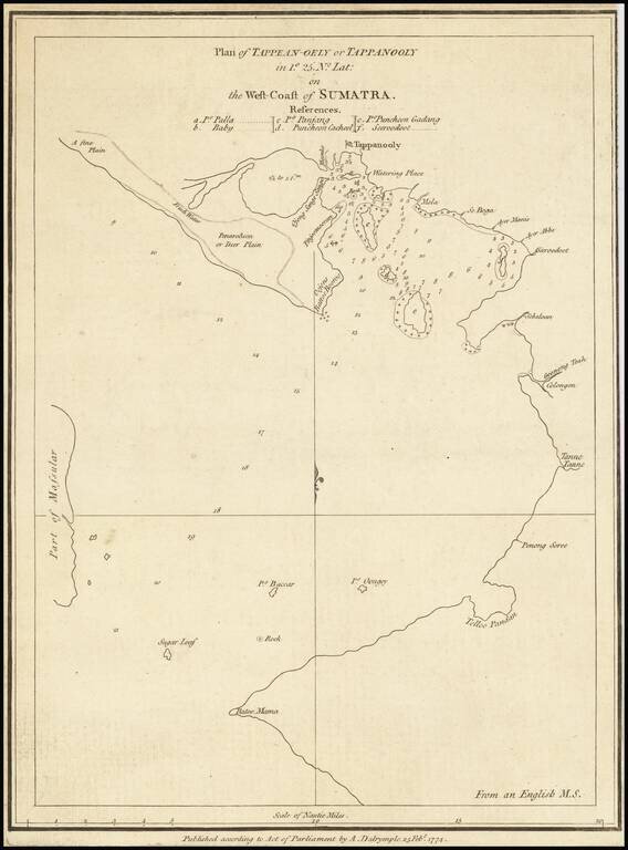
Rare early chart of Sibolga Bay and vicinity, on the west coast of Sumatra. The map notes that it is published from an English manuscript map. Alexander Dalrymple served as the first hydrographer to the admiralty from 1795 - 1808.
![[Java Sea, Java and Parts of Sumatra, Borneo, Bali & Madura]](/map/small/0249gh.jpg)
Rare seperately published English Sea Chart of the Java Sea, Java and parts of Borneo, Bally and Sumatra, with an inset map of part of the Island of Lubeck, published by William Herbert. Herbert is perhaps best known for his A New Directory for the...
![[Papua New Guinea, etc.] A New Chart of the Straits to the Westward of New Guinea; Comprehending The Straits of New Guinea, Revenge's or Galewo Straits, Pitt's or Sagewin Straits, Dampier's or Gamen Straits, with Bougainville's Passage . . . Captn. M. Hog](/map/small/39549.jpg)
Rare sea chart of West Papua, New Guinea, Waigeo, Pulau Raja, Pulau Sanjang, Pulau Aju, etc., published by Laurie & Whittle in London, based upon the surveys under the command of Captain Robert Williams aboard the Thames (1796 - 1797) and Captain...
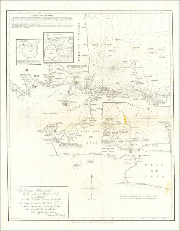
Detailed sea chart showing the Straits of Sunda, with a large inset Plan of Batavia Road and the Adjacent Channels and two smaller inset maps. This chart was published in numerous editions. The present map appears to be the earliest; we are aware of...
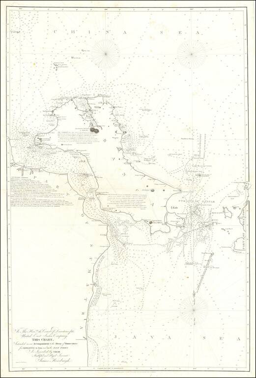
"IN ALL THESE STRAITS Piratical Proas usually Lurk" An extremely detailed navigational map showing the Strait of Bangka and the surrounding Java Sea. The map includes exhaustive soundings, shoal locations, reference points, and much more. In addition,...
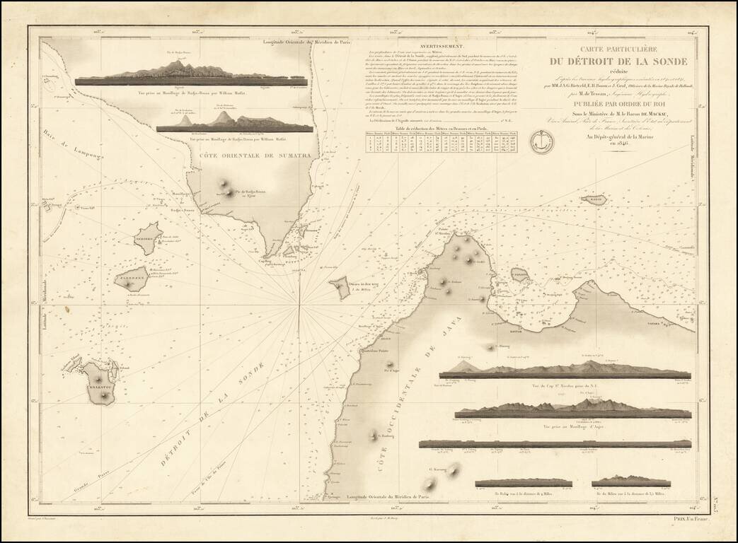
Fine early sea chart of the strait between Java and Sumatra, published by the Depot De La Marine in 1846. The chart includes 7 recognition profile views, soundings, sailing directions, and other important details. The routes to Batavia and China...