
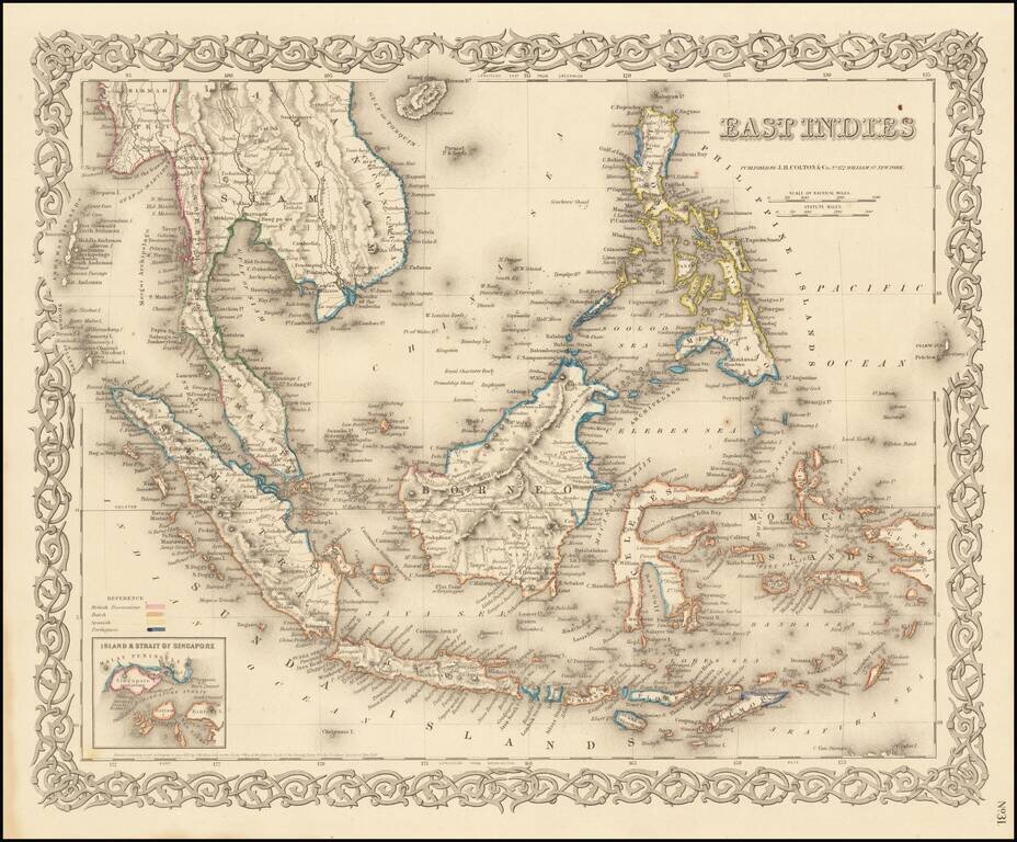
Very detailed map of Indonesia, Malaysia and the Philippines, with inset map of the Strait of Singapore. Color key shows the Dutch, British, Spanish and Portuguese Possession. A marvelously detailed map. Decorative border. A terrific regional map...
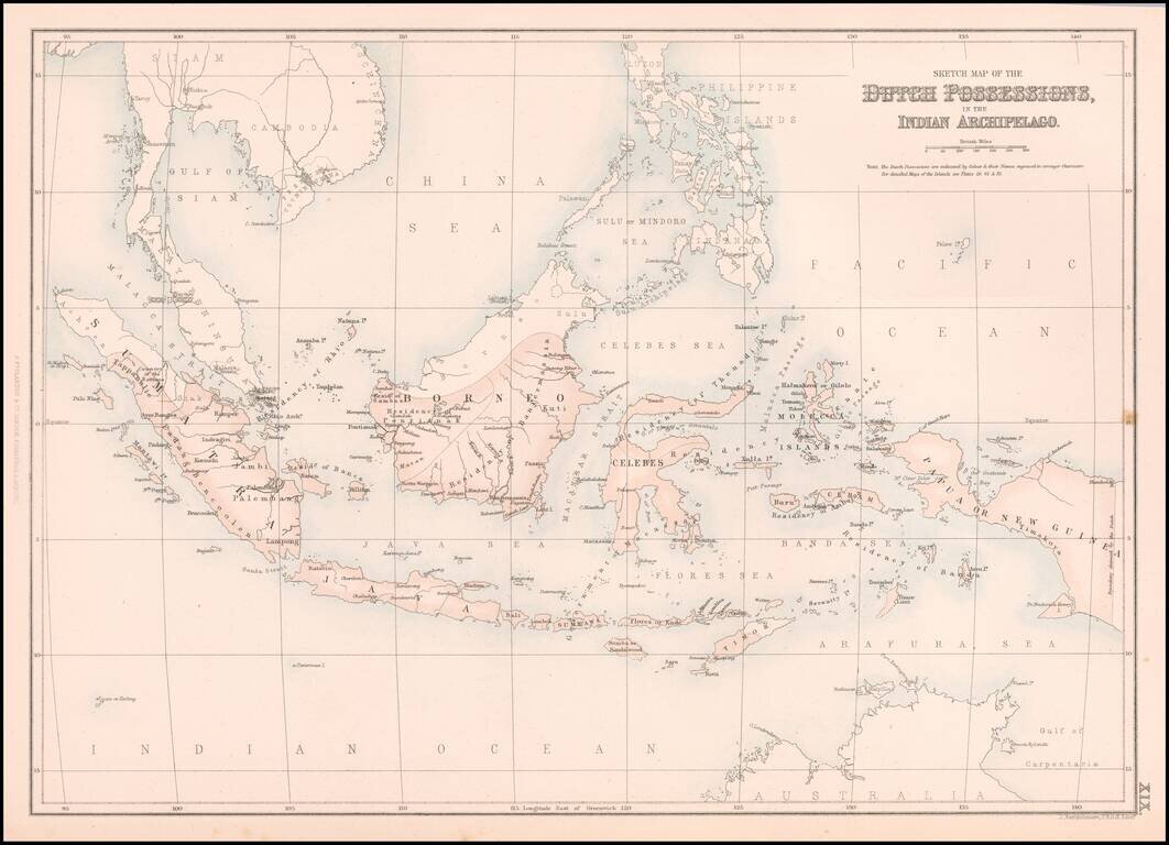
Nice map of Southeast Asia, centered on Borneo. Extends from Siam, Sumatra and the Malaysian Peninsula to Papua or New Guinea and the Philippines.
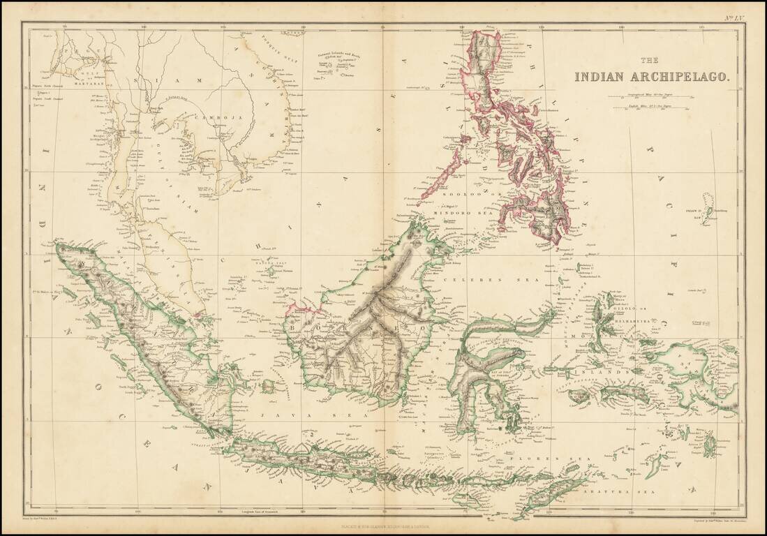
Highly detailed map of the Indian Archipelago, from the Philippines to Java to Sumatra and Pegu. 'The Weekly Dispatch' newspaper between the years 1856 and 1862 included in each edition a map of a part of the world. During this period a total of 118...
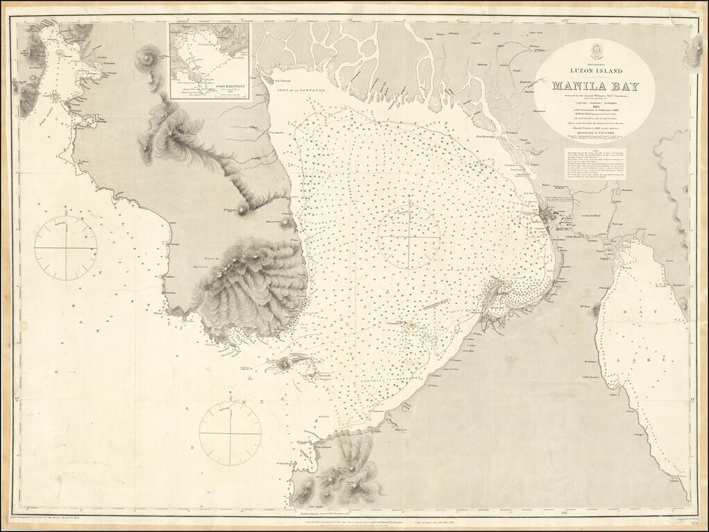
One of the Largest Obtainable English Language Maps of Manila Bay Highly detailed chart of the Bay of Manila, published by the British Hydrographical Survey. The map is a remarkably detailed work, based upon the Spanish Philippine Hydrographical...
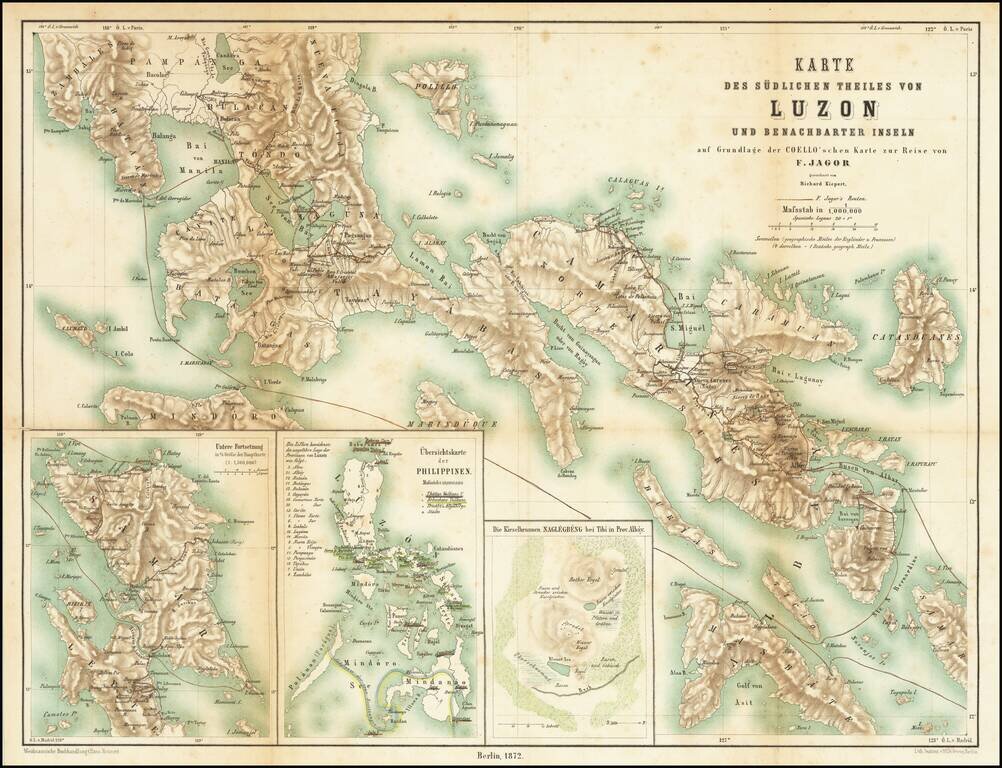
First edition of this classic book on the Philippines Fedor Jagor was perhaps the most meticulous observer of Philippine life and customs. Jagor was a German ethnologist, naturalist and explorer who traveled throughout Asia in the second half of the...
![[Philippine Islands] East India Archipelago [Eastern Passage to China and Japan] [Chart No. 6] . . . 1878](/map/small/64039.jpg)
Nice example of James Imray's large sea chart of the Philippine Islands, published in London in 1878. The map treats the vast majority of the islands with fine detail, lacking only the northernmost part of Luzon and some of the southernmost islands....

Scarce map of Manila Harbor, published by Rand McNally in 1898.
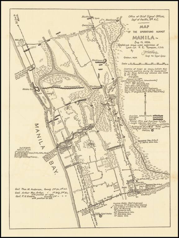
Detailed military map of the area between Malate and Pasai, to the south of Manila, published by American Army Signal Corps in October 1898. The map notes the position of various American Troops during the the Naval bombardment of Manila, before the...
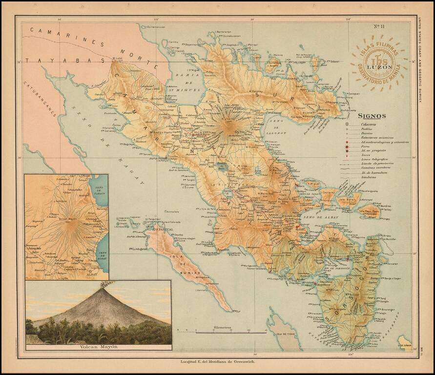
Fine map of part of Luzon published under the direction of Jose Algue and the United States Coast and Geodetic Survey in 1899. The map appeared in Atlas de Filipinas: Colleccion de 30 mapas trabajados por delineantes filipinos bajo la direccion del P....
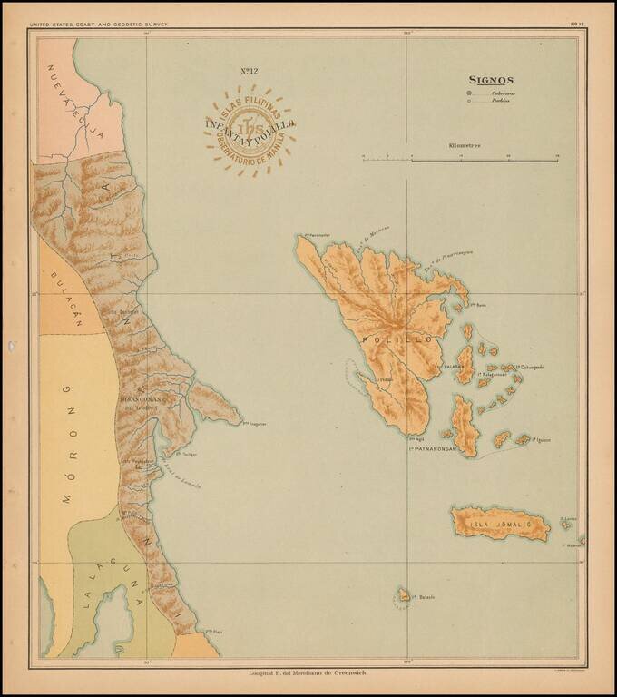
Fine map of the islands of Infanta and Polillo, published under the direction of Jose Algue and the United States Coast and Geodetic Survey in 1899. The map appeared in Atlas de Filipinas: Colleccion de 30 mapas trabajados por delineantes filipinos...
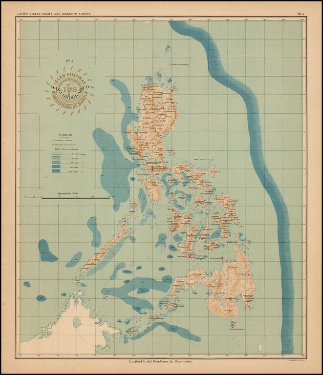
Fine orographical map the Philipines, published under the direction of Jose Algue and the United States Coast and Geodetic Survey in 1899. The map appeared in Atlas de Filipinas: Colleccion de 30 mapas trabajados por delineantes filipinos bajo la...
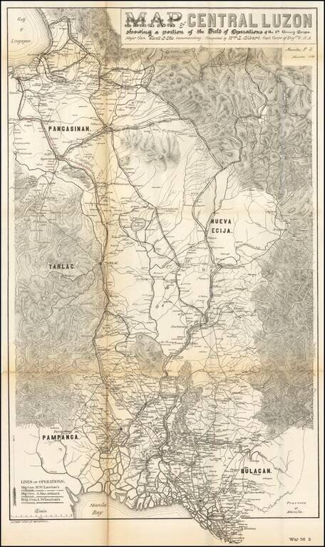
Rare military map showing part of the Island of Luzon, issued at the height of the Philippine-American War, compiled by William L. Sibert of the 8th Army Engineering Corp. The map covers central Luzon, from Manila Bay to Lingayen Gulf. The map shows...
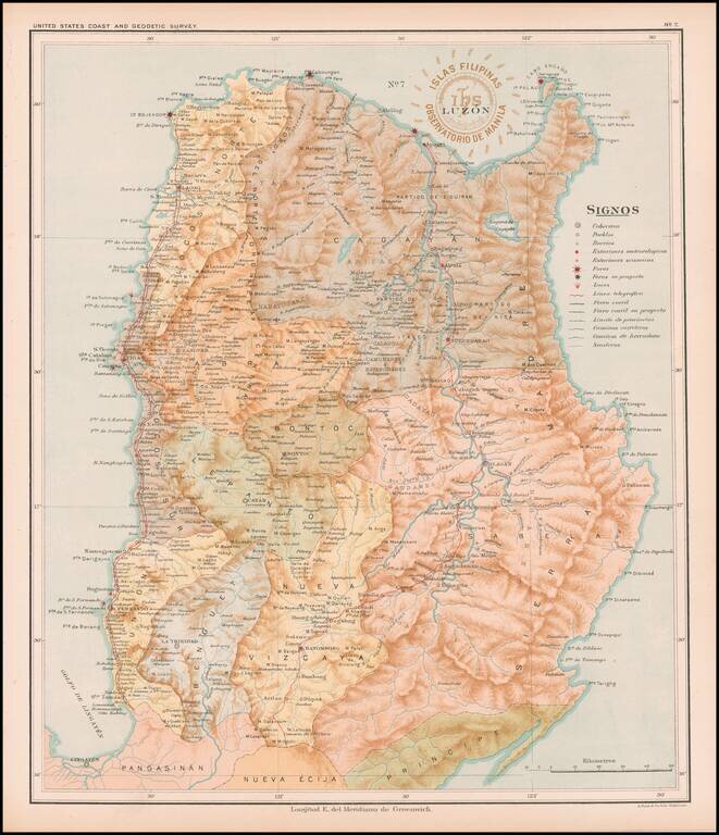
Detailed map of Luzon, published under the direction of Jose Algue and the United States Coast and Geodetic Survey in 1899. The map appeared in Atlas de Filipinas: Colleccion de 30 mapas trabajados por delineantes filipinos bajo la direccion del P....
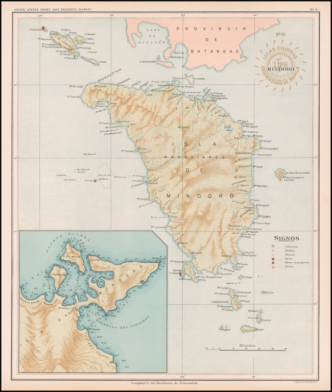
Fine map of the Island of Mindoro, published under the direction of Jose Algue and the United States Coast and Geodetic Survey in 1899. The map appeared in Atlas de Filipinas: Colleccion de 30 mapas trabajados por delineantes filipinos bajo la...
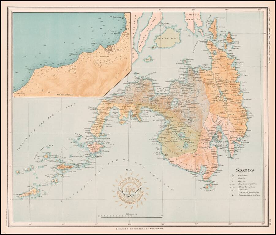
Fine map of the Island of Mindanao, with a large image inset of the area around Jolo, published under the direction of Jose Algue and the United States Coast and Geodetic Survey in 1899. The map appeared in Atlas de Filipinas: Colleccion de 30 mapas...
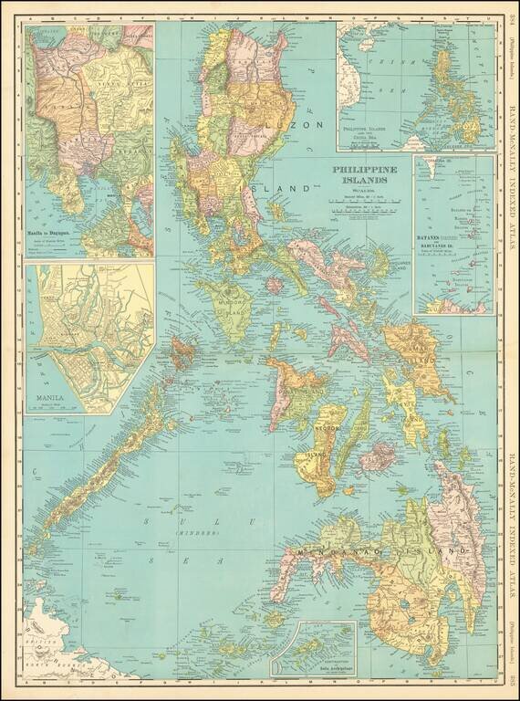
Gorgeous large plan of the Philippines, shortly after the Spanish American War. Includes a large town plan of Manilla and inset of the area Manila to Dagupan. One of the best large format maps of the region from a Commercial Atlas during this period.