Map size in jpg-format: 35.1407MiB
Click to open in high resolution (open in new tab).

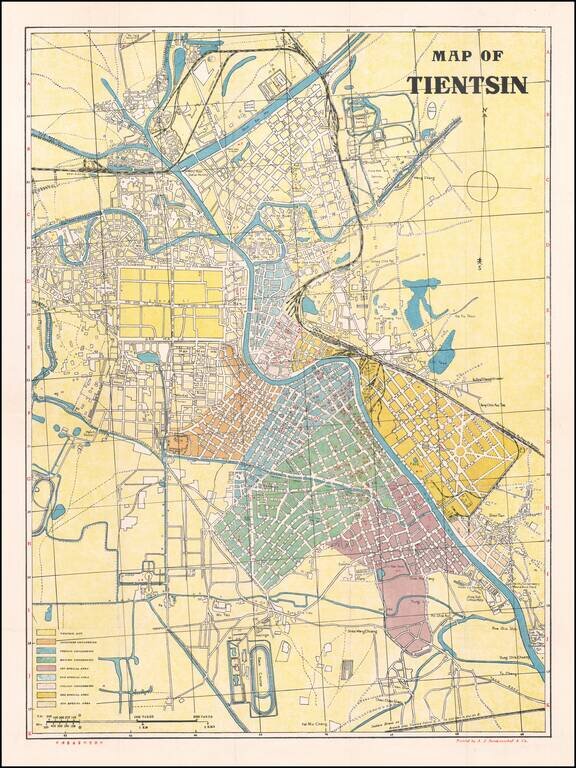
Large large-format map of Tianjin, China, Detailing the Foreign Concessions at the Time of the Japanese Occupation of Tianjin
Finely executed city map with a large key identifying the foreign concessions, including:
The map shows railroad lines, street names, public areas, buildings, the Race Course, Cotton Mills, Spinning Mill, Law College, Dock Yard, Lakes, parks a Coal Yard for the rail lines, and a host of other details.
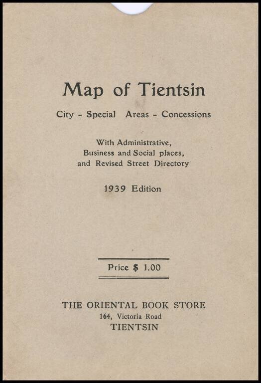
The map slip case notes that it was published by The Oriental Book Store.
Tianjin / The Tientsin Incident
On July 30, 1937, Tianjin was taken by Japan during the Second Sino-Japanese War. The Japanese did not completely occupy the city, showing respect for the foreign concessions until 1941, when the American and British concessions were occupied.
On June 14, 1939, the Imperial Japanese Army surrounded and blockaded the British concession over the refusal of the British authorities to hand over to the Japanese six Chinese who had assassinated a locally prominent Japanese collaborator, and had taken refuge in the British concession. The crisis ended when the British Prime Minister Neville Chamberlain was advised by the Royal Navy and the Foreign Office that the only way to force the Japanese to lift the blockade was to send the main British battle fleet to Far Eastern waters, and that given the current crisis in Europe that it would be inappropriate to send the British fleet out of European waters, thus leading the British to finally turn over the six Chinese, who were then executed. .
On August 9, 1940, all of the British troops in Tianjin were ordered to withdraw. On November 14, 1941 the American Marine unit stationed in Tianjin was ordered to leave, but before this could be accomplished, the Japanese attacked the United States. The American Marine detachment surrendered to the Japanese on December 8, 1941. Only the Italian and French concessions (the local French officials were loyal to Vichy) were allowed by the Japanese to remain. When Italy signed an armistice with the Allies in September 1943, Japanese troops took the Italian concession following a battle with its garrison, and the Italian Social Republic formally ceded it to Wang Jingwei's Japan-controlled puppet state. Japanese occupation of the city lasted until August 15, 1945, with the surrender of Japan marking the end of World War II.
Rarity
OCLC Locates 2 copies (University of California, Berkeley and State Library of Victoria (Australia))
If you are a student, write to us in telegram: @antiquemaps and indicate what material you need and for what work you need a map in high detail. We are ready to provide material on special terms. For students only!
![[Martin Behaim Globe / Book] Pars Globi terrestris Ao. 1492 a Martino Behaim Equite Lusitano Norimbergae confecti Delineavit Christoph. Theoph de Murr 1778 (bound with:) Diplomatische Geschichte des Portugesischen berühmten Ritters Martin Behaims](/map/small/68828.jpg)
![Il Disegno Della Terza Parte Dell' Asia [Gastaldi's Wall Map of SE Asia with extra panels!]](/map/small/30554hbp.jpg)
![Chinae, olim Sinarum regionis nova descriptio. auctore Ludouico Georgio. [English Edition!]](/map/small/71123.jpg)