
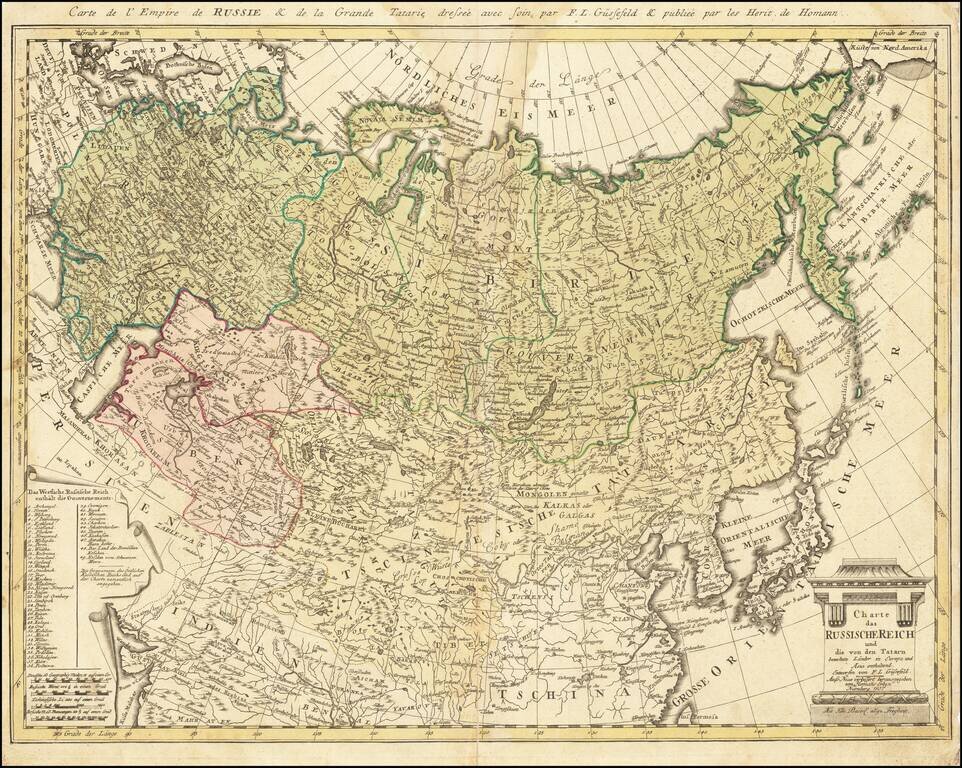
Rare late edition of this detailed map of the whole of Russia and parts of China and Central Asia. Interesting and highly detailed. This is the first time we have seen this state of the map.
![Russian Empire [with] Chart of the Communication Between The Archipelago And Black Sea](/map/small/64013.jpg)
Unusual pair of maps of Russia and the water route from the Black Sea and the Mediterranean, published in Edinburgh by Thomson. Striking regional map, showing all of Russia, the Arctic Ocean, Northeast Passage, and Chinese Tartary, along with Japan,...
![(Russian Adventurism in China) Карта Средней Азии Составлена К. Веберомъ... 1871. [Map of Central Asia Compiled by K. Weber... 1871.]](/map/small/58597.jpg)
The Russian Empire Eyes Western China. Important manuscript map of northern and western China and Mongolia prepared by K. Weber, Beijing, 1871, and copied by L. Brosse in St Petersburg. The map was the product of a major Russian expedition in China...
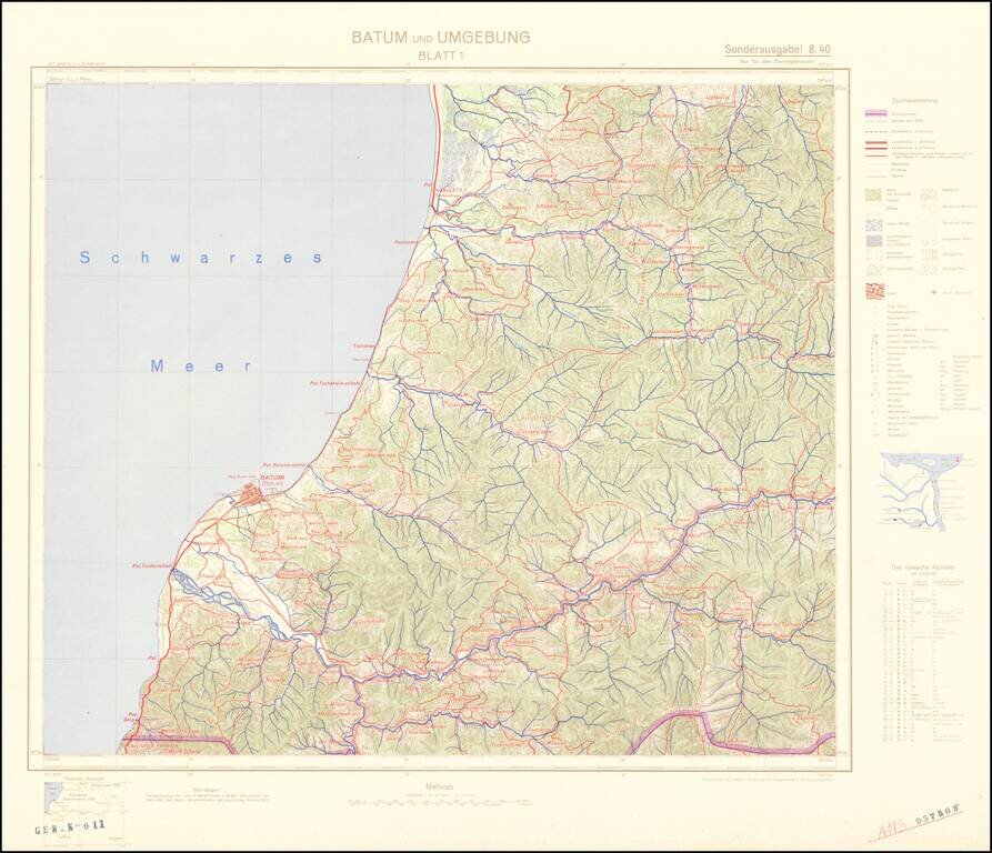
Four-sheet color-printed topographical map of the Adjarian Autonomous Soviet Socialist Republic and neighboring regions, prepared for strategic use by the General Staff of the German Army. The map is based on a 1917 German General Staff map. The area...

Map of the Russian Front Published in the British Empire Fascinating WWII broadside propaganda map, published in India, in order to keep the local populous informed about the War. The map illustrates the Russian Front, from the Caucus Mountains and...
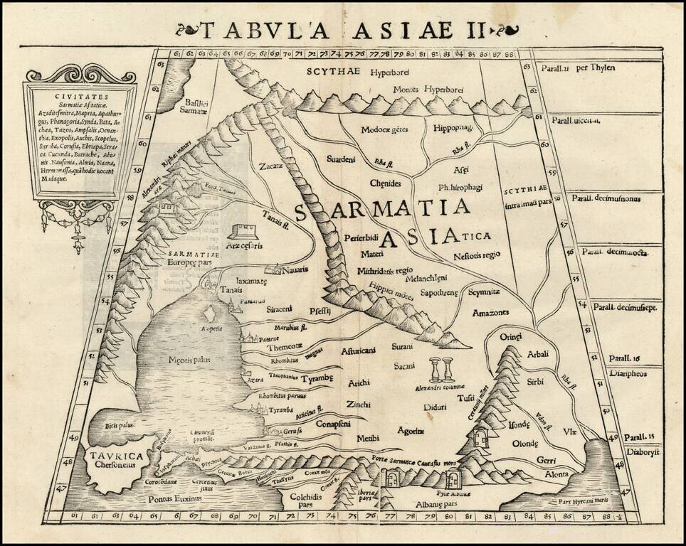
Rare first edition of Munster's Ptolemaic map of part of the Ukraine and the region between the Black Sea and Caspian Sea extending south to include all of Armenia Maior and part of Armenia Minoris. Shows Noahs Arc in the Caspian Sea, believed to have...
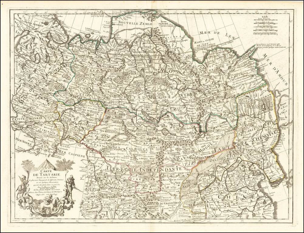
Nice example of this detailed map of Tartary, consisting of the Eastern part of Russia, Central Asia, China and Korea, first published by Nicholas De L'Isle in 1706. The map extends from the Peninsula of Korea in the east to the Caspian and Black...
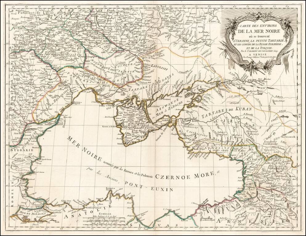
Scarce regional map centered on the Black Sea, published in Venice by Francois Santini. One of the most detailed maps of the region published in the mid-18th century.
![Turcici Imperii Imago [shows Cyprus]](/map/small/68676.jpg)
Fine Map of the Ottoman Empire from the Mercator-Hondius Atlas Striking example of this map of the Ottoman Empire, showing their territories in the Balkans, Anatolia, the Levant, the Arabian Peninsula, and North Africa. It was published by Henricus...
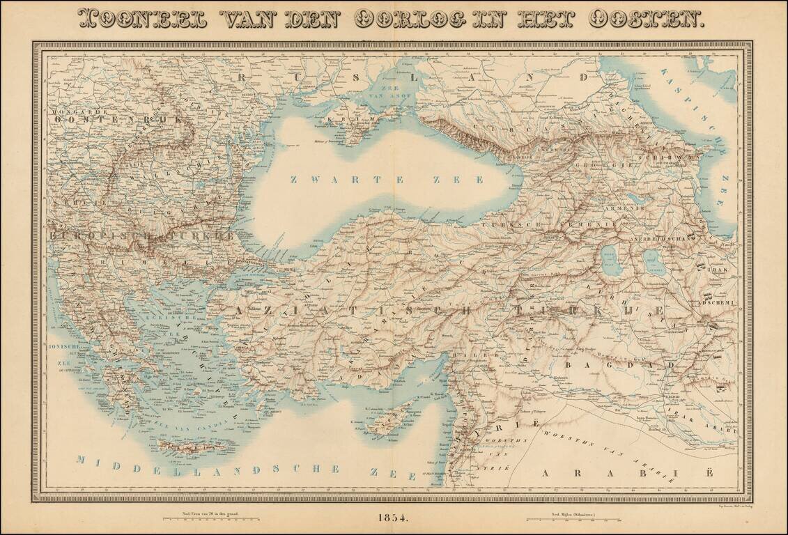
Rare large format map of the region between Greece and Hungary in the west and Iraq and the Caspian Sea in the east, centered on Turkey. The map shows rivers, roads, topographical and other features. This is the first time we have seen the map.
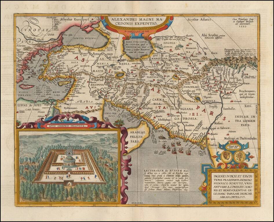
Detailed map of Alexander the Great's expedition to Macedonia. Includes an inset: Iovis Ammonis Oraculum, the oracle in Lybia which Alexander visited before he went to India. Several decorative cartouches, sailing ships, sea monsters, etc.
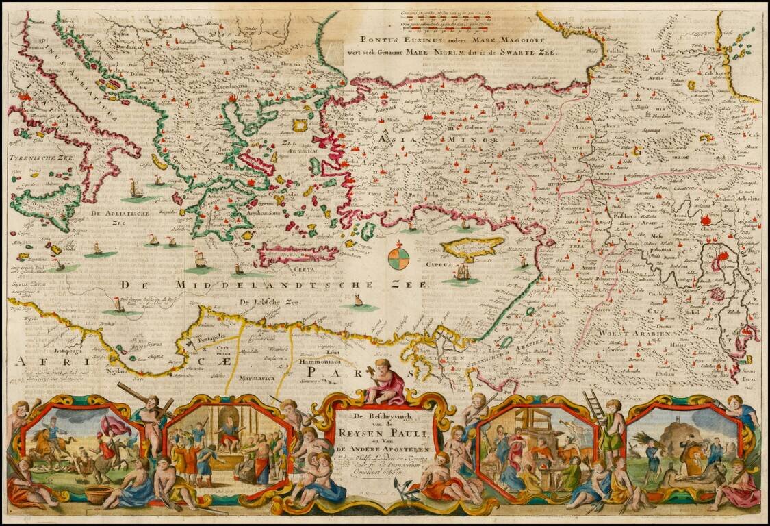
Nice example of Stoopendahl's map of the Eastern Mediterranean, showing the Travels of the Apostels. The map illustrates the travels of Paul in the Mediterranean, and includes 8 biblical scenes from Paul's travels.
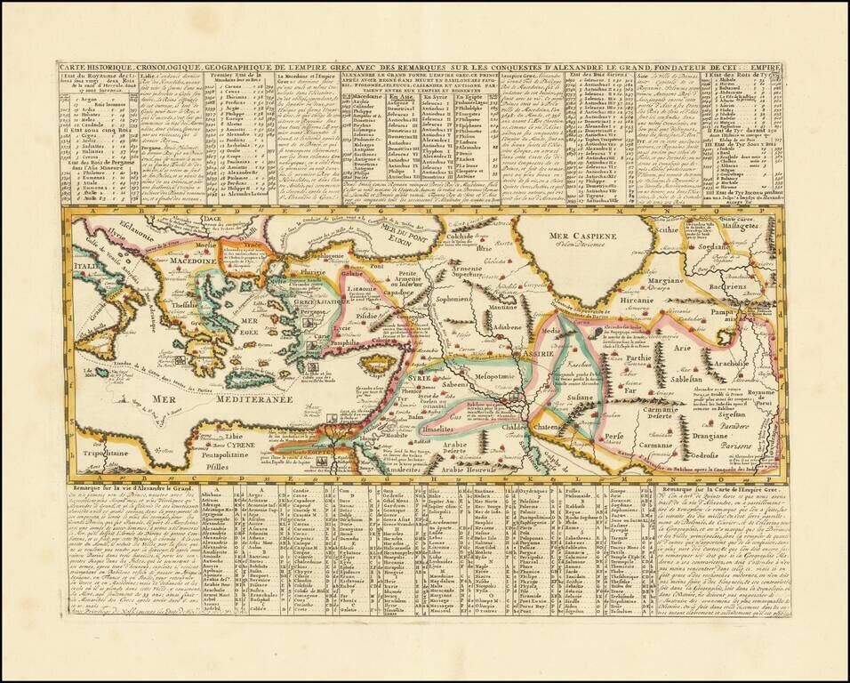
Mapping the Conquests of Alexander the Great. Interesting historical map of the Mediterranean, Black and Caspian Sea regions under Greek Rule. The map has excellent toponymic detail throughout, including extensive notes, trade routes, etc. The...
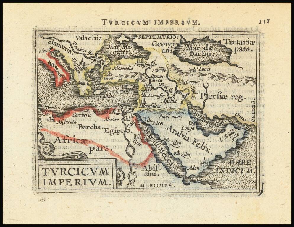
Decorative miniature map of the Turkish Empire. The map appeared in an early edition of Ortelius' Epitome, first published in 1579.
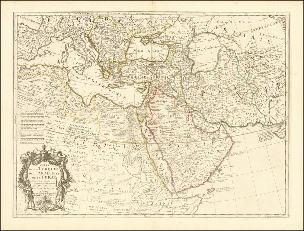
Fine example of an state of De L'Isle's map of the Turkish Empire and Arabian Peninsula, with De L'Isle's "Quai de l'Horlogie al Aigle d'Or" address, which was used only briefly after his move from Rue de Cannettes. Includes the Turkish Empire,...
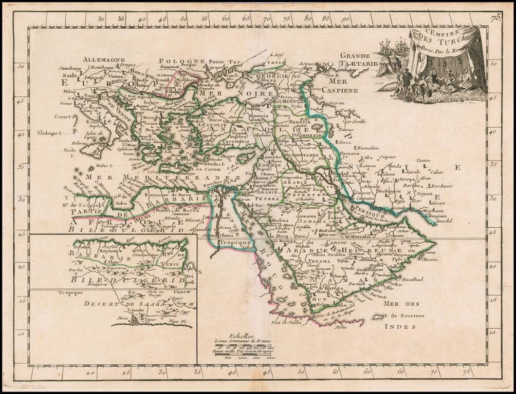
Scarce map of the Turkish Empire, from Le Rouge's Atlas Nouvel Portatif . . . , first issued in Paris in 1748. Includes a fine decorative cartouche.