
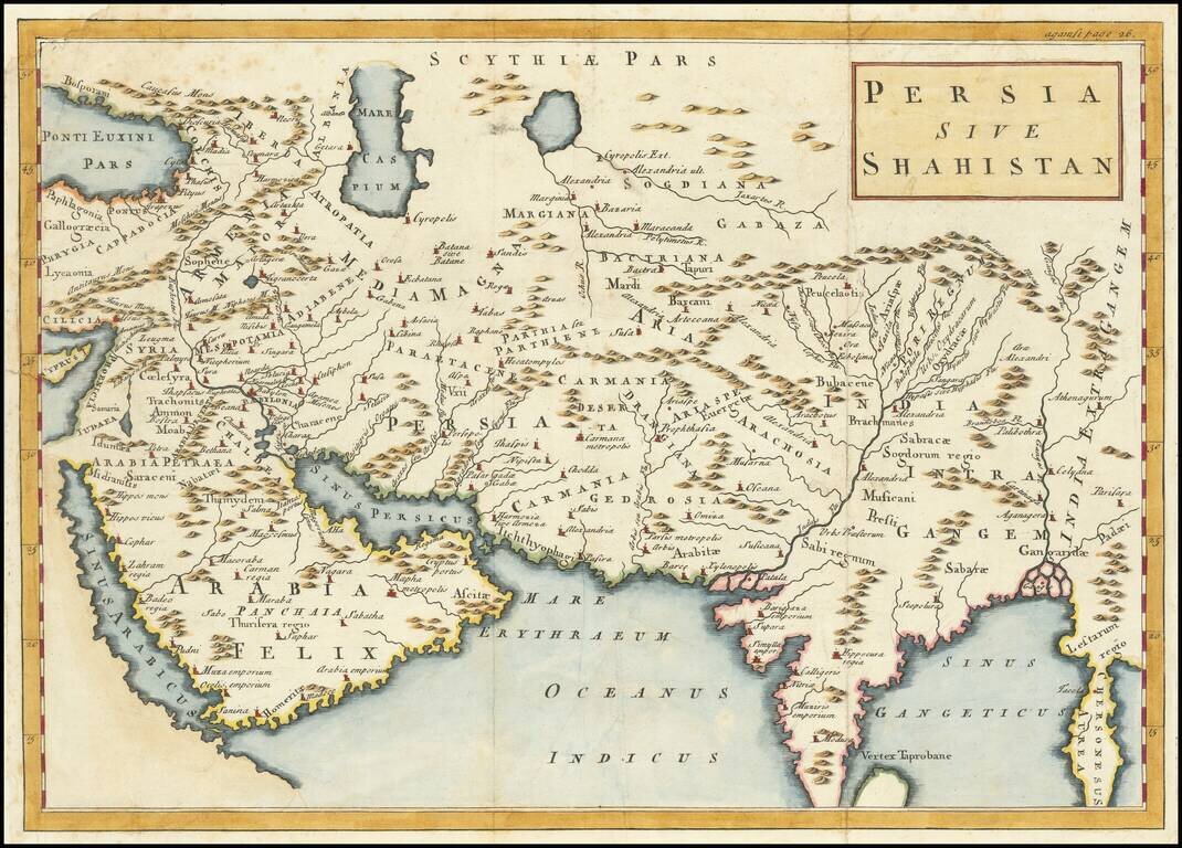
Terrific map of the Persian Empire, with ancient place names. The map appeared in an early edition of Cellarius' Notitia Orbis Antiqui, Sive Geographia Plenior...et Novis Tabulis Geographicis, which was published in London, Amsterdam and other places...
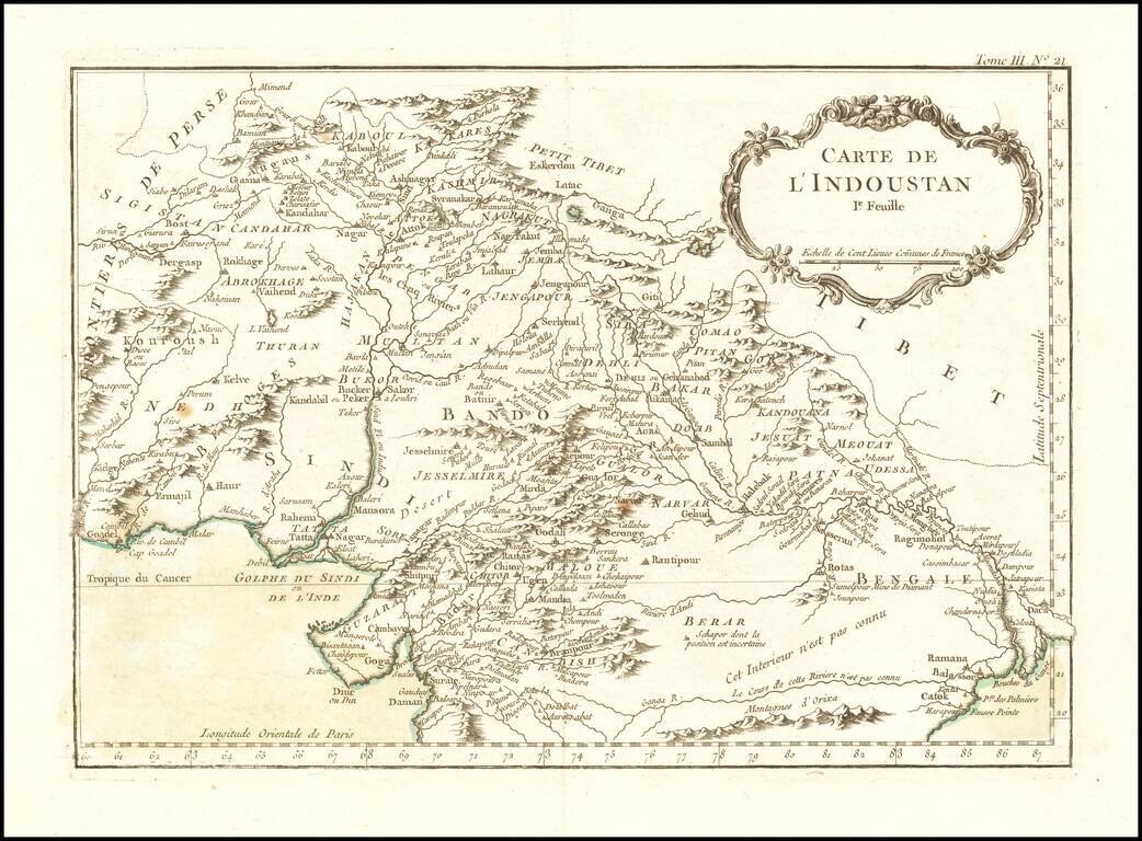
Finely engraved map of Afghanistan and Pakistan, from Jacques Nicolas Bellin's Le Petit Atlas Maritime Recueti de Cartes et Plans des Quatre Parlies du Monde en Cinq Volumes, first published in Paris in 1764. Jacques Nicolas Bellin Jacques Nicolas...
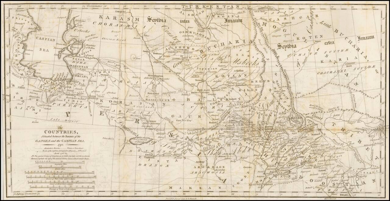
Interesting overview of the region east of the Caspian Sea to Bukara and Tibet, published by Rennell. Shows a wealth of cities, towns, tribes, river systems and general topography. Notably the ancient place names are shown in Italic Capitals while...
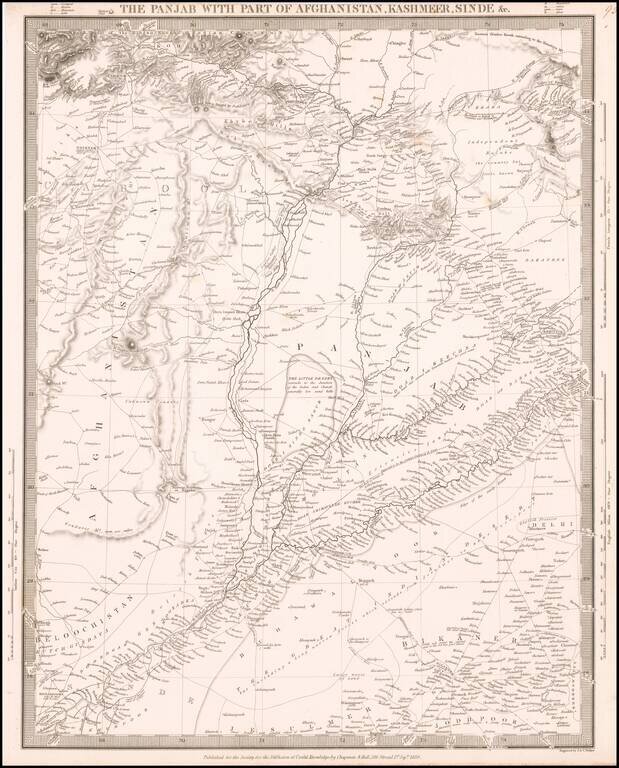
Highly detailed map of Northern India, Afghanistan and neighboring regions, from the Society for the Diffusion of Useful Knowledge. The map extends from north of the Khyber Pass to the northern part of India, focusing on the trade routes and roads in...
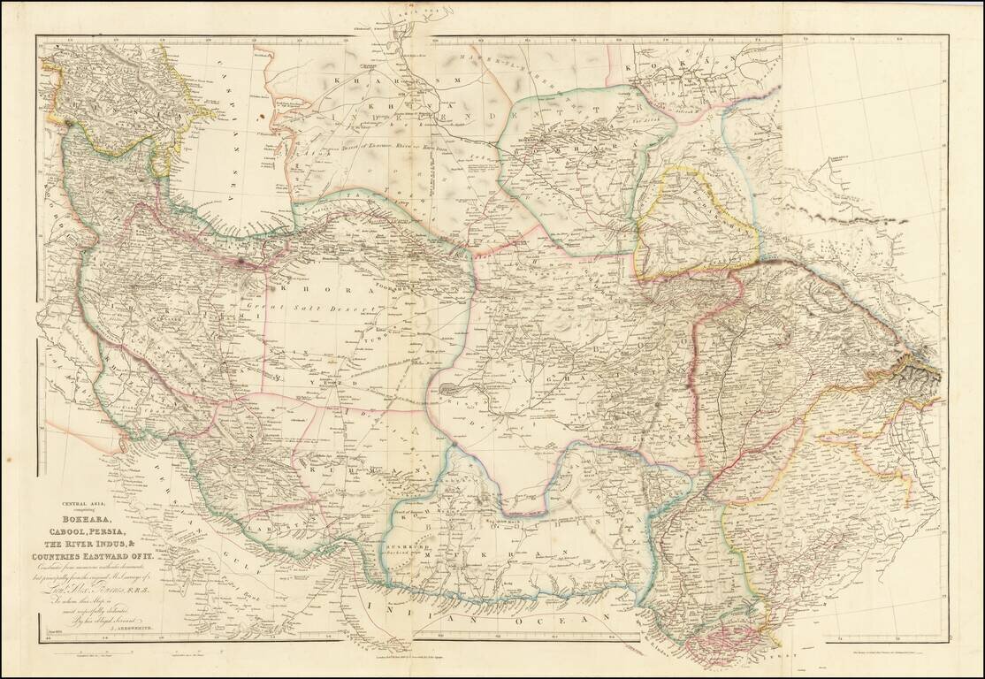
Fine example of Arrowsmith's map of the Iran and Pakistan, published by John Arrowsmith. The map illustrates the routes of Lieutenant Alexander Burnes through the region. Sir Alexander Burnes KT FRS (1805 – 1841) was a British explorer and diplomat...
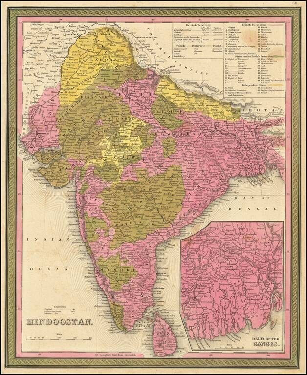
Detailed map of India and Ceylon, extending to the Himalayas. Shows towns, islands, rivers, mountains, gulfs, bays, etc. Large inset of the Delta of the Ganges. Tables show British, French, Portuguese and Danish Possessions and Independent States....
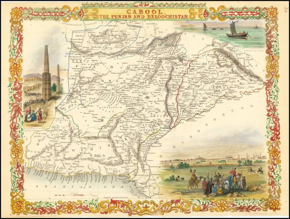
Nice example of this decorative regional map, covering Afghanistan and part of Pakistan. Decorative Vignettes of Boats on the Indus, Lahore and Sulton Mahmoud's Minars and Fortress, Ghuznee. Engraved for R. Montgomery Martin's Illustrated Atlas....
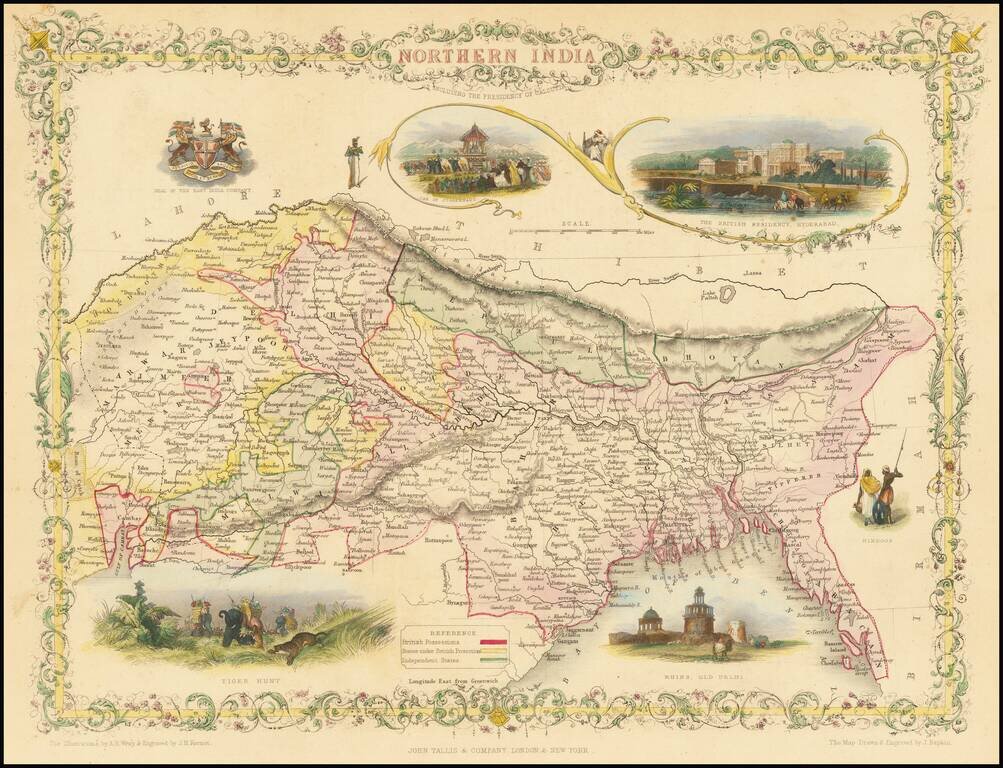
A striking full-color example of this marvelous map of the northern part of India. The area shown encompasses present-day northeastern India, Bangladesh, Bhutan, and Nepal. The map includes vignettes of life during the Company Raj as well as other...
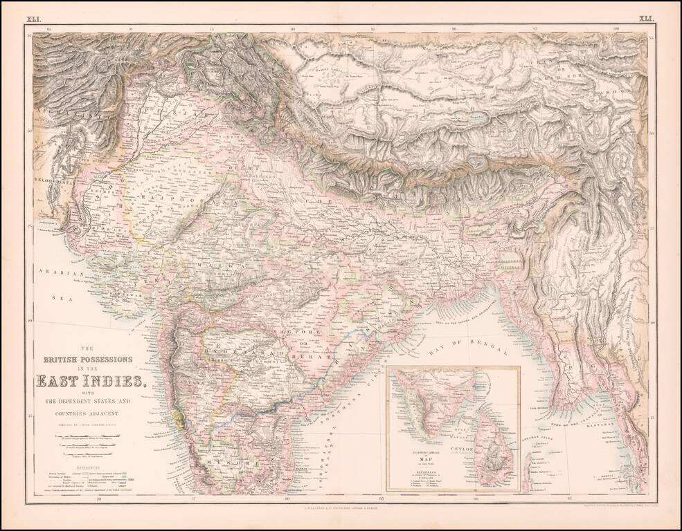
Highly detailed map of India, Pakistan, Afganistan, Tibet and the Himalayas, extending east to Siam. Inset of the southern tip of India and Ceylon.
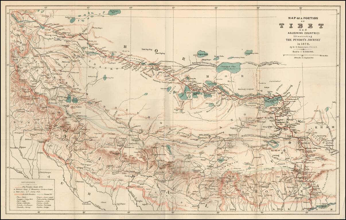
Fine map of a section of Tibet, illustrating "The Pundit's Journey" through the region, with the accompanying article from the Journal of the Royal Geographical Society, entitled Geographical Discoveries in Tibet. The journey was described in the...
![Карта Афганистана и Сопредѣльныхъ Странъ [Map of Afghanistan and the Bordering Countries].](/map/small/59123.jpg)
Russian Military Map of Afghanistan - Dating from The Great Game. Historically significant, rare military Russian map of Afghanistan and surrounding countries, compiled in the midst of the Great Game in Central Asia and outlining the new Russian lands...
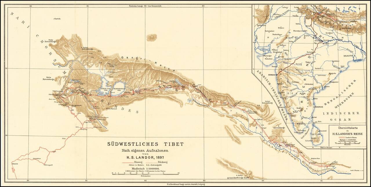
Scarce map of southwestern Tibet, illustrating the report of H.S. Candor. Candor was the first European to reach both sources of the Brahmaputra River. His book on Tibet was published in 1897.
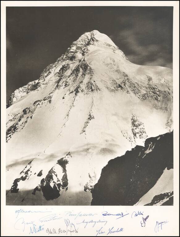
Vittorio Sella K2 Photograph Commemorating the Duke of Albruzzi's Expedition in 1909 -- Signed by A 1954 Team of Italian Climbers This photograph of the south-east face of K2 was taken on the expedition of Luigi Amedeo, Duke of Abruzzi's to K2 and...
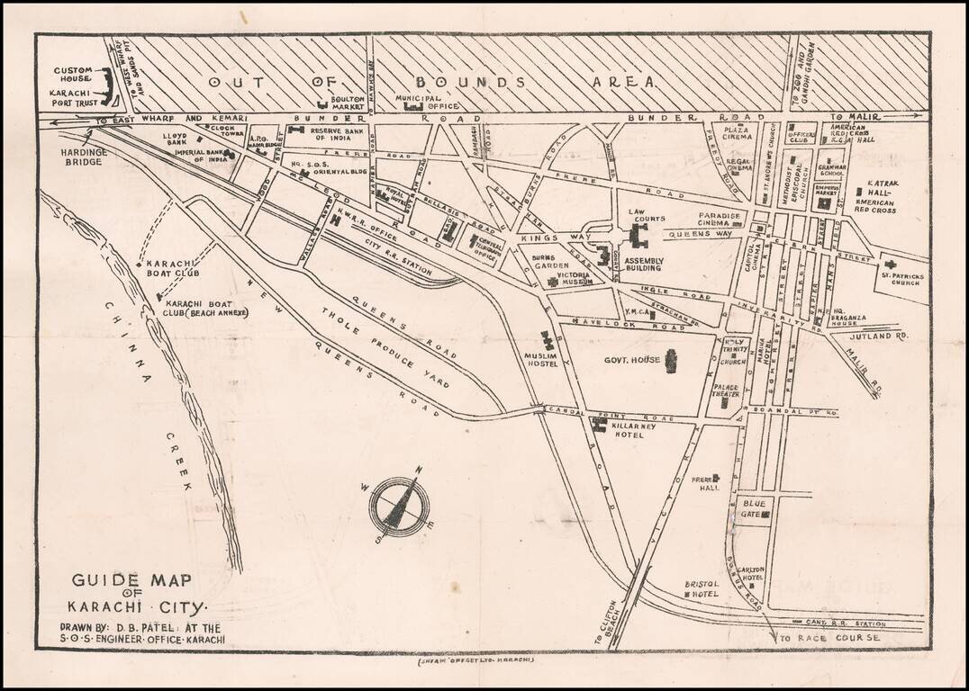
Rare Karachi Imprint Early guide map of Karachi, drawn by D.B. Patel. Points of interest shown on the map include: Customs House Karachi Port Trust Imperial Bank of India Boulton Market Reserve Bank of India Hq. S.O.S. Oriental Building...
![[Early Trekking Map] Latest Map of Kathmandu to Tibet](/map/small/51007.jpg)
Large format Trekking map of the Tibetan Mountains, published in Kathmandu. Includes a larger inset of Lhasa City and a second inset map of Tibet.
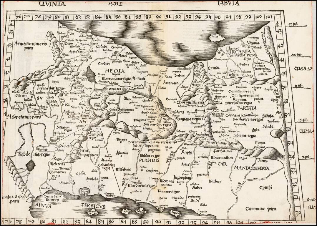
Martin Waldseemuller's important early map of Persia, Armenia and the region between the Caspian Sea to the Persian Gulf. Wood block map of Persia from Martin Waldseemüller's 1513 edition of Ptolemy, a landmark work that contributed to major advances...