
Map size in jpg-format: 51.6759MiB
Click to open in high resolution (open in new tab).

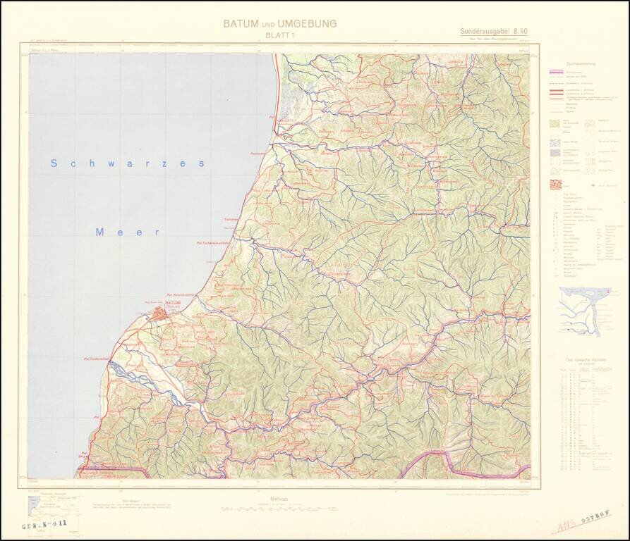
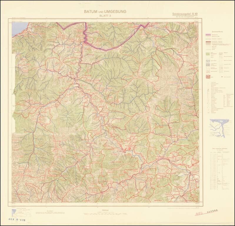
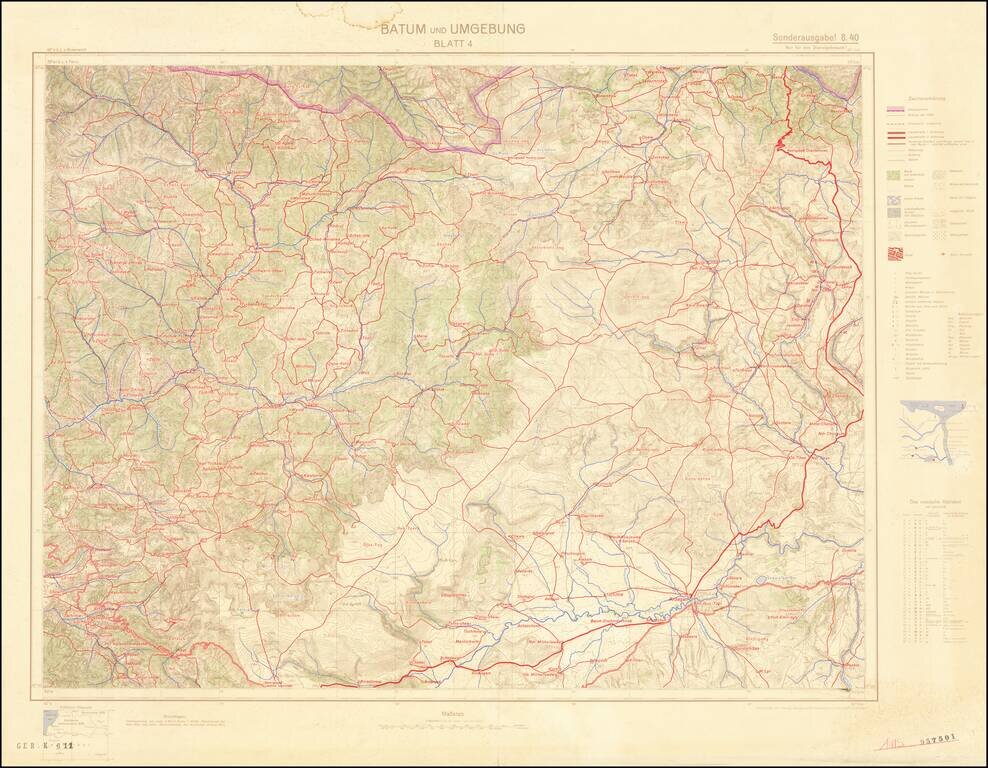
Four-sheet color-printed topographical map of the Adjarian Autonomous Soviet Socialist Republic and neighboring regions, prepared for strategic use by the General Staff of the German Army.
The map is based on a 1917 German General Staff map.
The area was of strategic importance to the Nazis, as it lay near their major Caucasus oil region target of Operation Barbarossa.
Marked "Nur fur den Dienstgebracuch!" (Only for Official Use!)
Includes a German-Cyrillic transliteration key.
If you are a student, write to us in telegram: @antiquemaps and indicate what material you need and for what work you need a map in high detail. We are ready to provide material on special terms. For students only!
![[Signed Political Satire Artwork] Vietnam ... Vietnam ... Vietnam ...](/map/small/68726.jpg)

