
![[Armenia and Caspian Region] Tabula III Asiae](/map/small/50935.jpg)
Marvelous map of Armenia and the regions between the Black Sea, Caspian Sea and the Caucus Mountains. Lorenz (Laurent) Fries was born in Alsace in about 1490. He studied medicine, apparently spending time at the universities of Pavia, Piacenza,...
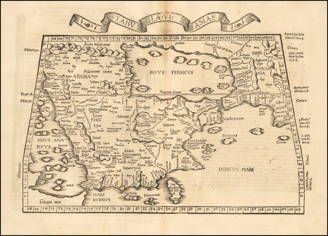
Rare 1525 Map of the Arabian Peninsula and Environs. Nice example of the 1525 edition of Lorenz Fries map of the Arabian Peninsula, Sinus Persicus and adjoining regions. Important early map of the Middle East, from the 1535 edition of Lorenz Fries'...
![Tabula VIII Asiae [Central Asia] (Title on Verso)](/map/small/50940.jpg)
Gorgeous Ptolemaic map of Central Asia and Tartary and Western China, from Lorenz Fries' edition of Ptolemy's Geographia. This map is largely based on the 1513 map by Waldseemuller.

Fine example of De Jode's modern map of the Middle East, from his Speculum Orbis Terrae, published in Antwerp in 1578 and engraved by Joannes & Lucas Van Deutecum. The complete title reads: Secundae partis Asiae: typus qua oculis subijciuntur...
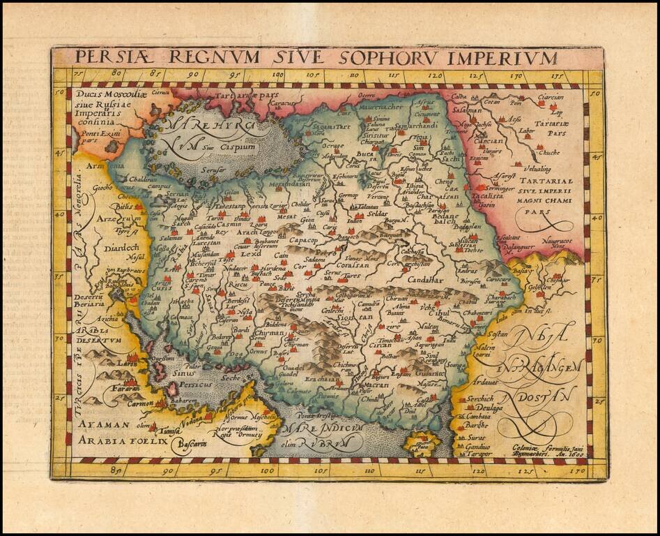
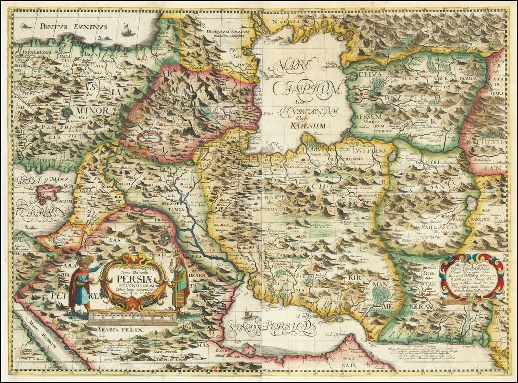
Detailed early map of Persia, including the Caspian Sea, parts of Arabia and Northwestern India, from this scarce 16th Century mapmaker. The map is based upon Gastaldi's modern map of Persia, as copied by Ortelius.
Nice colored example of Jansson's map of Persia. The map extends from the Eastern Mediterranian to Tacalistan and the Indus River and the Dalanguer Mountains and the Cabul Region, with the Red Sea and the Persian Gulf in the South and Caspian and...
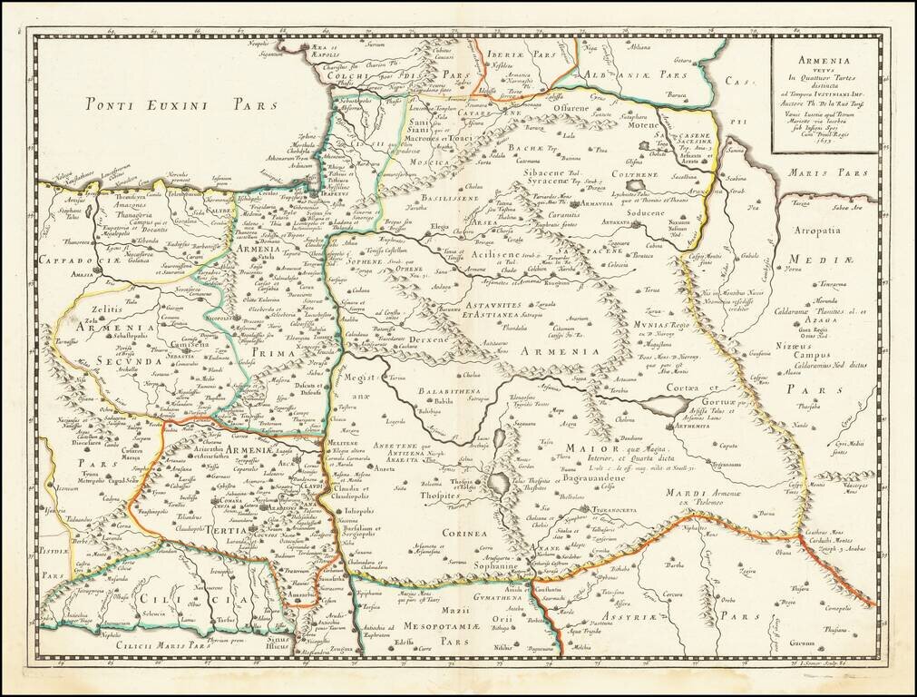
Ancient Armenia Scarce and highly detailed map of Ancient Armenia by De La Rue. One of the earliest printed maps to focus on Armenia.
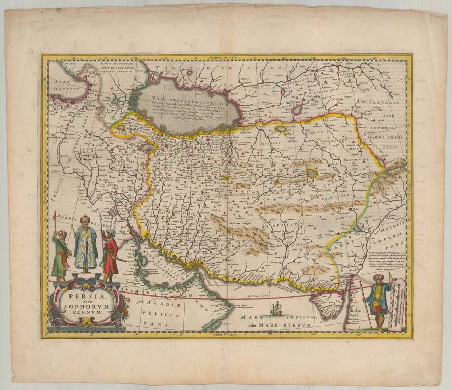
The First Realistic Map of Iran Highly important regional map of the Persian Empire, published by Adam Olearius in 1656.. Olearus' map represents a milestone in the cartographic history of the mapping of Persia and most notably its treatment of the...
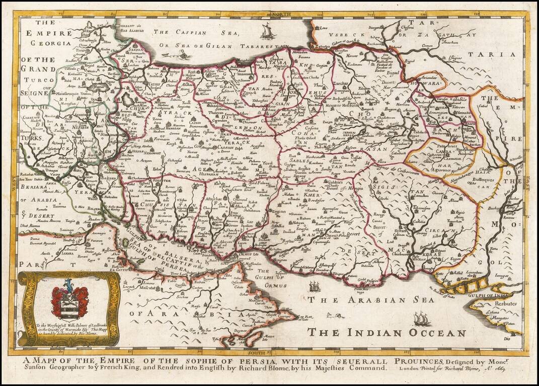
A striking dark impression of Richard Blome's scarce map of Persia, the earliest folio sized map of the region to be engraved in England. The map demonstrates the naïve engraving style characteristic of 17th century English engravers, and features an...
![Nova Persiae Armeniae Natoliae et Arabiae [shows Cyprus]](/map/small/70383.jpg)
Rare Cornelis Danckerts edition of this decorative and highly desirable map of the region bounded by the Saudi Peninsula, Red Sea, Nile River, Cyprus, Asia Minor, the Gulf of Aden, Indian Ocean, Armenia, the Caspian Sea, Afghanistan and the Indian...
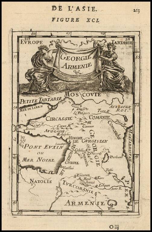
Detailed map of the Armenia and Georiga region between the Black Sea and Caspian Sea, extending south to Mesoptamia. Decorative cartouche.
![The Turkish Empire in Asia [shows Cyprus]](/map/small/37050.jpg)
Rare early English map of the Turkish Empire in Asia, along with Cyprus and extending to the Caspian Sea and the Tigris and Eurphrates Rivers. This first map appeared in Modern's rare Atlas Terestris, first published in 1687.
Rare English map of Persia, colored by Tribal Kingdoms and extending from the Gulf of Ormus to the Caspian Sea. This first map appeared in Modern's rare Atlas Terestris, first published in 1687.
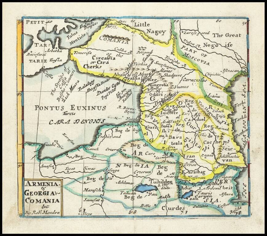
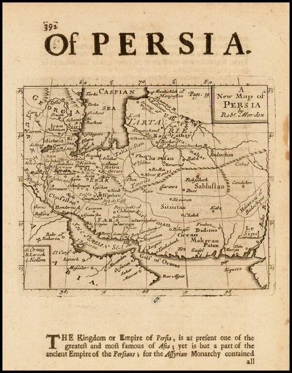
Rare English map of the region between the Black and Caspian Seas, published by Robert Morden. This map first appeared in Modern's rare Atlas Terestris, first published in 1687.
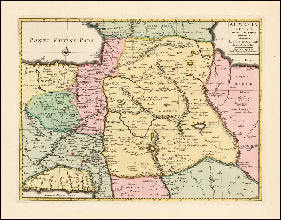
Scarce and highly detailed map of Ancient Armenia by Covens & Mortier, based upon an earlier map by Philippe De La Rue. One of the earliest printed maps to focus on Armenia.
![Imperii Persici In Omnes Suas Provincias . . . [includes Cyprus]](/map/small/64524.jpg)
Detailed map of the Persian Empire, published by Homann. The maps extends from the Black Sea, Khasikstan and Turkistan in the North to the Red Sea, Persian Gulf, Euphrates and the Mediterranean in the South, showing almost all of Cyprus. Decorative...