
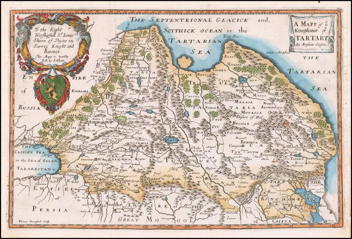
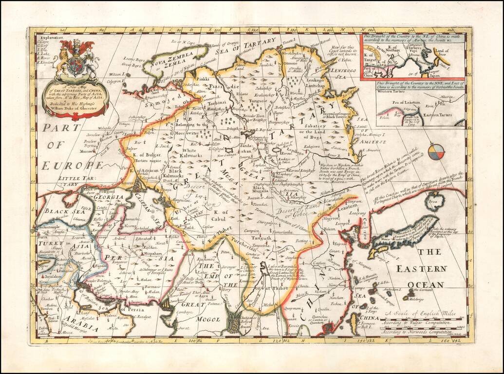
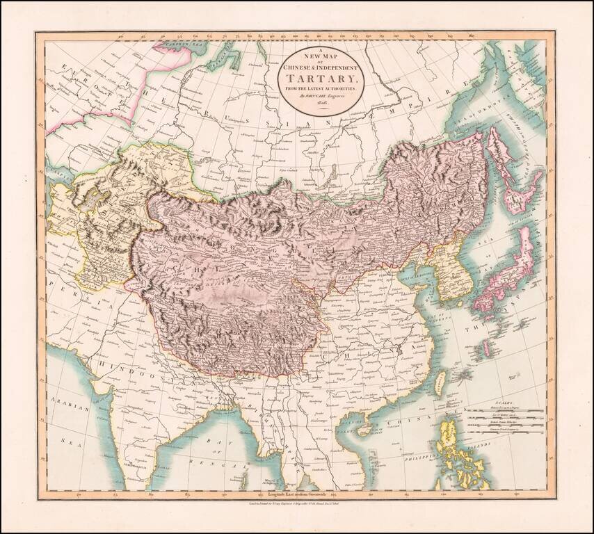
Rare Late State of the First Map of Tartaria Engraved In England. Nicely colored example of this scarce map of Tartaria. The present example is from a very late edition, where the title, dedication and coat of arms have been completely re-engraved....
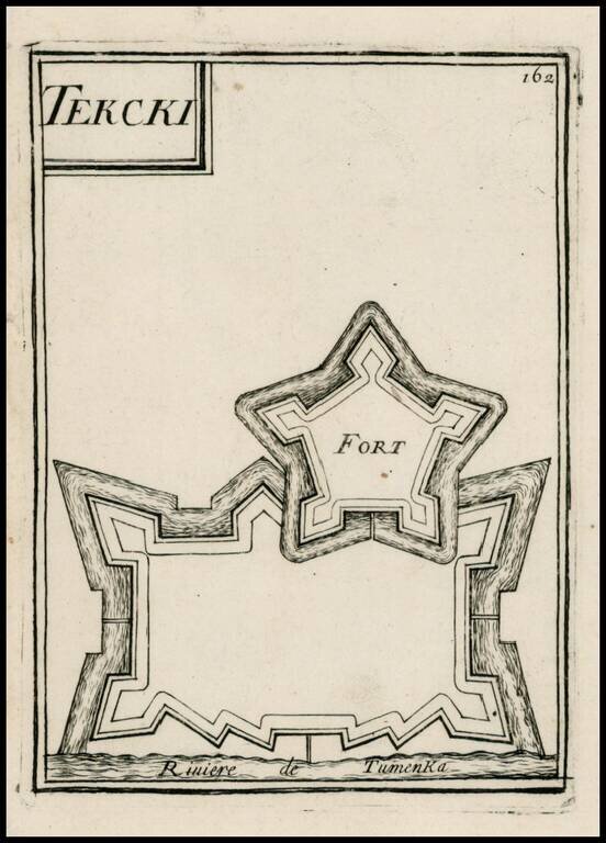
Map of the Terki fortress in the modern day Saratov Oblast, north of the Caspian Sea on the Volga River. From Mallet's monumental Description de l' Univers, first published in Paris in 1683, perhaps the greatest work of its kind in the 17th Century.
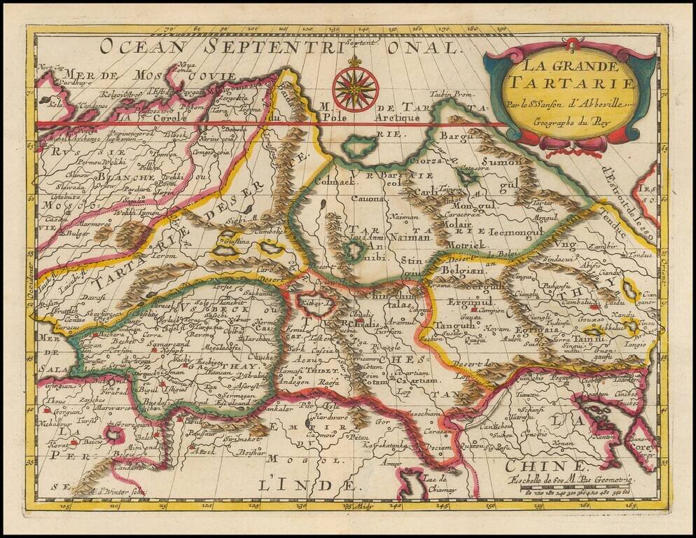
Fine old color example of this fine 17th Century map of Grand Tartaie by Nicolas Sanson. The map extends from the Tartarie Desert and Usbekistan in the west to Corea and Northeastern China.
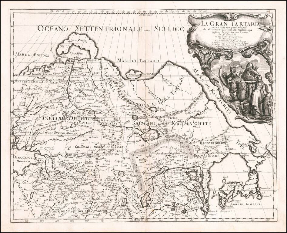
First edition of The Cantelli-Rossi map of Grand Tartary, extending from the Caspian to Japan and the Pacific and from Tibet to the Arctic. The Great Wall is shown, along with the Gobi Desert, Tibet, Korea and elongated peninsula, curiously shaped...
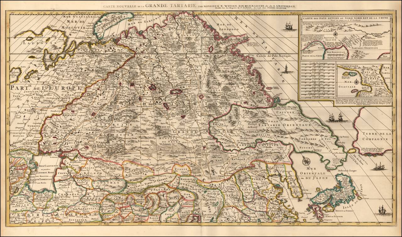
Highly Detailed Map of Tartary by Dutch Statesman and Russian Specialist Nicolaas Witsen with details from the Travels of Verbiest in China and De Vries in the North Pacific Nice example of Pierre Mortier's decorative and detailed map showing Central...
Decorative map of China, Tartary, Japan, Central Asia, etc. at the beginning of the 18th Century. Includes the mythical land bridge to America, the Island of Formosa or Bell Island, and other interesting details. This map was part of an atlas...

Detailed map of the region from the Caspian to Cathay, illustrating the earliest two Catholic Embassies to the courts of the Mongol Rulers. Giovanni da Pian del Carpine was one of the first Europeans to enter the Court of the Great Khan of the Mongol...
Decorative and detailed map showing Central Asia and the Tartary, from Chatelain's monumental 7 volume Atlas Historique. The map extends from Nova Semla in the northwest towards northern China and the peninsula of Korea in the southwest of the map....
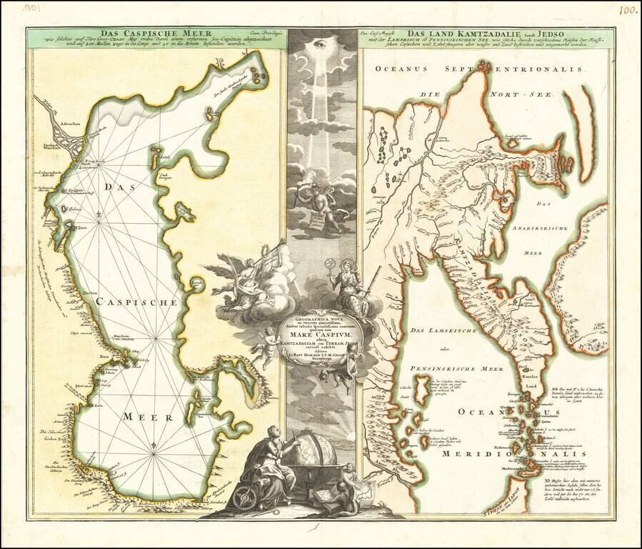
Decorative pair of antique engraved maps on one sheet, focusing on the Caspian Sea and Northeastern Russia and Kamtchatka. Includes an elaborate cartouche.
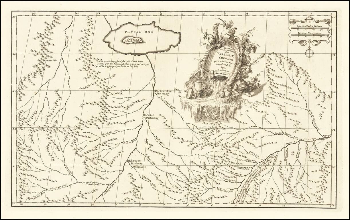
Fine example of D'Anville's map of the region just north of Mongolia. Shows a number of rivers and a few settlements and the road from Niptchou or Nerzinskoi to Beijing, beginning in eastern part of the map. Decorative cartouche. In 1765, an...
Fine example of D'Anville's map of the region just north of Mongolia.
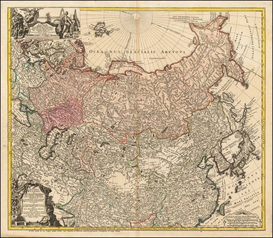
Detailed map of the Asian part of the Russian Empire, from the Caspian Sea and Bergen Island to Japan and the Pacific. The present example includes the portrait of Anna Ioannovna, who was regent of the duchy of Courland from 1711 until 1730 and then...
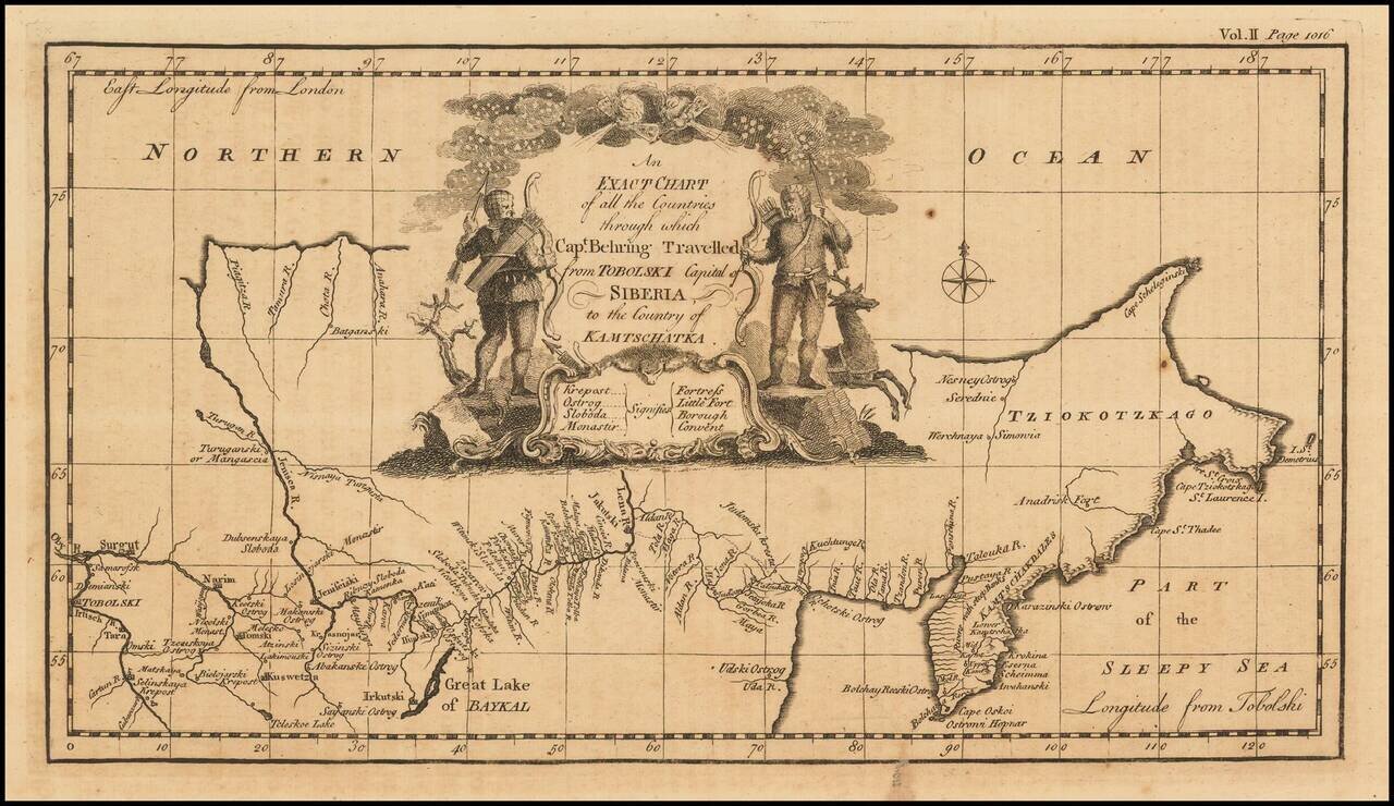
Nice example of the first English language map to show Vitus Behring's Route. In December 1724, Czar Peter the Great ordered the Danish-born Captain-Commander Vitus Bering (1681-1741) to lead the First Kamchatka Expedition (1725-30), in an effort to...
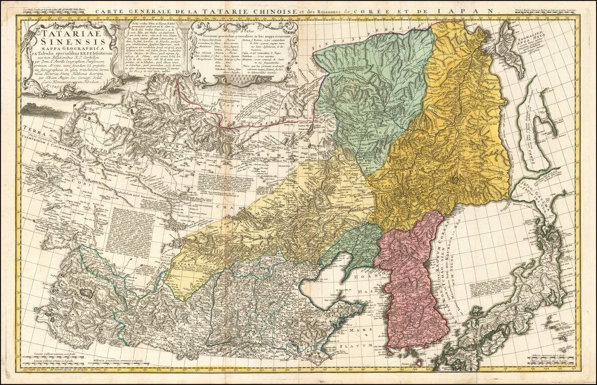
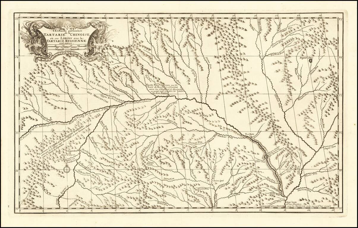
A scarce and interesting regional map of Chinese Tartary, extending from the Gobi Desert in the West to Mongolia in the East. Includes extensive notes and explanations in Latin. Based upon D'Anville's seminal work in 1732 map. The map Includes far...
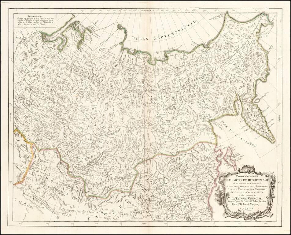
Interesting highly detailed map showing Central Asia, Russian Asia, Mongolia, etc. and extending southwest to the Gobi Desert and east to Kamchatka and the Northeast Passage. Based upon source material from De Vaungondy and De L'Isle's Russian Atlas.
Antique Map of Central and Eastern Asia, from the Caspian Sea to China A marvelous map of Chinese Tartary, Corea and Japan. Includes nice detail and notes in the interior of Mongolia. Shows towns, rivers, mountains, lakes and other features.