
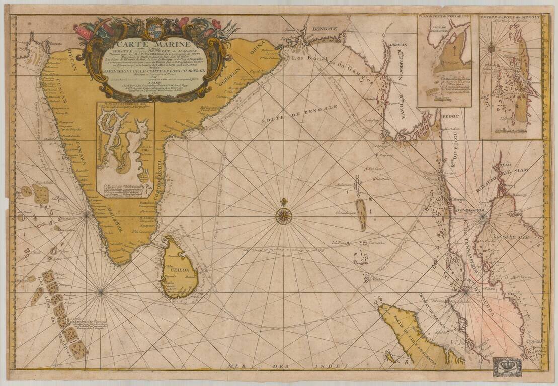
Old color example of this important chart of the Indian Ocean, illustrating the route of the Jesuit priest Guy Tachcard in 1697. The present example bears the bookplate (bottom right) of the Prussian Royal Academy of Sciences ( Königlich-Preußische...
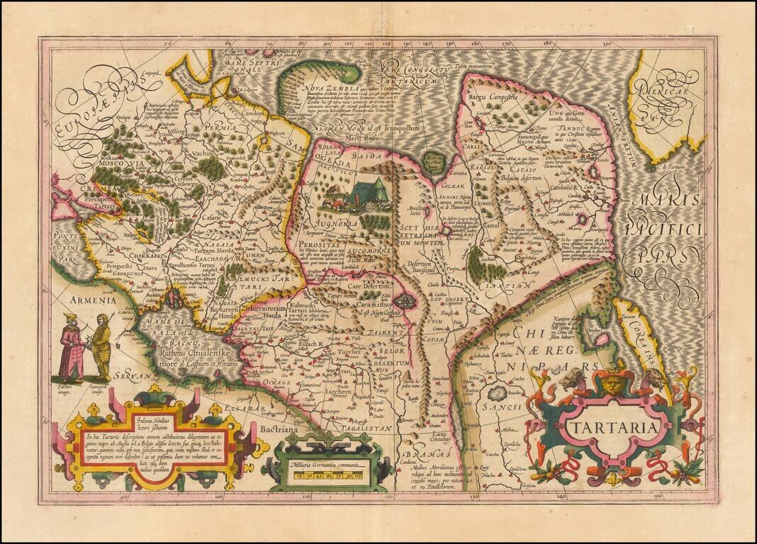
Nice example of Hondius' map of Tartary, China, Korea and adjacent regions. Shows the Great Wall of China, Corea as an Island, a very early example of the northwest coast of America, naming Cape de Fortuna and the Straits of Anian (overlooked by...
![A Map of the Icy Sea in which the several Communications with the Land Waters and other new Discoveries are exhibited [Sea of the West]](/map/small/0054dg.jpg)
An interesting map on a north hemispheric projection, showing the regions then being actively explored by the Russians, French and English. The projection is based upon Phillipe Buache's work from the prior decade and illustrates one view of the...
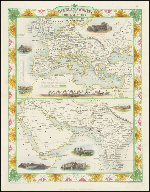
Striking full color example of this fascinating map, showing the various trade routes to Europe, with a larger map of Europe and the Mediterranean at the top, and a detailed regional map of the Middle East and Western India at the bottom. Decorative...
![[Ottman Empire] Partes confines Trium Magnorum Imperiorum Austriaci Russici et Osmanici Foliis VI compreshensa ex novissimis observationibus, dimensionibus optimisque tabulis geographicus descripta . . . Anno MDCCLXXXV](/map/small/52715.jpg)
Three Empires At War -- Austrian, Russian and Ottoman Fine 6 sheet map published in Berlin in the midst of the Austro-Turkish and Russo-Turkish wars, between the Austrian, Russian and Ottoman Empires. Centered on the Black Sea, the map shows the...
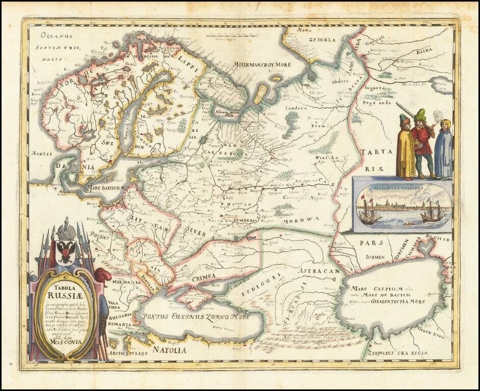
Nice example of the Merian edition Hessel Gerritsz's map of Russia, with view of Archangelsckagoroda. The map was compiled from manuscript maps and work brought back by Isaac Massa. Includes a decorative birdseye view. Richly decorated a large title...
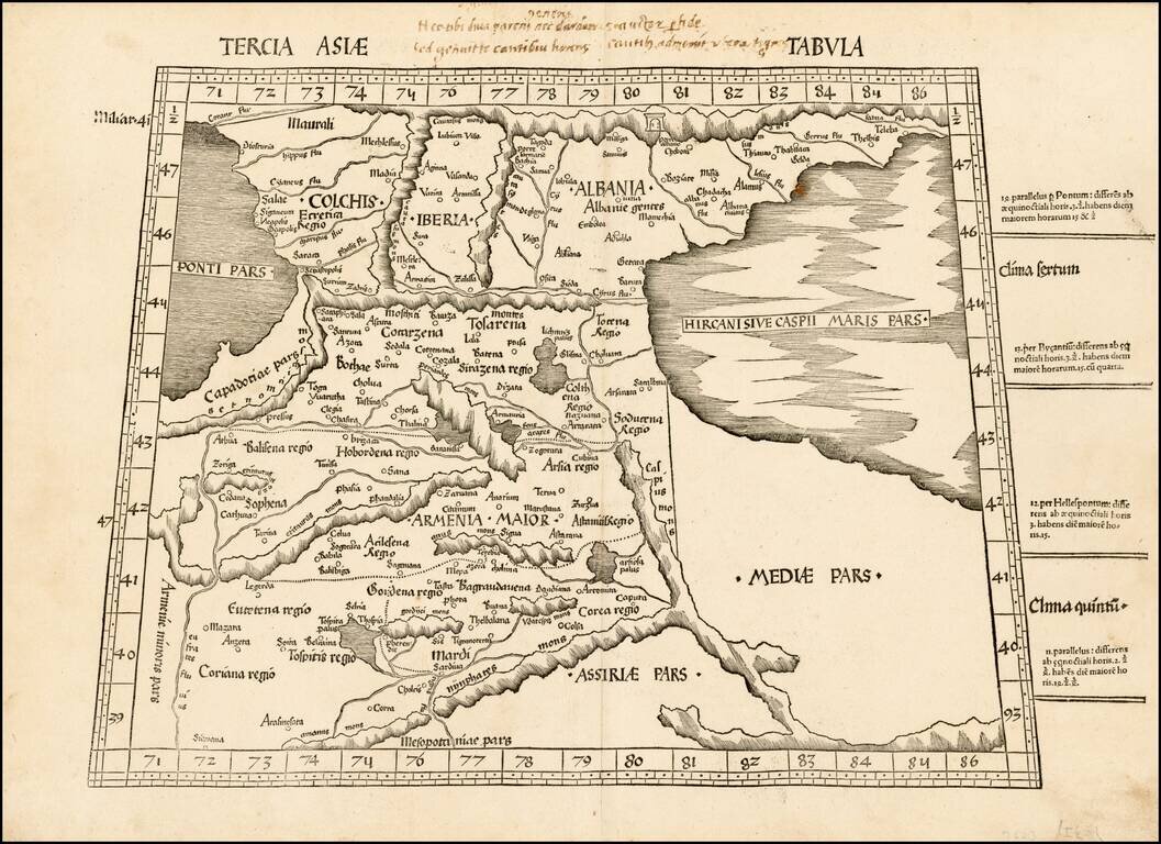
A striking example of Waldseemuller's map of the region between the Black and Caspian Seas, centered on Armenia. The first modern atlas, prepared by Martin Waldseemuller using the translation of Mathias Ringmann. This is one of the most important...
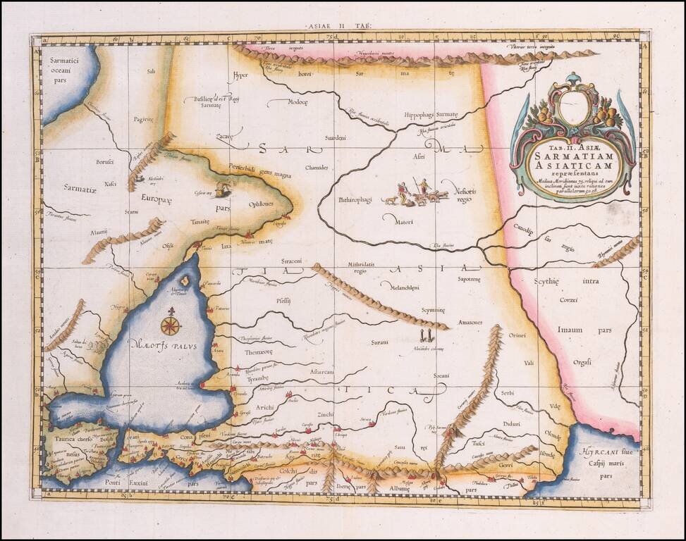
Colored example of Mercator's map of Armenia, Georgia, eastern Turkey, and parts of Ukraine and Southern Russia, from Mercator's Geographia, first published in 1578 and republished in Amsterdam beginning in 1695. Includes decorative cartouche and sea...
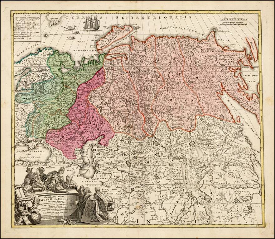
Striking large format map of Imperial Russia, at the beginning of the period when Russia was aggressively exploring the Pacific Ocean and Arctic Seas. Highly detailed map of the Russian Empire and northern China covering the region from Finland and...
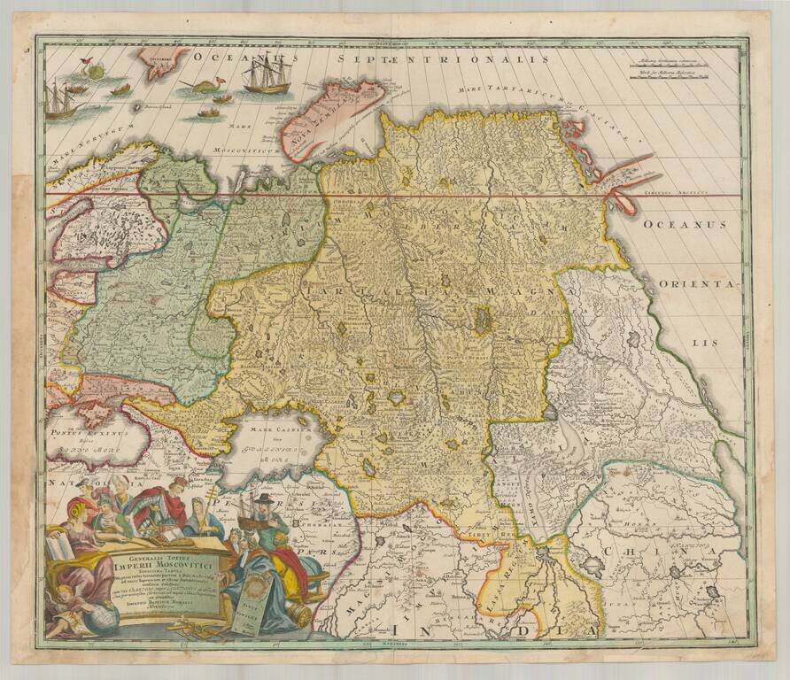
Decorative map of Russia and Central Asia, showing the Northeast Passage. Extends from the Black Sea and th Baltic to Kamchatka, China, Northern India and the mouth of the Indus River. Includes remarkable detail in areas still then not yet explored....
![[Book with map] Nova Descriptio Geographica Tattariae Magnae tam orientalis (with Das Nord =und Ostliche Theil von Europa und Asia . . . )](/map/small/68134.jpg)
First Edition of Strahlenberg's Seminal Work on Russia, bound with an English Edition of the Map Nice example of the London edition of Strahlenberg's map of Russia, one of the most important maps of Russia published in the 18th century, bound with the...
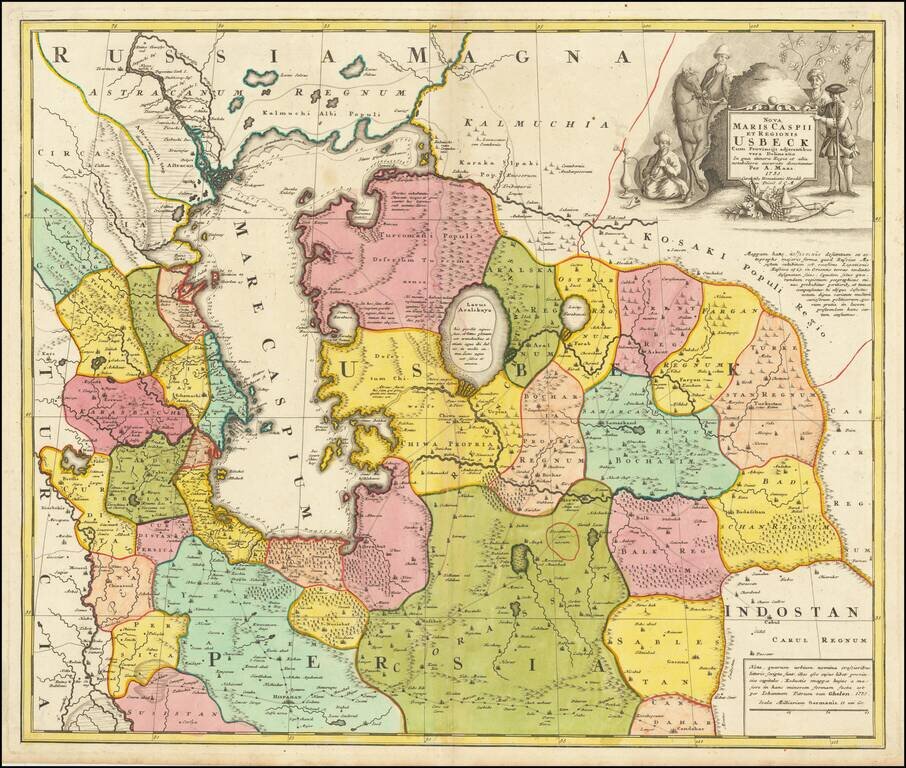
Antique Map of Usbekistan, Kazakhstan, Azerbaijan, Northern Iran, Turkmenistan and the Caspian Sea Region - The First Map to Name Usbekistan in the Title Decorative and detailed map of Usbekistan, Kazakhstan, Azerbaijan, Northern Iran, Turkmenistan...
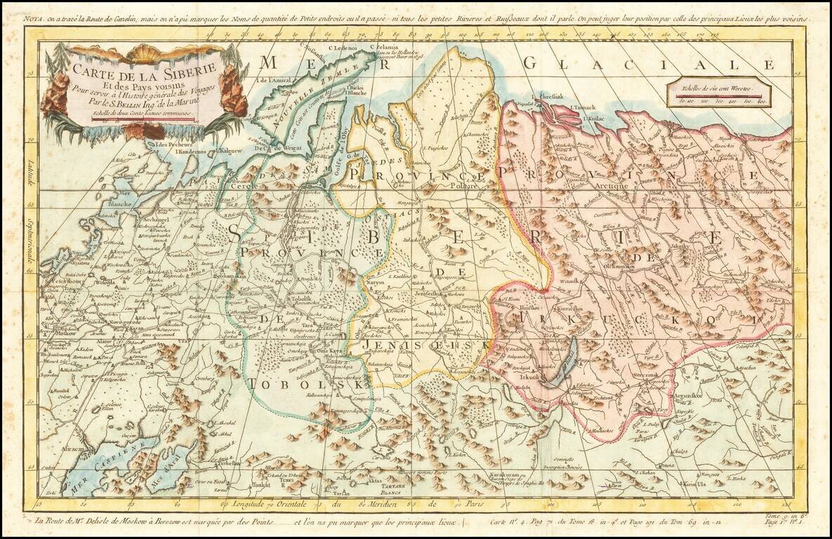
Detailed map of Siberia, extending from the White Sea and the Caspian Sea in the west to Irkuckoi Province, Jakutky on the Lena River and regions just to the east. Centered on the Jenisi River. Nicolas Bellin was the official map maker to the King of...
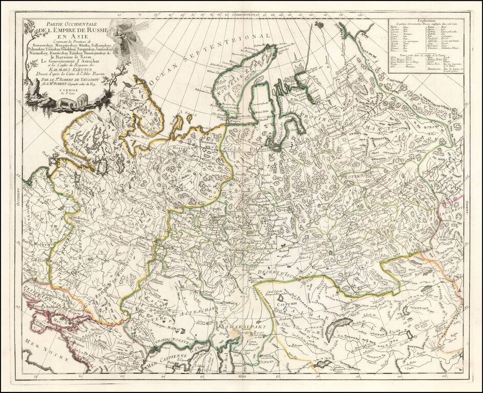
Highly detailed map of the Western Part of Russia, extending South to the Caspian and East to Irkurkoy and Ilimskoy. The map is drawn from the Atlas of Russia compiled under the direction of Joseph Nicolas De L'Isle in St. Petersburg.
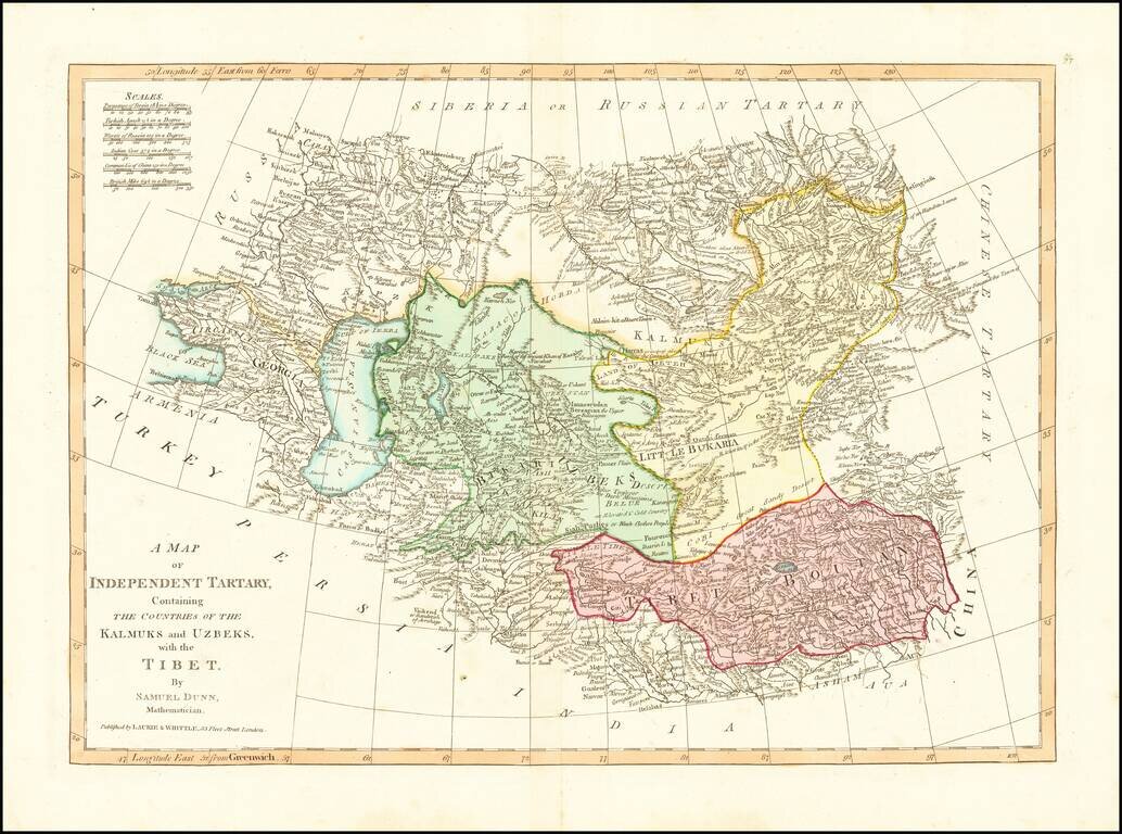
Detailed regional map, extending from European Russia and the Caspian Sea to Chinese Tartary. Nice detail in Tibet, Bukaria, and the Mountainous regions of western China. From Dunn's New Atlas or Mundane System of Geography.
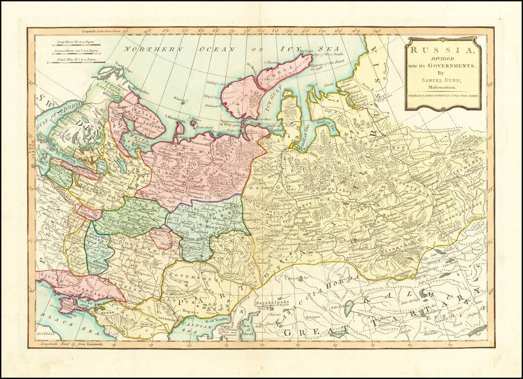
Finely colored map of Russia and its political divisions. Includes towns, mountains, rivers, lakes, islands, etc. From Dunn's New Atlas or Mundane System of Geography.