
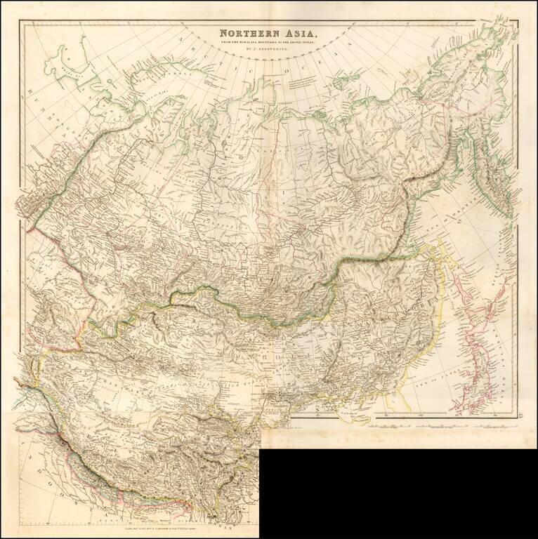
Striking example of Arrowsmith's rare map the region North of the Himalayas. A highly detailed map of Northern Asia, taking in Mongolia, Tibet, Bhutan, Tartary, Siberia and Manchuria. Part of Japan engraved also. The map provides a highly detailed...
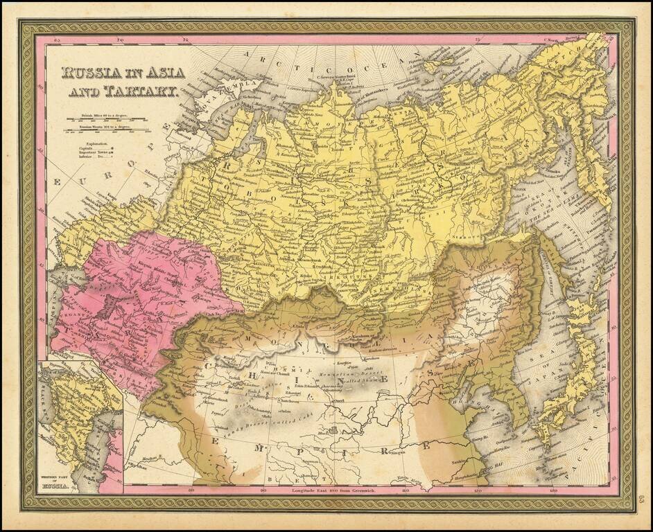
Detailed map of Russia, Tartaria and China, extending to Corea and Japan. Decorative border. An excellent map from the leading American mapmaker of the mid-19th Century.
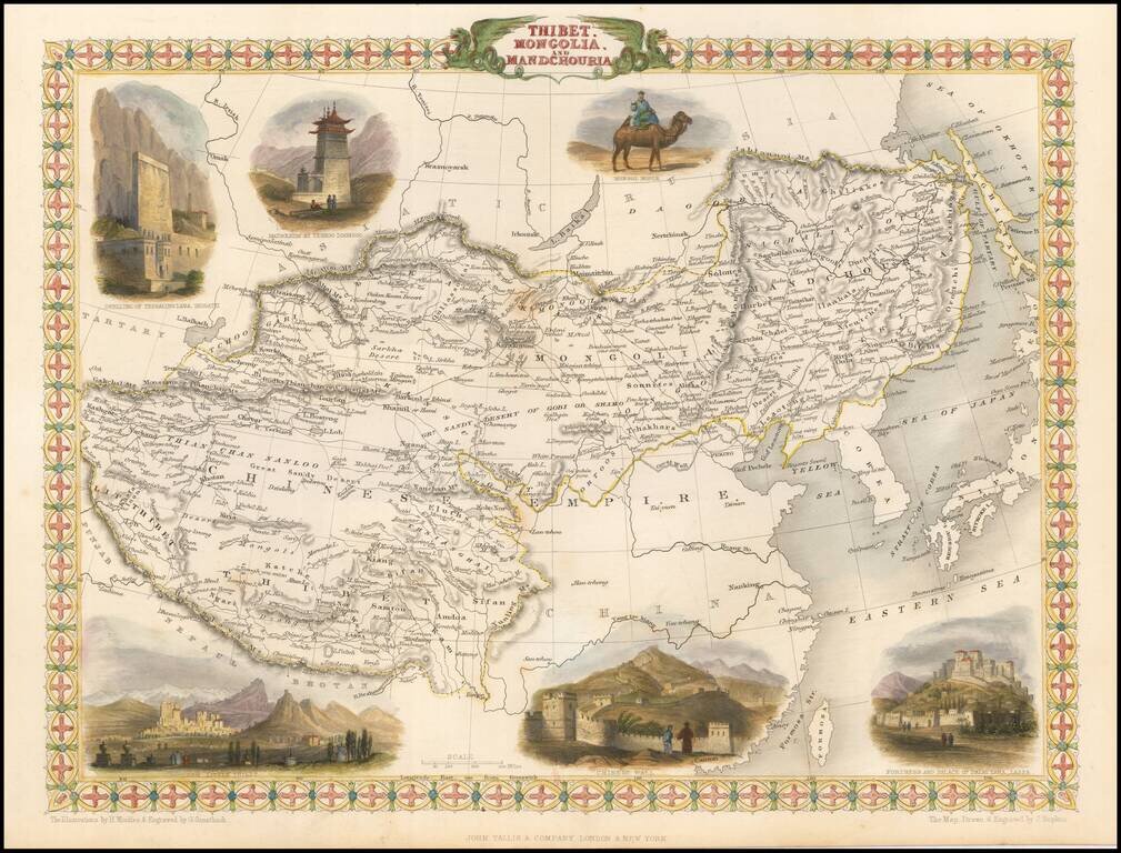
Striking full color example of this marvelous regional map. Extends to Nepal and Lake Balkach. Decorative vignettes of Dwelling of Tessaling Lama, Shigatei, Mausoleum At Teshoo Loom Boo, a Mongol Noble riding a camel, Fortress and Palace of the Dalai...
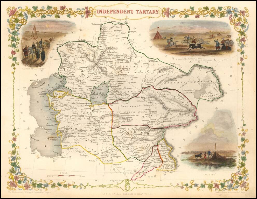
Striking full color map of Tartary, with vignettes of the Bride Chase, Tartars on the journey, and the Tent of those days. Engraved for R. Montgomery Martin's Illustrated Atlas. Tallis was one of the last great decorative map makers. His maps are...
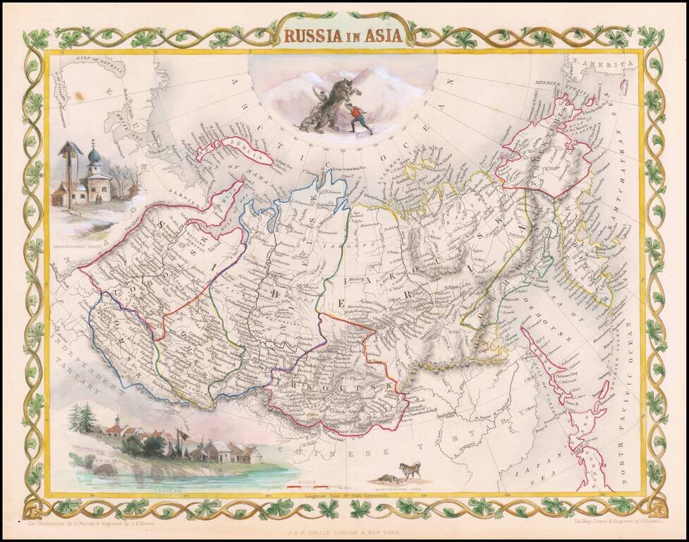
Decorative full color example of Tallis' decorative map of Russian Asia, with large vignettes of a polar hunting scene, Skorskarskoi Pagost, Troitsk and Kamchatkan Dogs. Engraved for R. Montgomery Martin's Illustrated Atlas. Tallis was one of the last...
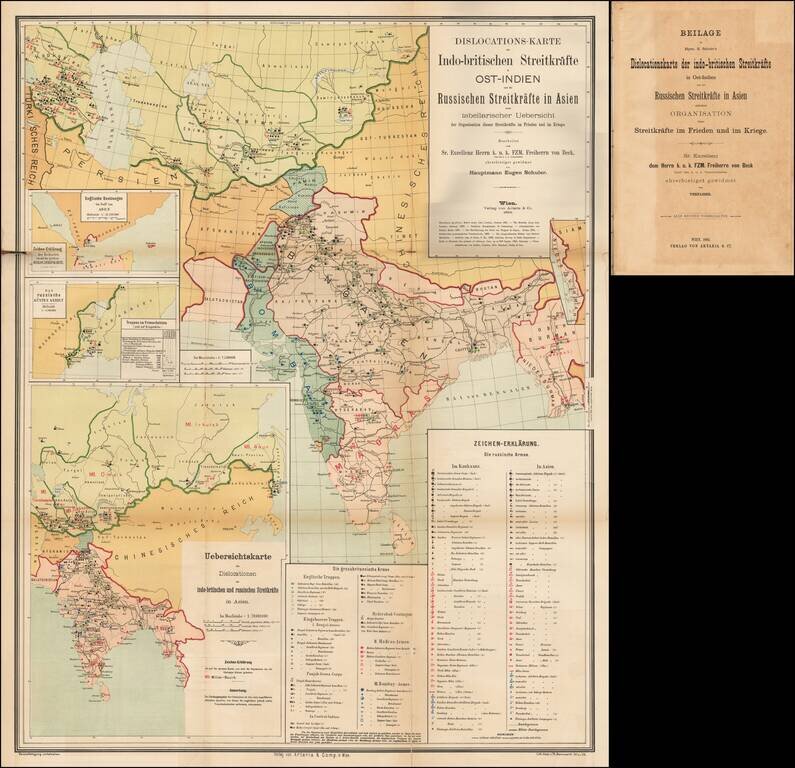
A Comprehensive Map of the Great Game. 4to, original ½ calf over blue paper boards, with original paper title label onlaid. Title, folding table, and large color-lithographed, German-language folding map covering central Asia and India, focusing on...
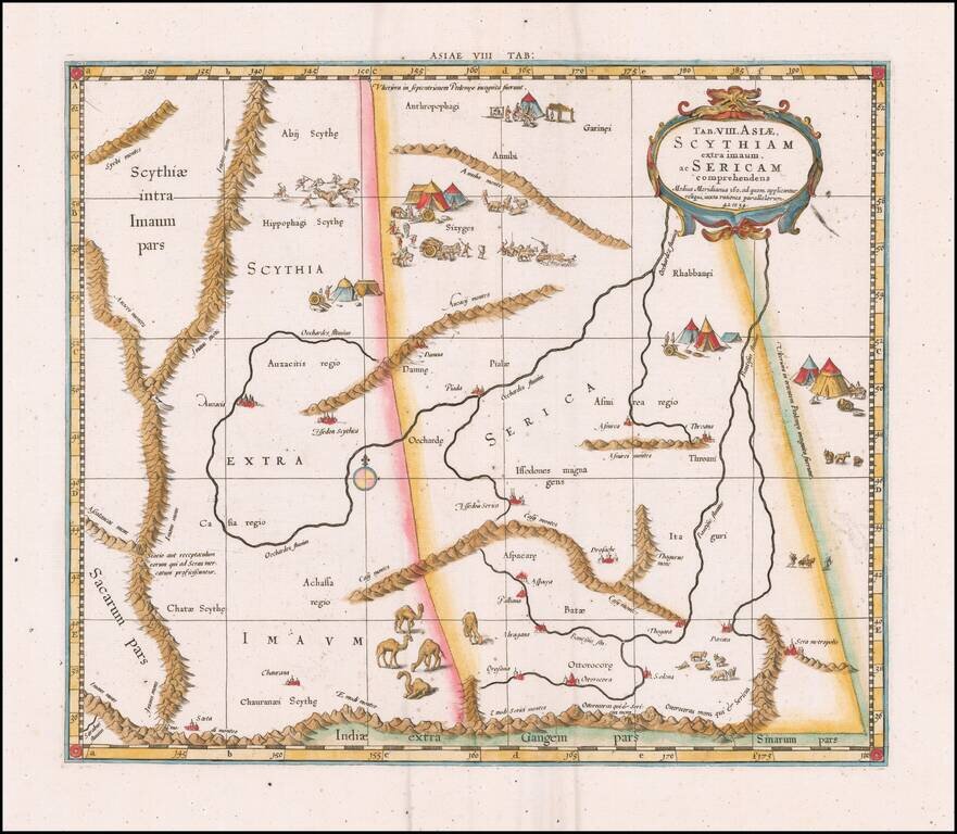
![Tabula VIII Asiae [Central Asia] (Title on Verso)](/map/small/31320.jpg)
Gorgeous Ptolemaic map of Central Asia and Tartary and Western China, from Lorenz Fries' edition of Ptolemy's Geographia. This map is largely based on the 1513 map by Waldseemuller. Lorenz (Laurent) Fries was born in Alsace in about 1490. He studied...
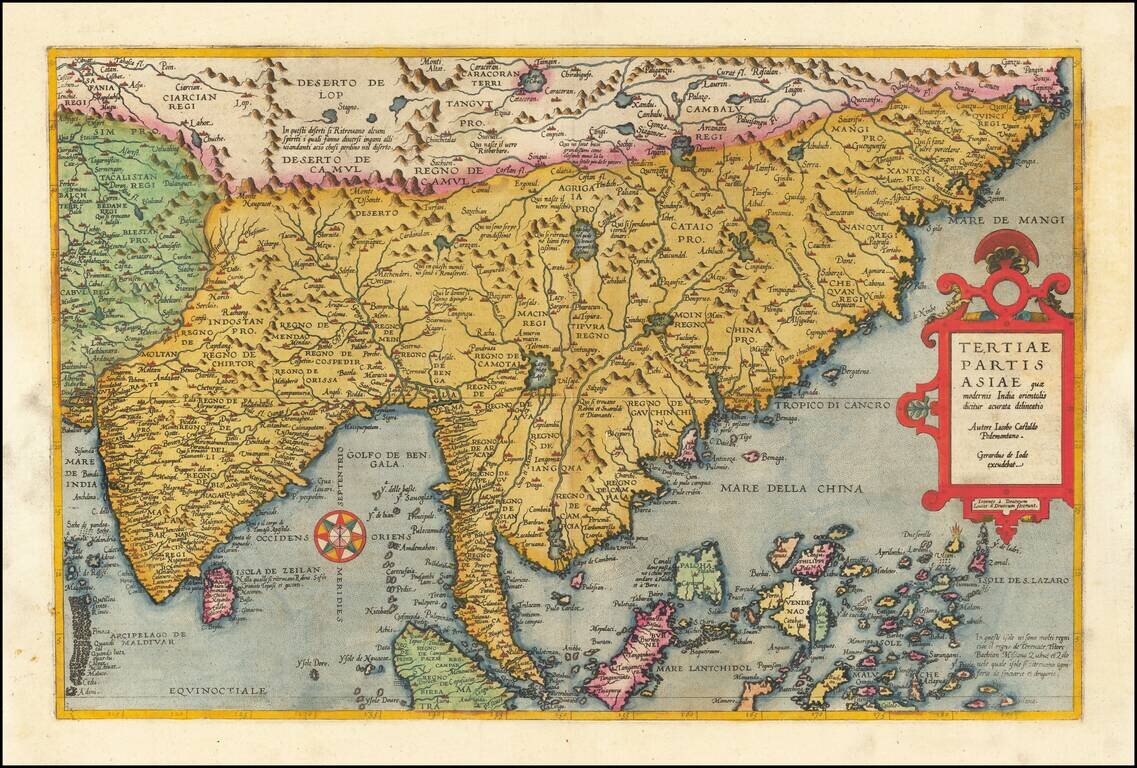
Fine old color example of Gerard De Jode's map of Eastern Asia, published in 1593, Engraved by Joannes and Lucas van Deutecum, who's signature is in the lower left part. De Jode's map is drawn directly from the first (northern) two sheets of Giacomo...
Fine Ptolemaic Map of Central Asia from Mercator’s Geographia Finely engraved map of Central Asia east of the Caspian Sea, encompassing parts of present-day Pakistan, Tajikistan, Kyrgyzstan, and western China. The map is from Mercator’s highly...
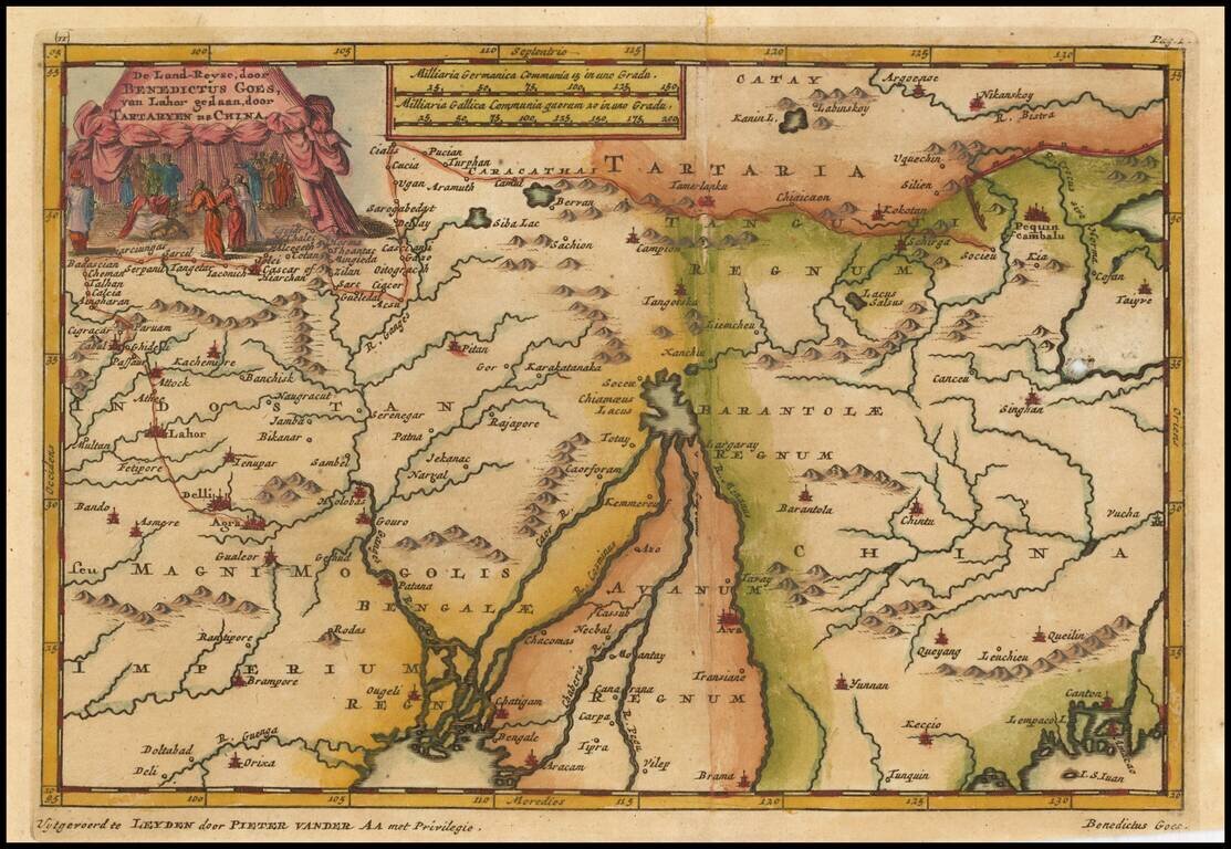
Interesting map showing the region of northeastern India, Nepal, Bhutan, Assam and Bangladesh. At center is the imaginary Chiamaeus Lacus with four huge rivers flowing south into Bangladesh and Burma. Decorated with a pictorial title cartouche of a...
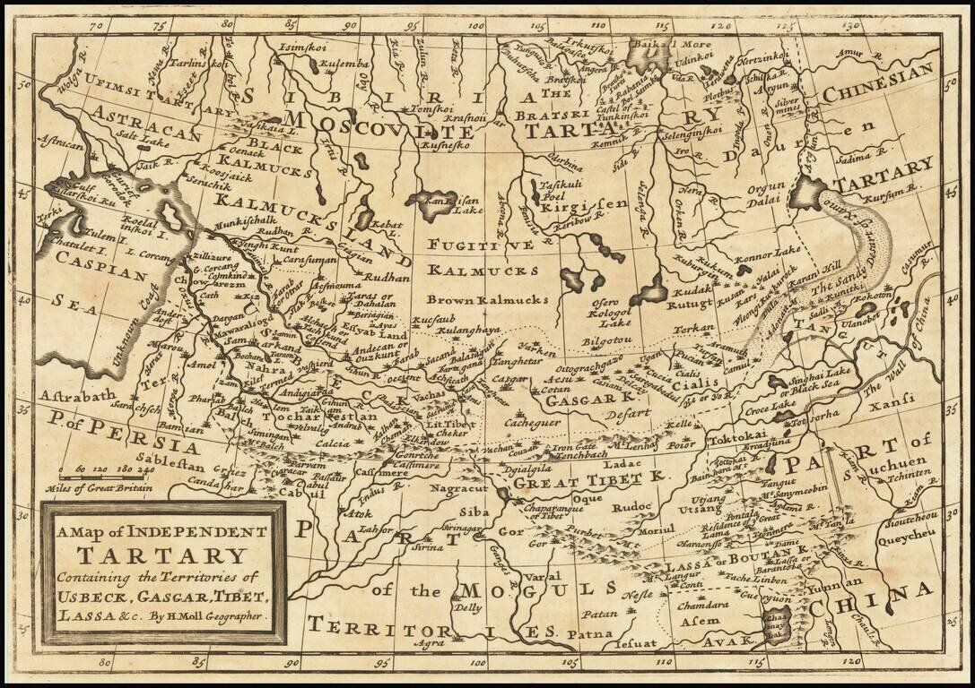
Scarce map of Central Asia, Tibet, Mongolia, Usbeck, etc. The map covers the region from the Caspian Sea to the Great Wall of China. The region is mostly the domain of the Kalmyk people with various areas denoted for Black Kalmucks, Fugitive Kalmucks,...
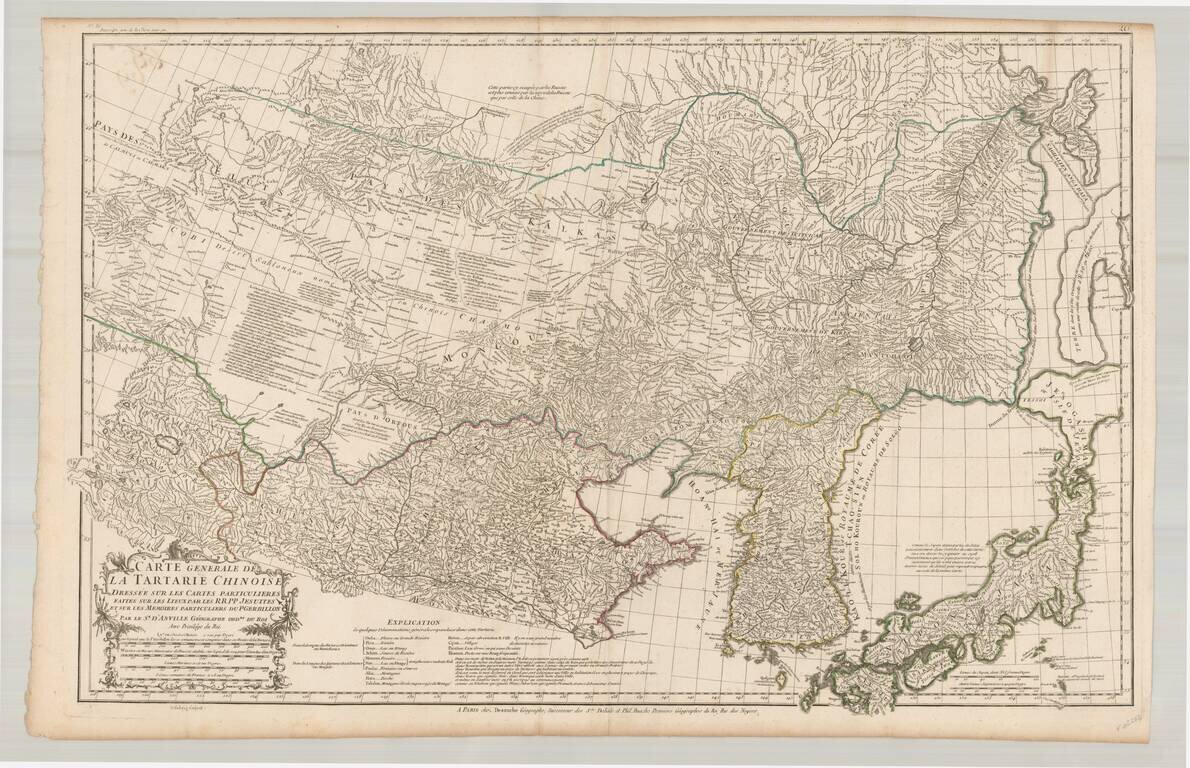
Fine example of the rare JA Dezauche edition of D'Anville's map of the region from Japan to the Gobi Desert, centered on Mongolia and Korea, from D'Anville's Atlas of China. Includes a nice treatment of Korea, Japan and China, along with a detailed...
![[Tibet] Carte Generale Du Tibet ou Bout-Tan Et Des Pays De Kashgar Et Hami Dressee Sur Les Cartes Et Memoires Des RR PP Jesuits De La Chine . . .](/map/small/43409.jpg)
Fine example of the Dezauche edition of the first European map of Tibet, first issued in 1737 by D'Anville. Much of the interior is captioned "Gobi ou Desert De Sable" (Gobi, or Sandy Desert) and several rivers are shown "lost" in the sands. There are...
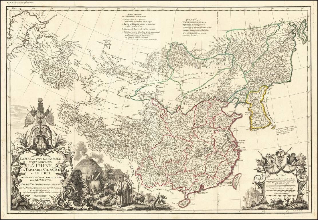
First edition of D'Anville's map of China, the finest printed map of the Middle Kingdom published in Europe during the 18th Century. J.B.B. D'Anville's groundbreaking map of the Middle Kingdom, an important and geographically progressive depiction of...
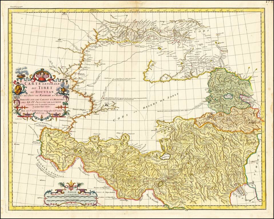
First Euopean Map of Tibet Fine old color example of the first European map of Tibet, first issued in 1737 by D'Anville. Much of the interior is captioned "Gobi ou Desert De Sable" (Gobi, or Sandy Desert) and several rivers are shown "lost" in the...
![La Tartaria Chinese . . . 1784 [show Corea]](/map/small/44378.jpg)
Decorative map, showing the region from Korea and Tartary to Northern China. Corea is spelled with a "C." Decorative cartouche. The map was issued in Zatta's Atlante Novissimo, a monumental 4 volume work and one of the last great decorative atlases.