
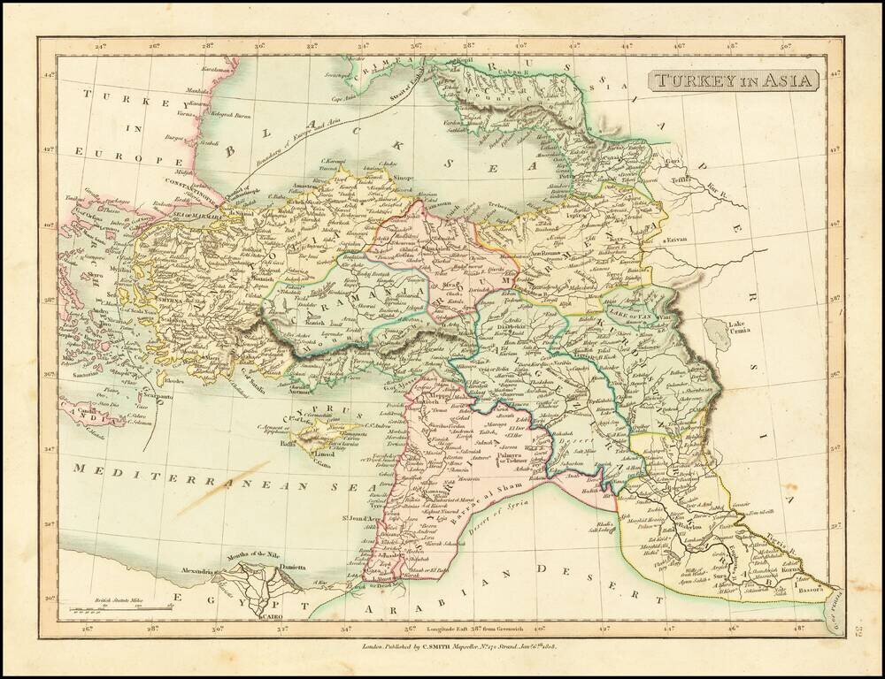
Detailed map of Asia Minor, Syria and Iraq. Excellent detail. Shows towns, rivers, mountains, islands, etc. From Smith's General Atlas. Nice topographical detail.
![Азіятская Турція, Персія, Аравія, и Часть Туркестана. [Asian Turkey, Persia, Arabia, and Part of Turkestan.]](/map/small/66732.jpg)
Detailed and very rare Russian-language the Middle East, published in Saint Petersburg in 1836. The map differentiates between Arabia, the Ottoman Empire (and internal regions such as Karamania), Persia, Afghanistan, Baluchistan, etc. Rarity The map...
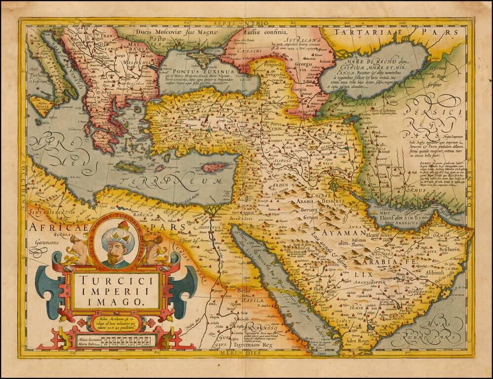
Fine Map of the Ottoman Empire from the Mercator-Hondius Atlas Striking example of this map of the Ottoman Empire, showing their territories in the Balkans, Anatolia, the Levant, the Arabian Peninsula, and North Africa. It was published by Henricus...
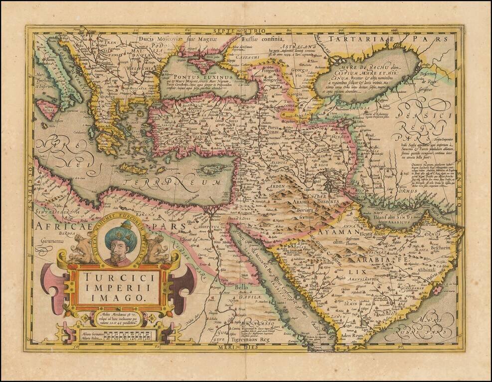
Fine Map of the Ottoman Empire from the Mercator-Hondius Atlas Striking example of this map of the Ottoman Empire, showing their territories in the Balkans, Anatolia, the Levant, the Arabian Peninsula, and North Africa. It was published by Henricus...
![[Bunting's Map of the Mediterranean Region]](/map/small/55211.jpg)
Map of the Mediterranean region, from Heinrich Bunting's Itinerarium Saccrae Scripturae first published in 1581. T he map shows the Eastern Mediterreanean, including Sicily, Malta, Cyprus, Rome, the Holy Land, Alexandria, the southern Black Sea,...

Attractive map of Cyprus, Asia Minor, the Holy Land and Egypt. The map appeared in Arrowsmith's London Atlas.
![Tabula Asiae VII [Iran, Afghanistan, Turkmenistan, Uzbekistan, Kazakhastan, Pakistan, India]](/map/small/60604.jpg)
Nice example of Munster's Ptolemaic map of the region north and east of the Black Sea and the Persian Gulf, extending to the Imaus Mountains. The map is unchanged from the 1540 first edition of this landmark work. Munster's Geographia was a...
![[Black & Caspian Sea Region] Tabula Asiae III](/map/small/71170.jpg)
Nice example of Munster's Ptolemaic map of the region between the Black Sea and Caspian Sea extending south to include all of Armenia Maior and part of Armenia Minoris. The map is centered on the modern countries of Armenia, Georgia and Azerbaijan....
![Primae Partis Asiae accurata delineatio… [shows Cyprus]](/map/small/57018.jpg)
De Jode's edition of Giacomo Gastaldi's Landmark Map of The Middle East and Asia Minor. Old color example of De Jode's highly desirable map of the region, bounded by the Black Sea and Mediterranean in the West and Afganistan and Central Asia in the...
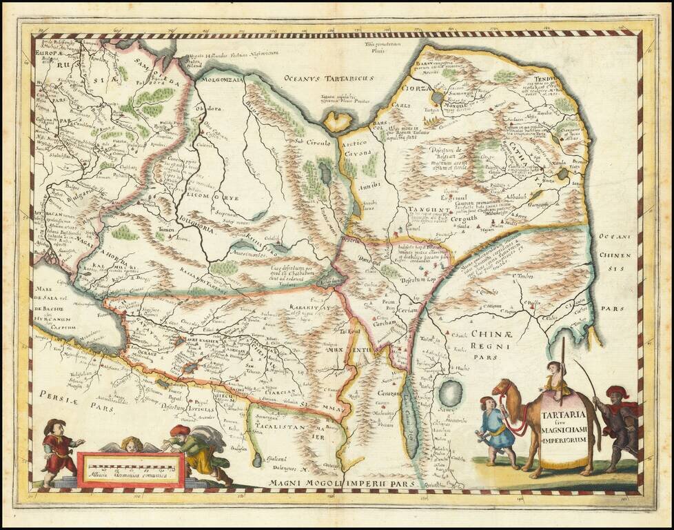
An attractive antique map of China, Tartary, and Central Asia. This map covers a vast area in intriguing detail which reflects European knowledge about the world at the time during which it was made. The detail shown includes many rivers, mountain...
An attractive antique map of China, Tartary, and Central Asia. This map covers a vast area in intriguing detail which reflects European knowledge about the world at the time during which it was made. The detail shown includes many rivers, mountain...
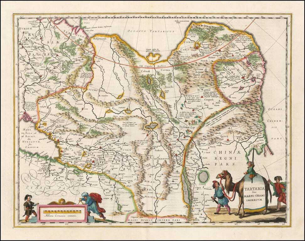
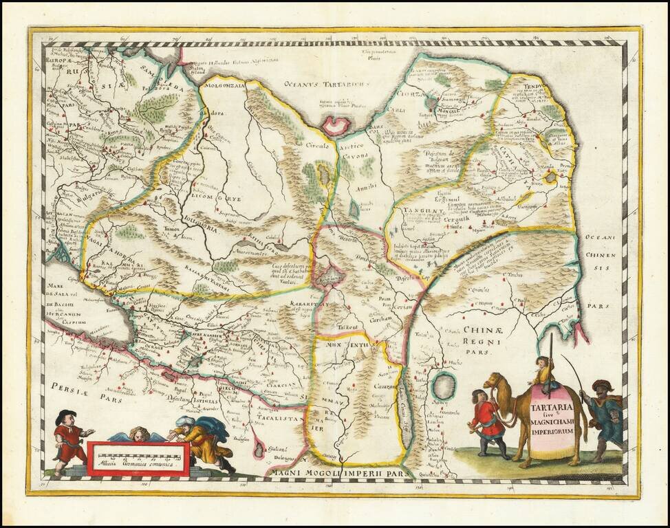
Nice example of Blaeu's map of China, Tartary and Central Asia, extending from Mongolia and Xanadu to the Caspian and the Volga River, and to Tibet and the Upper Ganges River. The Great Wall of China appears prominently.
![Description De La Tartarie tiree en partie de plusiurs Cartes, qui en ont este faictes en parte diverses Relations et de divers Autheurs Arabes . . . 1654 [Korea as an Island]](/map/small/59148.jpg)
Early French map of Tartary, extending from the Caspian to Korey Isle (the Island of Korea). One of the earliest detailed maps of the region published in France. The map was prepared by Pierre Marriete for Sanson's Cartes Generales de Toutes les...
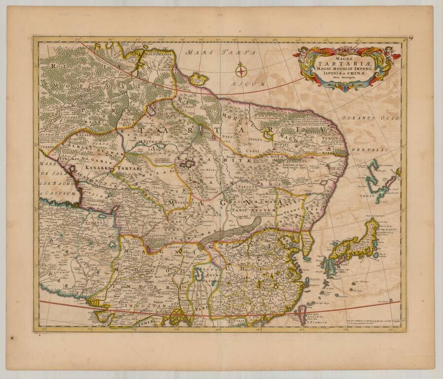
Nice old color example of De Wit's map of Northeastern Asia, extending from the Island of Formosa, the Ganges, and the eastern part of the Caspian to Yedso, Tartaria, Siberia and Molgomzaia in Russian Asia in North. The Great Wall of China is shown,...
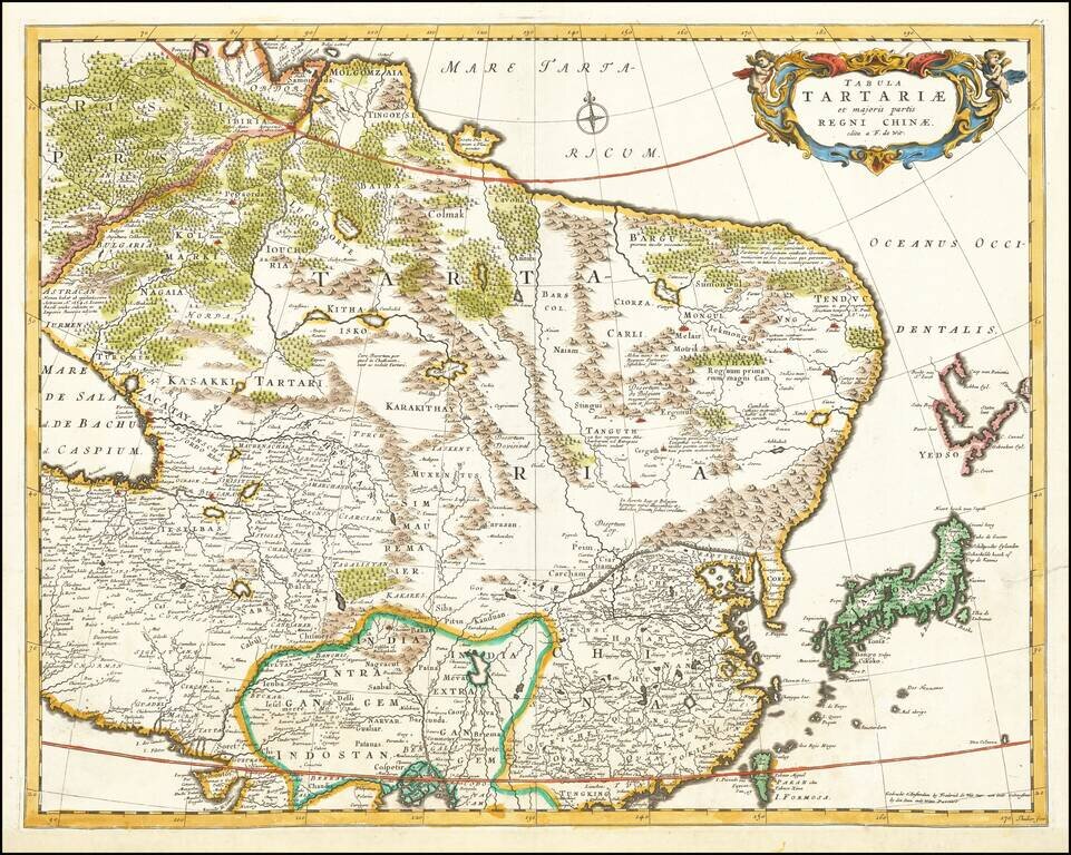
Attractive example of De Wit's map of the northeastern part of Asia. The map extends from the Island of Formosa, the Ganges and the eastern part of the Caspian in the south to Yesso, Tartaria, Siberia and Molgomzaia in Russian Asia in the north. The...
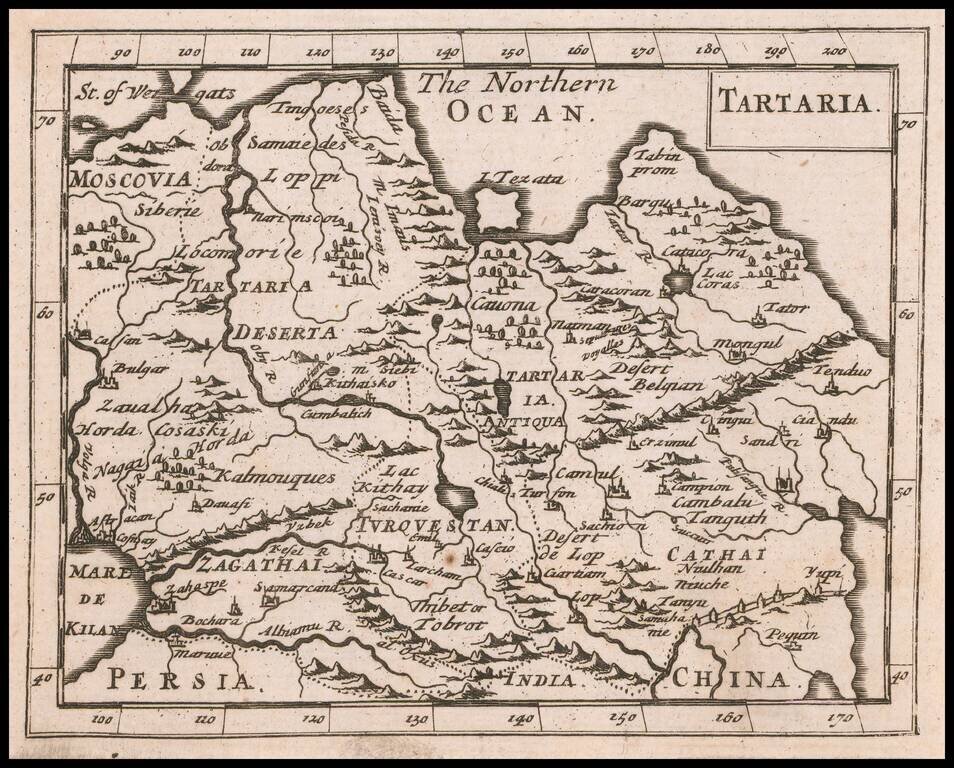
Rare Miniature English Map of Tartary. Rare English map of Tartary, which appeared in Moore's A New Geography. Many of the plates in the work were engraved by Herman Moll, who had moved to London in 1678 and had not yet begun publishing under his...