Carey & Son refers to the period when Mathew Carey (1760-1839) ran his publishing business with his son, Henry Charles Carey (1793-1879). Mathew began the business in the 1790s and published several important atlases, including the earliest general atlas of the United States, the American Atlas. Henry entered the firm as a junior partner in 1817 and worked alongside his father until 1822, when his father retired and Henry bought out his father’s shares. They also brought in Isaac Lea (1792-1886) as a junior partner; Lea had recently married Henry’s sister. From then, the firm was known as Carey & Lea.
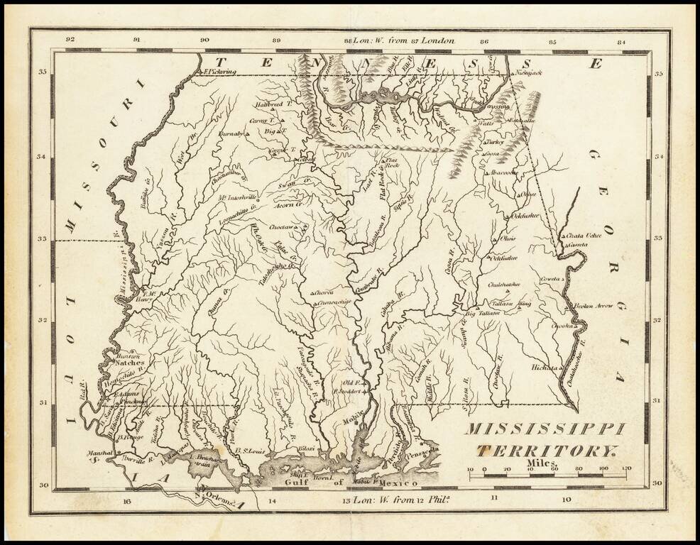
Nice example of Carey's map of Mississippi Territory, illustrating the region prior to the creation of Alabama Territory. A highly detailed map, which includes towns, roads, rivers, mountains, and many other details.
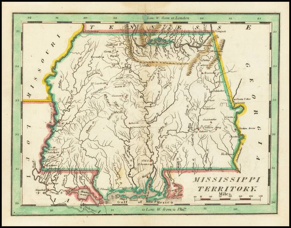
Nice example of Carey's small map of Mississippi Territory, illustrating the region prior to the creation of Alabama Territory. A highly detailed map, which includes towns, roads, rivers, mountains, and many other details.
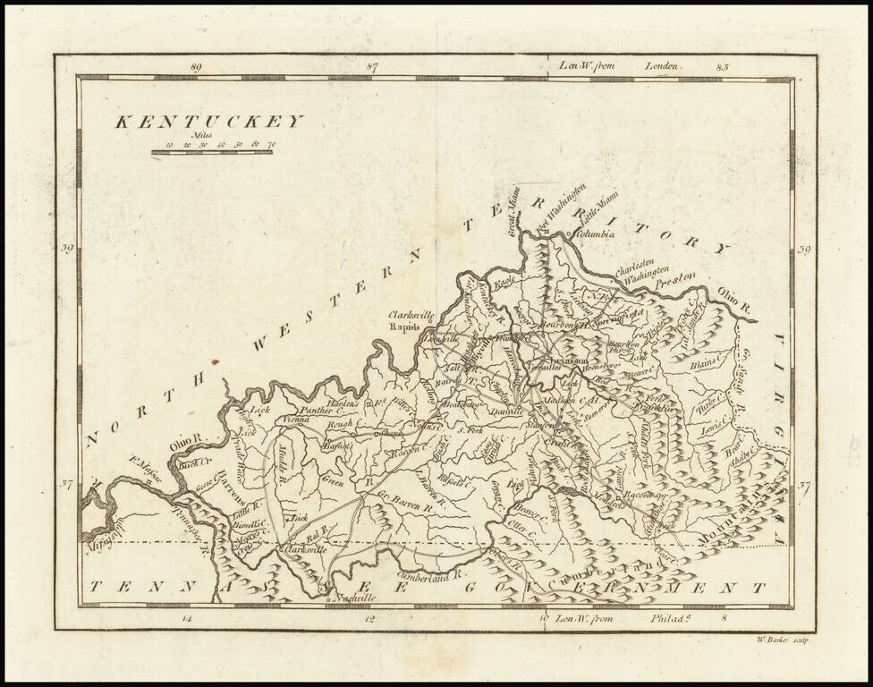
One of the earliest printed maps of the State of Kentucky. The map provides a fine and extensive treatment of Kentucky's early roads. Numerous towns and courthouses are also shown, along with the Rapids below Louisville on the Ohio River. Includes...
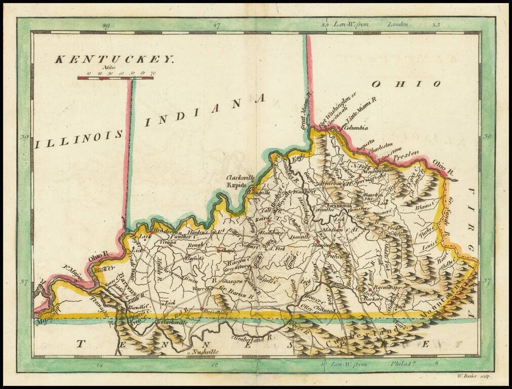
Scarce early map of Kentucky, published by Mathew Carey. This later 1814 edition references Ohio, Illinois and Indiana above. The prior state showed only the "Northwestern Territory.
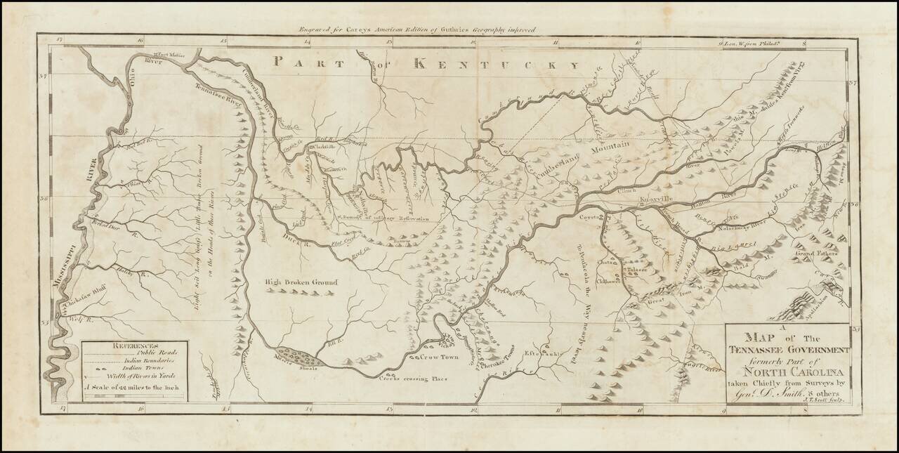
Nice example of the first state of Mathew Carey's map of Tennessee, published in Carey's American Atlas. This is the first state of the map, issued in 1795 and distinguishable from the second state by the words "Tennassee Government" in the title,...
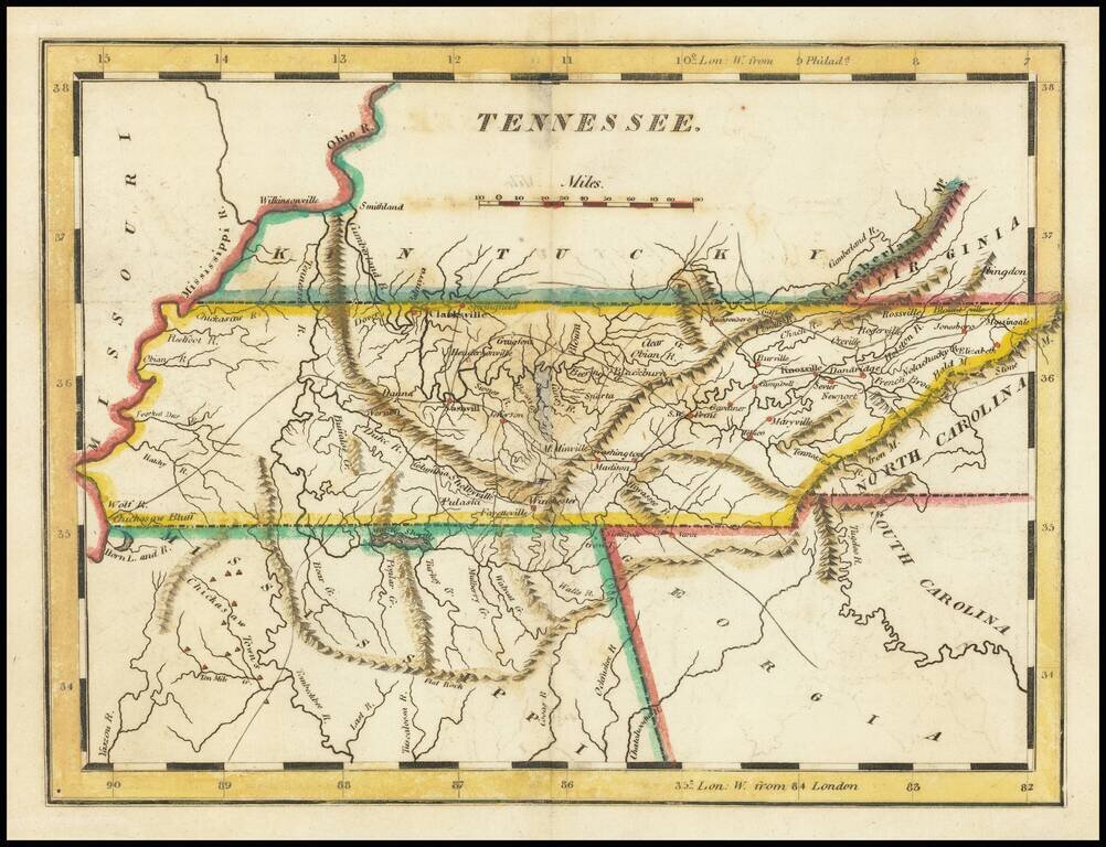
Nice example of Matthew Carey's early map of Tennessee. A highly detailed map, which includes towns, roads, rivers, mountains, and many other details.
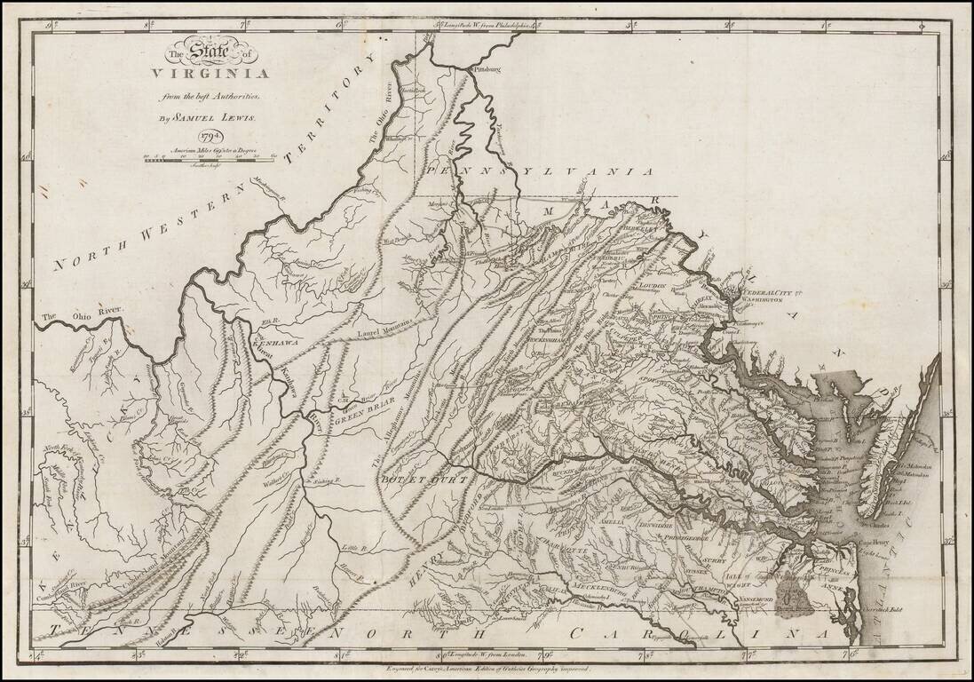
First edition of Carey's map of Virginia, one of the earliest obtainable maps of Virginia published in the U.S. Wheat & Brun note: This is a topographical map showing much detail. Many towns and court houses are indicated; county names are given...
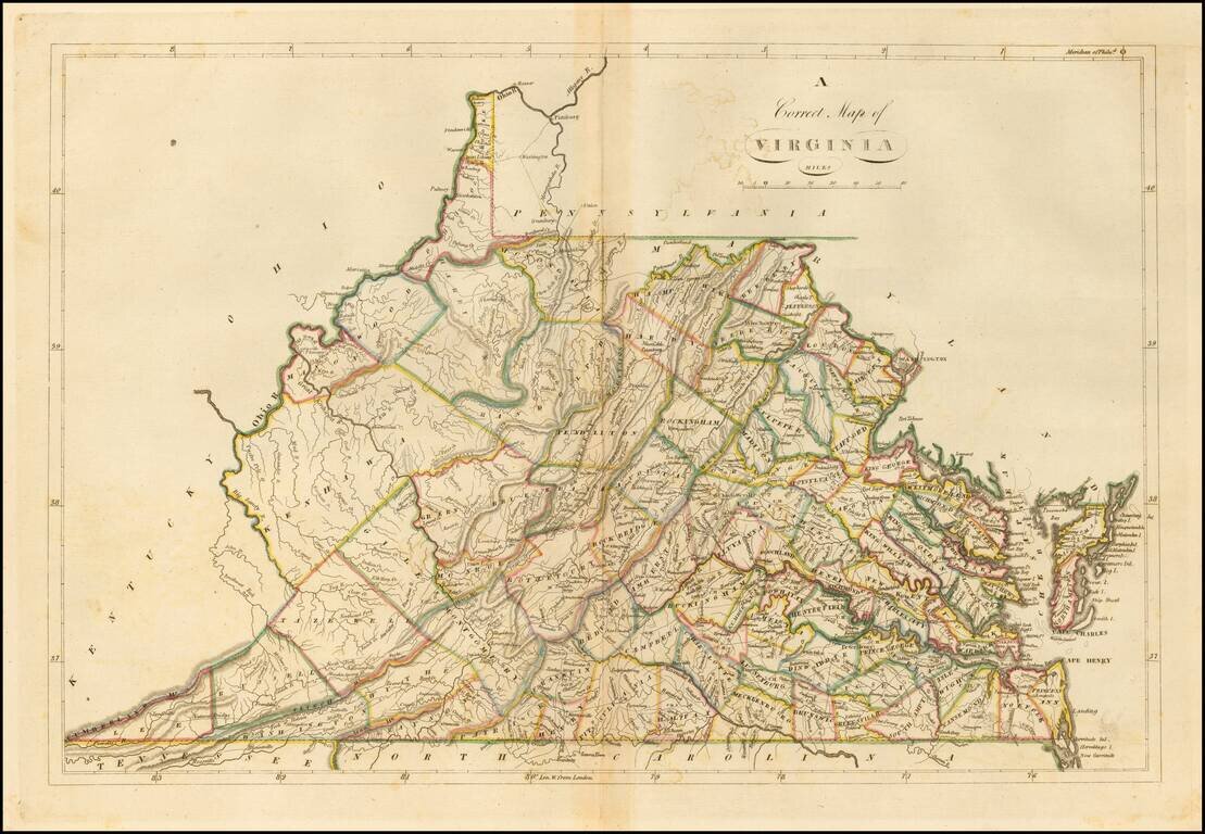
Nice example of the 1814 edition of Carey's map of Virginia, one of the best large format maps of the state to appear in a Commercial Atlas. The map is attractively hand colored by counties and shows, towns, roads, mountains, rivers, lakes, islands,...
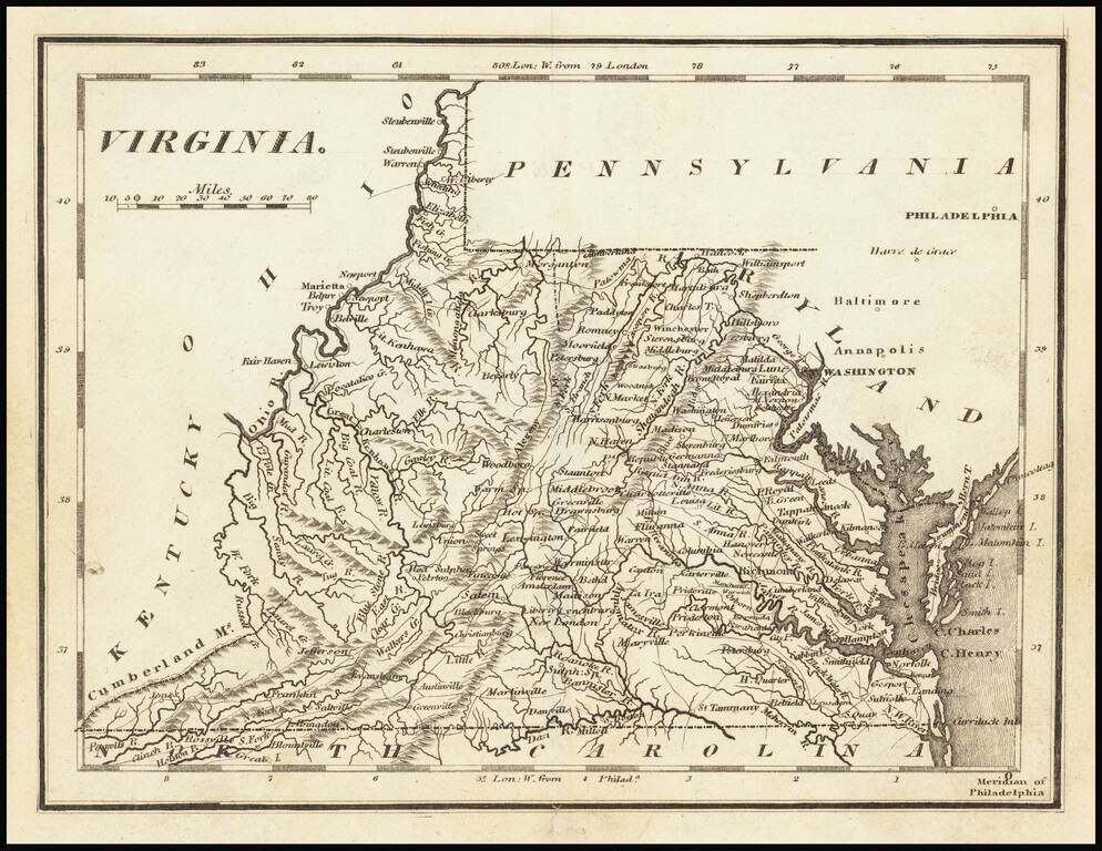
Nice example of Carey's map of Virginia. A highly detailed map, which includes towns, roads, rivers, mountains, and many other details.
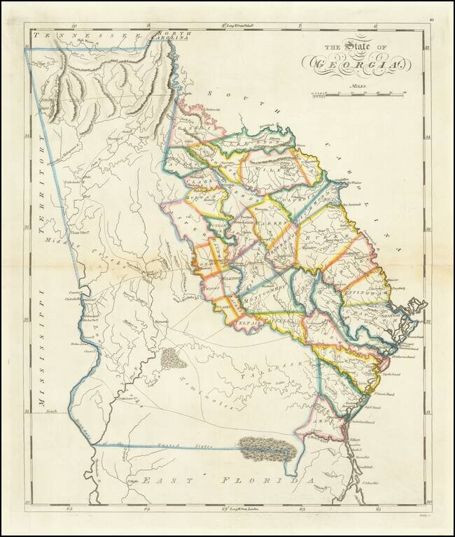
One of the Earliest Obtainable Maps of Georgia in its Modern Configuration. Rare full wash color example of Matthew Carey's second map of Georgia, first issued in 1814. Following the creation of Mississippi Territory in 1798, the borders between...
Striking example of Mathew Carey's map of North Carolina, one of the earliest large format maps of the State after independence. Includes the topography of North Carolina, as well as roads, towns, rivers, lakes, and a host of other details. The map...
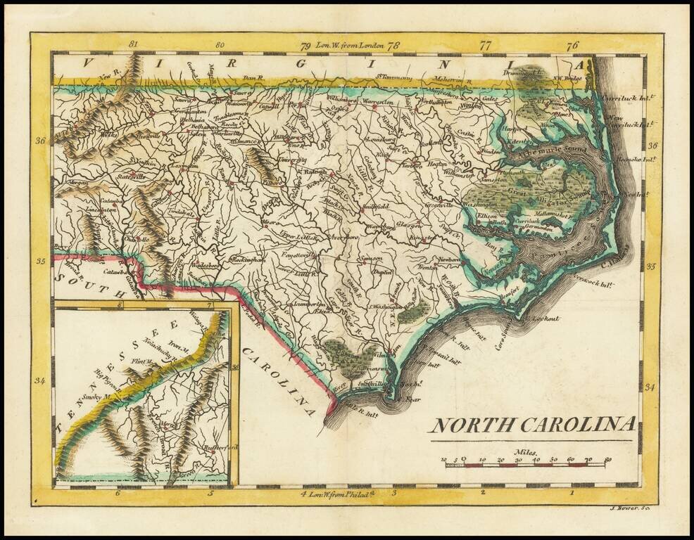
Scarce early map of the North Carolina, published by Mathew Carey. As noted on the North Carolina Map Blog: Although slightly smaller than the 1796-1810 map, it is most easily distinguished from the earlier plate by the presence of an inset of...
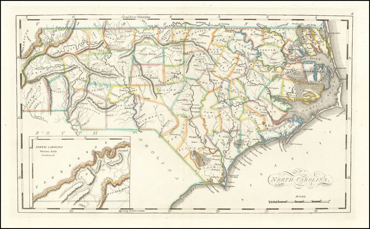
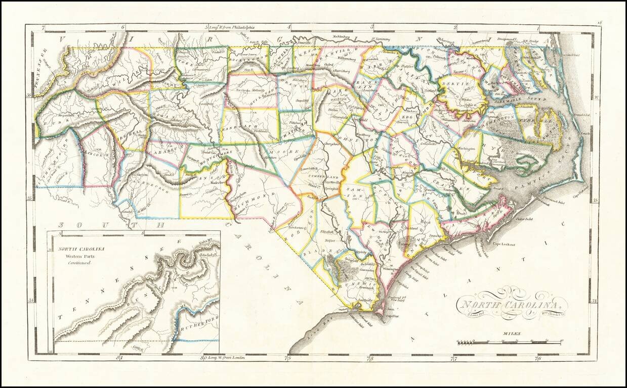
Rare Final State From 1818 Striking example of the edition of Mathew Carey's map of North Carolina, one of the earliest large format maps of the State after independence. Includes the topography of North Carolina, as well as roads, towns, rivers,...
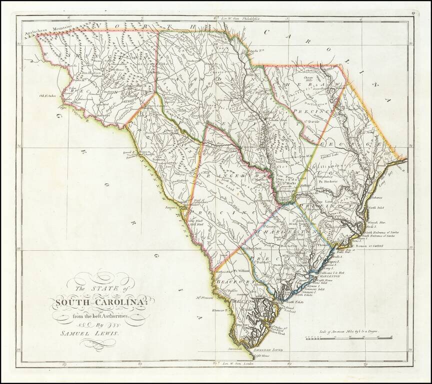
Finely colored example of Carey's map of South Carolina, hand colored by counties, from the rare 1816 edition of Mathew Carey's General Atlas. The map provided a large format and highly detailed map of the state, showing towns, roads, rivers,...
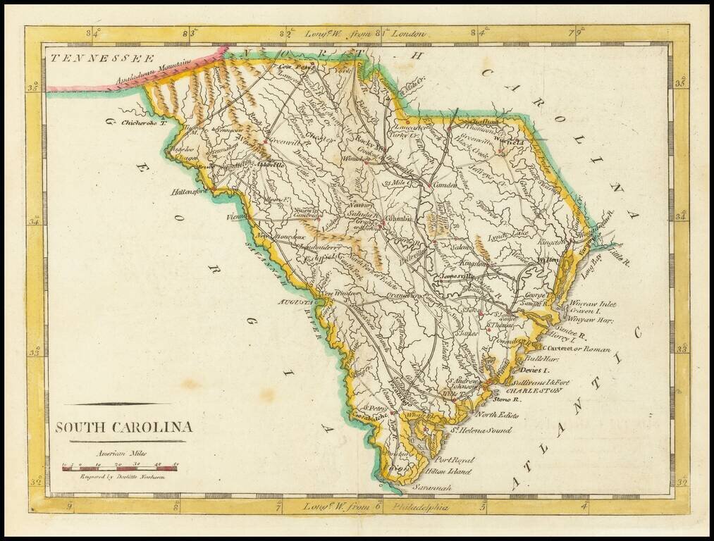
Nice early map of South Carolina from Carey's American Pocket Atlas. The map shows towns, roads, rivers, mountains and other topographical features. Following the publication of Carey's American Atlas in 1795, there were a small group of 18th Century...
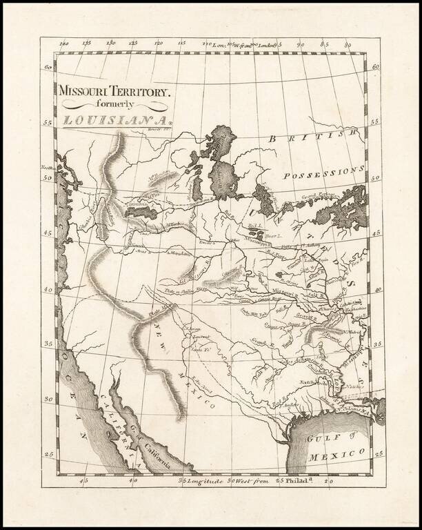
One of the Earliest Maps To Incorporate Lewis & Clark's Reports From Their Expedition Across America To The Pacific Reduced size example of Matthew Carey's map of Missouri Territory, published shortly after the return of Lewis & Clark and in...