Carey & Son refers to the period when Mathew Carey (1760-1839) ran his publishing business with his son, Henry Charles Carey (1793-1879). Mathew began the business in the 1790s and published several important atlases, including the earliest general atlas of the United States, the American Atlas. Henry entered the firm as a junior partner in 1817 and worked alongside his father until 1822, when his father retired and Henry bought out his father’s shares. They also brought in Isaac Lea (1792-1886) as a junior partner; Lea had recently married Henry’s sister. From then, the firm was known as Carey & Lea.
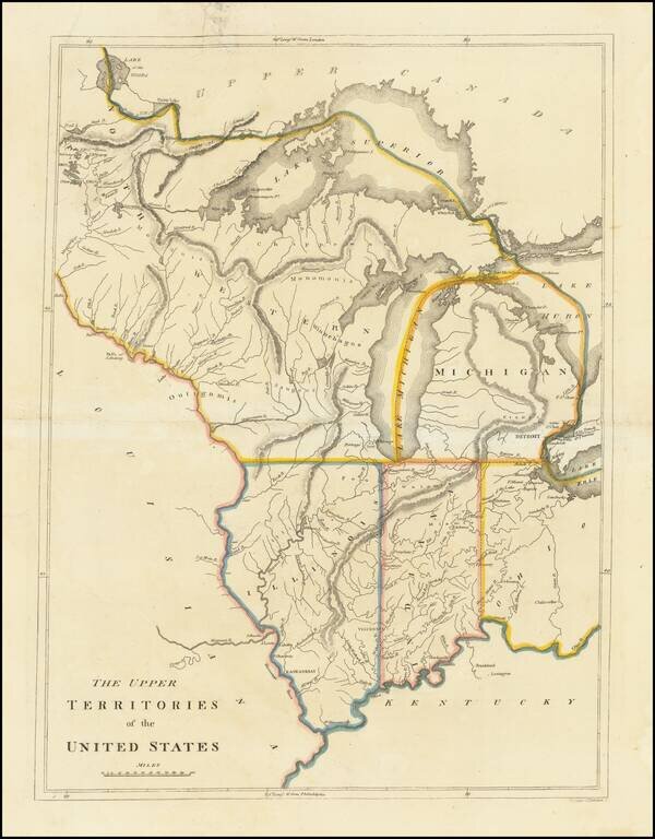
An Early American Map of the Old Northwest Nice example of the rare 1814 edition of Mathew Carey's map of the old Northwest. The map reflects a very early appearance of Michigan Territory (organized 1805), which had not yet appeared separately on any...
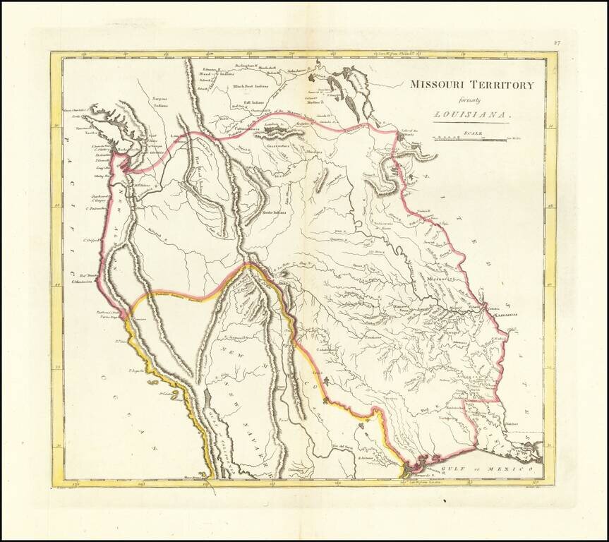
The First American Atlas Map of the Transmississippi West -- Based Upon Lewis & Clark's Reports Nice example of Mathew Carey's highly important map of Missouri Territory. Published shortly after the return of Lewis & Clark, Mathew Carey's...

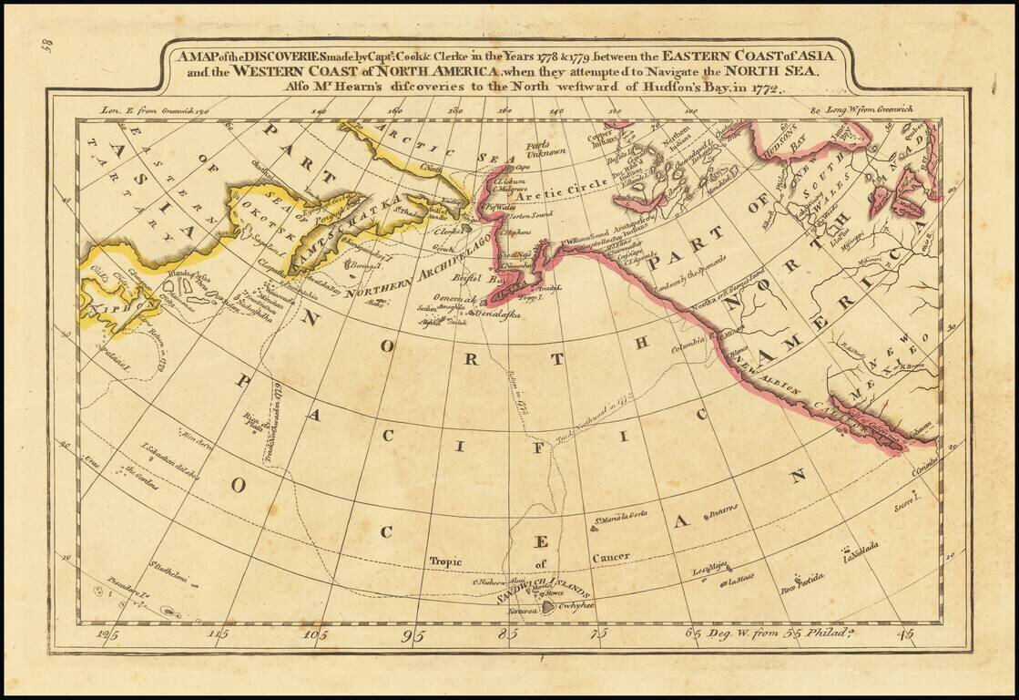
First edition of Carey's map of Cook's Discoveries in the Pacific and Hearne's discoveries west of the Hudson, in search of the Arctic Sea. This is one of the earliest appearances of a Cook map to be published in America. Excellent conjectural NW...
Outline color example of Carey's map of Cook's Discoveries in the Pacific and Hearn's discoveries west of the Hudson, in search of the Arctic Sea. This is one of the earliest appearances of a Cook map to be published in America. Excellent conjectural...
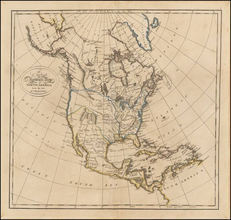
Columbia or River of the West! Fine example of Matthew Carey's map of North America, from his General Atlas. The map includes nice pre-Lewis & Clark information in the Transmississippi West. The "Columbia or River of the West" flows to the R....
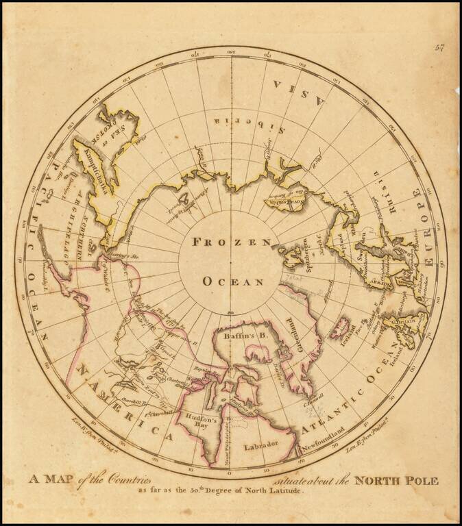
Early American map showing the extent of explorations in the North Pole, with emphasis on the efforts to find a Northwest passage and Hearne's and MacKenzies' routes.
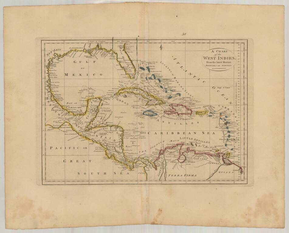
Interesting general map of the Caribbean, published by Matthew Carey in his General Atlas.
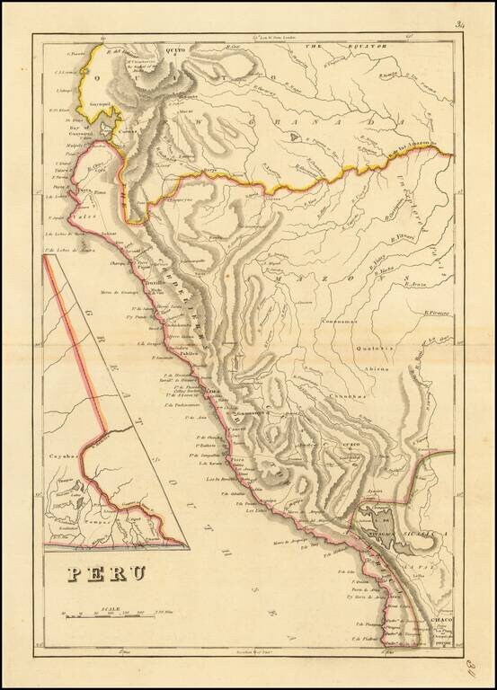
Peru at the Dawn of Its Indpendence Movement Detailed map of Peru, from a scarce late edition of Mathew Carey's General Atlas, the first atlas published in America. In 1808, Napoleon invaded the Iberian Peninsula and took the king, Ferdinand VII,...
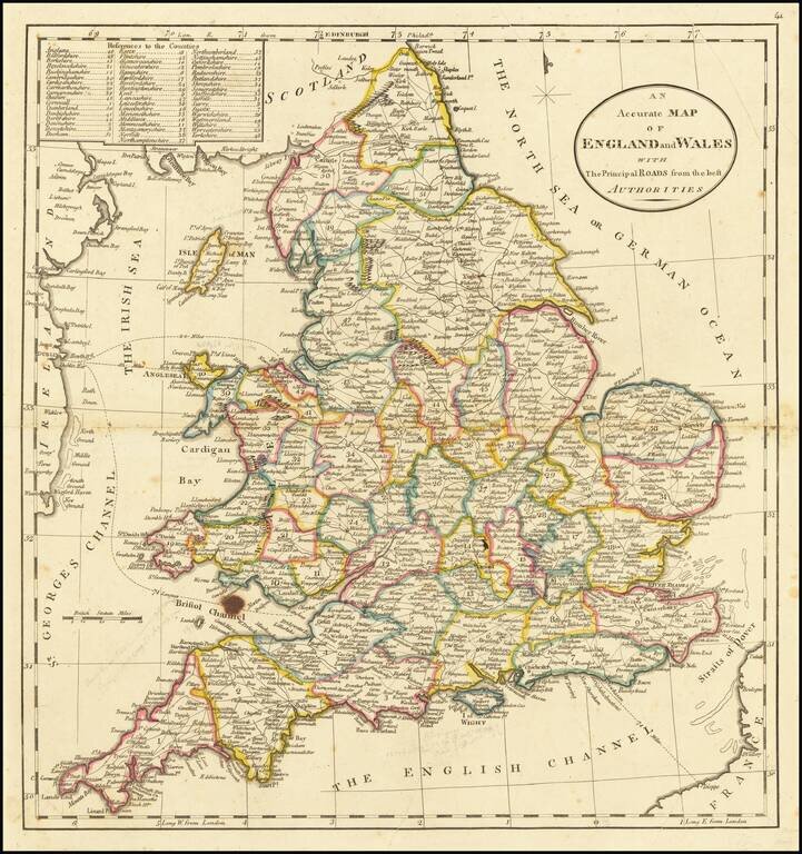
Detailed map of England, showing towns, roads, rivers mountains, lakes, etc. Nice detail. From the 1814 edition of Carey's American Atlas.
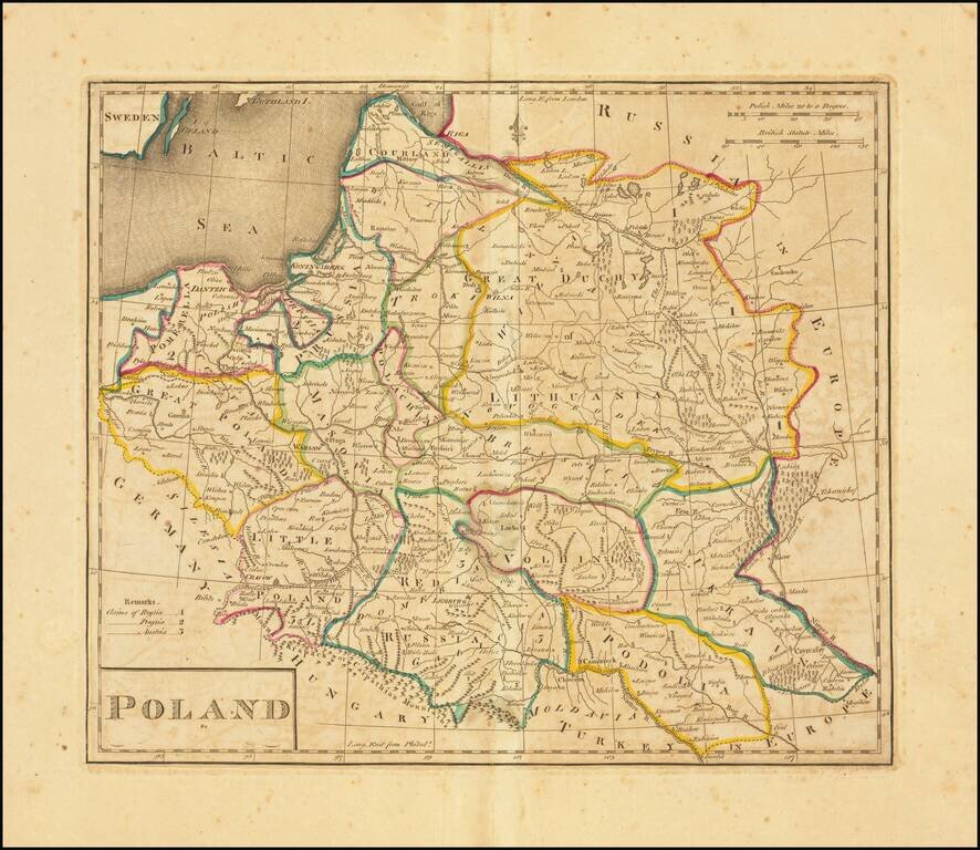
Second edition of the first map of Poland published in the United States. Published by Matthew Carey in 1814. Title revised and shortened from the first edition, although the content is unchanged.
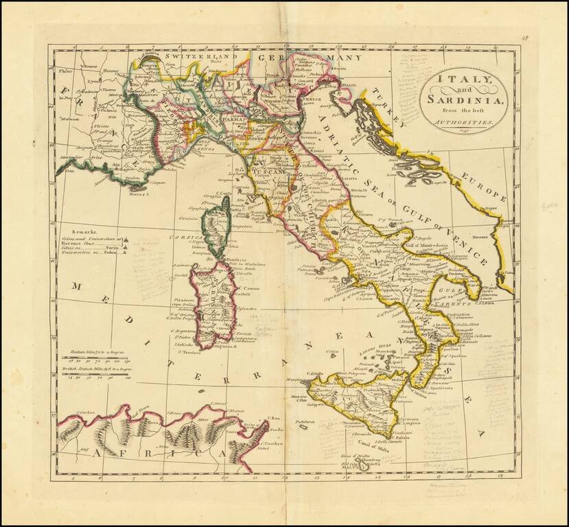
Interesting map of Italy, Sicily, Corsica and Sardinia, from the 1814 edition of Matthew Carey's General Atlas.