logo

1795. The State of Virginia from the best Authorities By Samuel Lewis 1794

  • The State of Virginia from the best Authorities By Samuel Lewis 1794

The State of Virginia from the best Authorities By Samuel Lewis 1794 information:

Year of creation: 
Resolution size (pixels): 
 2157x1510 px
Disk Size: 
 921975B
Number of pages: 
 1
Place: 
 Philadelphia
Author: 

Print information. Print size (Width x height in inches):
Printing at 72 dpi 
  29.96 х 20.97
Printing at 150 dpi 
 14.38 х 10.07
Printing at 300 dpi 
 7.19 х 5.03

An example of detailing the file of this map of in a printable high-resolution:

Click to open in high resolution (open in new tab).
Attention! this is just the central piece (central area 960x960 px) of the map file!
This is an example, so that you can see and study the level of detail of a given map. The entire Map will be fully available after payment!

The State of Virginia from the best Authorities By Samuel Lewis 1794

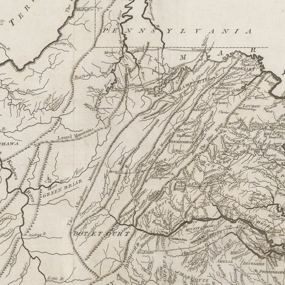
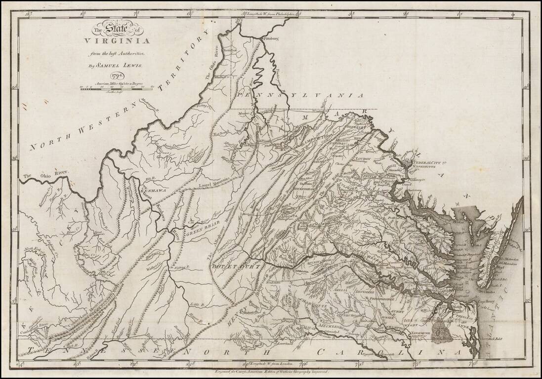
First edition of Carey's map of Virginia, one of the earliest obtainable maps of Virginia published in the U.S.

Wheat & Brun note:

This is a topographical map showing much detail. Many towns and court houses are indicated; county names are given but no boundaries, and a number of roads are shown. The western boundary follows the west fork instead of the east fork of the Gr: Sandy R. [i.e., the Big Sandy River] to the Cumberland Divide. The northwest corner of North Carolina is shown on the Blue Ridge Divide instead of on Stone Mountain.

John Reid would later copy this map for his American Atlas, with minor changes.

Swem 354; Coolie Verner 28; Wheat & Brun 568.

Special conditions for students!

If you are a student, write to us in telegram: @antiquemaps and indicate what material you need and for what work you need a map in high detail. We are ready to provide material on special terms. For students only!

Item information:

Year of creation:
Size:
2157x1510 px
Disk:
921975B
Number of pages:
1
Place:
Philadelphia
Author:
Mathew Carey.
$9.99

Related item