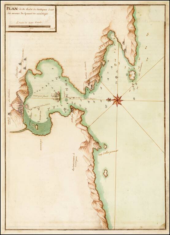
Fine early manuscript map of the Harbor at Cartagena, prepared by an skilled French mapmaker. Although anonymous, the level of detail and beauty force the belief of it having been made by a skillful artist; French sailors made the map, possibly after...
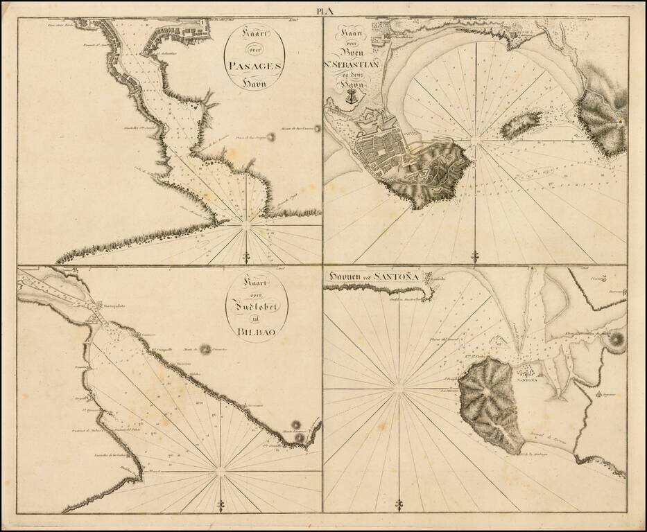
Rare set of four harbor plans (San Sebastian, Bilbao, Santoña and Pasaia) along the Basque Coast, pubilshed in Copenagen. The present set of charts appears in a very rare Danish work, which is titled "Samling af Kaart over Havne og Ankerpladse,...
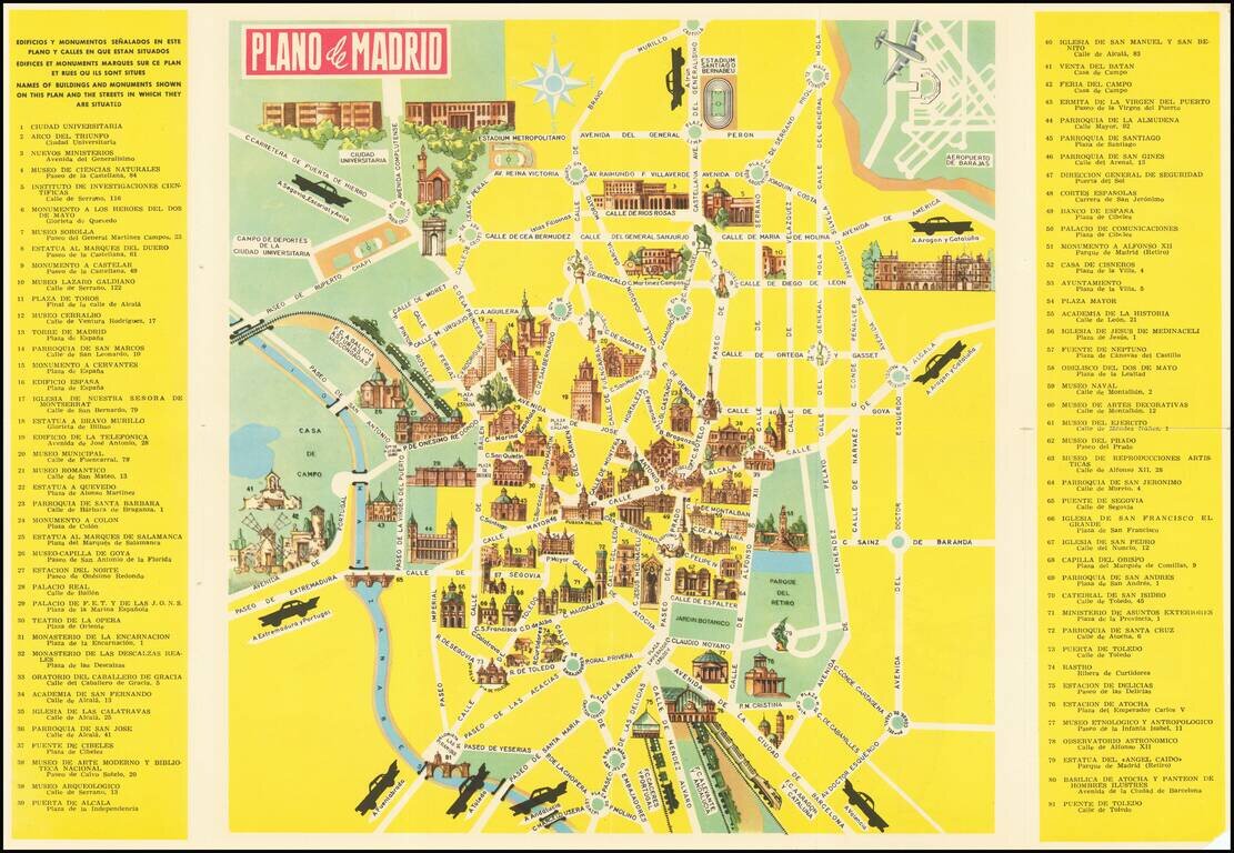
Pictorial Tourist map of Madrid, published for tourists. Features vignettes of Madrid's major monuments and points of interest. Includes advertising for the Hotel Carleton on the verso.
![[Eastern Mediterranean]](/map/small/59510sb.jpg)
The Only Surviving Example Rare Lafreri school map of the Eastern Mediterranean and vicinity. The map is the Southeastern Sheet of an Unrecorded Map of Europe, published in Venice. The present example is the third state of three.
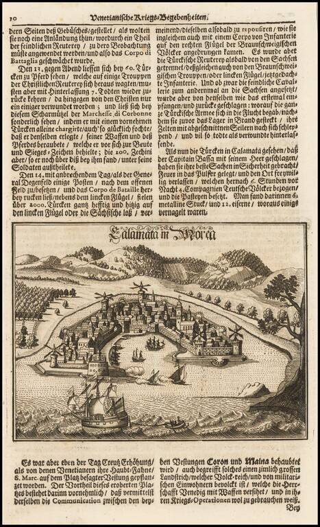
Fine view of the town and harbor of Kalmata, shown during the Venetian Wars.
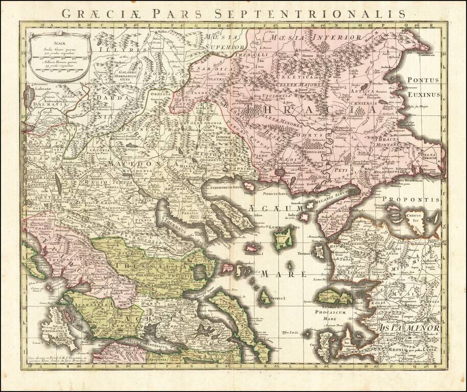
Detailed map of the northern part of Greece, published in Augsburg. Includes Roman Roads, towns and topographical information.
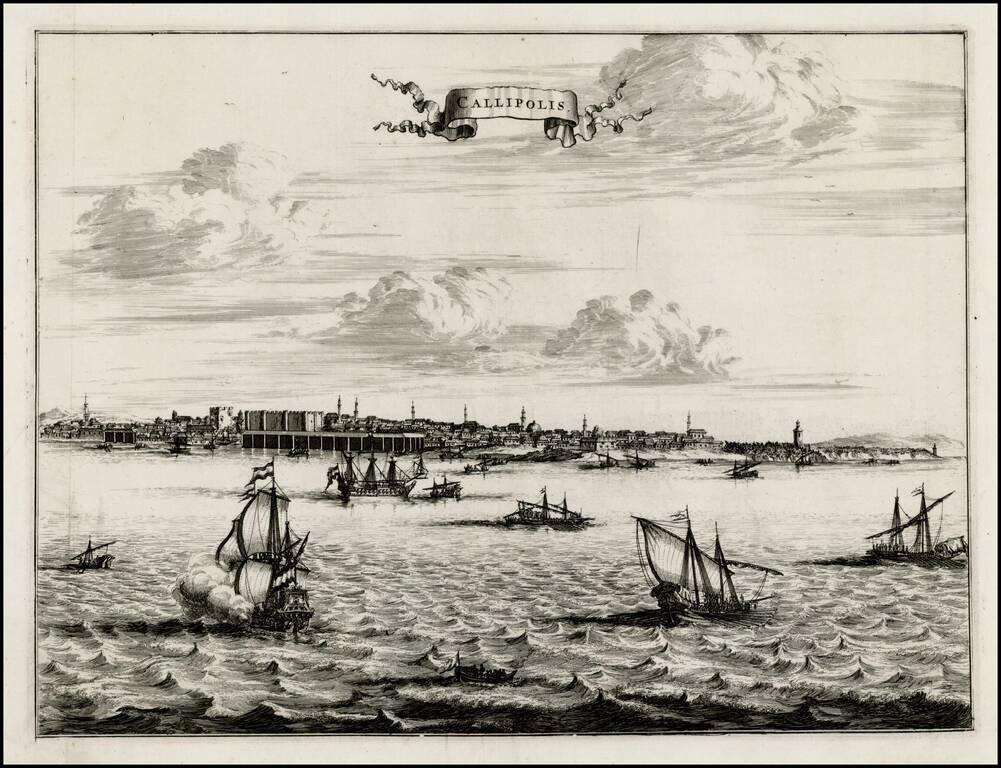
Fine early view of Gallipoli, from an unknown source. A fine view from the harbor, with sailing vessels in the foreground and a profile of buildings and Minarets on the horizon.
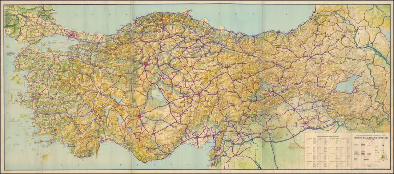
Large Format Road Map of Turkey Celebrating the Anniversary of the General Directorate of Highways Detailed general road map of Turkey focused on major highways, cities, topography, and administrative boundaries. The map’s title is centered over...
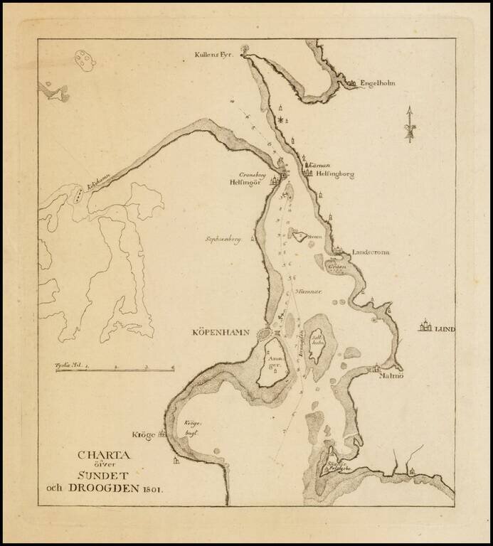
Scarce sea chart the region around Copenhagen, Lund and Malmo.
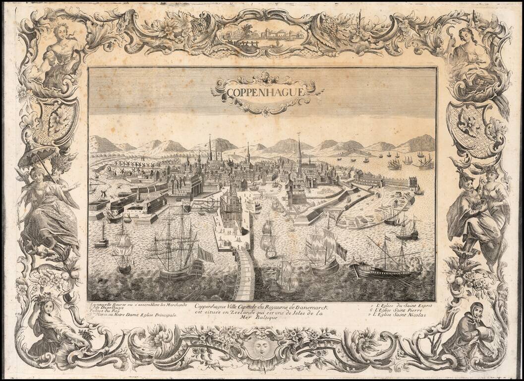
Rare large decorative view of Copenhagen, with an elaborate engraved border. The view shows an elaborate waterfront image, with wharves, windmills, shipbuilding, etc. 7 major sites are identified in the key below the view. The view is rare, with...
![[Odense Fyord Manuscript Map] Beschreibung dess Haffens beij Metsundt Indieser Haffen ist class wasser unterveilen . . .](/map/small/39966se.jpg)
Finely executed manuscript map of the Odense Fjord, prepared at the end of the 18th Century.
![[Jutland and Fyn Island]](/map/small/39278.jpg)
Scarce separately issued map of Jutland and Fyn Island, likely published in Denmark.
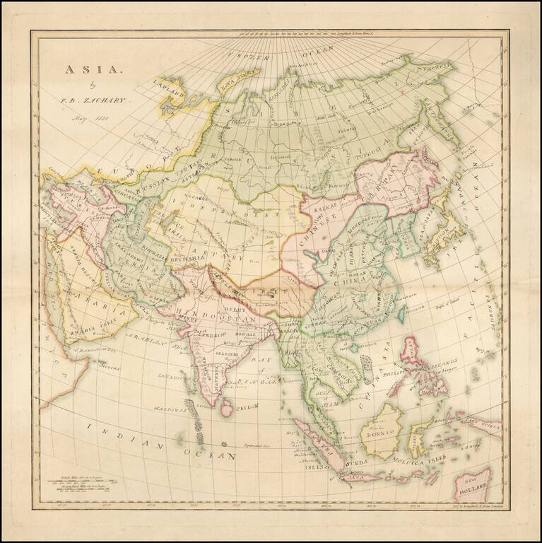
Finely executed manuscript map by F.D. Zachary. We suspect that FD Zachary is Francis Daniel Zachary, who appears to have gone on to practice law in England and whose name appears as a Chess player of some notariety.
Hand Drawn Map of the Wuhua County in the Guangdong Province Finely executed late Qing Dynasty Chinese manuscript map of Wuhua County, northeast of Hong Kong in eastern Guangdong Province, China. The map, which uses the Qing name of the region,...
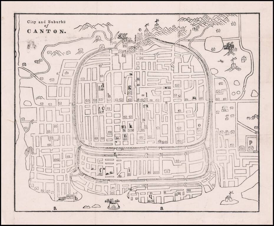
Early Missionary Map of Canton (Guangzhou), Published in Canton in the First Major Journal of Sinology Fine woodblock map of Canton showing the city’s street plan, waterways, and important buildings and sites. The plan was based on a Chinese map and...