![(China) КАРТА КИТАЙСКAГО ГОСУДАРСТВА. [Map of the Chinese State.]](/map/small/56505.jpg)
Rare, separately issued hand-colored lithographed map of China, published in Russian, probably around 1850. The map presents a circumscribed view of Chinese territory, with much of the west and north of modern-day China not included. Much of Inner...
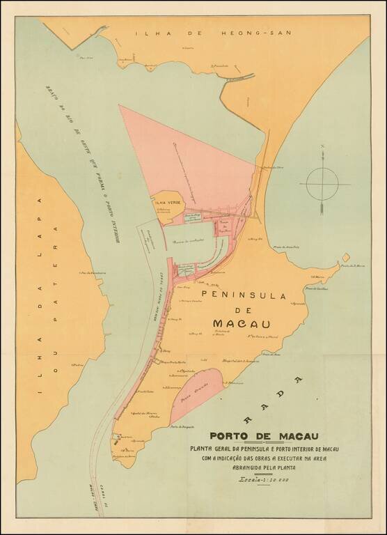
Rare and decorative large plan of the Peninsula of Macau, showing the beginnings of the significant man-made changes to the Portuguese colony. This artistically virtuous map employs attractive pastel colors and a transitional Art Nouveau-Art Deco font...
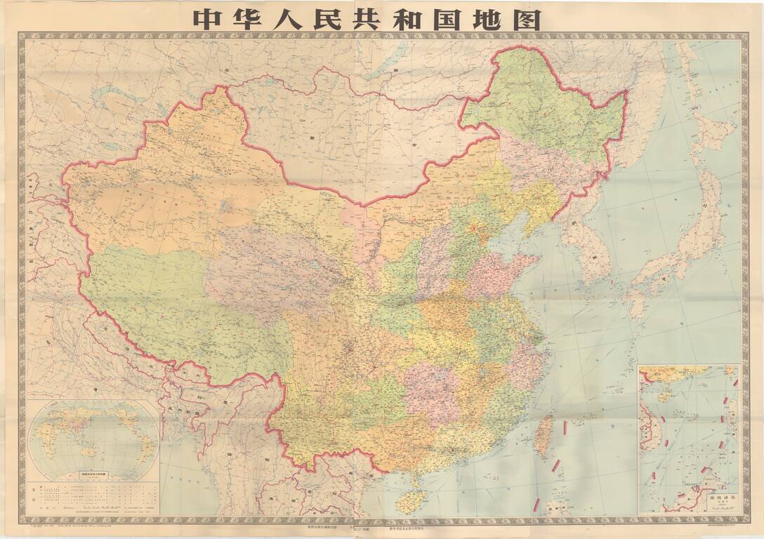
Striking large format map of the People's Republic of China.
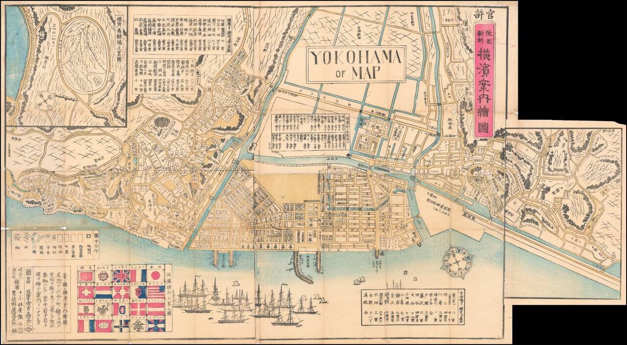
Wonderful Richly Illustrated Map of Yokohama, Featuring Flags of Foreign Nations and a Wonderful Malapropism "Yokohama of Map". Color woodblock map of the trading port of Yokohama, highlighting trade with foreign nations that flourished under the...
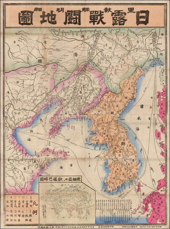
Fine large map of Korea and contiguous parts of China, published in 1904 or Meiji 37. The map was issued during the early days of the Russo-Japanese War (1904-1905), including the Japanese invasion of China and Korea, and the conflict that ensued with...
![[Tiruchirappalli] 1763 Plan de Trichenapaly](/map/small/58955.jpg)
Striking Plan of Tiruchirappalli, Drawn at the End of the Carnatic Wars Finely-executed manuscript plan of the city of Tiruchirappalli, here called Trichenapaly, on the south bank of the Kaveri River. The French plan, executed in 1763, was completed...
![[Northern India] (hand drawn map of Northern India)](/map/small/64513.jpg)
Finely executed manuscript map of the northern part of India, drawn by an anonymous French hand. The map's primary feature is the illustration of the primary topography of the region, including mountain, valleys, rivers, lakes and towns, with some...
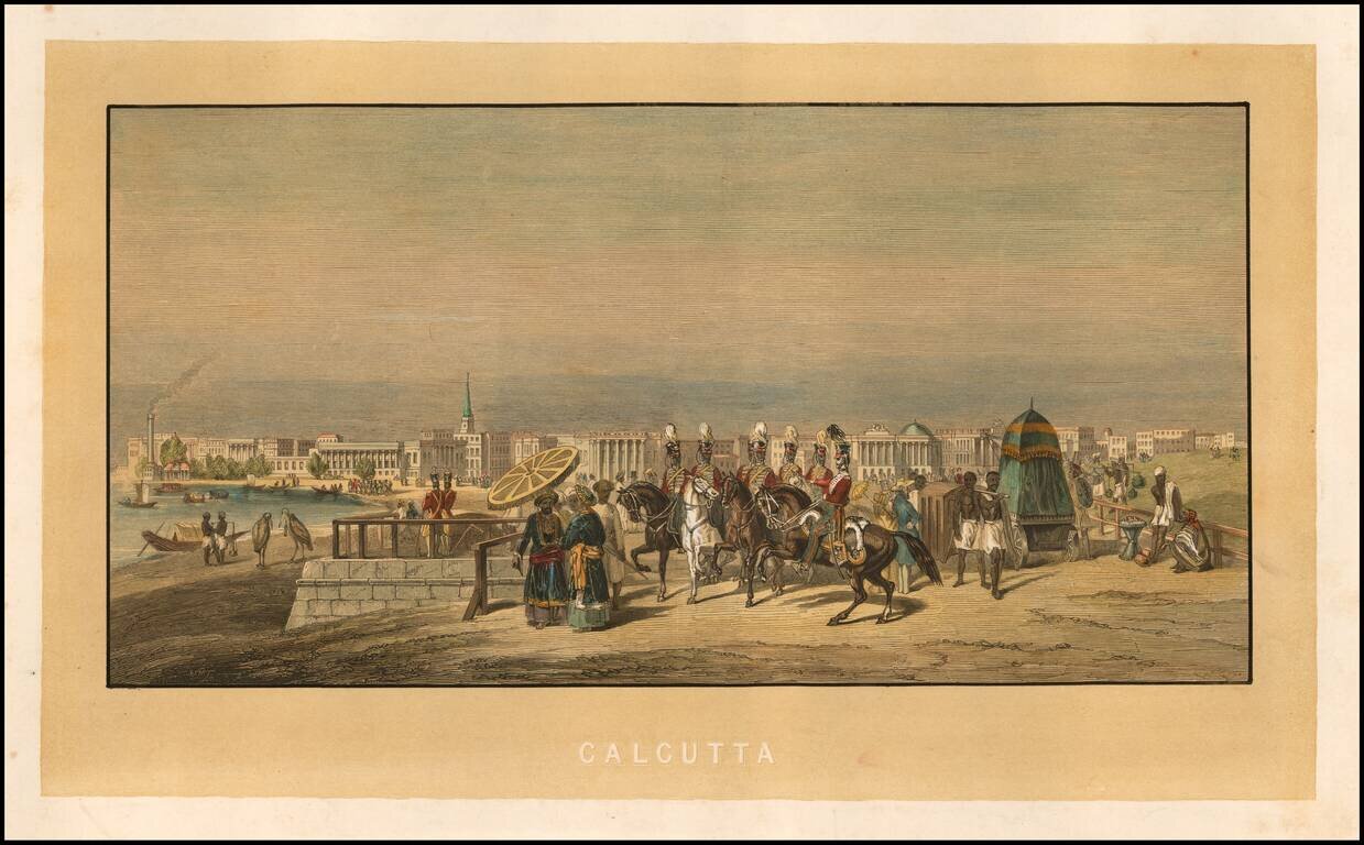
Fine early view of Calcutta, with various soldiers and costumed figures in the foreground and the city on the banks of the Hoogley River beyond. The printing of the image is rather intriguing, as it would appear that the yellow background and...
![[Puducherry-- Hand Drawn Map] Plan de la Ville de Pondichery. Legende des Rues de la ville blanche et de la ville noire de Pondichery avec les numeros d'ordre correspondant a ceux du plan que Mr. le Gouvernor a approuve le Mai 1856](/map/small/58607.jpg)
"Black Town" and "White Town": Geographical Segregation in French-Colonial India Fine hand-drawn plan of Puducherry, "Corresponding to the Plan approved by the Governor May 13, 1856." The map is meticulously drawn, illustrating the streets, canals,...
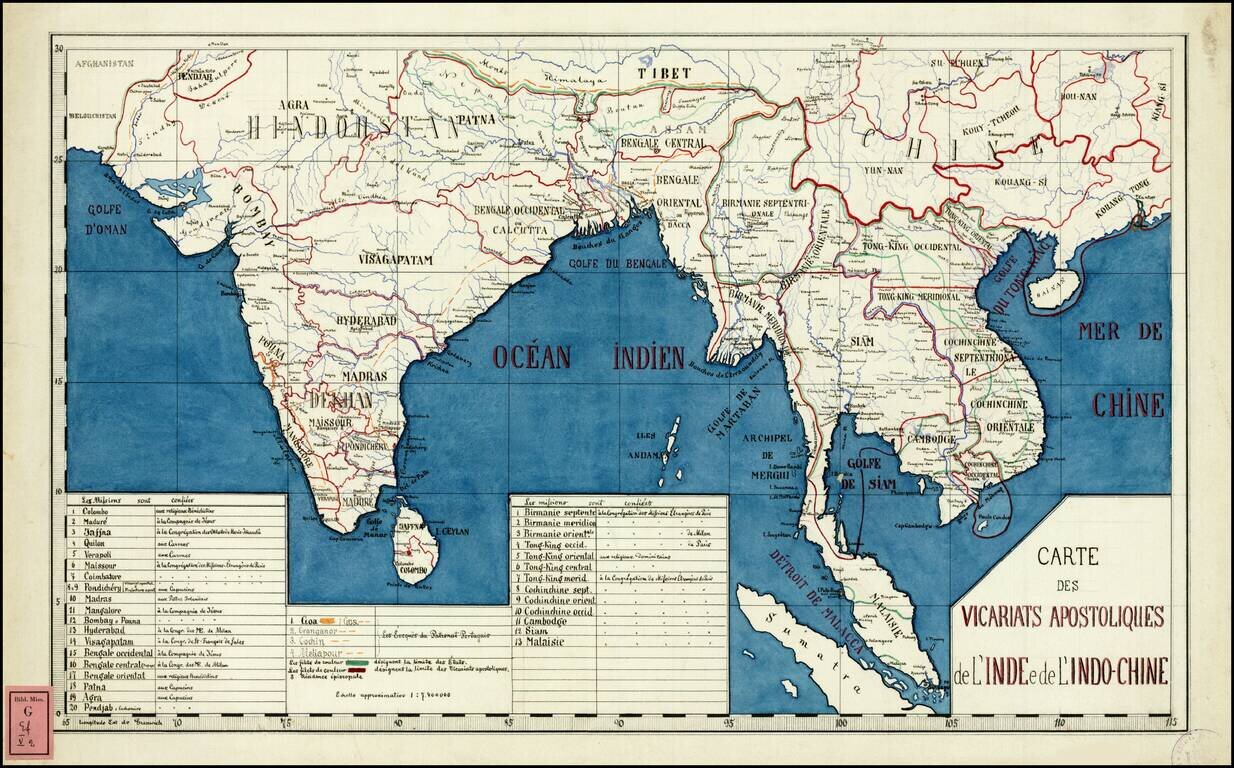
Rare and highly detailed map of Southeast Asia and India, divided into the regions established by the Catholic Missionaries. An extensive key at the bottom of the map identifies the various missions and branches of the Church which were overseeing...
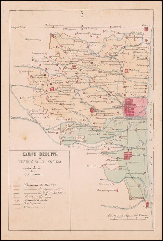
Manuscript Map of the Newly Created Administrative Territory of Karikal and its 3 Communes Fine french manuscript map of the Territory of Karikal, showing the territory as newly divided into divided into communes under the Decree of March 12, 1880....
![[District Bholawade]](/map/small/66013.jpg)
Fine large map of Bholawade District and environs, in the region of Maharashtra, in Western India.
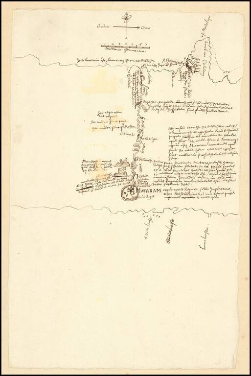
VOC Manuscript Map Record of an Inland Expedition to the Kingdom of Mataram Important early VOC manuscript map of Central Java, focusing on the Kingdom of Mataram at the time of the Dutch embassy led by Captain Tack to Surakarta in 1685. The map...
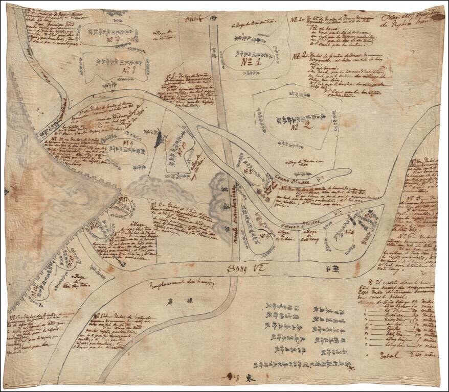
Remarkable and Singular Vietnamese and French Manuscript Map Illustrating the Long Wall of Quảng Ngãi and the Route Mandarine This fascinating Vietnamese manuscript map on linen depicts the huyên or district of Nghĩa Hành, located in the rural...
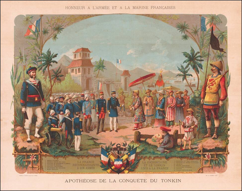
Fine chromolithograph celebrating the French conquest in Indochina. Includes a fine mix of French Military costumes and contemporary Vietnamese costumes.
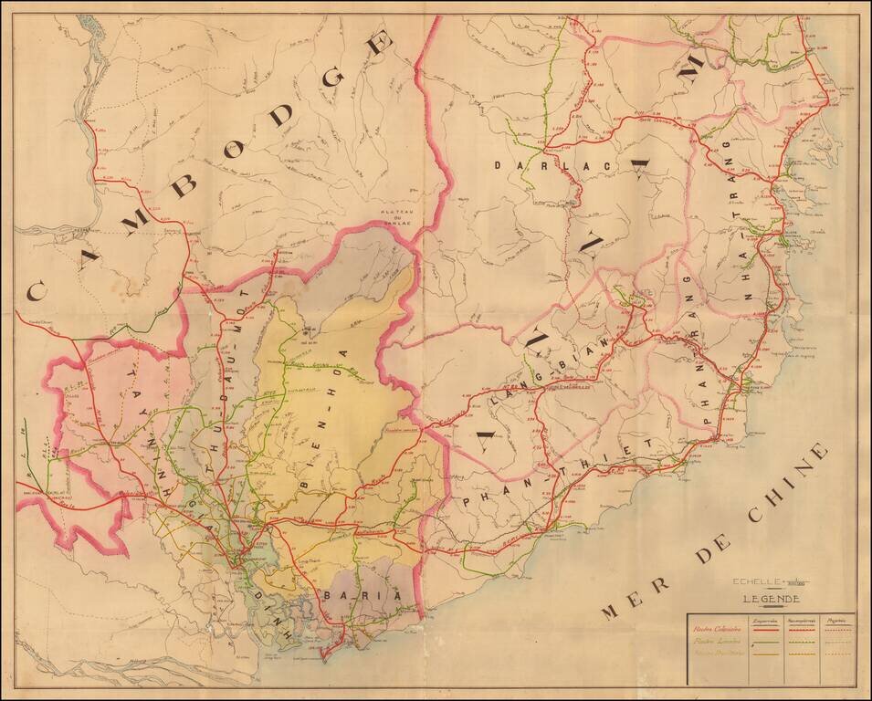
A Detailed French Study of the Roads in Southern Vietnam Finely mauscript map of part of Southern Vietnam, drawn by an unknown French source. The map focuses on the various roads throughout the region, all of which include distances in Kilometers at...