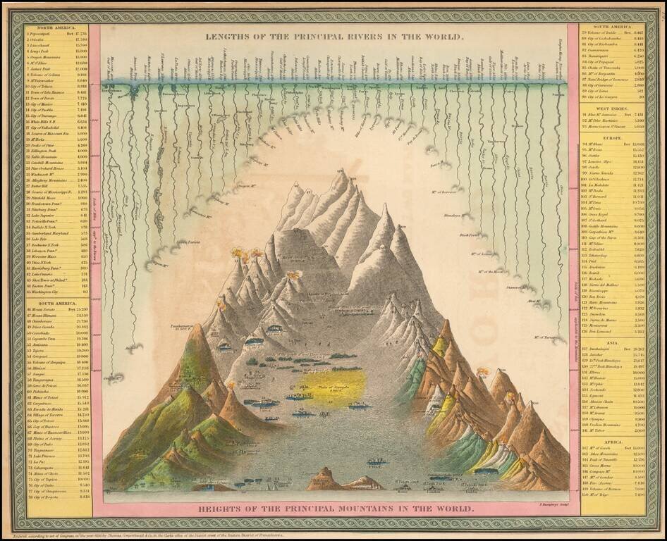
Interesting chart of the principal mountains and rivers of the World, with a key on either side identifying the mountains and rivers shown, including a number of active volcanoes.
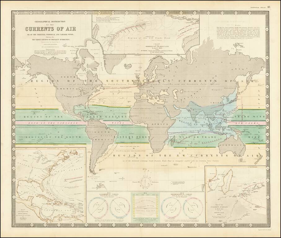
Fascinating map of the world, focused on hurricanes, air currents and other details. At the lower left is a model illustrating Hurricanes in the West Indian regions. At the top center is a model of the Rodriguez Hurricane of April 1843, the lower...
![Colton's Map of the United States of America, The British Provinces, Mexico, The West Indies and Central America . . . 1856 [Folding Map with original slip case]](/map/small/37488hf.jpg)
Fine example of this rare 1856 edition of Colton's map of the United States. This edition includes 2 short-lived western territorial anomalies, the "Uninhabited" lands between New Mexico and Chihuahua and the unincorporated block of land between...
Scarce map of the United States, from Morse's General Atlas of the World. The map captures the Transmississippi West, shortly after the Gadsden Purchase, with many of the large territorial configurations still in evidence, including a very early...
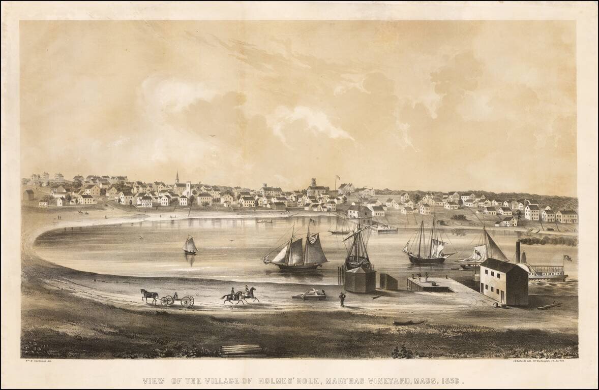
Fine early birdseye view of Vineyard Haven on Martha's Vineyard. Vineyard Haven, known until 1871 as Holmes' Hole, was a fishing and shipbuilding village, and a primary harbor for boats traveling the coast between New York and Boston. Bufford's view...
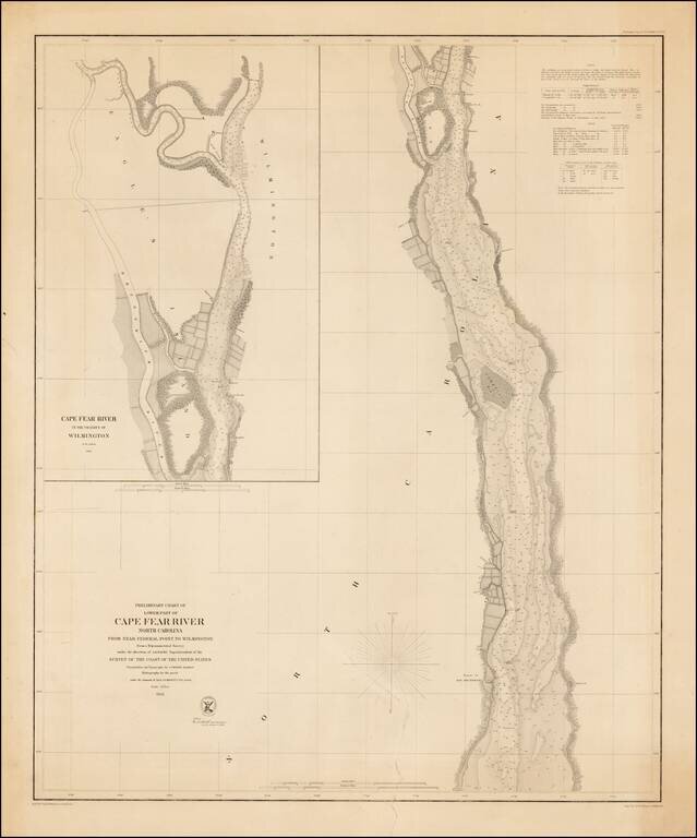
Rare separately issued example of the first edition of this detailed chart of the Lower Part of the Cape Fear River, from the Wilmington area to just south of the Ruins of Old Brunswick, first issued in 1856. Includes a large inset of the area around...
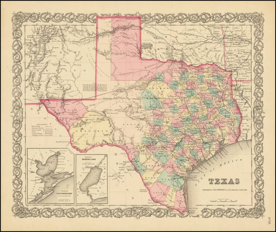
Early State of Colton's Atlas Map of Texas Fine early map of Texas, from Colton's General Atlas, the only edition to appear in a single page format. The map shows a very incomplete set of Western Texas Counties. The German Settlements in Gillespie...
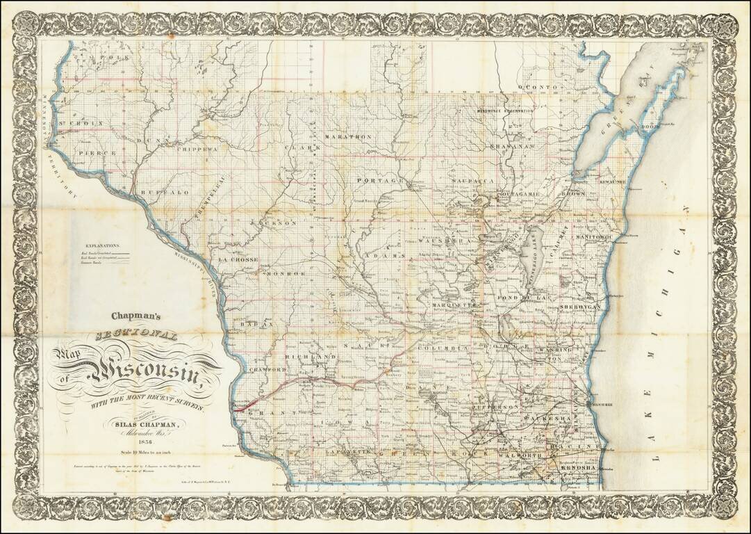
Identifying the Major Sites from the Blackhawk War: The Battle of Wisconsin Heights, The Battle of Bad Axe, and Fort Atkinson. Early Silas Chapman sectional map of Wisconsin, focusing on the lower half of the state and illustrating the extent of major...
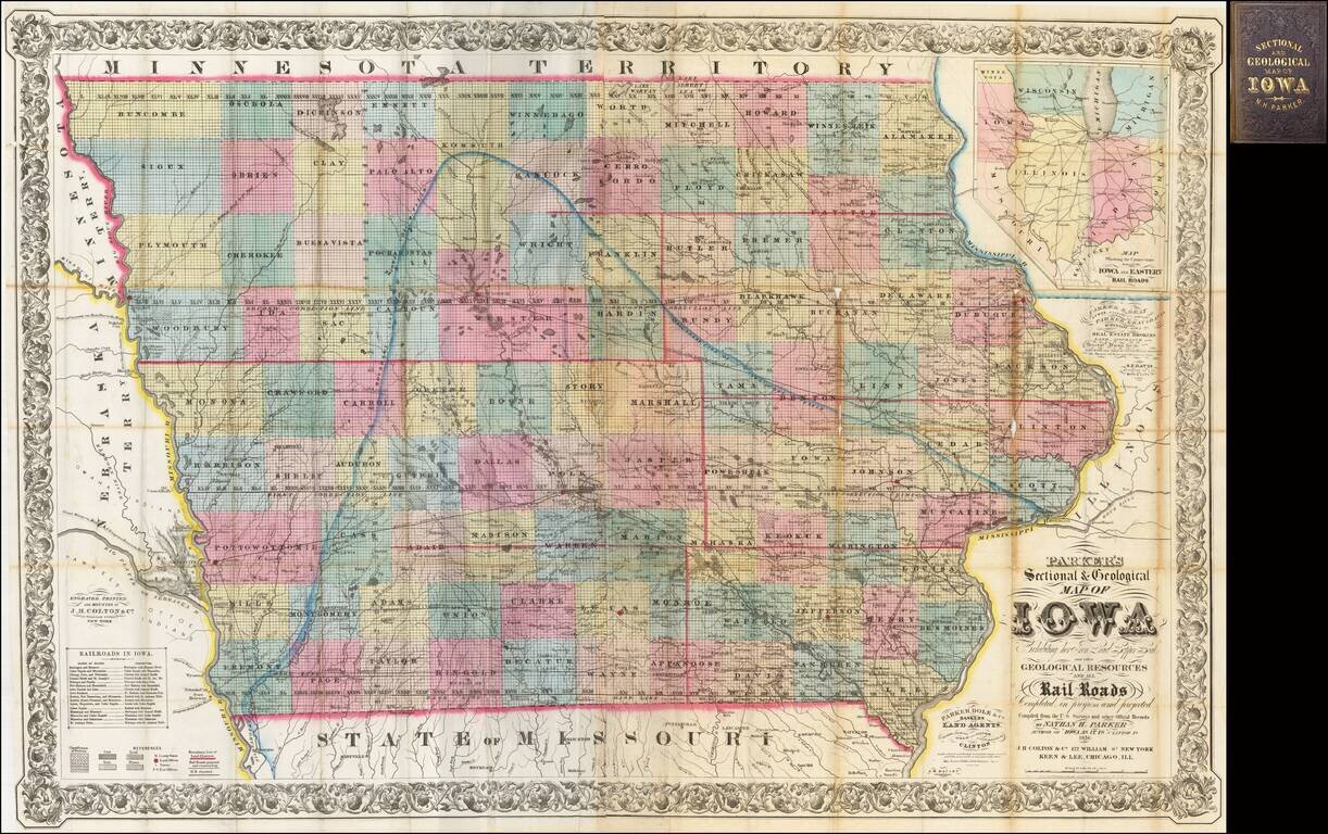
The First Commercially Published Geological Map of Iowa A fine large format map of Iowa, published by Nathan H. Parker in Clinton, Iowa and printed by J. H. Colton in New York and Keen & Lee in Chicago. This is one of the earliest appearances of...
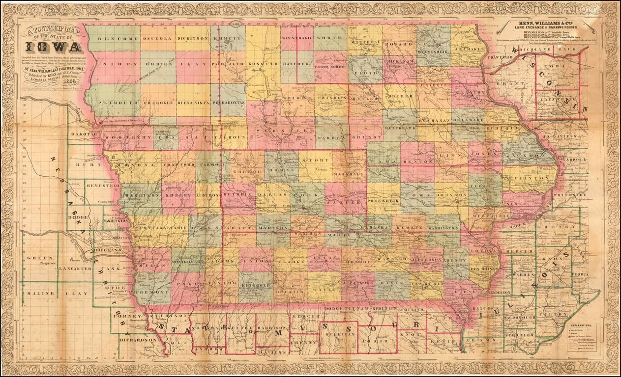
Nice example of the third edition of Henn, Williams & Co.'s large format map of Iowa. The map is hand colored by counties and shows township surveys, towns, railroasd,s roads, rivers, post offices and other details. The map has been entirely...
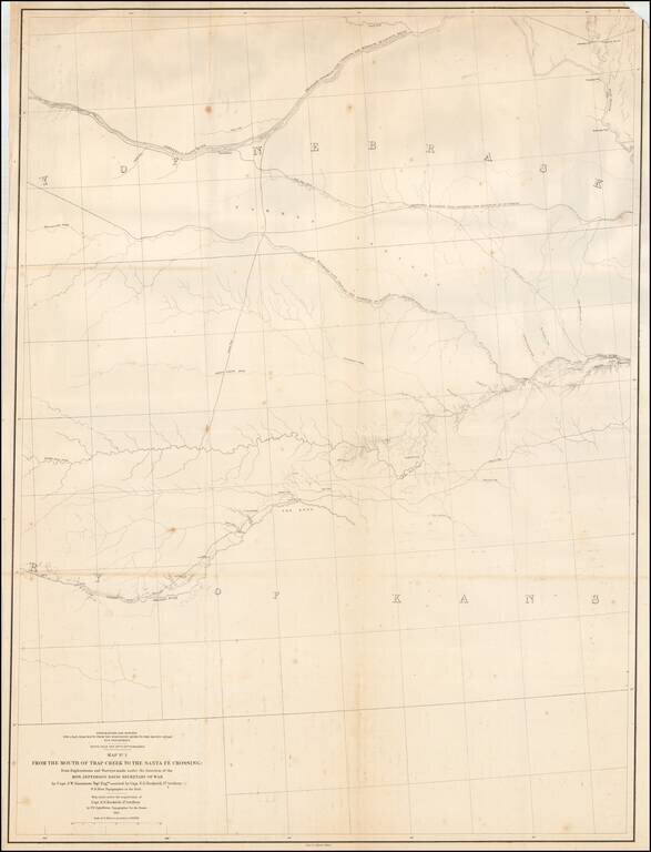
Detailed map of large portions of Kansas and Nebraska, prepared in connection with the Surveys to determine the most practicable routes for Transcontinental Railroads in the the 1850s. The map provides a detailed treatment of the region between the...
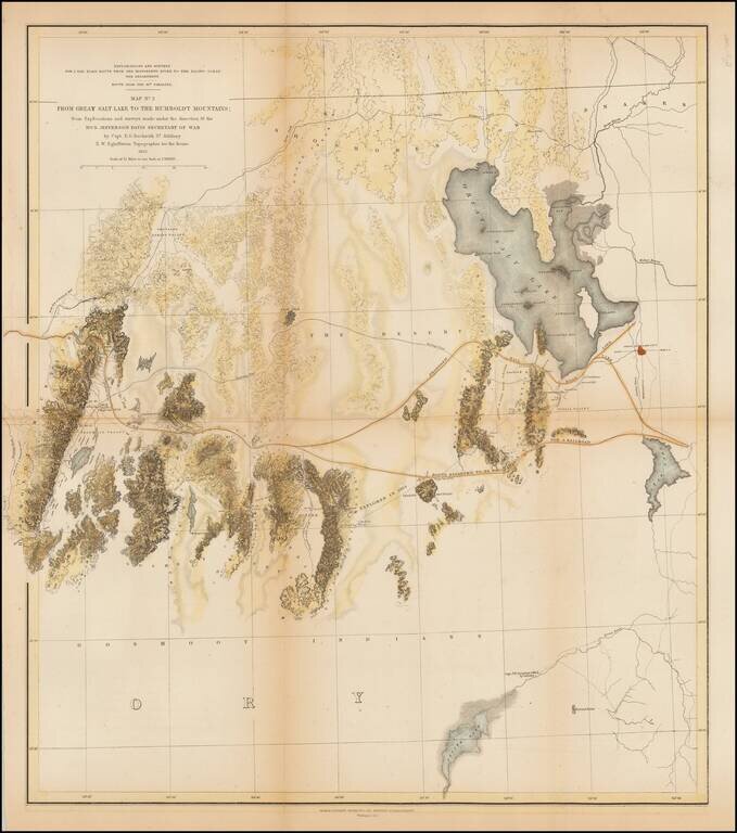
A detailed map showing the Great Salt Lake, Utah Lake and Sevier Lake, with the Humboldt Mountains at left edge. Includes the region from the Great Salt Lake and across the flats to the Humboldt range. Several proposed railroad routes noted, including...
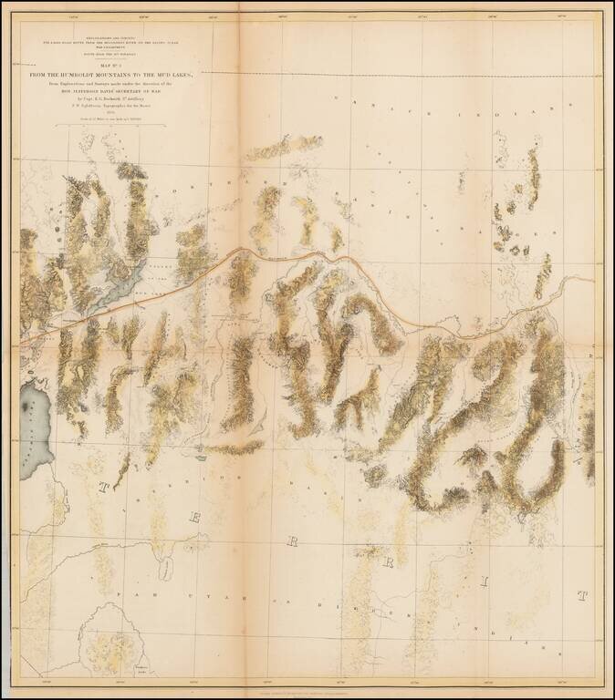
A detailed map of Northwestern Nevada, showing Pyramid Lake, the Carson River, Walker River and northern part of Walker Lake and extended East to the Elko area and the south fork of the Humboldt River. Wheat considers this an excellent map "due in...
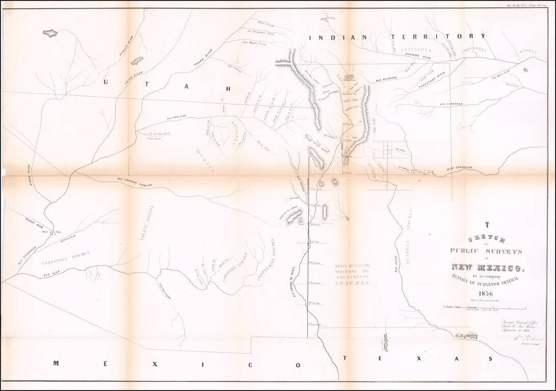
Interesting early map of New Mexico and Arizona, published by the General Land Office. The map extends from the confluence of the Colorado and Gila Rivers to Nicollet River in the northwest, the Rio Pecos in the southwest and Bent's Fort, the...
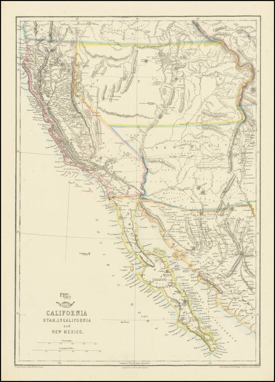
Nice example of the Ettling / Weekly Dispatch map of California and the Southwest, one of first atlas maps published in Europe to focus on the Territories of Utah and New Mexico. The map includes an excellent post Gadsden Purchase treatment of...
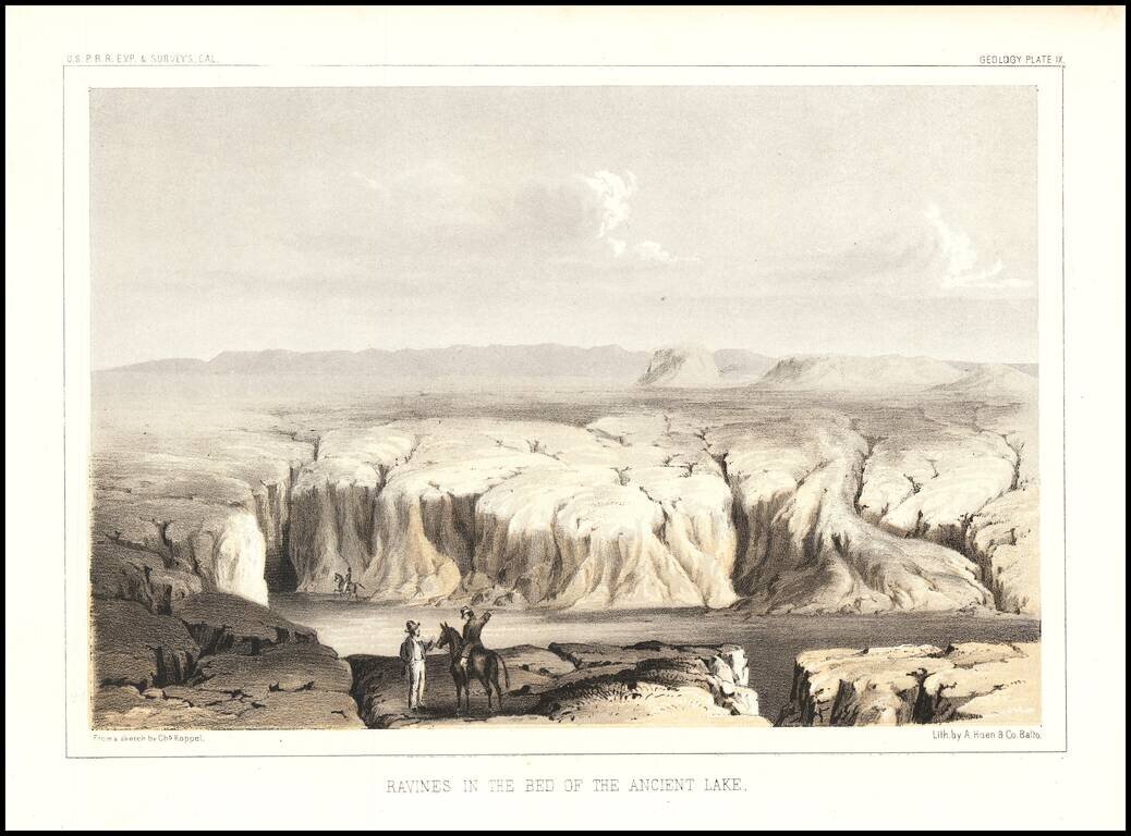
Interesting view showing a dry lake bed on the Arizona/California Border. The view was engraved by Charles Koppel for the Reports of Explorations and Surveys To Ascertain The Most Practicable and Economical Route For A Railroad From The Mississippi...