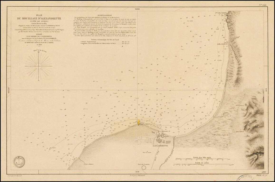
Fine chart of the coastal region of Syria, centered on Alexandrette (now called İskenderun or Scanderoon), published by the French Hydrographical Department in 1856. The chart shows soundings, the Iskendrun lighthouse, and topographical features,...
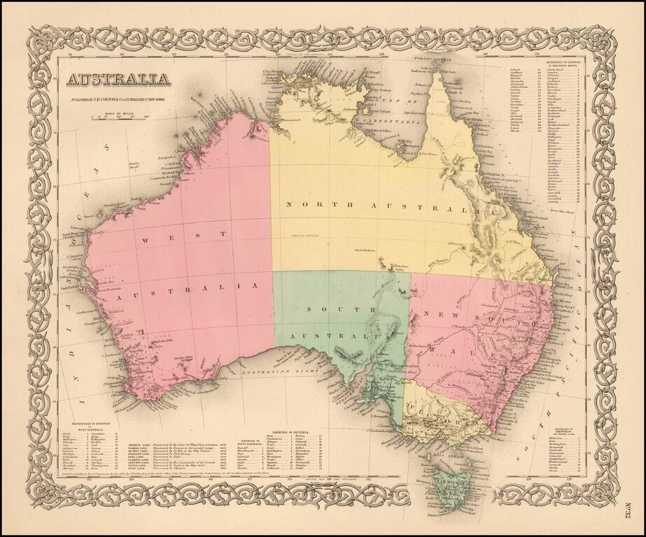
Highly detailed map of Australia, colored by provinces. Includes a key showing the various counties in each of the provinces. Shows towns, rivers, lakes, mountains, islands, etc. The interior is still highly primitive and unknown. Decorative border. A...
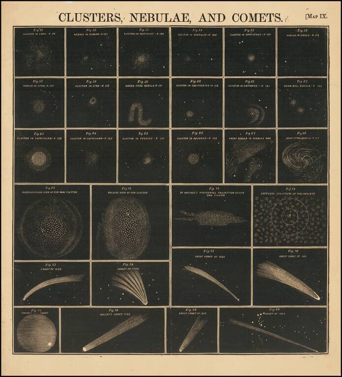
An Intriguing Bird's Eye View of Our Galaxy This is a fabulous chart of various faint objects visible in the night sky, showing both deep-space clouds of gas as well as near-earth comets. The individual images are well designed, showing the objects in...