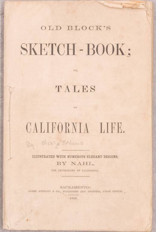
"Both author and illustrator are characteristically Californian, and few volumes have a truer flavor of the Mother Lode than this result of their combined efforts ... The illustrator collaborated with 'Old Block' in other volumes but this particular...
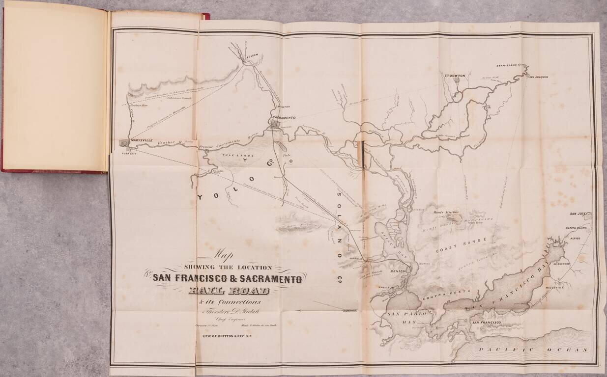
The Thomas W. Streeter - Warren Heckrotte Copy -- Rare Early California Railroad Map and Pamphlet By One of America's Most Important Railroad Engineers Rare early report on a California railroad, produced by Theodore Judah, the engineer who was the...
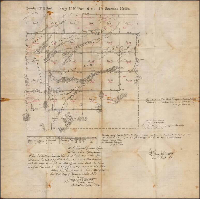
San Bernardino High Desert - Hesperia area manuscript map Manuscript copy of an original survey, signed by California Surveyor General John W. Hays. The present example was drawn by James T. Stratton, U.S. Surveyor General in California. The area...
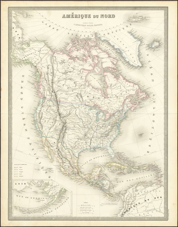
Excellent detailed map of North America, published in Paris by Andriveau-Goujon. Alaska is still Russian America, with Western Canada filled with early Forts and trading posts of the Northwest Company and Hudsons Bay Company. The border between...
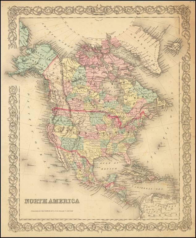
Detailed map of North America, published by JH Colton in New York. The map shows early western territorial configurations, including a massive Nebraska, Kansas running to the Rockies, and only California, Oregon, Washington, Utah and New Mexico west...
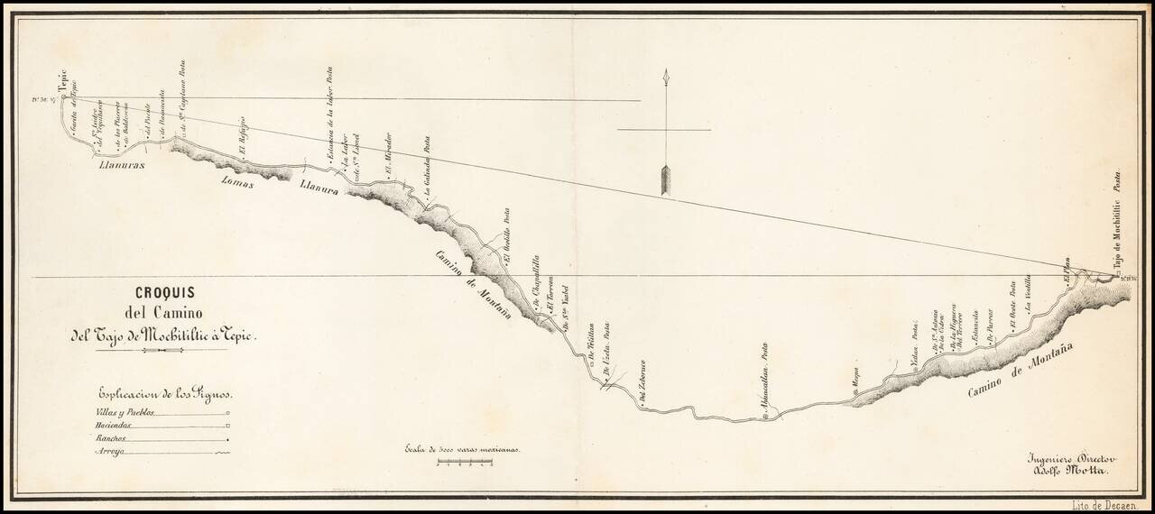
Detailed map of the road from Tepic, southeast toward Guadalajara, published in Mexico City and signed by Ingeniero Director Adolfo Motta. The map is based upon a manuscript map by J.A. Motta, drawn in 1856, as described by Manuel Orozco y Berra, in...
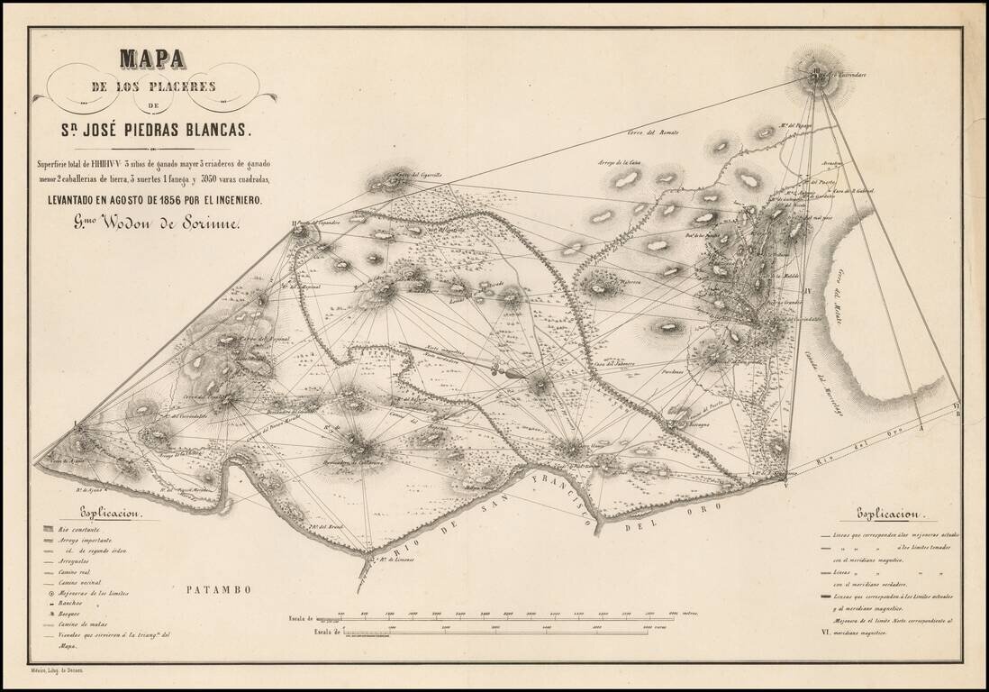
Detailed map of the area around San Jose Piedras Blancas (Michoacan) by the Belgian Engineer Guilermo Wodon de Sorinne, an important observer of regional Mexican culture. The map shows Wodon de Sorinne's triangulation methodology in surveying the...
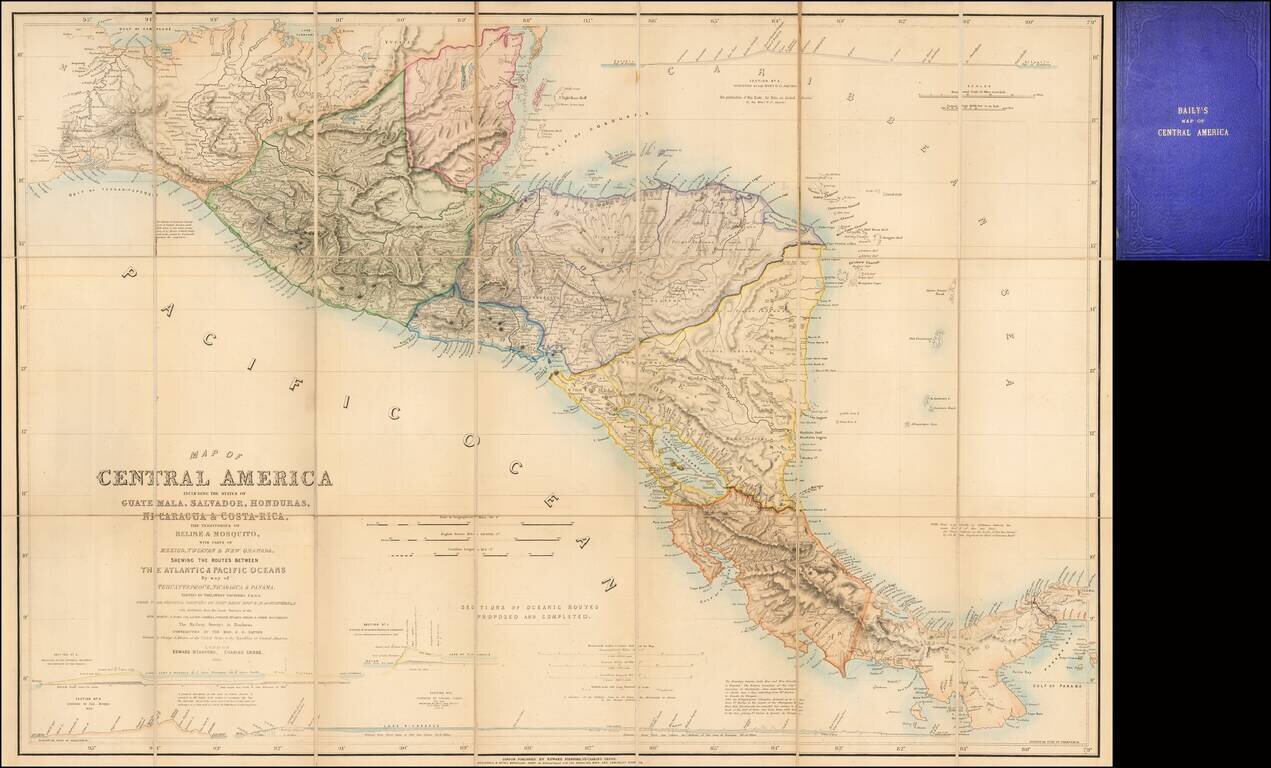
Fine example of the second edition of this finely detailed map of Central America, prepared by John Baily, who served as a surveyor of Nicaragua and was an early proponent of a canal across Central America, published in London by Trelawney Saunders....
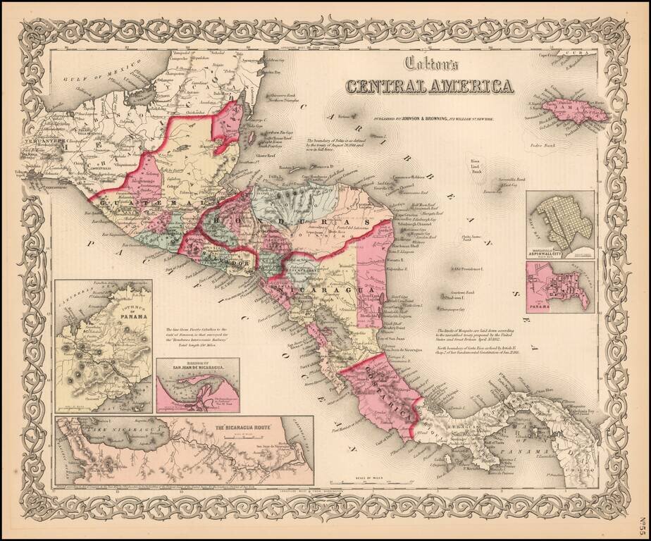
Detailed map of Central America, colored by country and province. Insets of the Republic of Nicaragua, Harbor of San Juan Nicaragua, Manzanilla Island, Aspinwall City and the City of Panama. Interesting text annotations.
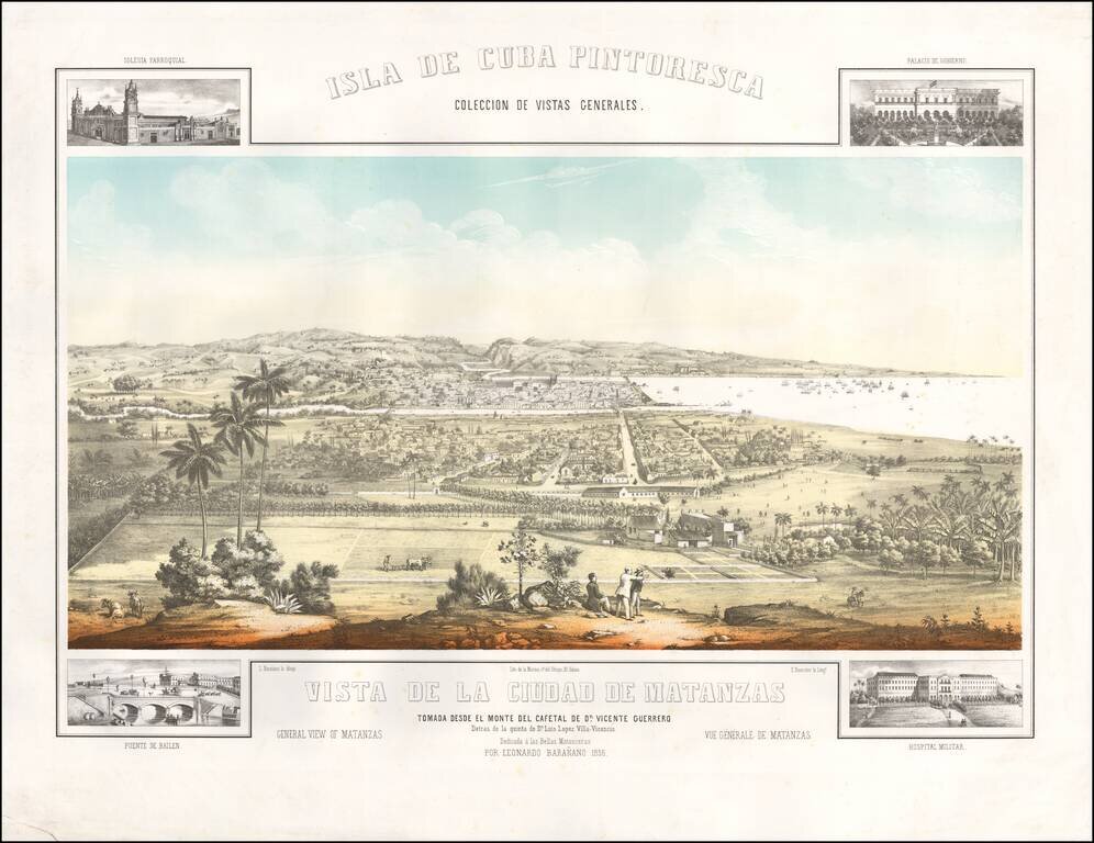
Rare view of the City of Matanzas taken from the Monte de Cafetal de Dn. Vincente Guerrero. Spectacular panorama of the city of Matanzas, northwest of Cuba, designed by Leonardo Barañano, lithographed in color by Eugenio Bourrelier. The view is...
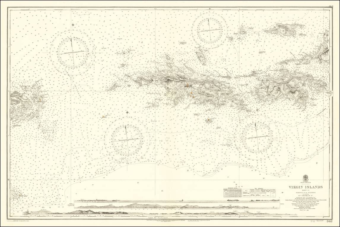
Finely detailed map, extending from Culebra and Vieques Island in the west to St. John, Tortola and Jost Van Dyke Island in the east, centered on St. Thomas. Includes profile views across the bottom. A fine detailed sea chart of this portion of the...
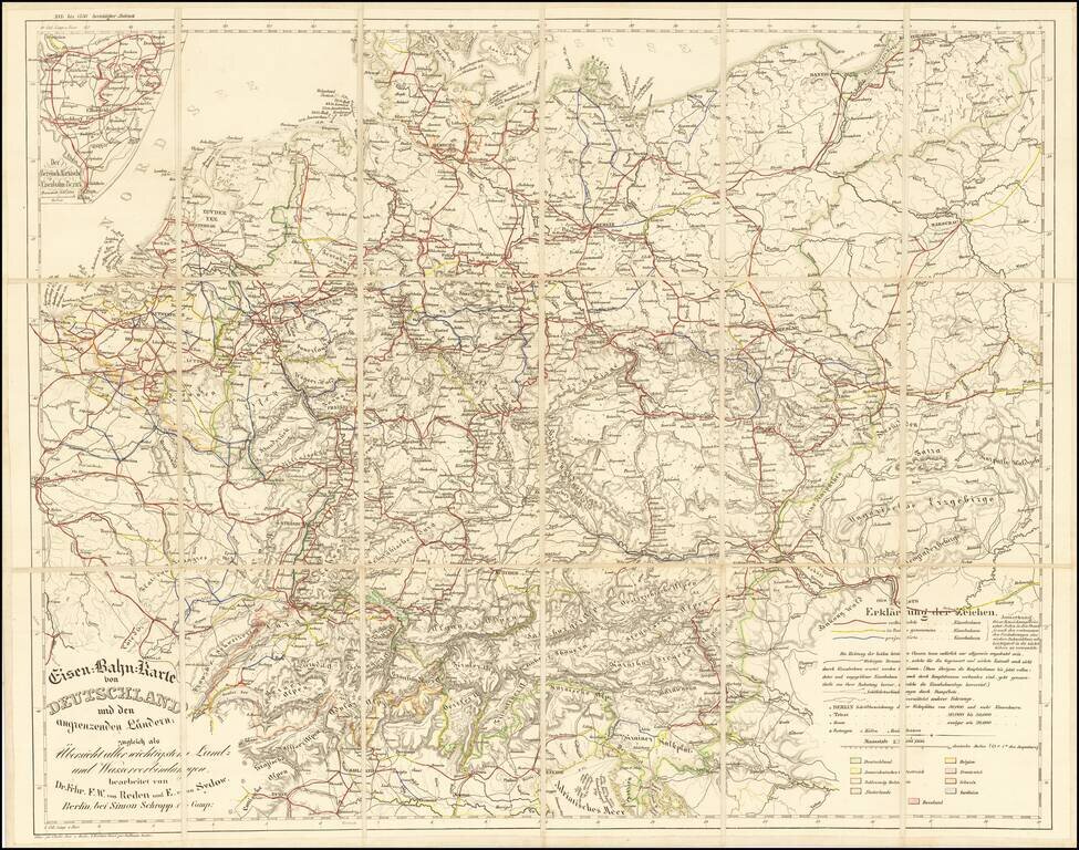
Rare railroad map of Western Europe, centered on Germany, noting the major railroads, roads and other means of commercial transit radiating out from Germany at the center of the map. The map illustrates railroad lines completed (red), under...
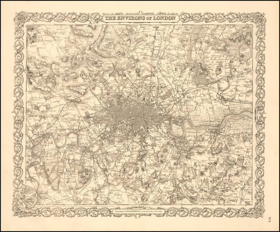
Very detailed map of London showing all streets, sections, roadways, rivers, significant public and private buildings, etc. The first plan of the London area to appear in an American Atlas.
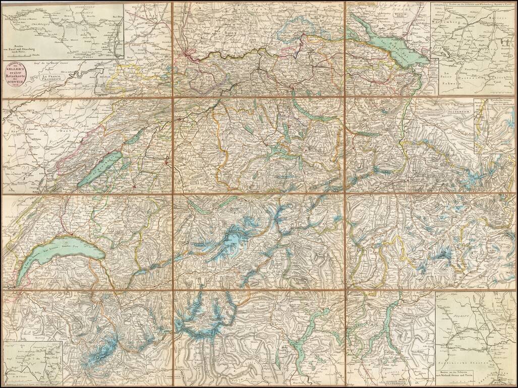
Detailed map of of Switzerland, published by Heinrich Keller in Zurich. The map focuses on topographical features, roads and the locations of towns, rivers, mountains etc. Includes 4 inset route maps and a small map of an area in Tyroolia....
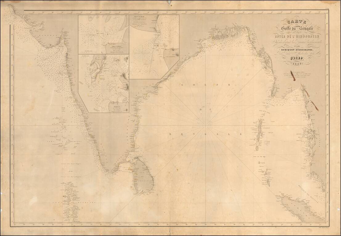
Scarce French sea chart of India and the west coast of Malaysia, etc., published in Paris by Robiquet. Includes large inset maps of: Bombay Amerst Akiab (Sittwe, Myanmar) Includes pencil annotations showing a voyage of the coast of Coromandel...
![[Puducherry-- Hand Drawn Map] Plan de la Ville de Pondichery. Legende des Rues de la ville blanche et de la ville noire de Pondichery avec les numeros d'ordre correspondant a ceux du plan que Mr. le Gouvernor a approuve le Mai 1856](/map/small/58607.jpg)
"Black Town" and "White Town": Geographical Segregation in French-Colonial India Fine hand-drawn plan of Puducherry, "Corresponding to the Plan approved by the Governor May 13, 1856." The map is meticulously drawn, illustrating the streets, canals,...