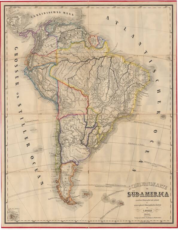
Very rare (unrecorded) wall map of South America, published by Leinhert Holle in Wolfenbuttel. The Geographisch-lithographisches Institut was an active publisher of maps in the mid-19th Century and thereafter. During a brief burst of activity in the...
![Valetta, the Capital of the Island of Malta [with] Balearic Islands [and] Corsica and Sardinia](/map/small/54874.jpg)
Detailed plan of Valetta, with a map of the Balearic Islands and a map of Sardinia and Corsica.
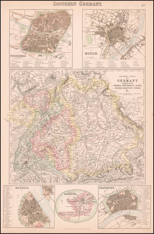
Detailed map of central and northern Germany, with 5 detailed inset plans. The plans include Nuremberg, Munich, Mayence, Frankfort and State of Frankfort.
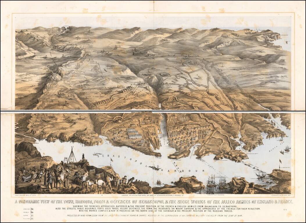
A large panoramic plan of the town, harbour, forts and defenses of Sevastopol in Ukraine. Chromolithographed and designed by Thomas Packer, and published by Stannard and Dixon, 7, Poland Street in London. Full Title: A panoramic view of the town,...
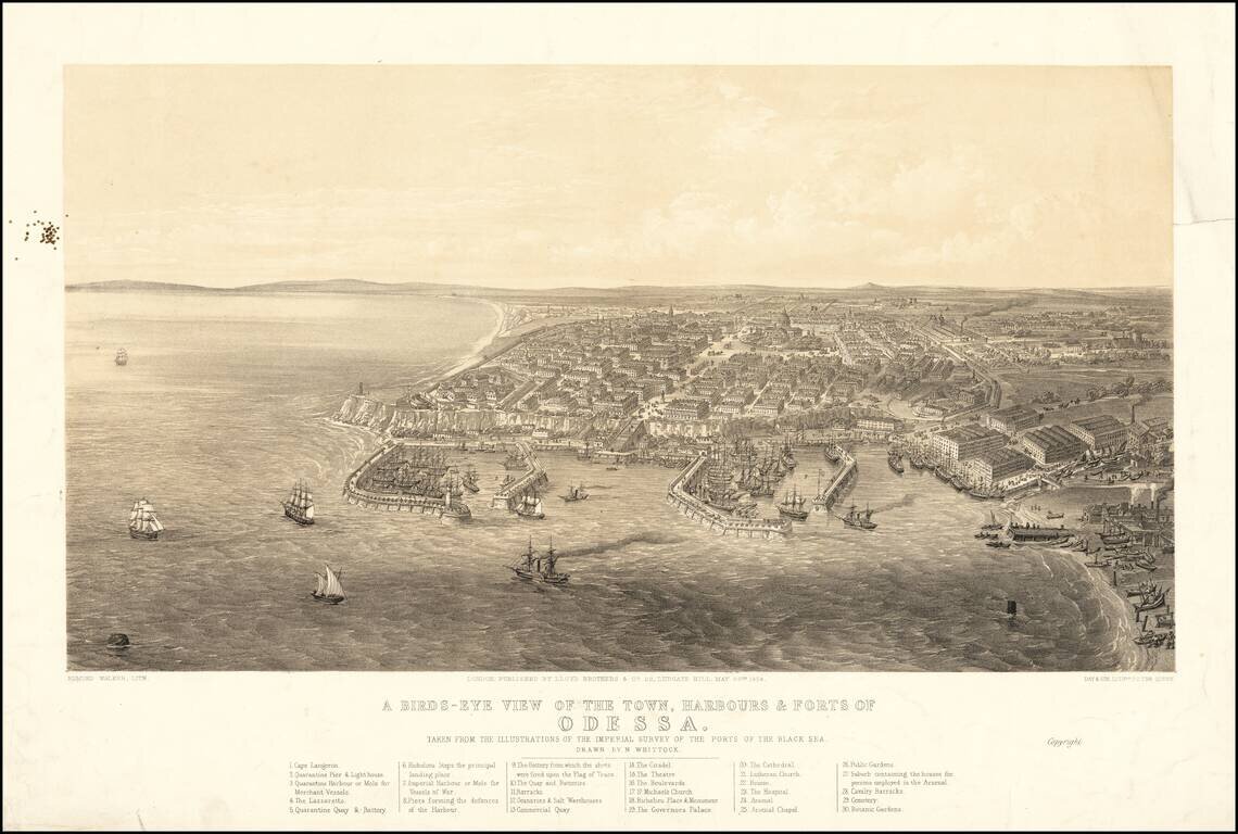
Fine early view of Odessa, published by Lloyd Brothers & Co. in New York and Lithographed by Edmund Walker for Day & Son, Lithographers to the Queen. The view include a key locating 30 points of interest, and is based upon a drawing by...
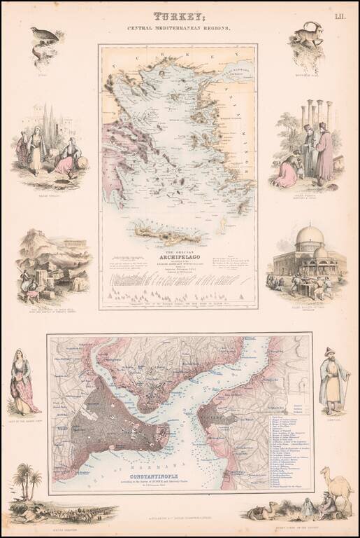
Highly detailed map of Turkey, Greece, the Greek Islands and the Aegean, with a second large map of Istanbul. Two maps on one sheet, the first showing The Grecian Archipelago, the second showing Constantinople. Decorative vignettes showing local...
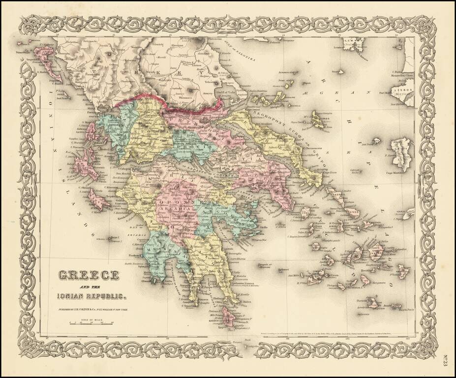
Detailed map of the Greek Islands, showing towns, mountains, rivers, roads, lakes, gulfs, bays, etc. Decorative border. A terrific regional map, from JH Colton, one of the most prolific American mapmakers of the mid-19th Century.
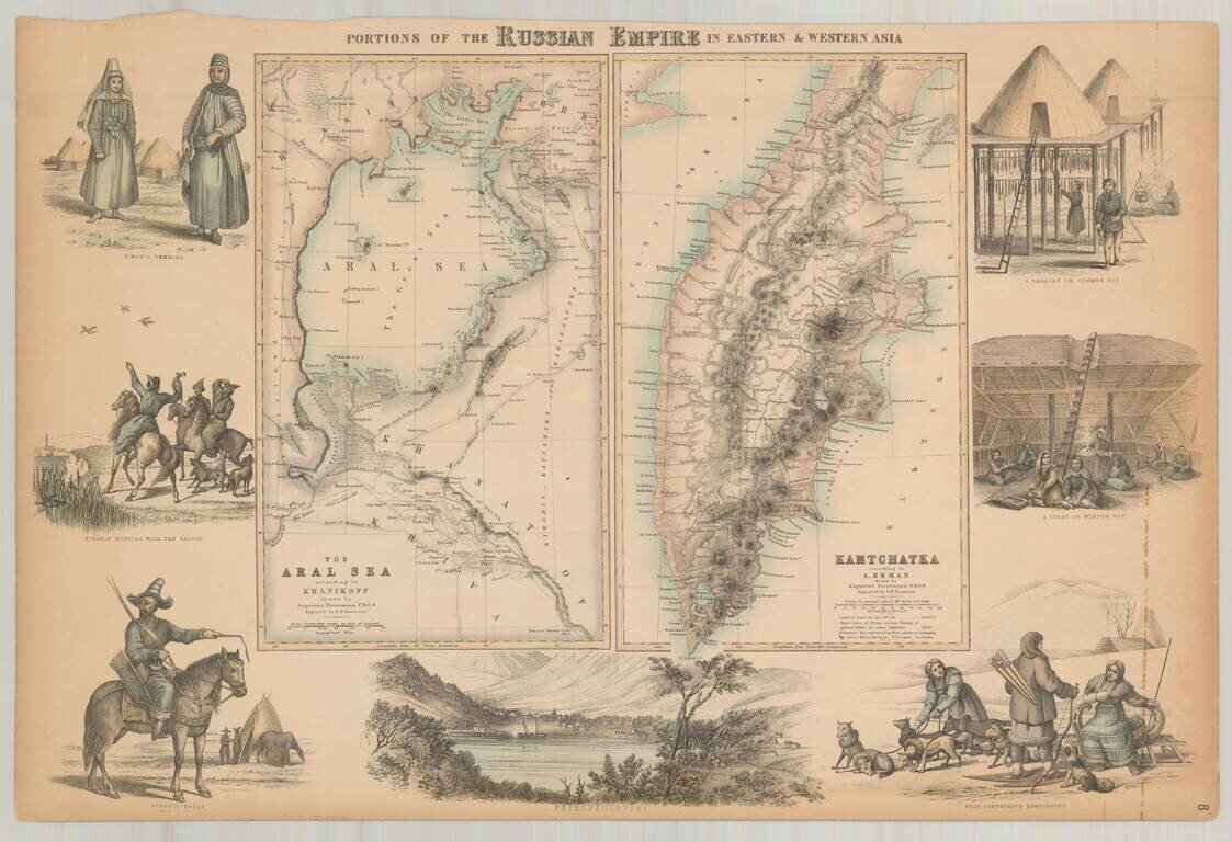
Decorative pair of maps on a single sheet, with the right sheet showing Kamtschatka according to Erman and the left sheet showing the Aral Sea according to Khanikoff. Large view at the bottom showing Petropaulovski. Decorative vignettes showing local...
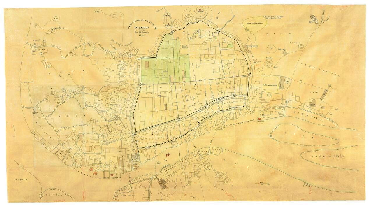
The Earliest Known Example of Rev. Daniel Vrooman's Monumental Manuscript Map of Canton, China. Vrooman's exceedingly rare manuscript plan offers a little-seen view of Canton on the eve of the Second Opium War. Constructed by Vrooman using Chinese...
![[The United States in North America | Russian Empire in Europe] [Kita-Amerika-nai Gasshukoku | Yoroppa-nai teikoku Roshia]](/map/small/55548.jpg)
This kawaraban shows the portraits of two officers, an American and a Russian, with explanatory text printed around these figures it reflects the interest in these two powerful countries following their arrival in Japan in 1853. It seems likely that...
![[American Lady] [Amerika fujin] | [Chinese Man from Nanjing] [To Daishin Nankin-jin]](/map/small/55554.jpg)
Kawaraban Illustration of a 19-year-old American Woman. Interesting woodblock kawaraban illustrating a 19-year-old American woman named "Arikisanteru" [Alexandra], and a Chinese man from Nanjing kneeling at here feet suggesting he may be her...
![[On Europe: Dutch Man, English Man, Russian Man, North American Man, and French Man] [Yoroppa no bu: Oranda-jin, Igirisu-jin, Furansu-jin, Kita-Amerika-jin, Roshia-jin]](/map/small/55553.jpg)
Hand-colored woodblock kawaraban of five western men in military uniforms. Counter-clockwise from the top right they are: Dutch, French, American, English, and Russian. The accompanying text largely focuses on Dutch seaborne trade.
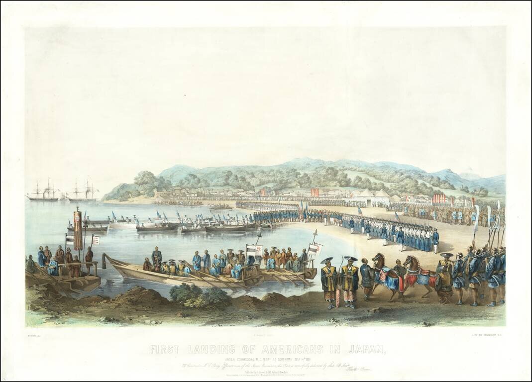
The Most Dramatic Image of Commodore Perry Landing on Japanese Soil. Exceptional antique lithograph of Perry's first landing in Japan. The print is the most dramatic of Perry's first landing in Japan, and shows a flotilla of American barges, with all...
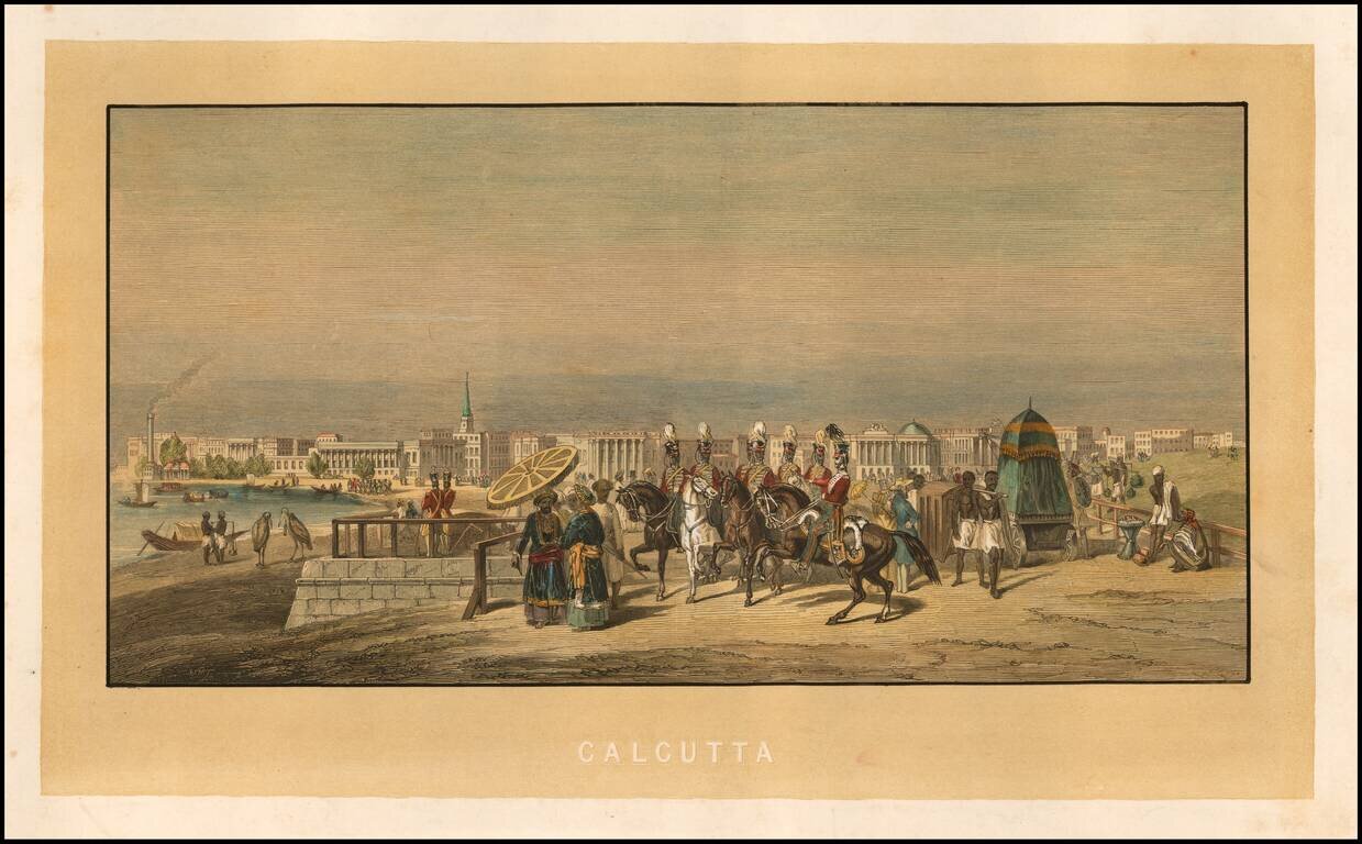
Fine early view of Calcutta, with various soldiers and costumed figures in the foreground and the city on the banks of the Hoogley River beyond. The printing of the image is rather intriguing, as it would appear that the yellow background and...
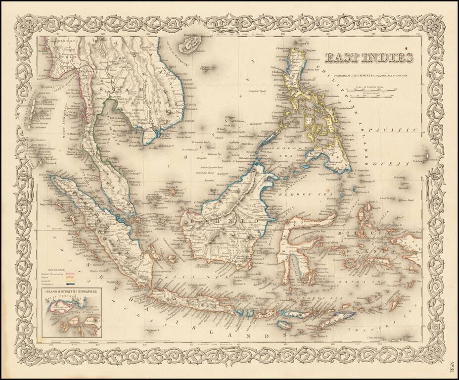
Very detailed map of Indonesia, Malaysia and the Philippines, with inset map of the Strait of Singapore. Color key shows the Dutch, British, Spanish and Portuguese Possession. A marvelously detailed map. Decorative border. A terrific regional map...
![[Manuscript Map of Nile River Expedition in 1855]](/map/small/61011.jpg)
Hand Drawn Antique Map of the Nile from the Cataracts to Alexandria Detailed map of the Nile River from Alexandria to the Cataracts and the Nubia-Egypt border, illustrating the travels of an English expedition up and down the Nile and from January 12,...