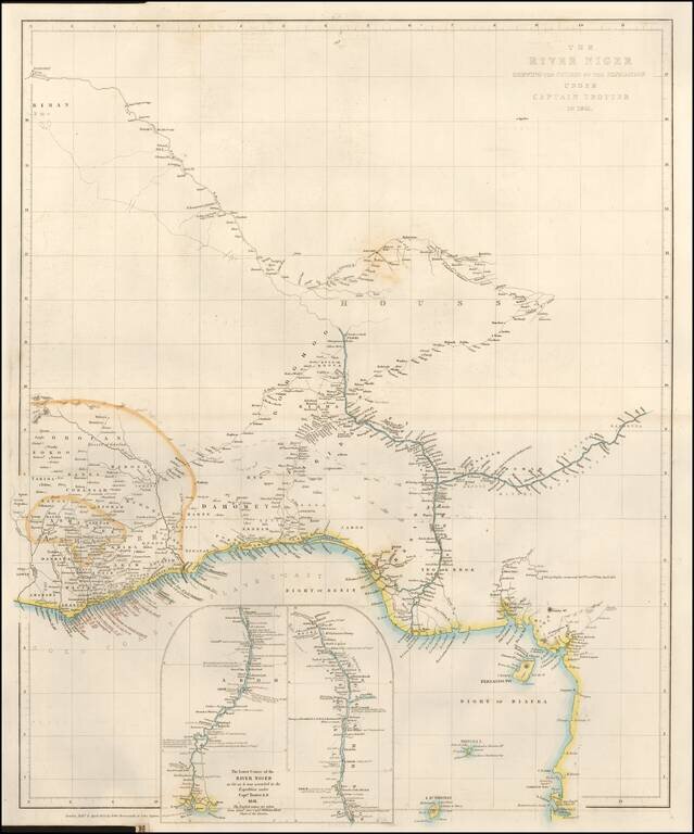
Fine large format map of the Course of the Niger River, published by John Arrowsmith in London. H.D. Trotter was the leader of an expedition up the Niger River, as part of a delegation of British Officers, including William Allen (1793–1864), under...
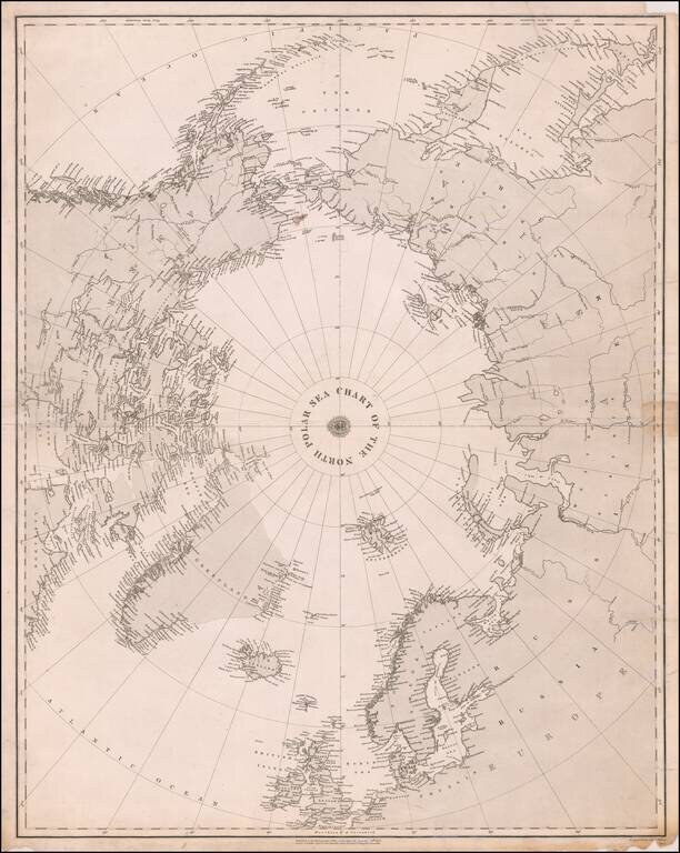
Rare separately published map of the Polar regions, published in December 1855 in London by the British Admiralty. Oriented with Greenwich meridian at the bottom, the map covers the Arctic Ocean and Arctic landmasses adjacent to it. On the verso are...
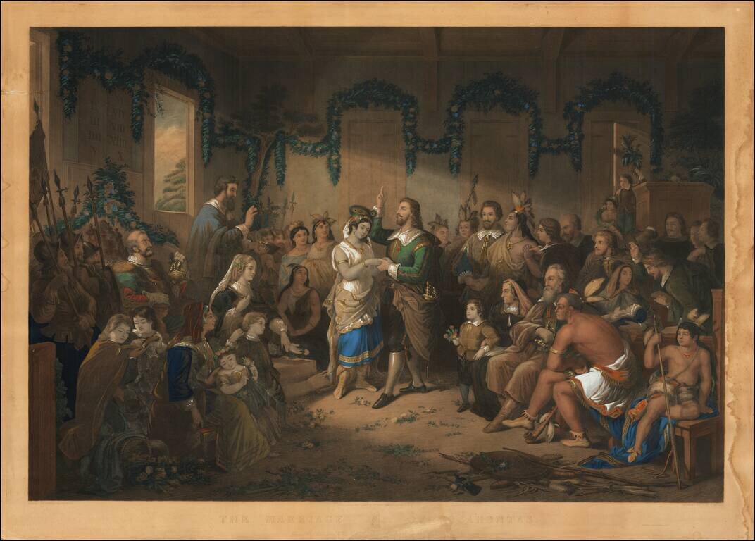
Impressive hand-colored engraving of the marriage of Pocahontas and the Englishman John Rolfe. The stylized historical scene is summarized by the Library of Congress in their entry for the print: Painter Henry Brueckner imagined the 1616 wedding...
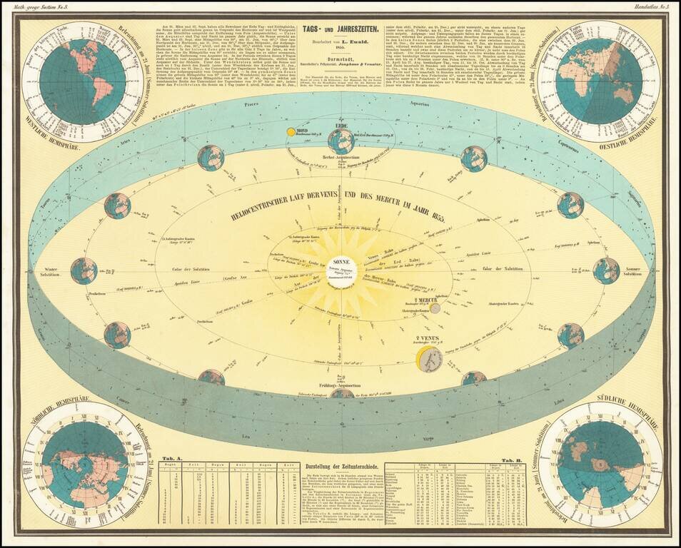
This is a great antique German celestial chart explaining the changing of the seasons. Showing a plethora of information, this work is ingeniously designed and presented. The central chart shows the solar system within the Earth's orbit. Information...
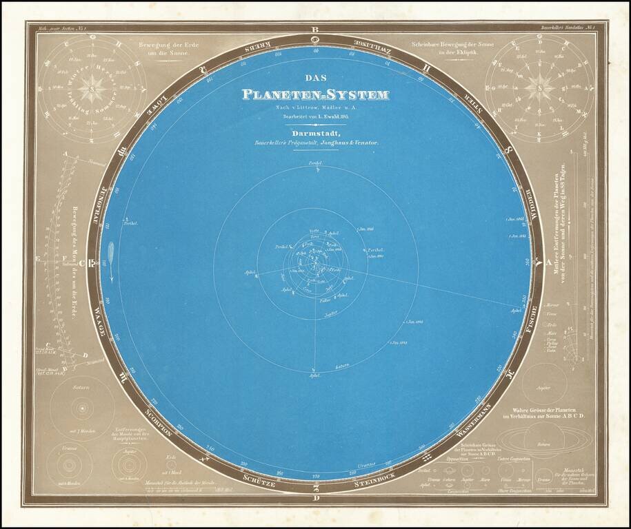
Marvelous Model of the Solar System Fine example of this scarce model of the solar system, published by Bauerkeller. At the top right and left corners, a seasonal Astrological model showing the dates relative to the signs of the Zodiac is given, show...