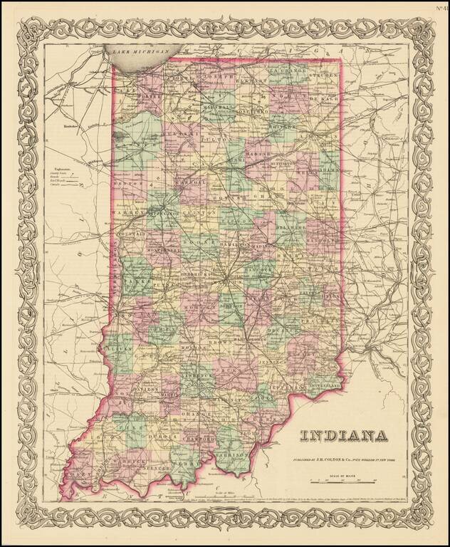
Detailed map of Indiana, published by JH Colton. The map is colored by counties and showing towns, townships, roads, railroads, canals, post offices, rivers, lakes, etc. From the first edition of JH Colton's New General Atlas. JH Colton was one of...
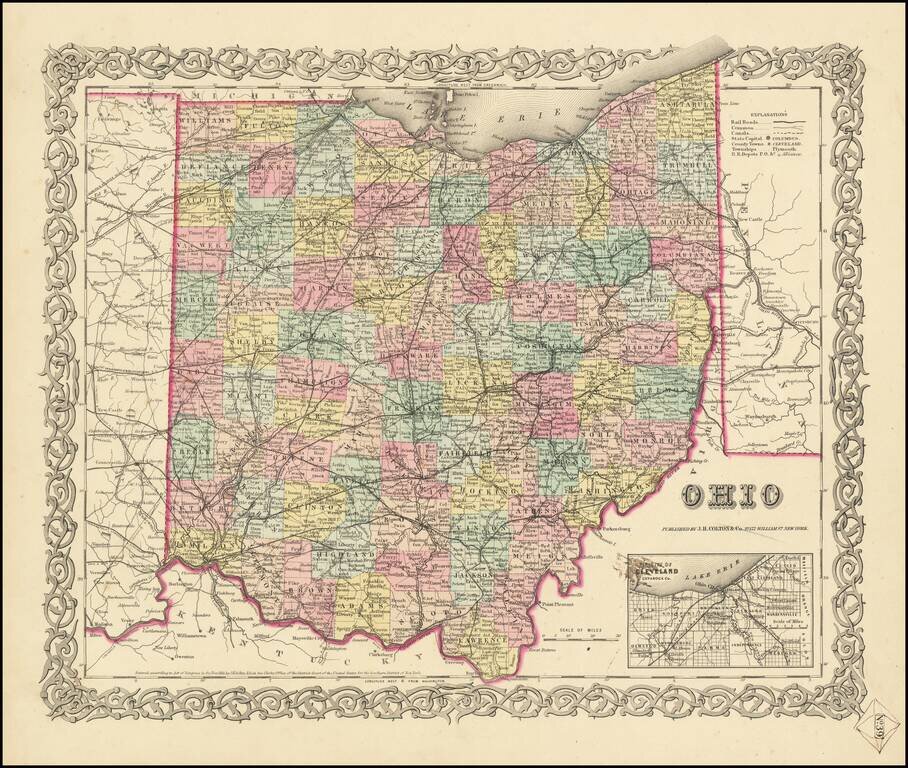
First Edition of JH Colton's Map of Ohio Detailed map of Ohio, published in New York by J.H. Colton. The map is colored by counties, and shows roads, railroads, towns, villages, post offices, canals, rivers, lakes, stations and a host of other...
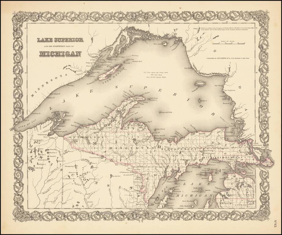
Rare outline color example (first state) of Colton's map of Lake Superior and the Upper Peninsula. Detailed map of the region, showing towns, townships, rivers, lakes, etc. Still no railroad service. JH Colton was one of the pre-eminent American map...
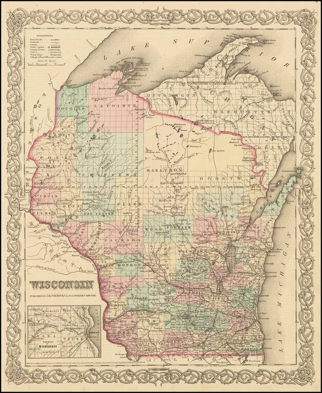
Detailed map of Wisconsin, colored by Counties, with massive Oconto, Marathon, La Point, Douglas, Polk, Burnett and Chippewa counties dominating the north. Inset of Milwaukee. Shows towns, townships, lakes, rivers, post offices, etc. JH Colton was one...
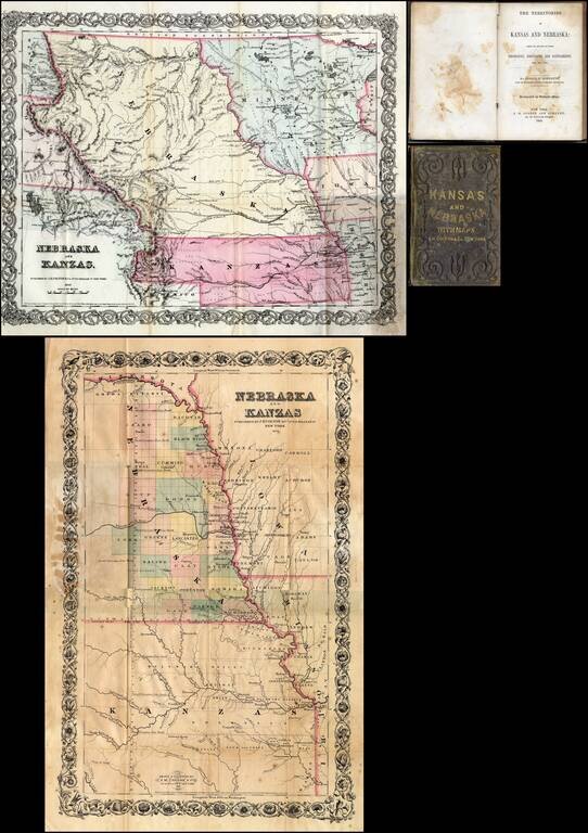
First edition of this fine early guide book to Kansas Territory and Nebraska Territory by Joseph F. Moffette, embellished with rare variant editions of two maps of Kansas and Nebraska, published by J.H. Colton & Company in New York. Pocket guide...
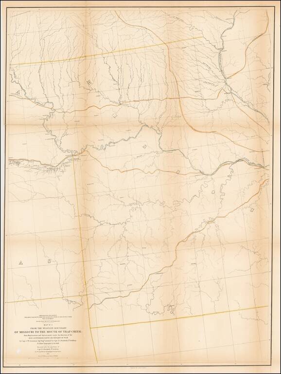
Detailed survey map of the region centered on the course of the Missouri River, published as part of the Surveys to find the most practicable routes from the Mississippi River to the Pacific Ocean. The present map is one of the first maps created by...
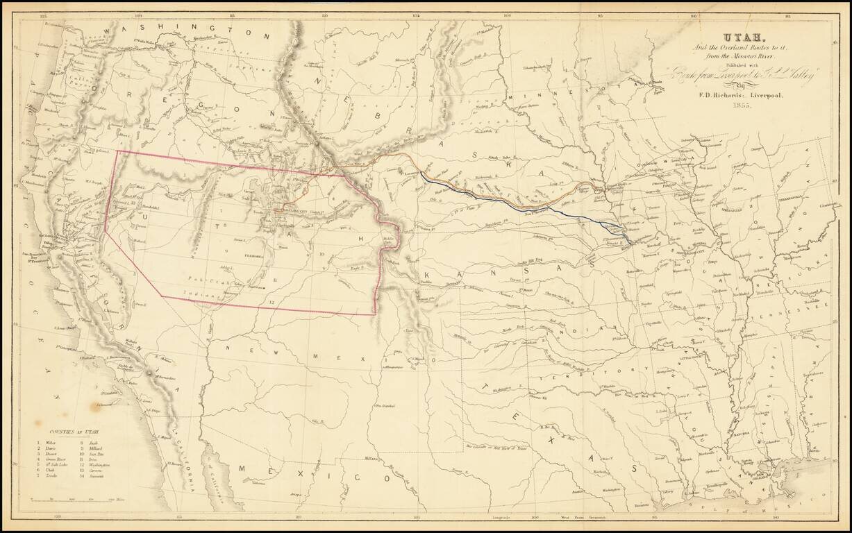
The Only Contemporary Map of the Mormon Trail. Rare hand-colored lithographed antique map of the American West focusing specifically on the routes by which Mormon's could reach Utah from points on the Missouri River. As such, it is the only...
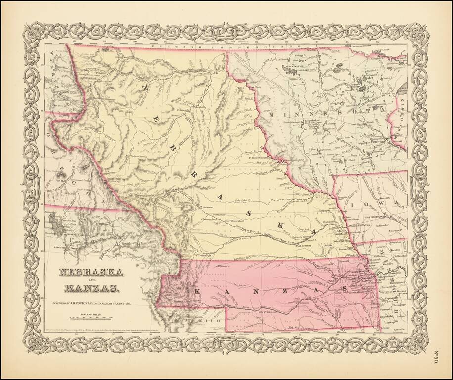
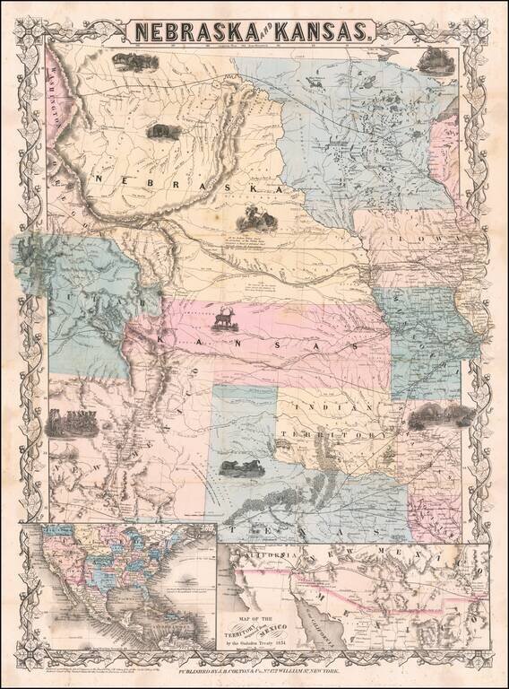
First State of Colton's Map of Kanzas and Nebraska Colton's highly sought after regional map of Nebraska and Kanzas, first published in 1855. Nebraska extends to Canada and the Rockies, taking up large portions of Montana, Wyoming and Utah. Kanzas...
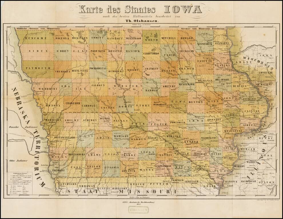
Rare separately issued map of Iowa, published in Kiel in a promotional tract, Der Staat Iowa geographisch und statistisch beschrieben von Theodor Olshausen in St. Louis in Staate Missouri . . ., published in 1855. Olshausen is also known to have...
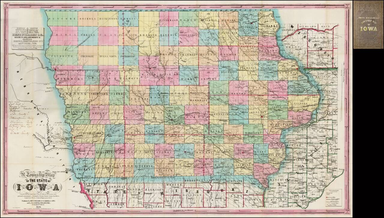
Nice example of the second state of Henn, Williams & Co.'s large format map of Iowa. The evolution of the Henn, Williams & Co. map of Iowa over the first 3 years of its publication provides a remarkable visual depiction of the rapid growth of...
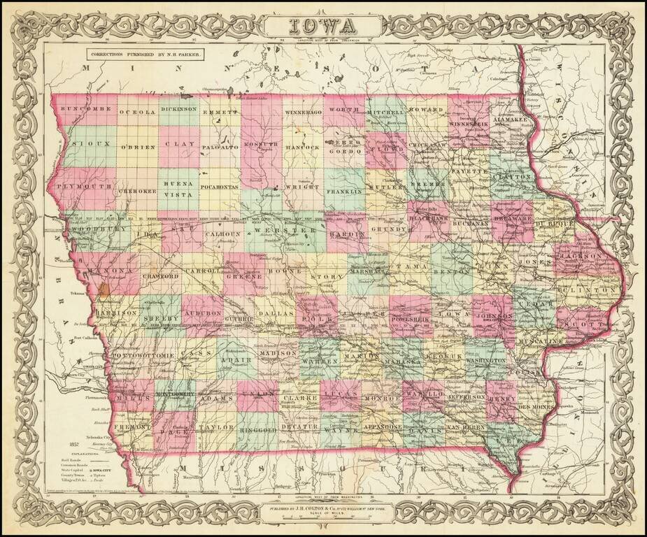
Scarce early separately issued map of Iowa, pre-dating the first edition Colton's atlas map of Iowa. An attractive and detailed map of Iowa with an ornate border. It is colored by counties and shows cities, towns, railroads, rivers, and lakes.
First edition, second state of this rare and important separately issued map of Kansas and Nebraska, published by J.H. Colton in New York. Colton's map is the first printed map to show the configurations of Nebraska and Kansas after the creation of...
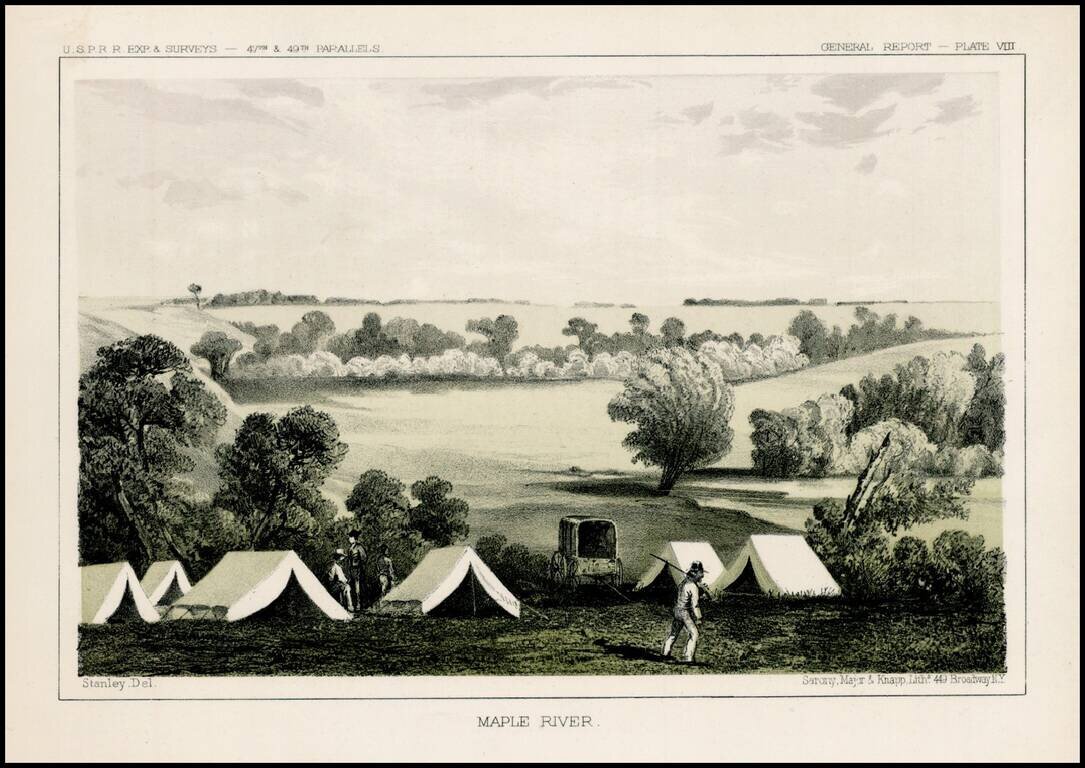
Fascinating view of an encampment on the Maple River in South Dakota, prepared as part of the United States survey for the most practicable route for a railroad line to the West Coast of America, conducted just prior to the Civil War. A scenic view as...
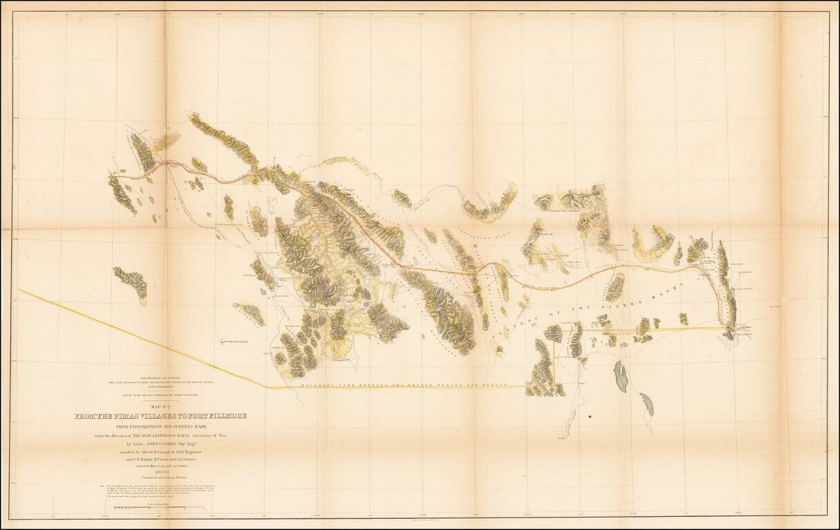
U.S. Mexican Boundary Commission map of Arizona and New Mexico's border with Mexico. Hand-colored lithographed folding map of the southern part of modern-day Arizona and New Mexico, by one of the great cartographers of the Southwest, John G. Parke....
A Search For The Best Routes To The West. "[O]ne of the most interesting maps of the West" - Wheat 868 This is a scarce map which accompanied the Report of Capt. R. Ingalls on the March of L. Col. Steptoe from Ft. Leavenworth to California, in 1854...
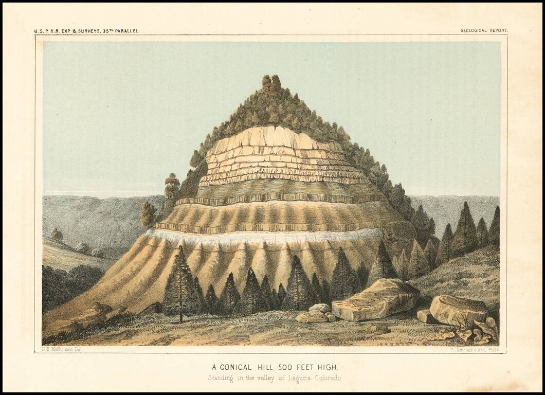
Detailed view of the Valley of the Kah Wee Yah River (Tulare River) and the Kings River. The expedition surveying the southern route along the 35th parallel, led by Lieutenant Amiel Weeks Whipple, explored from Little Rock, Arkansas, through Oklahoma,...