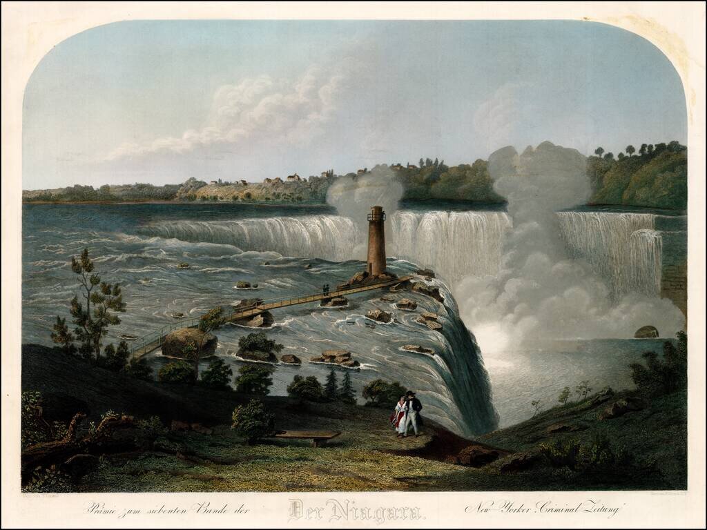
Finely engraved view of Niagara Falls, by Frederck Girsch. The view is taken from Goat Island and shows a striking image of Horse Shoe Fall. Frederick Girsch, a German artist and engraver, emigrated to the United States in 1849. The first works he...
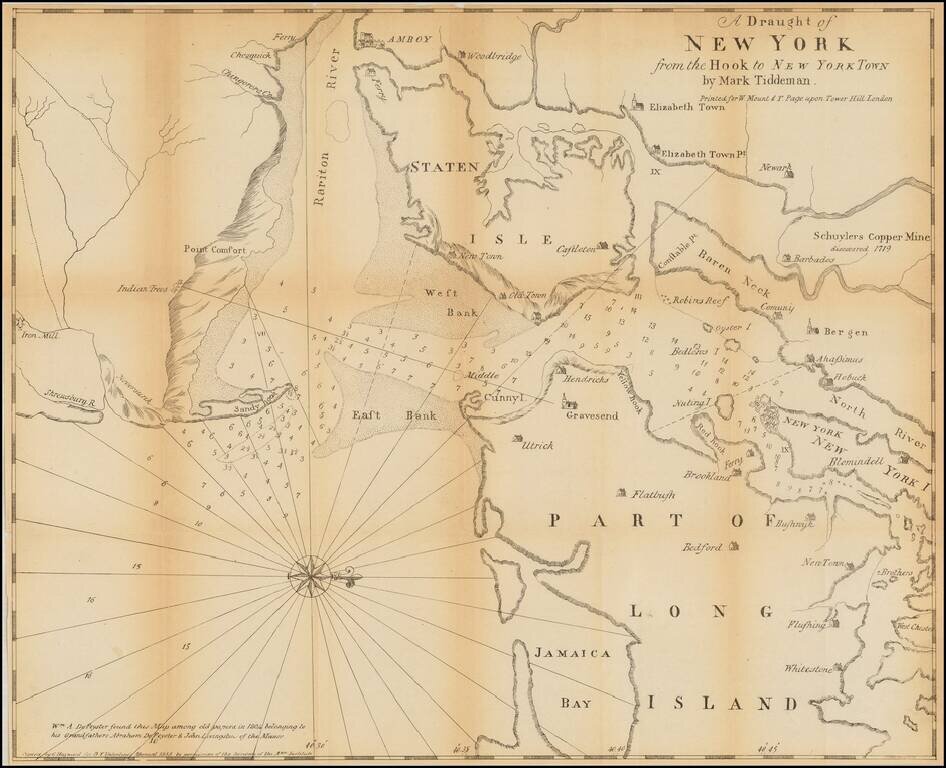
Valentine's Manual edition of Mark Tiddeman's important early chart of New York Harbor. Tiddeman's chart of New York Harbor shows the area between Sandy Hook and Westchester with part of Long Island. The chart includes the Rariton River, Staten...
![The Cities of Pittsburgh and Allegheny with Parts of Adjacent Boroughs [with] The City of Cincinnati Ohio.](/map/small/39410.jpg)
Two nice town maps on a single sheet, each with excellent detail and colored by ward. Early Pittsburgh maps are scarce. Decorative border. A terrific map, from JH Colton, one of the most prolific American mapmakers of the mid-19th century.
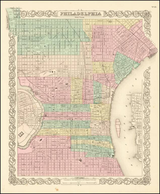
Detailed map of of Philadelphia, colored by wards and showing streets, roads, buildings, rail lines, wharfs, stations and other details. An excellent pre-Civil War map. JH Colton was one of the pre-eminent American map publishing firms in the mid-19th...
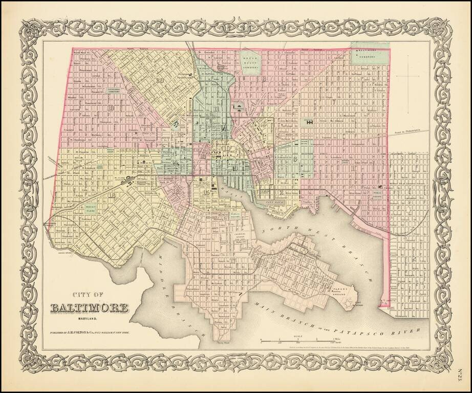
Detailed map of Baltimore, published in the first edition of Colton's General Atlas. The map shows streets, railroads, buildings, etc. Many public buildings along with City Dock, Ferry Point, Fort McHenry, Mt. Claire Station, etc. Hand colored by...
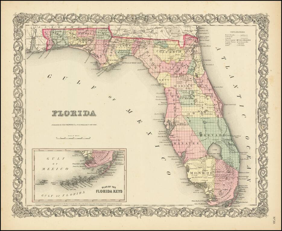
Detailed map of Florida, colored by counties. Shows railroads, roads, towns, rivers, swamps, lakes, islands, forts, etc. Large inset Plan of the Keys. South Florida consists of Brevard, Manatee, Monroe and Dade Counties only. An excellent pre-Civil War...
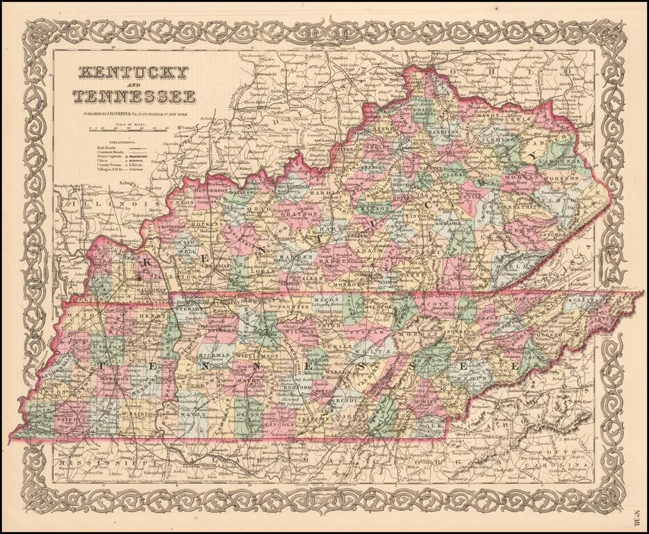
Detailed map, colored by counties and showing roads, railroads, towns, rivers, lakes, stations and a host of other details. JH Colton was one of the pre-eminent American map publishing firms in the mid-19th century.
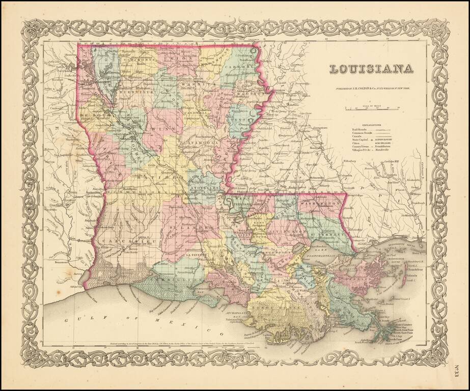
Detailed map of Louisiana, colored by parish and showing roads, railroads, post offices, township surveys, towns, rivers, lakes, stations and a host of other details. JH Colton was one of the pre-eminent American map publishing firms in the mid-19th...
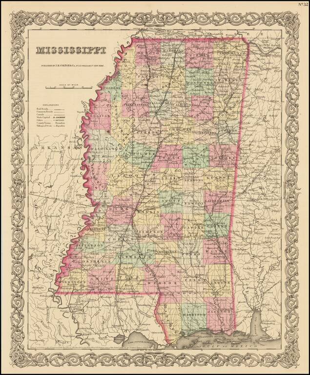
Detailed map of Mississippi, colored by counties and showing roads, railroads, towns, villages, post offices, canals, rivers, lakes, railroad stations and a host of other details. The map appeared in the first edition of JH Colton's Atlas. JH Colton...
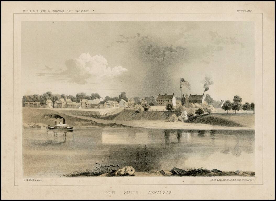
Fine early view of Fort Smith, Arkansas, prepared as part of the United States survey for the most practicable route for a railroad line to the West Coast of America, conducted just prior to the Civil War.
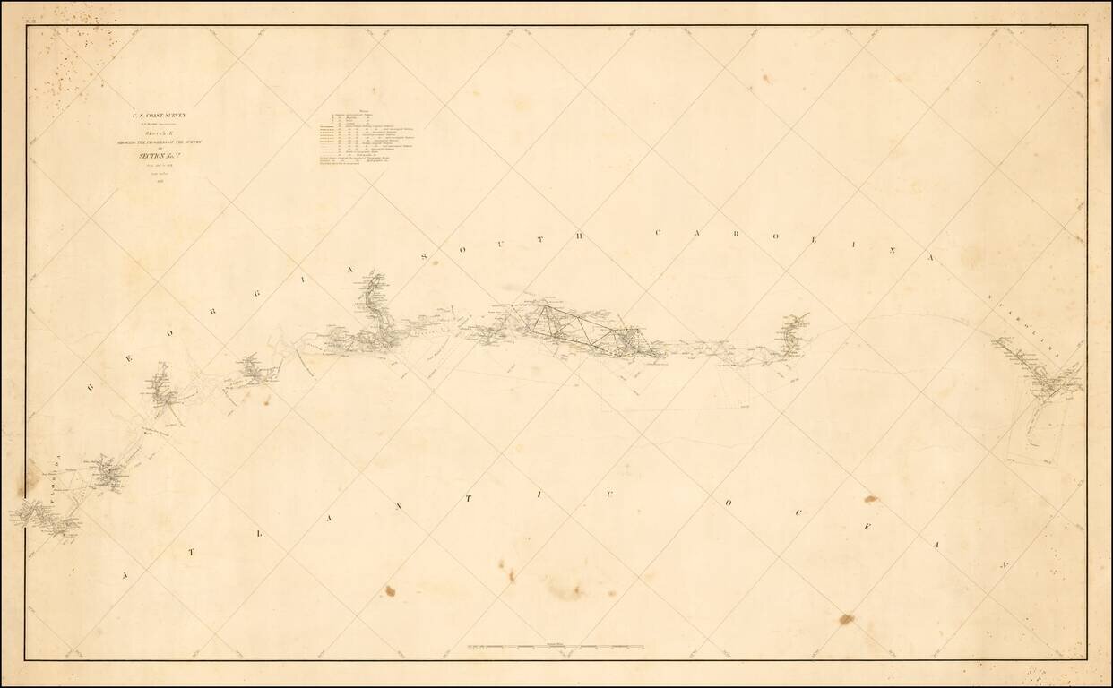
Unusual thick paper copy of the US Coast Survey progress chart from North Carolina to South Carolina, tracking the progress of the survey from 1847 to 1857 on along the Southeast Coastline. The accompanying notes identify the location of Astronomical...
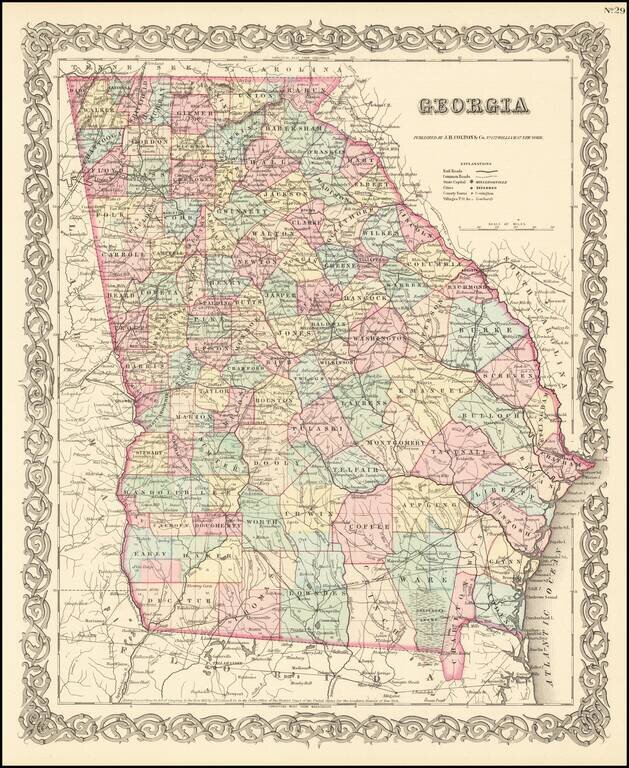
Detailed map of Georgia, colored by counties. Shows roads, railroads, towns, villages, post offices, rivers, lakes, stations and a host of other details. Decorative border. A terrific map, from John Hutchins Colton, one of the most prolific American...
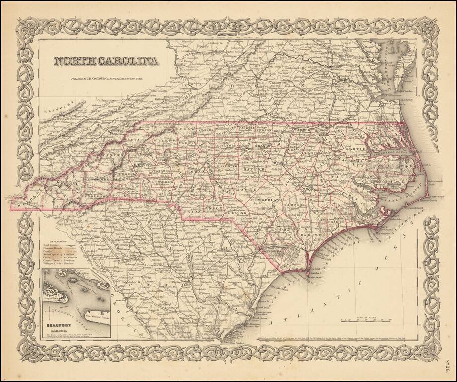
Colton's detailed map of North Carolina, hand colored by counties. Shows roads, railroads, towns, villages, post offices, rivers, lakes, stations and a host of other details. Inset map of Beaufort. Decorative border. A terrific map, from JH Colton,...
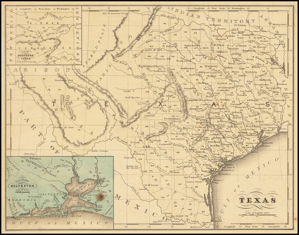
Detailed map of Texas, published in McNally's School Geography. Dallas is shown on the map. Most of the western counties are still not formed.
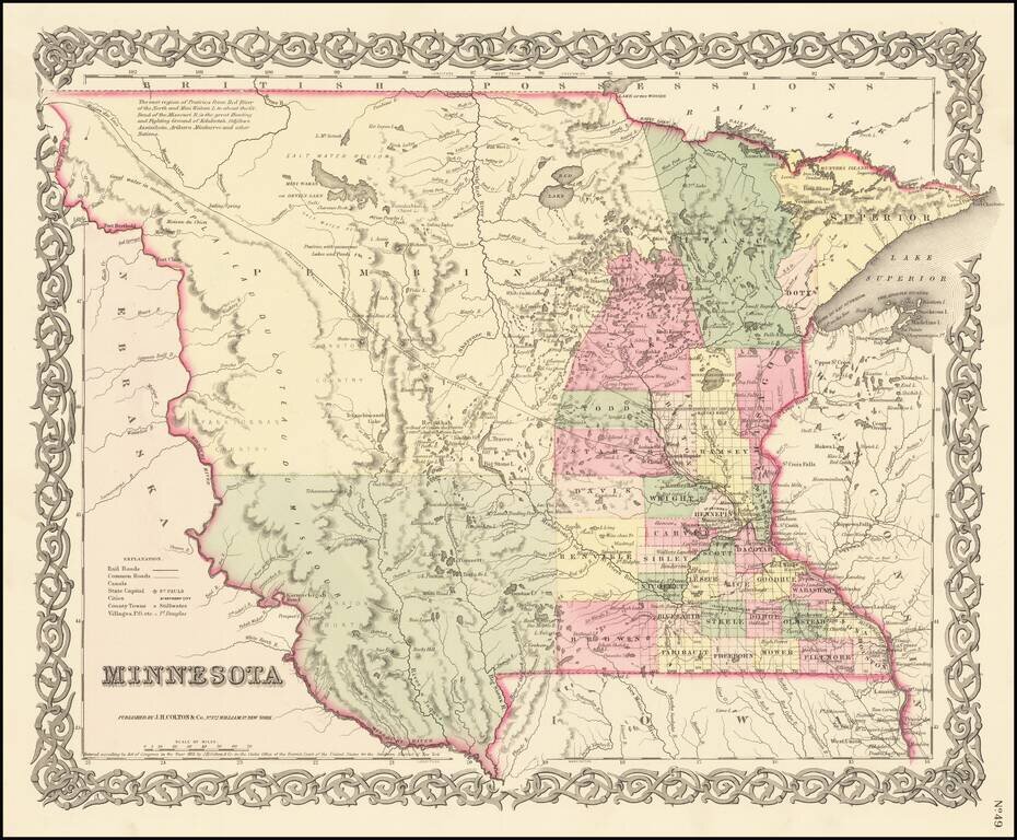
First Atlas State of Colton's Map of Minnesota Territory First atlas state of Colton's Map of Minnesota Territory, which extends to the Missouri River. Massive Pembina County and Yankton County dominate the western 2/3rds of the map. Only a hand...
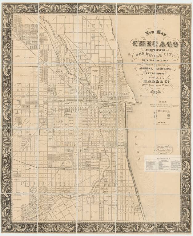
Unknown Variant - One of the Earliest Printed Maps of Chicago Published in Chicago. This lithographed folding map of Chicago, published by Hall & Co. in 1855, and printed by Ed. Mendel at 170 Lake Street, is one of the very first maps of Chicago...