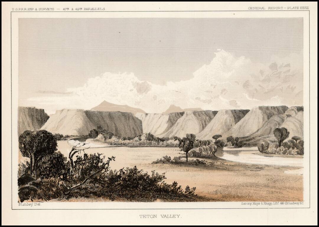
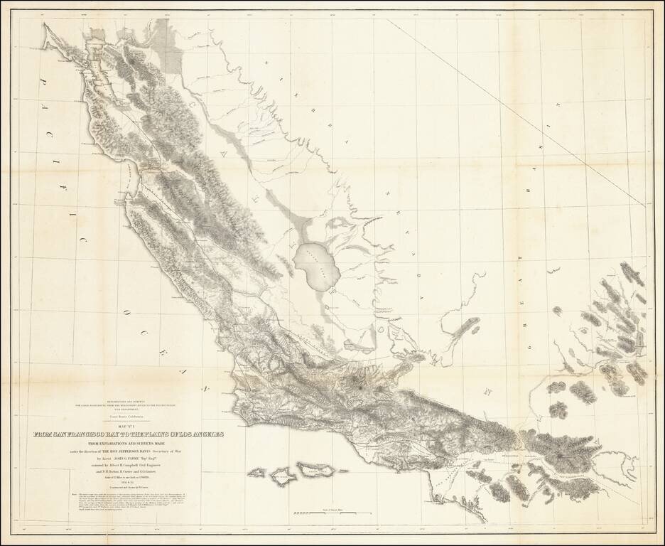
Detailed view from the Report of the United States Pacific Railroad Expedition and Surveys
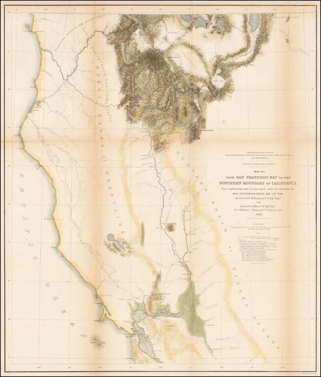
Important early survey map, covering the region between Crescent City and San Francisco Bay, showing the results of R.S. Williamson and H.L. Abbot's surveys in Oregon and California, in anticipation of the location of the first transcontinental...
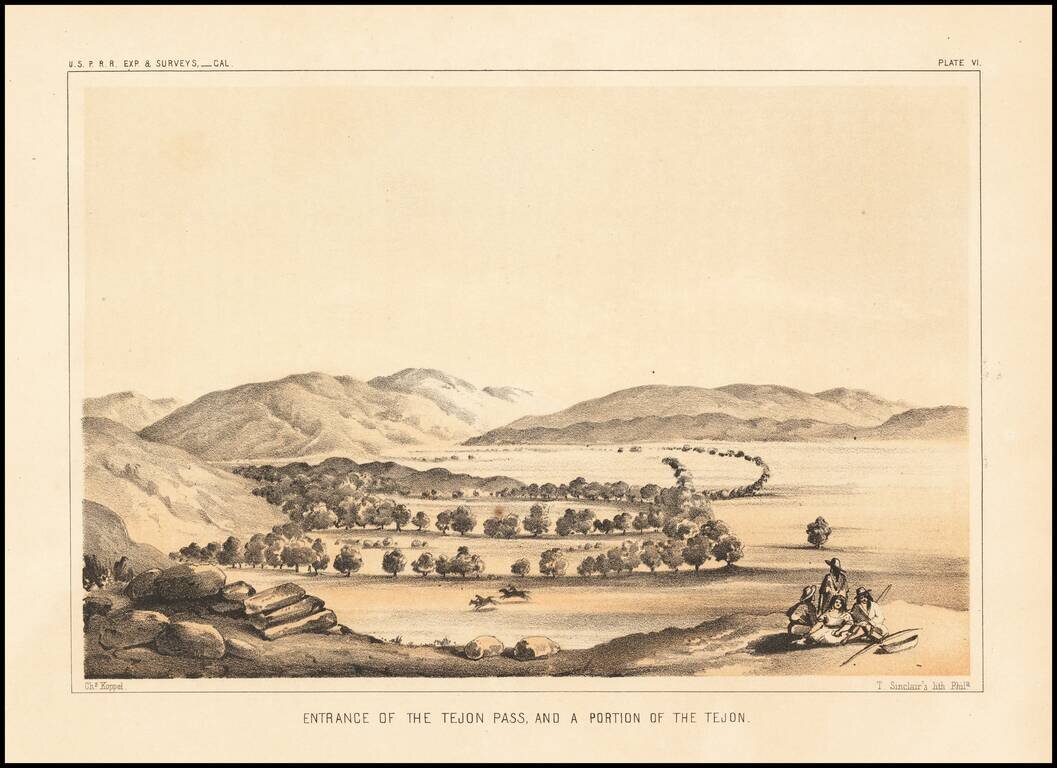
Interesting early view, looking into the Valley from the Tejon Pass.
![Valley of Kah Wee Ya River (Four Creeks) [San Joaquin Valley]](/map/small/61893.jpg)
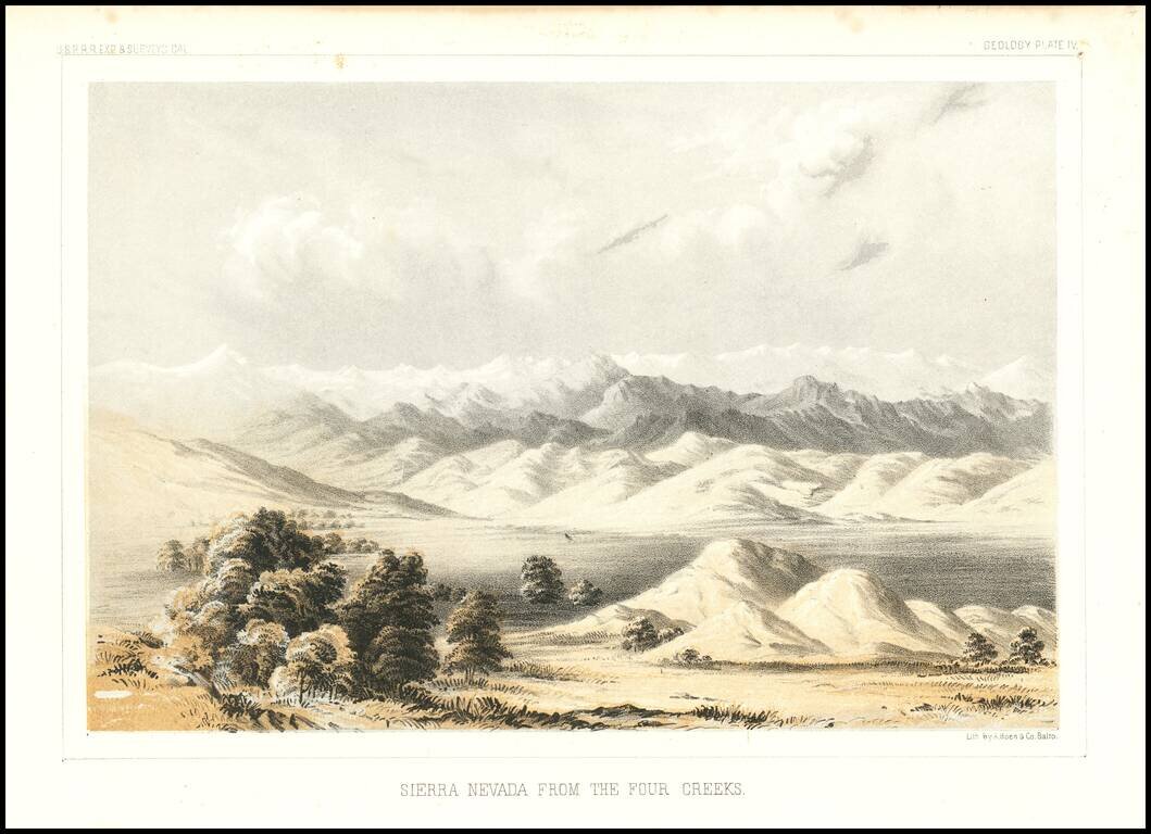
Detailed view of the Valley of the Kah Wee Yah River, apparently the Tulare River.. From Reports of Explorations and Surveys, to ascertain the most practicable and economical route for a railroad from the Mississippi River to the Pacific Ocean, made...
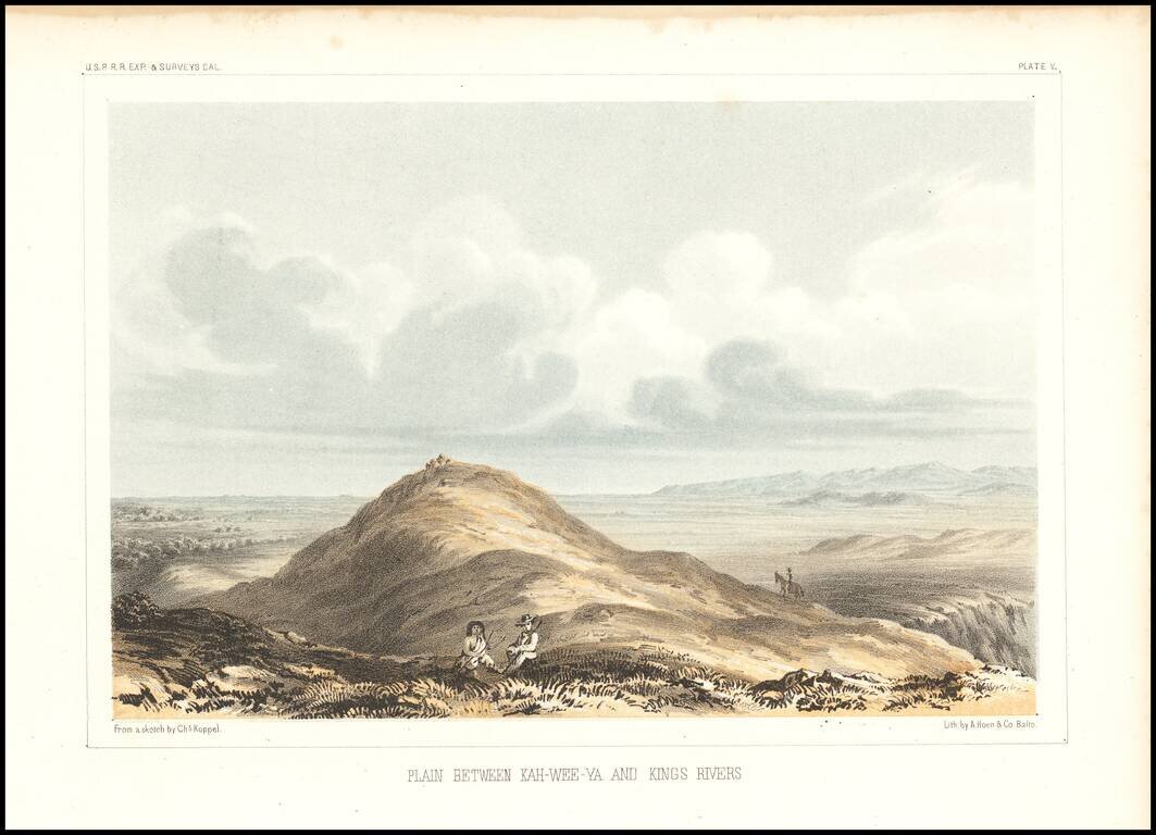
Detailed view of the Valley of the Kah Wee Yah River (Tulare River) and the Kings River. From Reports of Explorations and Surveys, to ascertain the most practicable and economical route for a railroad from the Mississippi River to the Pacific Ocean,...
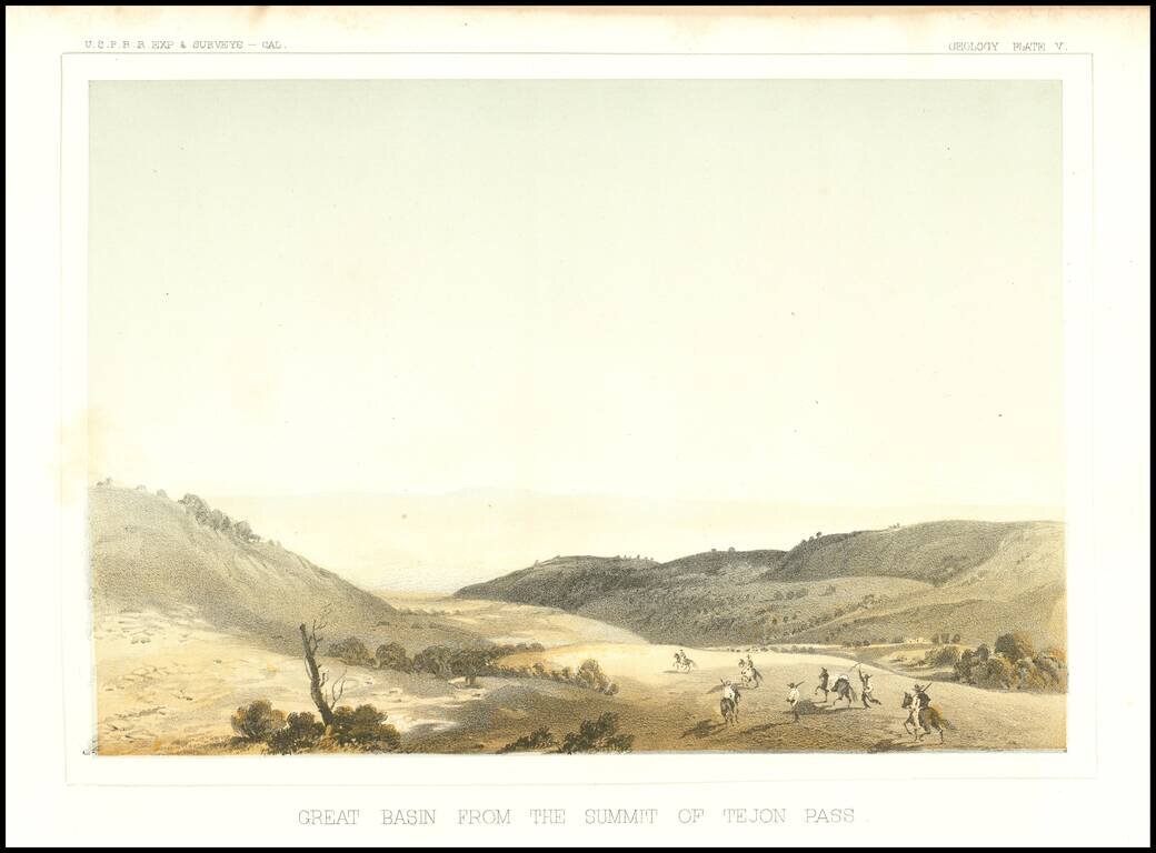
Early view of the Tejon Pass, looking to the northeast.
Detailed view of the Valley of the Kah Wee Yah River (Tulare River) and the Kings River. The expedition surveying the southern route along the 35th parallel, led by Lieutenant Amiel Weeks Whipple, explored from Little Rock, Arkansas, through Oklahoma,...
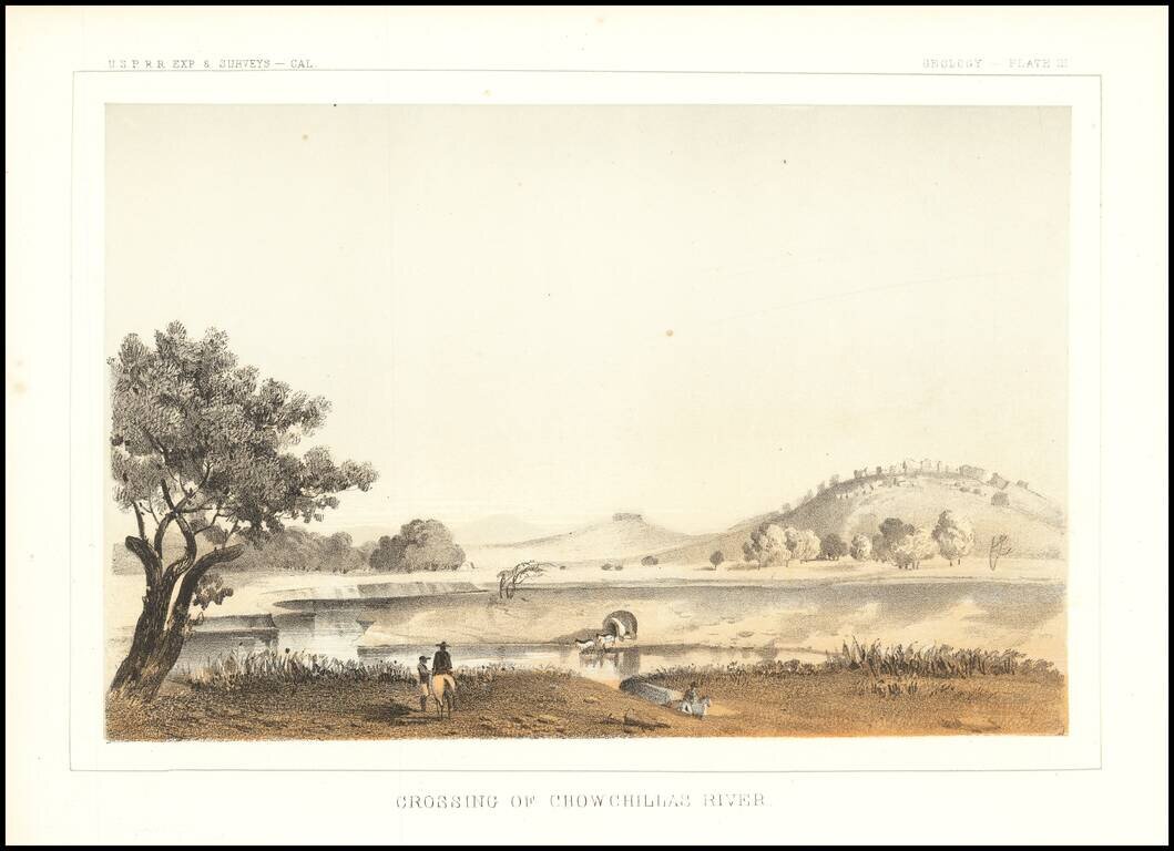
Interesting depiction of a crossing of the Chowchilla River, in Central California. The Chowchilla River is a river in Central California and a minor tributary of the San Joaquin River. It flows for 65 miles from the western side of the Sierra Nevada...
Fabulous regional map, extending from just north of San Francisco Bay to Orange County (not named) and the San Bernardino Valley. The map includes remarkable topographical detail throughout.
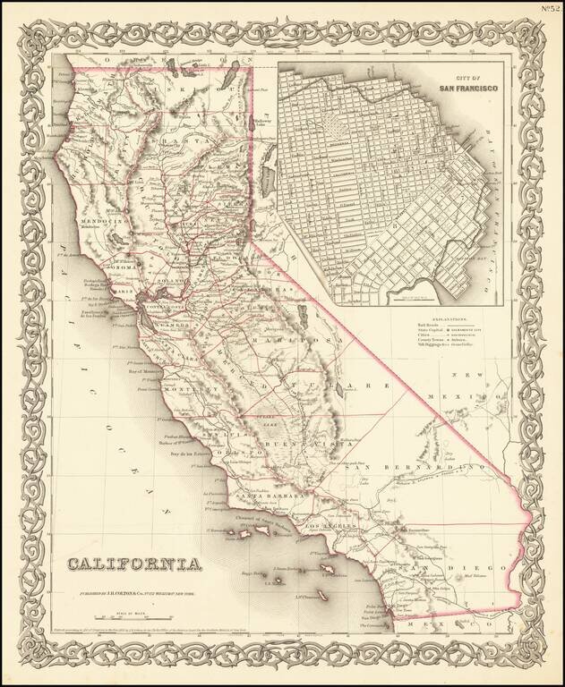
Rare first state of Colton's map of California, from Colton's Atlas of the United States. Only 6 counties in Southern California, including San Diego, Los Angeles, San Bernardino, Buena Vista, Santa Barbara and San Luis Obispo. Decorative border.
![Sketch of Anacapa Island In Santa Barbara Channel . . . 1854 [with] Reconnaissance of Smith's or Blunt's Island Washington . . . 1854 [J.A. Whistler engraving]](/map/small/70293.jpg)
Whistler's Seagulls -- Earliest Known Engraving Work By James Abott MacNeil Whistler An extremely important set of maps of from the California Coastline, being the first known example of the engraving work of James Abbott MacNeill Whistler, who would...
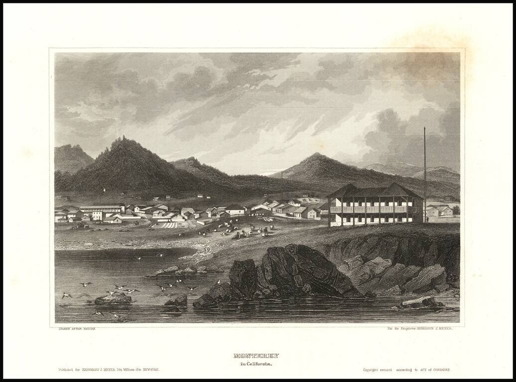
Detailed view of the town of Monterey, from Meyer's Universum. One of the view obtainable views of a city in Spanish California
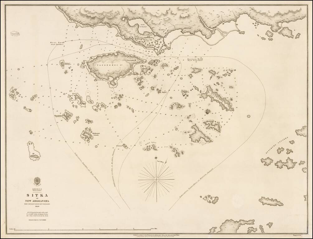
Exceedingly rare and highly detailed British Admiralty Chart of Sitka, Alaska and environs, based upon an earlier chart by the Russian Sea Captain Ivan Vasilyev. This exceptional chart shows one of the earliest obtainable scientifically drawn surveys...
![Hawaiian Group or Sandwich Islands [with] New Zealand [and] Feejee Group, Society Island, Marquesas and Galapagos Islands](/map/small/71009.jpg)
First state (with the strapwork border and "No. 33") of Colton's early map of the Hawaiian Islands, New Zealand, Galapagos, Fiji, Society Islands, and Marquesas. Shows towns, rivers, lakes, mountains, islands, etc. A terrific regional map, from J.H....
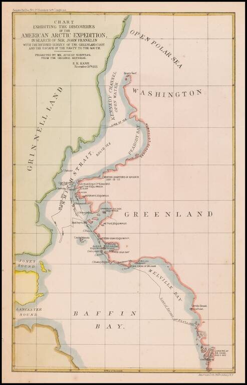
Map of the area of the Upper Part of Baffin Bay and the coasts of Greenland and Grinnell Land, illustrating the tracts of the Second Grinnell Expedition in 1854-1855. The Second Grinnell expedition of 1853–1855 was an American effort, financed by...