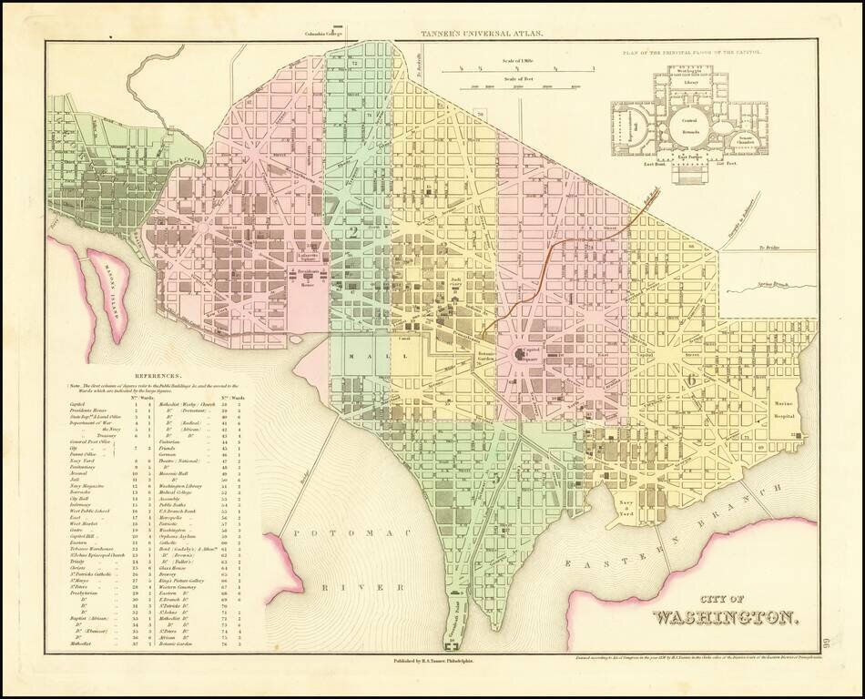
Early map of Washington DC from Tanner's Universal Atlas. Colored by ward, shows streets, buildings, bridges, railroad lines, etc. Key to 76 main buildings and plan of the Capitol. Highly desirable early edition of this town plan.
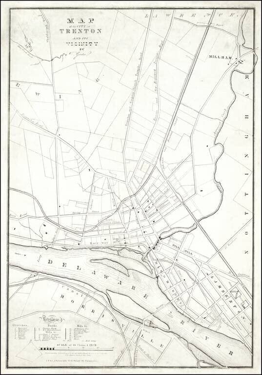
A Trenton Rarity One of the earliest printed maps of Trenton, New Jersey, by one its most important early mapmakers. The map was lithographed by "J.F. & C.A. Watson, Lithrs. No. 62 Walnut Street Philadelphia." The map credits "T Gordon." This...
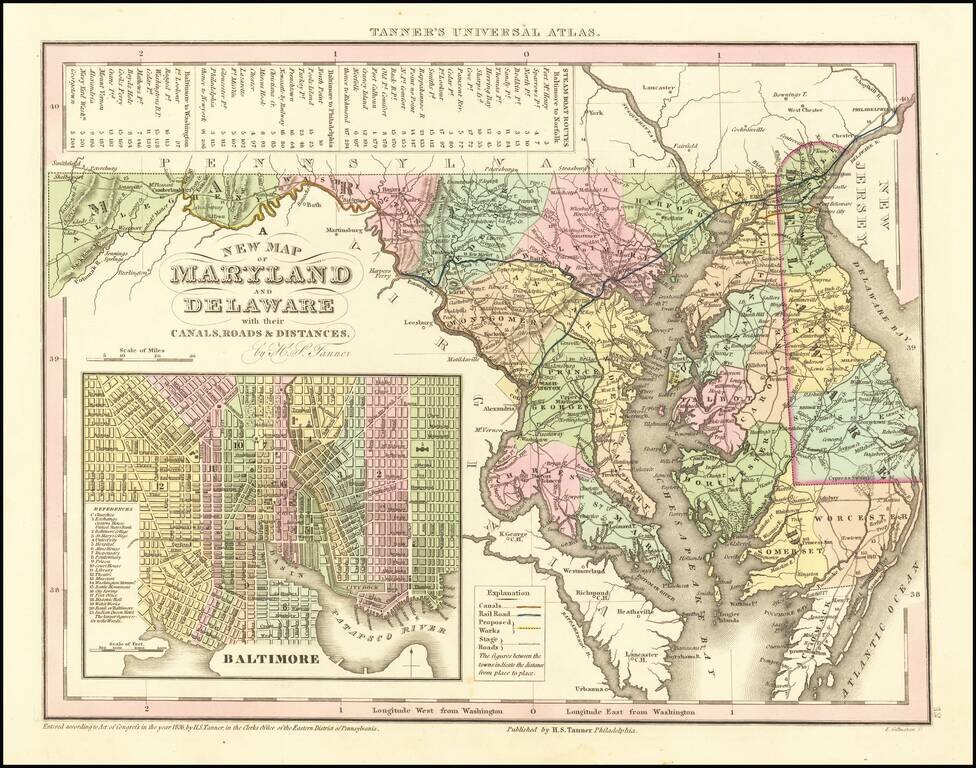
Scarce Carey & Hart edition of Tanner's map of Maryland and Delaware, from Tanner's Universal Atlas. Detailed and interesting map, hand colored by county and showing towns, rivers, bays, lakes, railroads, roads, distances, etc. Tables of Steam...
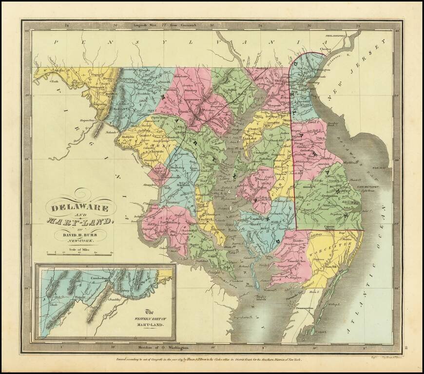
Rare example of the first edition of David Burr's map of Maryland and Delaware, which appeared in his Universal Atlas, first issued in 1836. Shows counties, towns, rivers, roads, courthouses and other details. Burr's Atlas was perhaps the most...
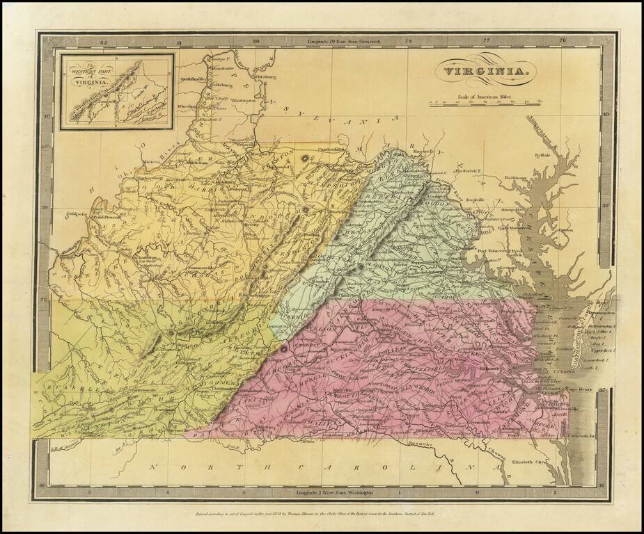
Striking full color map of Virginia, which first appeared in David Burr's Universal Atlas, in 1836. Burr is widely regarded as one of the most important names in American Cartographic history. Burr's Atlas was perhaps the most elegant American...
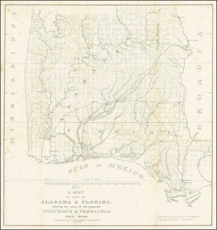
Detailed map of Alabama and western Florida, showing the route of the proposed Columbus & Pensacola Railroad, which accompanied the report of Major J.D. Graham, February 6, 1836. An early and important railroad map of parts of southern Alabama and...
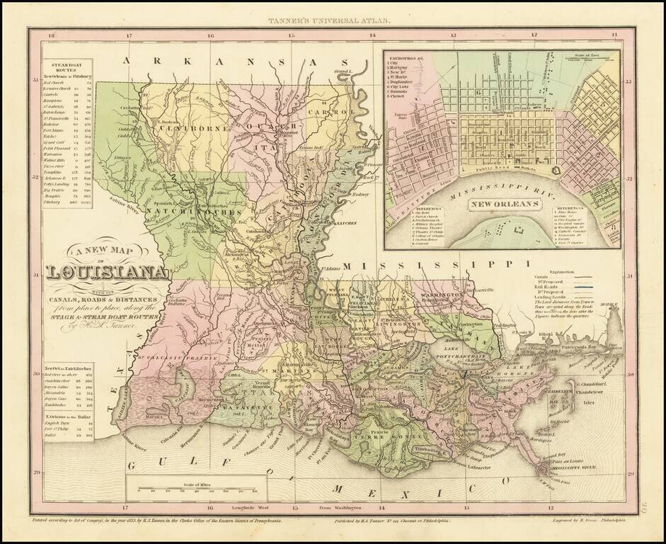
Gorgeous example of Tanner's map of Louisiana, with a large inset map of New Orleans. The map is hand colored by county and shows towns, rivers, canals, roads, railroads etc. A key lists steamship routes and distances. Tanner's maps are now quite...
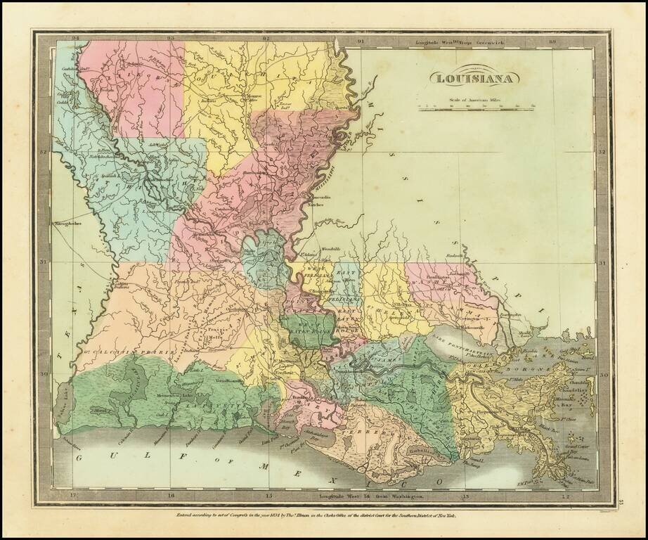
Striking full color example of David Burr's scarce map of Louisiana. The Parish system is still quite primitive, especially in the north and west, where 7 parishes dominate the region. The early roads are shown, although few traverse the state from...
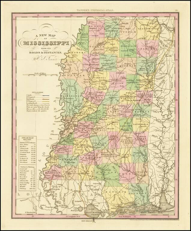
Fine example of Tanner's map of Mississippi, from the first edition of Tanner's Universal Atlas. This example of the map was first issued in 1836. It is hand colored by counties, and shows towns, roads with distances, railroads, steamship routes, and...
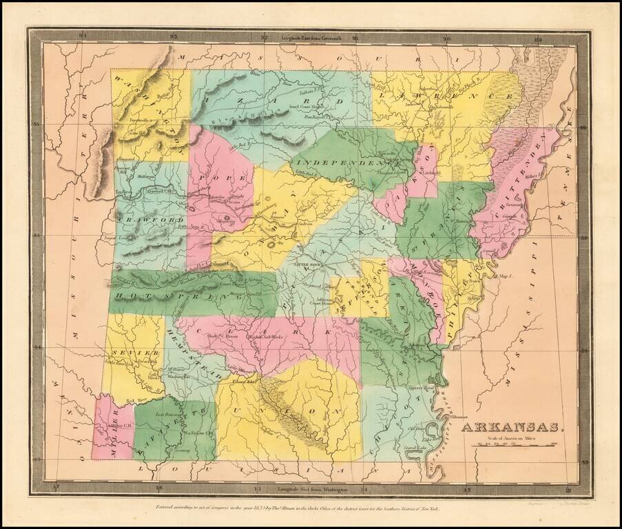
The First Map of Arkansas Territory in its "Statehood" Configuration. Burr's map of Arkansas Territory is the earliest printed map of Arkansas in its final statehood configuration to appear in a commercial atlas. All earlier maps show Arkansas...
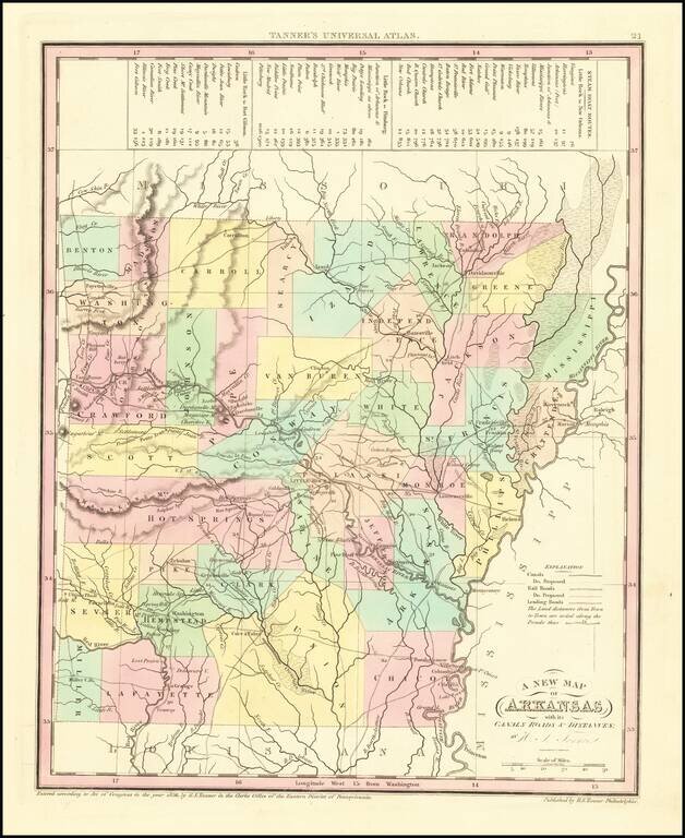
Scarce early map of Arkansas from Tanner's Universal Atlas. Shows canals, proposed canals, railroads, proposed railroads, major roads, distances, towns, rivers, etc. A key at the top of the map shows the steamboat routes and distances. Well less than...
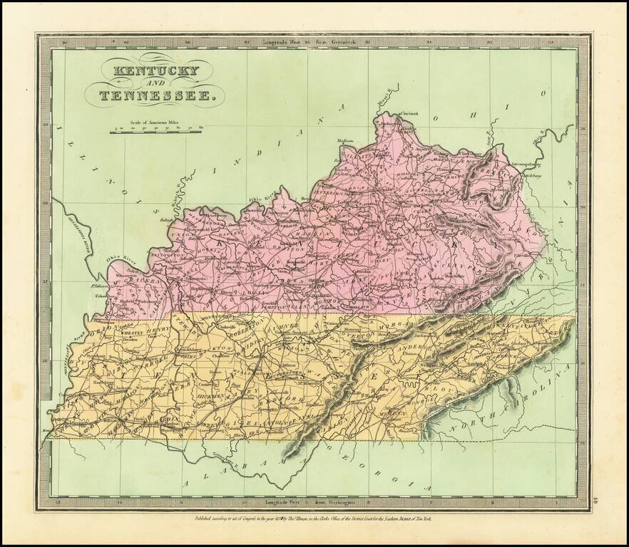
Attractive example of David Burr's scarce map of Kentucky & Tennessee, from his rare Universal Atlas. The map shows counties, towns, roads, rivers, mountains, lakes, forts and other important details. Nice wide margined example of this hard to...
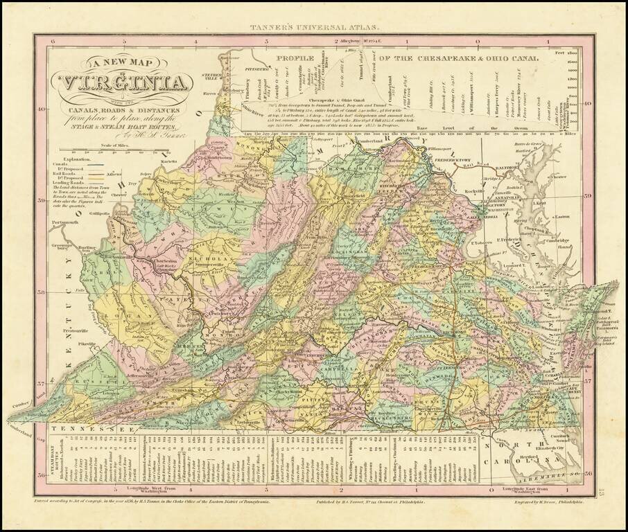
Detailed map of Virginia, from Tanner's Universal Atlas. Detailed and interesting map, hand colored by county and showing towns, rivers, bays, lakes, railroads, roads, distances, etc. Tables of Steam Boat routes and distances. Population Table by...
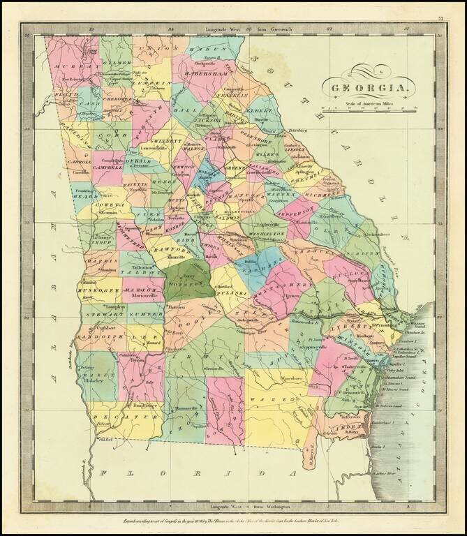
Striking full color example of David Burr's map of Georgia, which first appeared in David Burr's Universal Atlas, in 1836. Burr's Atlas was perhaps the most elegant American commercially published atlas of its time, utilizing wonderful wash colors and...
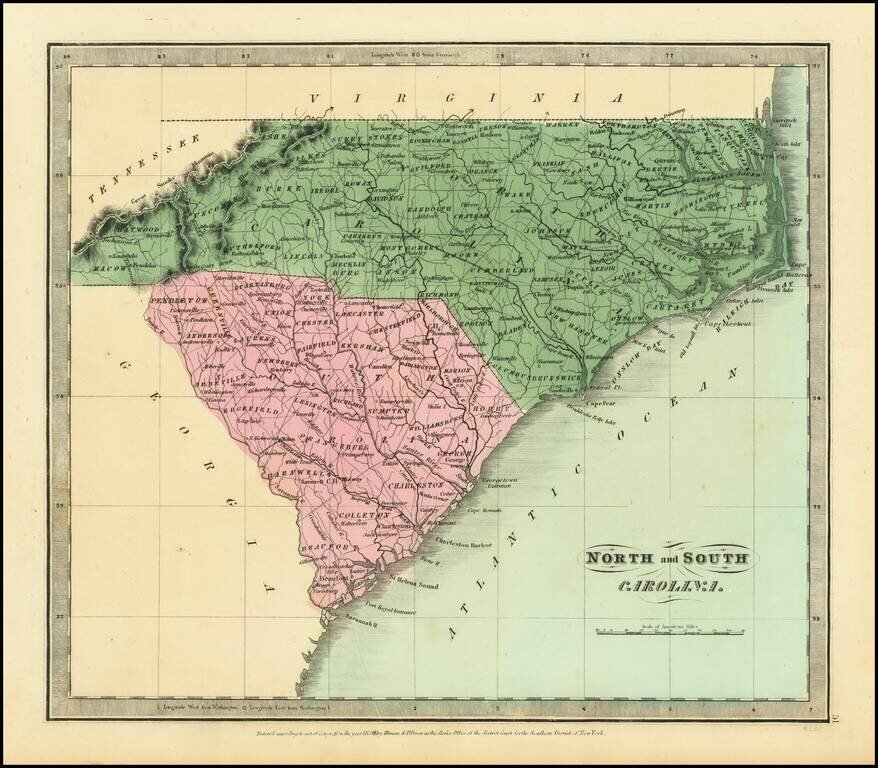
Nice example of the first edition of David Burr's map of the Carolinas, which appeared in his Universal Atlas, first issued in 1836. Shows counties, towns, rivers, roads, courthouses and other details. Burr's Atlas was perhaps the most elegant...
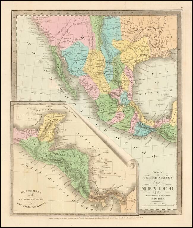
Scarce map of Texas, Upper California, Mexico, etc. from the first edition of David Burr's Universal Atlas. While the map bears the copyright date of 1832, this example is published in 1836. One of the earliest American maps to show Texas in its...