![[Map of the Kingdom of Prussia and the Kingdom of Poland] Карта Королевства Прусского и Царства Польского](/map/small/66819.jpg)
Shows the Free, Independent, and Strictly Neutral City of Cracow with its Territory! Detailed and very rare Russian-language map of Poland, Prussia, and the Free City of Krakow, published in Saint Petersburg in 1836. This map shows Krakow as the Free...
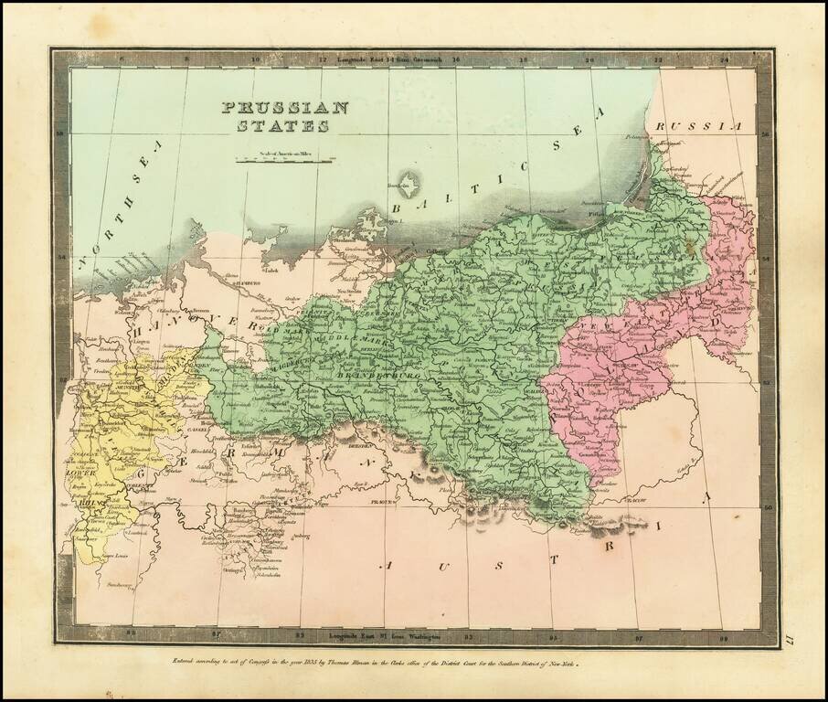
Attractive engraved antique map of Prussia (part of modern-day Poland and Germany), published by David Burr in New York in 1836. The map extends from the Lower Rhine in the west to central Poland in the east. Numerous towns are named, such as Leipzig,...
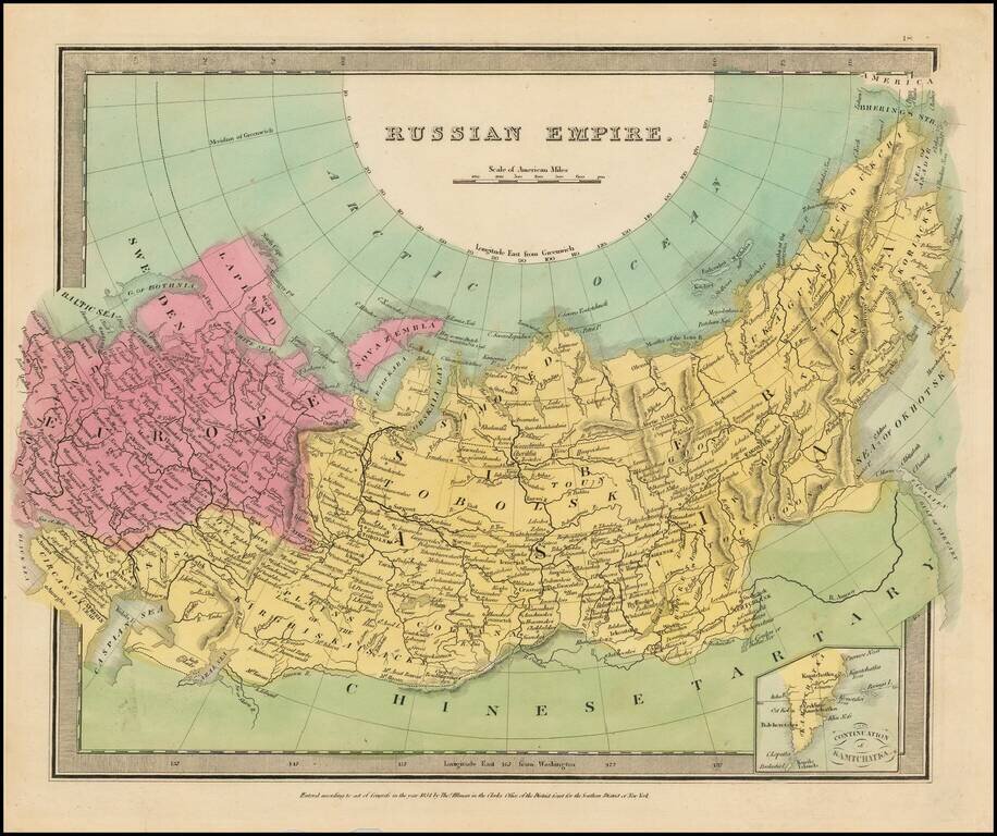
Full color example of the first edition of David Burr's map of the Russian Empire, which appeared in his Universal Atlas, first issued in 1836. Burr's Atlas was perhaps the most elegant American commercially published atlas of its time, utilizing...
![[The European Part of the Russian Empire.] Европейская Часть Россійской Имперіи.](/map/small/66704.jpg)
Detailed and very rare Russian-language map of the European part of Russia, published in Saint Petersburg in 1836. Rarity The map is very scarce. We have been unable to find any other examples in sales databases, libraries and archives, nor in...
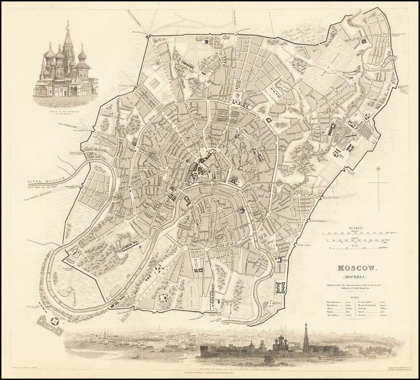
Highly detailed town plan of Moscow, showing streets, buildings, rivers, parks, public squares, a race course, churches, barracks, bridges, and a host of other details. Large vignette of the Church of the Assumption in the Kremlin and a view of the...
![[Map of Italy] Карта Италіи](/map/small/66941.jpg)
Detailed and very rare Russian-language map of Italy, Sicily, Corsica and Sardinia, published in Saint Petersburg in 1836. Rarity The map is very scarce. We have been unable to find any other examples in sales databases, libraries and archives, nor...
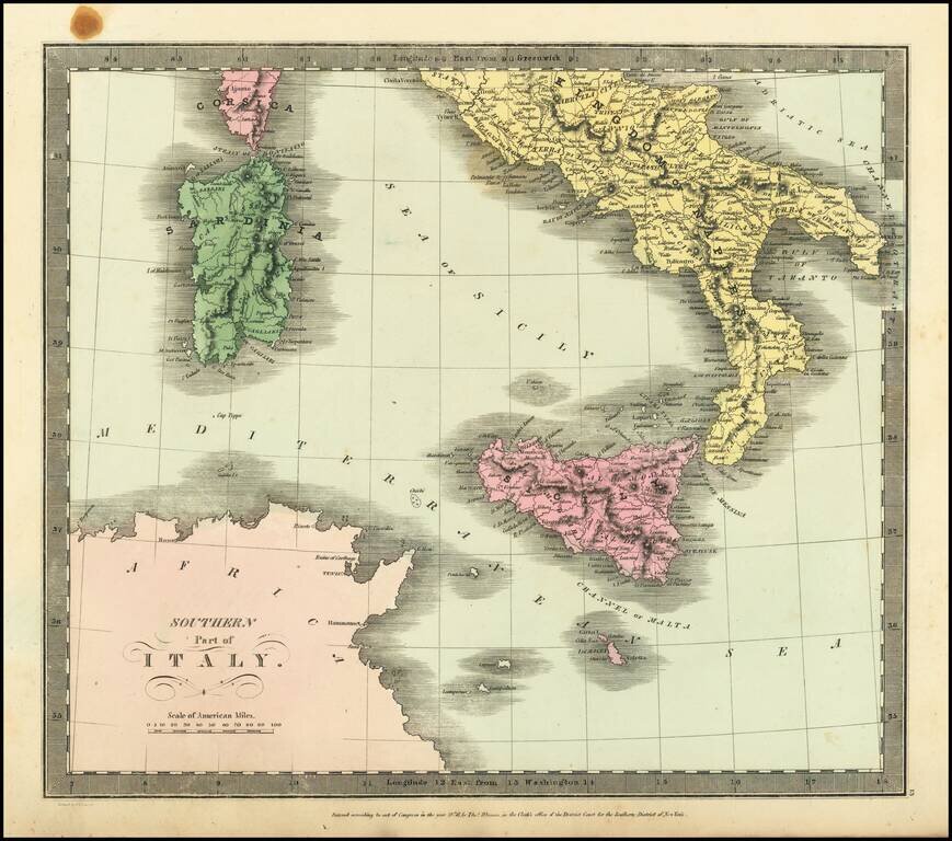
Striking full hand-color engraved map of Italy (with Sicily, Sardinia, Malta and Part of Corsica), which appeared in David Burr's Universal Atlas, in 1836. Burr's Atlas was perhaps the most elegant American commercially published atlas of its time,...
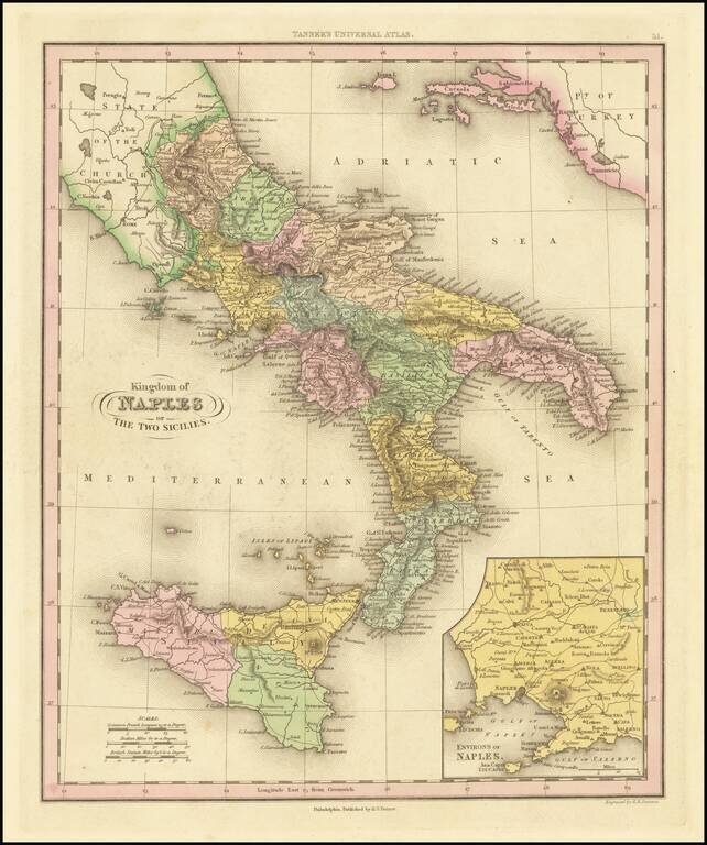
Interesting map of Naples and Sicily, divided into regions. Shows towns, rivers, roads, lakes, mountains, volcanoes, islands, bays, etc. Large inset of the Naples region. This map is from an early edition of Tanner's New Universal Atlas, first issued...
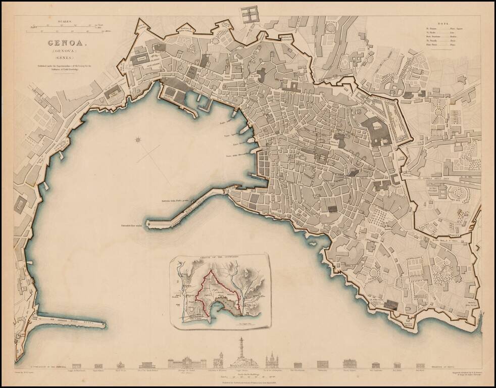
Detailed plan of Genoa, with an inset plan of the Outworks. Includes profiles of 14 prominent buildings. One of the best 19th Century English towns plans to appear in a commercial atlas.
![Азіятская Турція, Персія, Аравія, и Часть Туркестана. [Asian Turkey, Persia, Arabia, and Part of Turkestan.]](/map/small/66732.jpg)
Detailed and very rare Russian-language the Middle East, published in Saint Petersburg in 1836. The map differentiates between Arabia, the Ottoman Empire (and internal regions such as Karamania), Persia, Afghanistan, Baluchistan, etc. Rarity The map...
![Turkey in Asia [Shows Cyprus]](/map/small/67948.jpg)
Detailed map of Asia Minor, Cyprus, Syria, Armenia, Al-Jesira, Irak, Kurdistan and Azerbijan. Shows towns, islands, rivers, mountains, gulfs, bays, etc. Includes Cyprus and a large insets of the Environs of Constantinople. Nice ethnic detail, with...
![[Map of Sweden and Norway] Карта Швеціи и Норвегіи](/map/small/66784.jpg)
Detailed and very rare Russian-language map of Scandinavia, published in Saint Petersburg in 1836. Rarity The map is very scarce. We have been unable to find any other examples in sales databases, libraries and archives, nor in general online...
![[Map of Asia] Карта Азіи](/map/small/66748.jpg)
Detailed and very rare Russian-language Asia, published in Saint Petersburg in 1836. The map is probably most valuable for its mapping of Russia and Central Asia. Elsewhere, particular at the extremities of the map, it is less accurate in interesting...
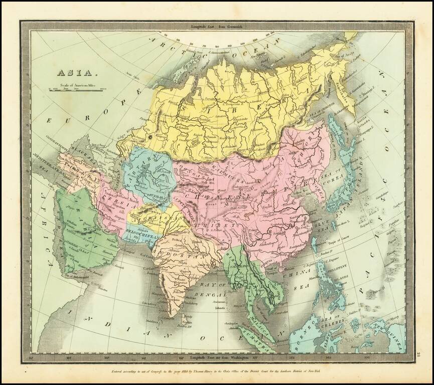
Striking full hand-color example of Burr's map of Asia, which first appeared in David Burr's Universal Atlas, in 1836. Burr's Atlas was perhaps the most elegant American commercially published atlas of its time, utilizing wonderful wash colors and...
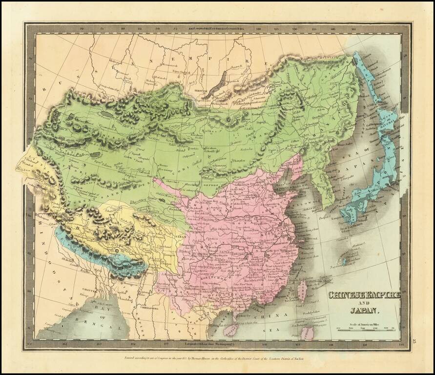
Striking full hand-color example of Burr's map of China, which first appeared in David Burr's Universal Atlas, in 1836. Burr's Atlas was perhaps the most elegant American commercially published atlas of its time, utilizing wonderful wash colors and...
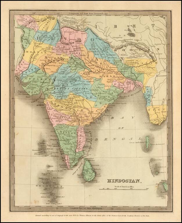
Full color example of the first edition of David Burr's map of India, which appeared in his Universal Atlas, first issued in 1836. Burr's Atlas was perhaps the most elegant American commercially published atlas of its time, utilizing wonderful wash...