Map size in jpg-format: 15.4403MiB
Click to open in high resolution (open in new tab).
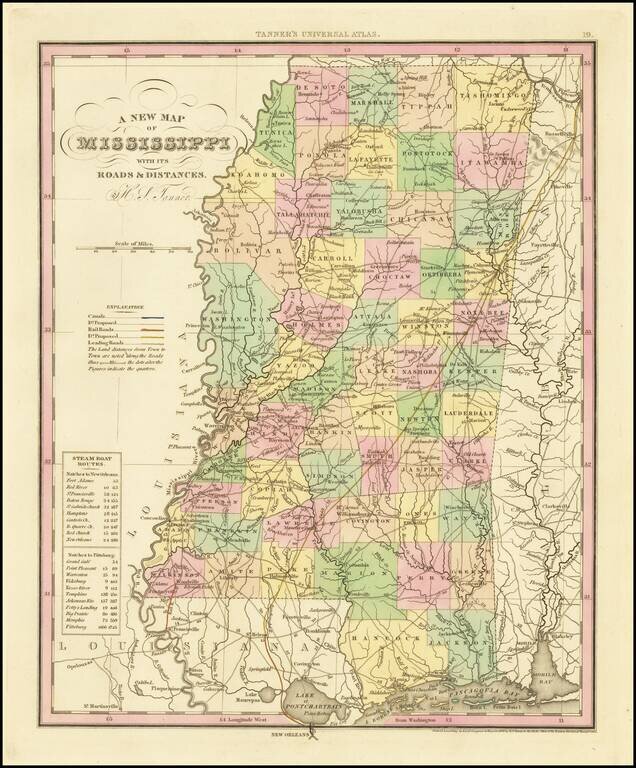
Fine example of Tanner's map of Mississippi, from the first edition of Tanner's Universal Atlas.
This example of the map was first issued in 1836. It is hand colored by counties, and shows towns, roads with distances, railroads, steamship routes, and a host of other details.
One of the best early atlas maps of Mississippi, with still primitive counties in the Northwest.
If you are a student, write to us in telegram: @antiquemaps and indicate what material you need and for what work you need a map in high detail. We are ready to provide material on special terms. For students only!
![The Coast of West Florida and Louisiana . . . [with] The Peninsula and Gulf of Florida or Channel of Bahama with the Bahama Islands . . .](/map/small/38977.jpg)
![The Coast of West Florida and Louisiana . . . [with] The Peninsula and Gulf of Florida or Channel of Bahama with the Bahama Islands . . .](/map/small/66344.jpg)
