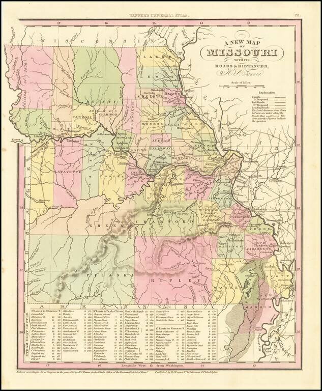
Detailed map of Missouri from Tanner's New Universal Atlas. Hand colored by county and showing towns, rivers, lakes, railroads, roads, etc. Table of Steam Boat routes and distances. Includes a number of ovesized counties, including Barry, Taney,...
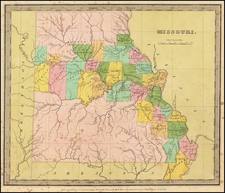
Striking full color example of the first edition of David Burr's map of Missouri, which appeared in his Universal Atlas. Includes fascinating primitive counties, large unnamed counties in the north and south, Bounty Lands above Chariton, etc. The...
The map is quite detailed for its size and includes a fine wash color. Burr's Atlas was perhaps the most elegant American commercially published atlas of its time, utilizing wonderful wash colors and elegant engraving style. Burr studied under Simeon...
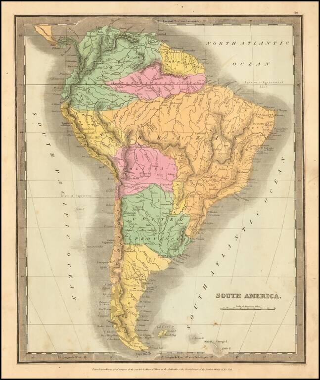
Elegantly colored map of South America, from one of the most interesting early 19th century American map publishers. South America is depicted at the end of its Revolutionary Period, with the Spanish presence now ended. The territorial divisions...
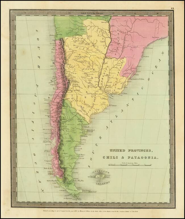
Striking map of the southern portion of South America, colored by provinces.
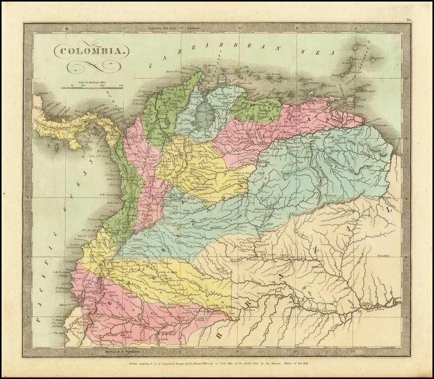
Striking map of Colombia, hand colored by provinces. Includes excellent detail on the River Systems, and shows towns, mountains, lakes, islands, etc. From David Burr's rare Universal Atlas.

Striking full color example of David Burr's map of Peru and Bolivia, which first appeared in David Burr's Universal Atlas, in 1836. Burr's Atlas was perhaps the most elegant American commercially published atlas of its time, utilizing wonderful wash...
![[Peruvian Coast] Sheet XII Peru Cape Lobos to Pescadores Point By Captn. Robert Fitz Roy R.N. The Officers of H.M.S. Beagle 1836](/map/small/58399.jpg)
Detailed chart of a portion of the Coast of Peru, with contemporary annotations showing use at sea in 1872. Includes four profile views. The present chart is based upon surveys on the coast of South America aboard the H.M.S. Beagle in 1836, during...
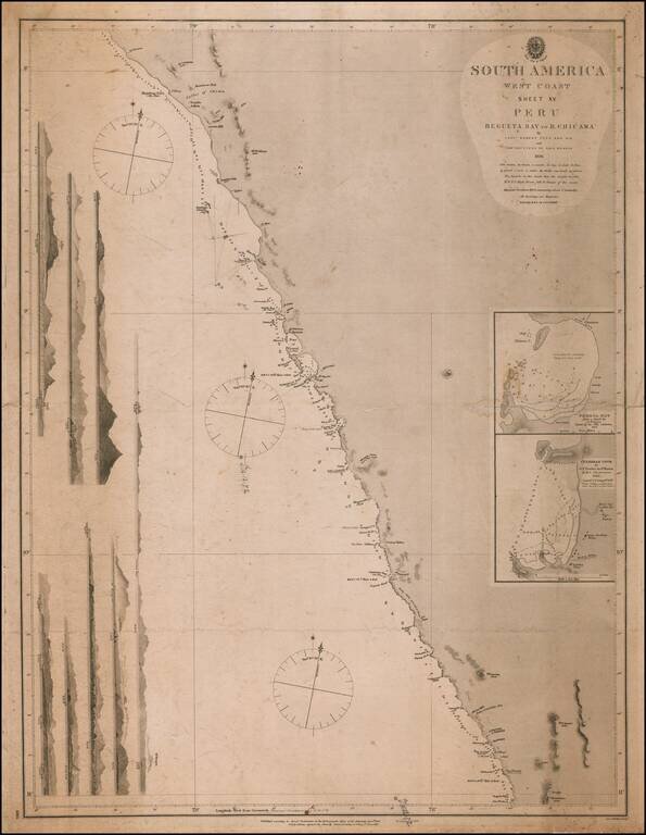
Detailed chart of a portion of the Coast of Peru, with contemporary annotations showing use at sea in 1872. Includes seven profile views. The present chart is based upon surveys on the coast of South America aboard the H.M.S. Beagle in 1836, during...
![[Map of Great Britain and Ireland] Карта Великобританіи и Ирландіи](/map/small/67013.jpg)
Detailed and very rare Russian-language map of England, Wales, Scotland, and Ireland, published in Saint Petersburg in 1836. The map includes an inset of the Channel Islands. Rarity The map is very scarce. We have been unable to find any other...
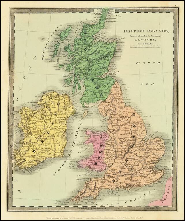
Scarce map of the British Isles, published in New York by David Burr. Burr would go on to become the Topographer of the United States and one of the most important 19th Century American mapmakers.
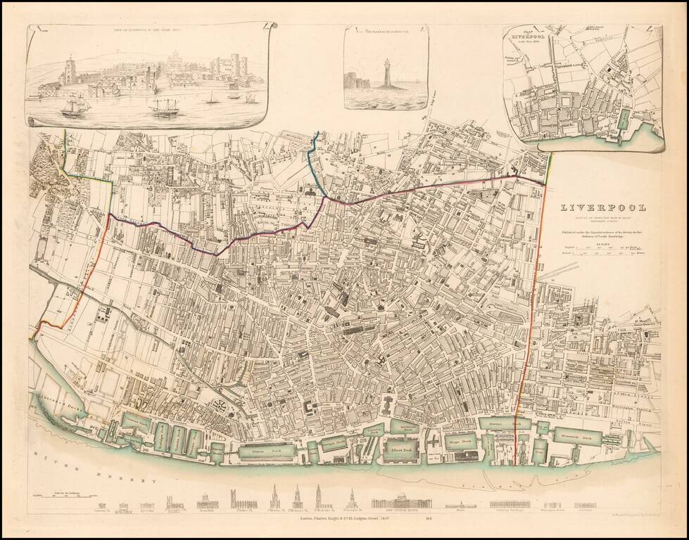
Detailed plan of Liverpool, with inset views from the Harbor and Black Rock Lighthouse, along with a profile showing the 15 major buildings and churches and a small plan of Liverpol in 1729. Marvelous town plan.
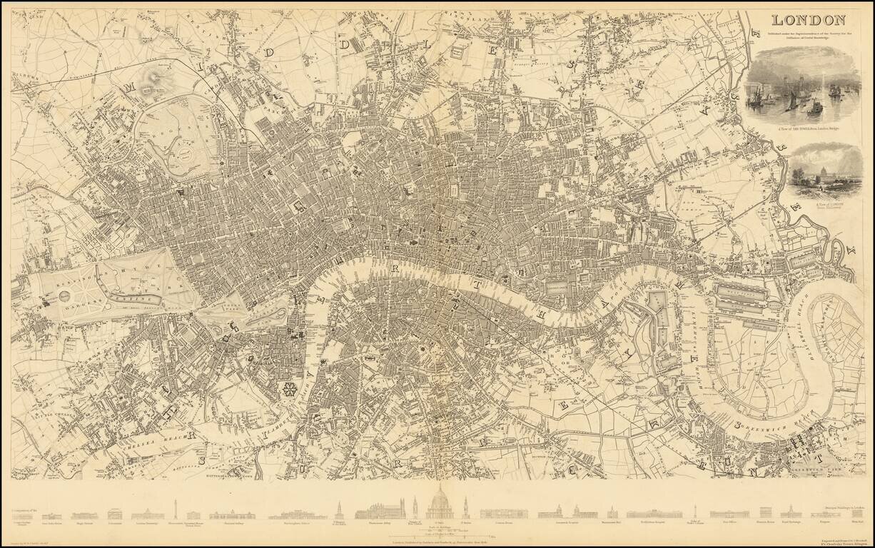
Rare first edition of this detailed map of London, centered on the Thames and extending from Greenwich Reach and Bromley, to Kensington Gardens and St. Marleybone. The first edition can be recognized by the inclusion of 2 vignettes: Tower of London...
![[Map of Switzerland] Карта Швейцаріи](/map/small/66888.jpg)
Detailed and very rare Russian-language map of Switzerland, published in Saint Petersburg in 1836. Rarity The map is very scarce. We have been unable to find any other examples in sales databases, libraries and archives, nor in general online...
![[Map of France] Карта Франціи](/map/small/66907.jpg)
Detailed and very rare Russian-language map of France, published in Saint Petersburg in 1836. Rarity The map is very scarce. We have been unable to find any other examples in sales databases, libraries and archives, nor in general online searches....