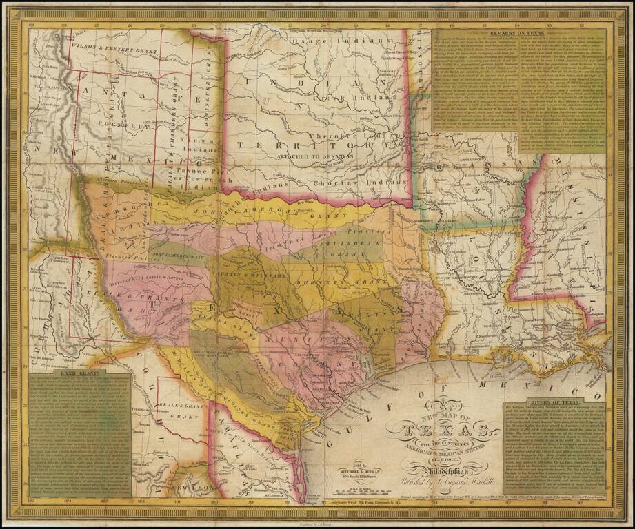
A fine example of Young & Mitchell's map, one of the truly great early maps of Texas, published in 1836, the year that Texas became the independent 'Lone Star Republic'. Young & Mitchell's A New Map of Texas, especially in the present first...
![Mexico & Guatemala [Showing pre-Republic of Texas (Coahuila and Texas)]](/map/small/71256.jpg)
Detailed map of Mexico and the Southwest, featuring Texas and Coahuila, on the eve of Texas Independence. The Austins Colony appears prominently in Texas, along with Austin's Grant, Washington, Houston, Goliad and a number of other early settlements....
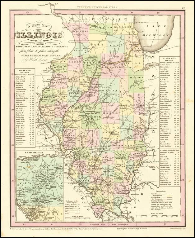
Marvelous example of Tanner's map of Illinois, hand colored by counties. Shows canals, railroads, towns, roads, distances, and tables with steam boat routes and distances. The county configuations are largely complete. Inset of the Lead Region of...
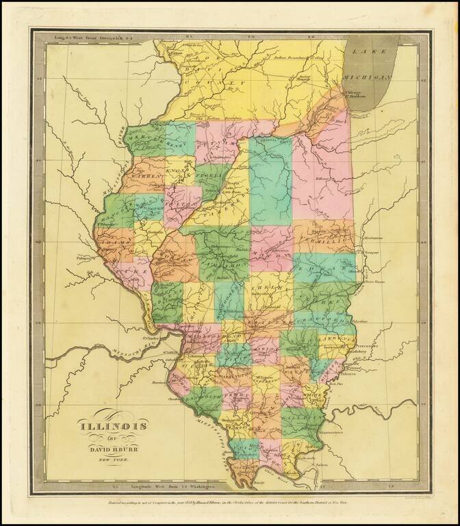
Striking full color example of the first edition of David Burr's map of Illinois, which appeared in his Universal Atlas, first issued in 1836. Includes fascinating primitive counties, including an odd Joe Davis County at the top and a number of...
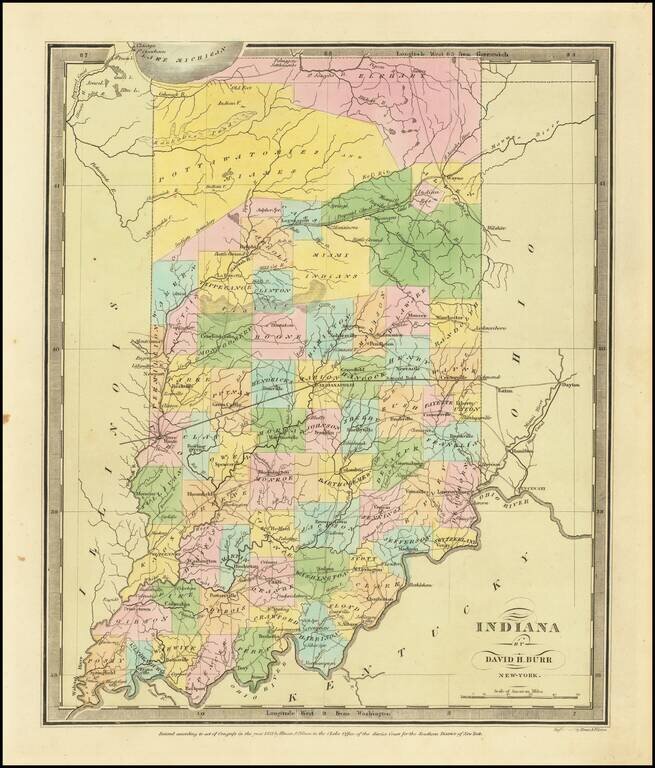
Full color example of the first edition David Burr's map of Indiana, which appeared in his Universal Atlas, first issued in 1836. Includes fascinating primitive counties, including massive regions designated for the Pottawatomies and Miamis Indians,...
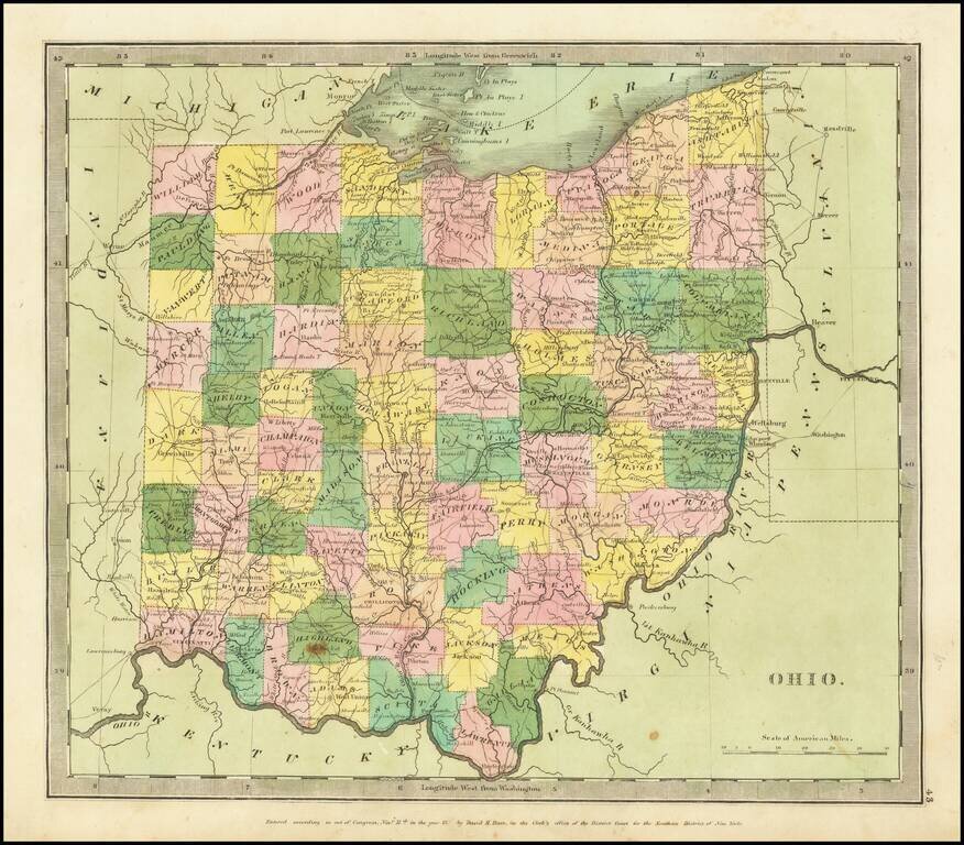
Full color example of the first edition David Burr's map of Ohio, which appeared in his Universal Atlas, first issued in 1836. Burr's Atlas was perhaps the most elegant American commercially published atlas of its time, utilizing wonderful wash colors...
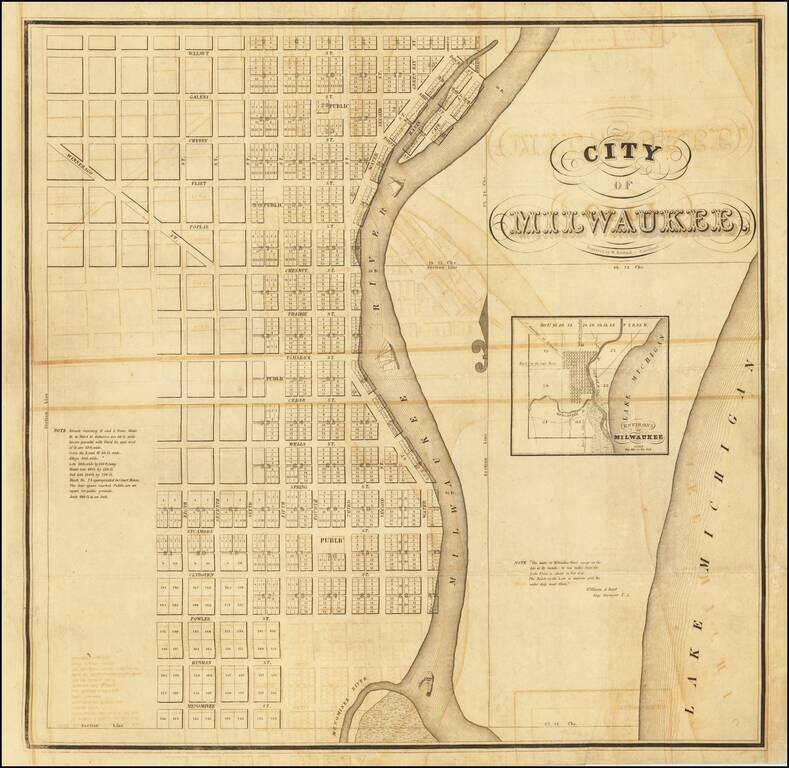
The Exceptionally Rare First Printed Map of Milwaukee, Wisconsin. Unseen on the Market Since 1934. An important American map, being the first printed map of Milwaukee, Wisconsin, executed by Increase Lapham and Byron Kilbourn in 1835-36, and engraved...
![[Western Territory]](/map/small/68666.jpg)
Antique Map of the Plains and Indian Territory, Extending the Rocky Mountains Rare and important map from the 1835 Dodge-Kingsbury expedition (only 500 copies printed). The map identifies place names as far west as Santa Fe New Mexico, Pike's Peak...
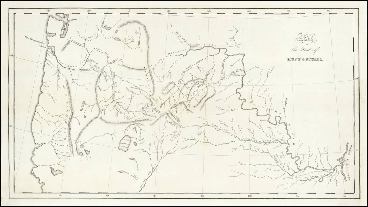
St. Louis to Astoria, Oregon in the 1810s—the Hunt and Stuart Expeditions Intriguing early map of the routes of Hunt and Stuart, two of the earliest American overland travelers, immediately following Lewis and Clark. The map illustrates Wilson...
![[Pacific Whaling] A New Chart of The Pacific Ocean, Exhibiting The Western Coast of America from Cape Horn to Beerings Strait, The Eastern Shores of Asia Including Japan, China . . . according the most Modern Surveys . . . Additions to 1836 (Large Insets](/map/small/56007.jpg)
With Manuscript Tracks Showing the Course of An American Whaler in the Pacific. Fine example of Norie's monumental sea chart of the Pacific Ocean. The chart is noteworthy for the large insets maps of San Francisco, San Diego, Hawaii, Honolulu and...
![[Map of Russian Possessions in North America] Карта Российскаго Владѣнія въ Сѣверной Америкѣ](/map/small/66569.jpg)
Extremely Rare Russian-Language Map of Russian America (Alaska). Detailed engraved map of Alaska, labeled "Russian Possessions", published in Saint Petersburg in 1836. This is one of very few contemporary Russian maps to focus specifically on Russian...
![[Russian Territory In California] Carte Generale de l'Amerique Septentrionale, et des Iles qui en Dependent . . . 1836](/map/small/65208.jpg)
Blue Dot For Fort Ross, California -- Part of Russian Territory Nice example of Brue's map of North America, published in Paris in 1836 Excellent map of North America and the West Indies. Beautifully engraved on fine heavy paper with the embossed...
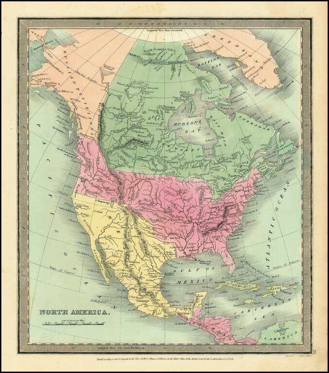
Attractive example of David Burr's scarce map of North America, from his rare Universal Atlas. The cartography of the Northwest and Upper Missouri regions are dominated by information from Lewis & Clark. The map includes a 54-40 or fight...
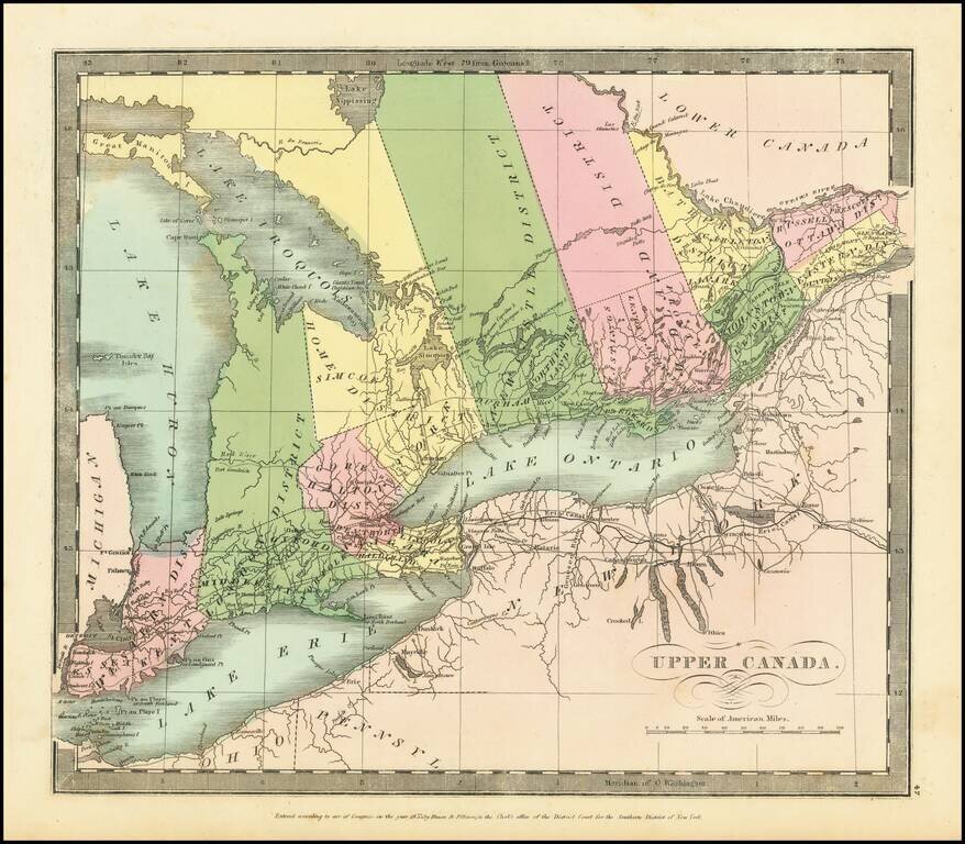
Interesting map of Upper Canada by David Burr, from his New Universal Atlas. Names Toronto on Lake Ontario, and, in the far west, Detroit. The internal districts are named and colored individually.
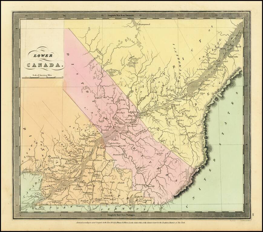
Interesting map of Lower Canada by David Burr, from his New Universal Atlas. The map is centered on the St. Lawrence River. The internal districts are named and colored individually.
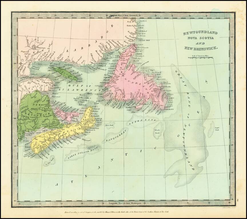
Detailed map of Northeastern Canada, published by David Burr.