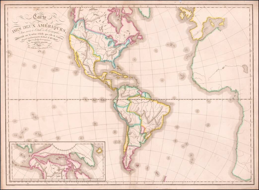
A Fascinating Cartographic Teaching Tool with a Curious Northwest Passage Large format map of America, intended as a teaching tool. While the map is large, the geographical features are devoid of names and it was likely the purpose of the author to...

Nice wash color example of Africa, colored by regions and kingdoms. The map still includes the fantastical Mountains of the Moon and Mountains of Kong.
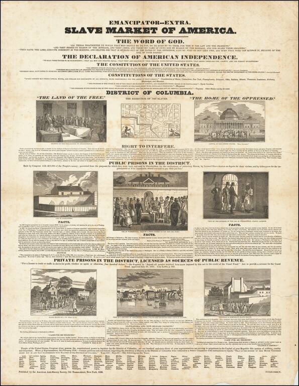
Rare Anti-Slavery broadside protesting the US House of Representatives vote for the so-called "gag bill". Published by the American Anti-Slavery Society, the broadside was a response to legislation passed by the House preventing even the discussion of...
![[Map of the Five Parts of the World Accroding to Mercator's Projection] Карта Пяти Частей Свѣта по Проекціи Меркатора](/map/small/66676.jpg)
Detailed and very rare Russian-language the World, published in Saint Petersburg in 1836. Labels Alaska as Russian Possessions, etc. Rarity The map is very scarce. We have been unable to find any other examples in sales databases, libraries and...
![[Image of the Globe] Изображеніе Земнаго Шара](/map/small/66770.jpg)
Detailed and very rare Russian-language map of the World, published in Saint Petersburg in 1836. The map is projected with the Pacific ocean at the center. Antarctica, which shows the first hints of discovery is labeled "Southern Ice Sheet Ocean"....
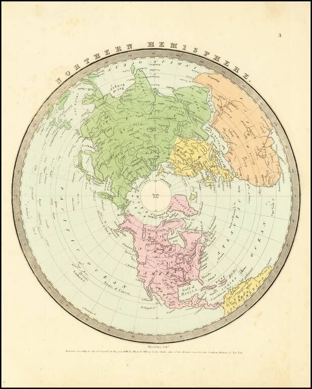
Interesting map of the Northern Hemisphere by David Burr, one of 4 hemispheric map projections in his New Universal Atlas. The map provides a nice depiction of the known extent of the North Polar regions and the coastlines of Northwestern America and...
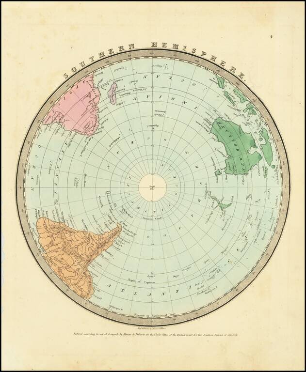
Interesting map of the Southern Hemisphere by David Burr, one of 4 hemispheric map projections in his New Universal Atlas. The map provides a nice depiction of the known extent of the South Polar regions.
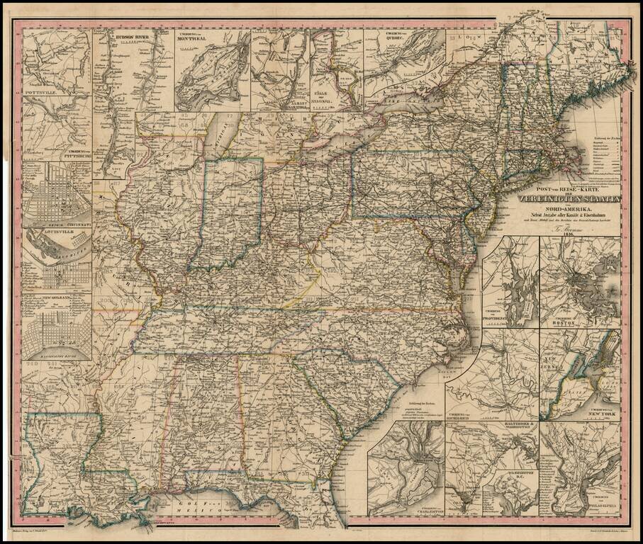
A very early example of one of Traugott Bromme's travel maps of the US. Early map and scarce U.S.-published item from the most prolific German travel writer on America. The inclusion of railroads, postal routes and canals makes the map of particular...
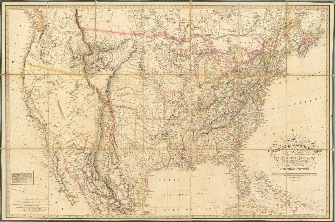
Rare 1836 edition of Laurie's Fredonia, which has been substantially updated in Texas and the West. First issued in 1830, the map faithfully incorporates information from all important early explorations, including Lewis & Clark, Stephen Long, and...
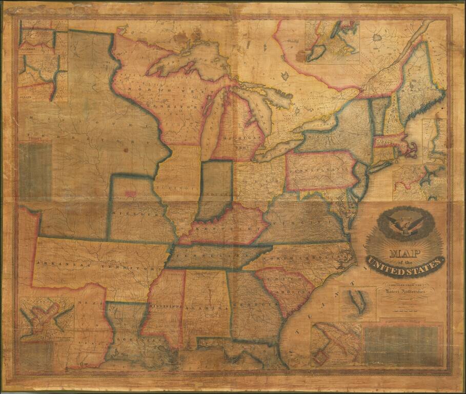
Very rare map of the United States by Vermont mapmaker Lewis Robinson. Historically important wall map of the United States and a portion of the Republic of Texas, extending from Texas and the Missouri Territory to the East Coast, including parts of...
Burr's atlas was perhaps the most elegant American commercially published atlas of its time, utilizing wonderful wash colors and elegant engraving style. Burr studied under Simeon DeWitt in New York. His first atlas was an Atlas of New York State, the...
![Maine [showing disputed boundaries as claimed by US, New Brunswick and as settled by the King of the Netherlands]](/map/small/70387.jpg)
Elegant map of Maine by David Burr, one of the most important cartographic publishers of the early 19th Century. The map is highly detailed, showing towns, roads, rivers, lakes, mountains, and a host of other details. The map locates the disputed...
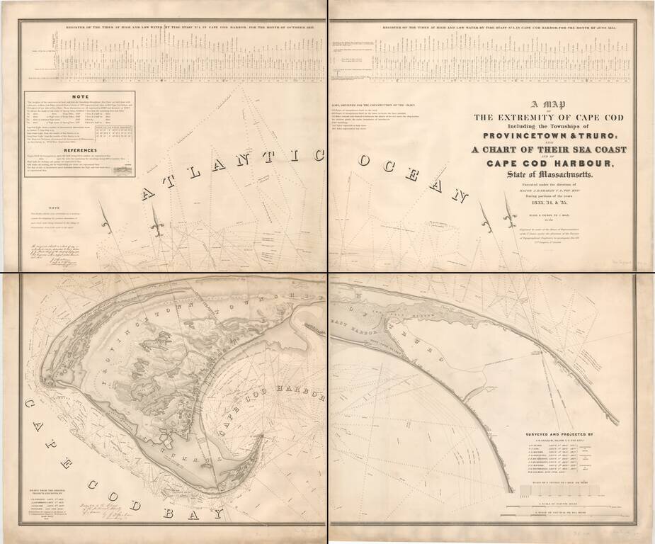
A remarkably detailed chart of the waters around Truro and Provincetown, by one of America's great topographical engineers of the 19th century. This mammoth chart is based on extensive surveys conducted by the Topographical Engineers in 1833-35, "to...
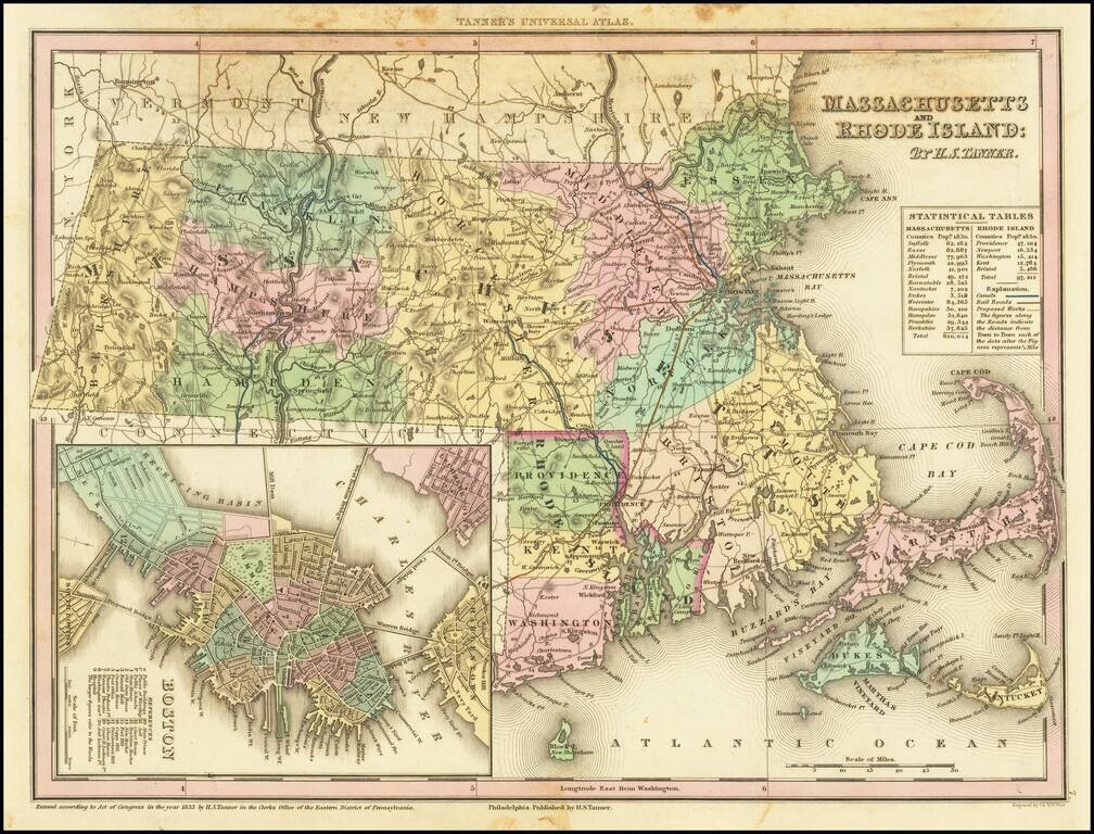
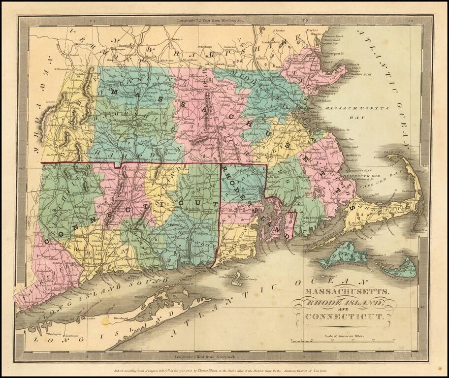
Nice example of Massachusetts and Rhode Island from Tanner's New Universal Atlas. This map is hand colored by county and contains great detail, including, waterways, travel routes, and rail lines. A statistical inset provides population by county....
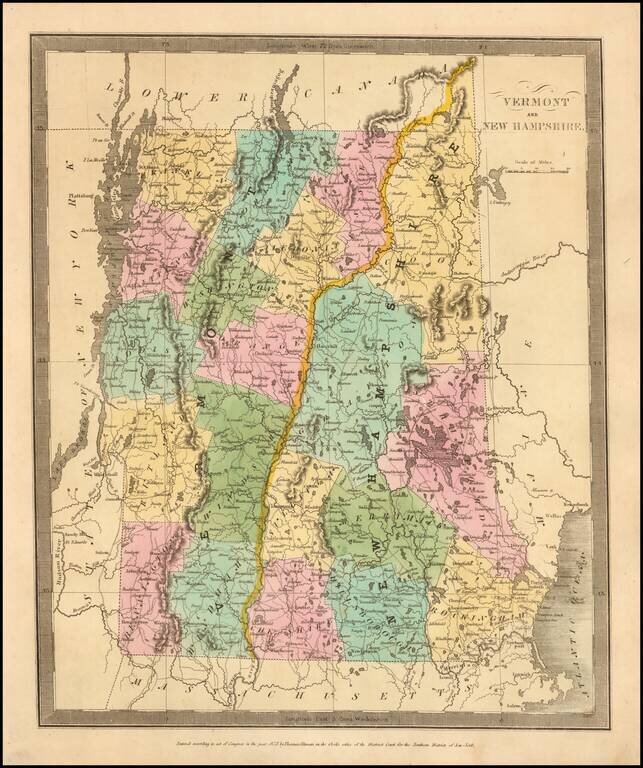
Nice wash color example of David Burr's map of Vermont & New Hampshire, hand colored by counties.
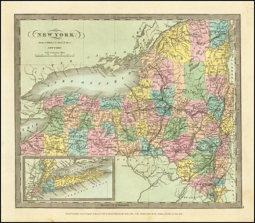
Striking full hand-color example of the first edition David Burr's map of New York, which appeared in his Universal Atlas, first issued in 1836. A highly detailed map, owing undoubtedly to Burr's prior New York Atlas and separate county pocket maps,...