Map size in jpg-format: 19.298MiB
Click to open in high resolution (open in new tab).
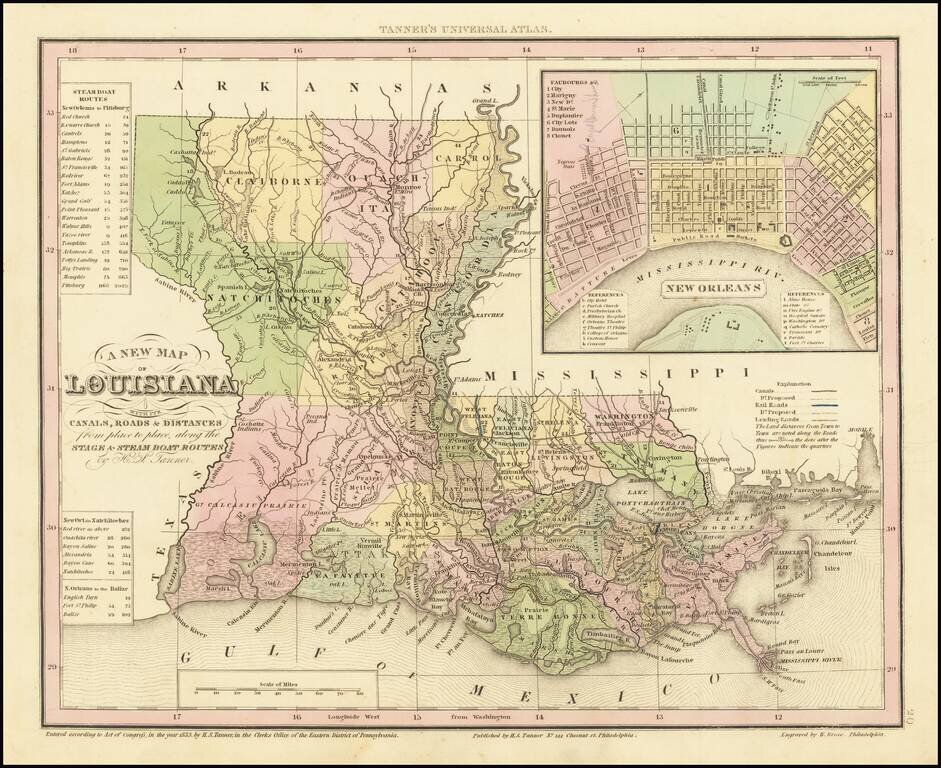
Gorgeous example of Tanner's map of Louisiana, with a large inset map of New Orleans.
The map is hand colored by county and shows towns, rivers, canals, roads, railroads etc. A key lists steamship routes and distances.
Tanner's maps are now quite scarce.
If you are a student, write to us in telegram: @antiquemaps and indicate what material you need and for what work you need a map in high detail. We are ready to provide material on special terms. For students only!
![The Coast of West Florida and Louisiana . . . [with] The Peninsula and Gulf of Florida or Channel of Bahama with the Bahama Islands . . .](/map/small/66344.jpg)