Map size in jpg-format: 778954B
Columbia or River of the West!
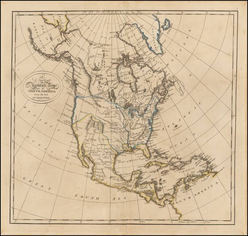
Fine example of Matthew Carey's map of North America, from his General Atlas.
The map includes nice pre-Lewis & Clark information in the Transmississippi West. The "Columbia or River of the West" flows to the R. Oregan, a vestage from the first half of the 18th century, with a short portage over to a tributary of the Upper Mississippi River. A wide open, convenient passage through the Rocky Mountains accommodates this unusual feature.
Apacheria is shown, along with the Pimas, Yuma and other Indian tribes. On the west coast, most of the major California harbors are shown, including San Pedro.
The Rocky Mountains are still largely unknown south of the Canadian border. A number of Indian tribes are located. The northwest coast reflects the recent discoveries of Vancouver and La Perouse.
Decorative swash letter title. Illustrates the still naïve engraving style of American mapmakers in the early 19th century. One of the most interesting atlas maps of North America from this period.
If you are a student, write to us in telegram: @antiquemaps and indicate what material you need and for what work you need a map in high detail. We are ready to provide material on special terms. For students only!


![[Signed Political Satire Artwork] Vietnam ... Vietnam ... Vietnam ...](/map/small/68726.jpg)