Map size in jpg-format: 22.1735MiB
Click to open in high resolution (open in new tab).
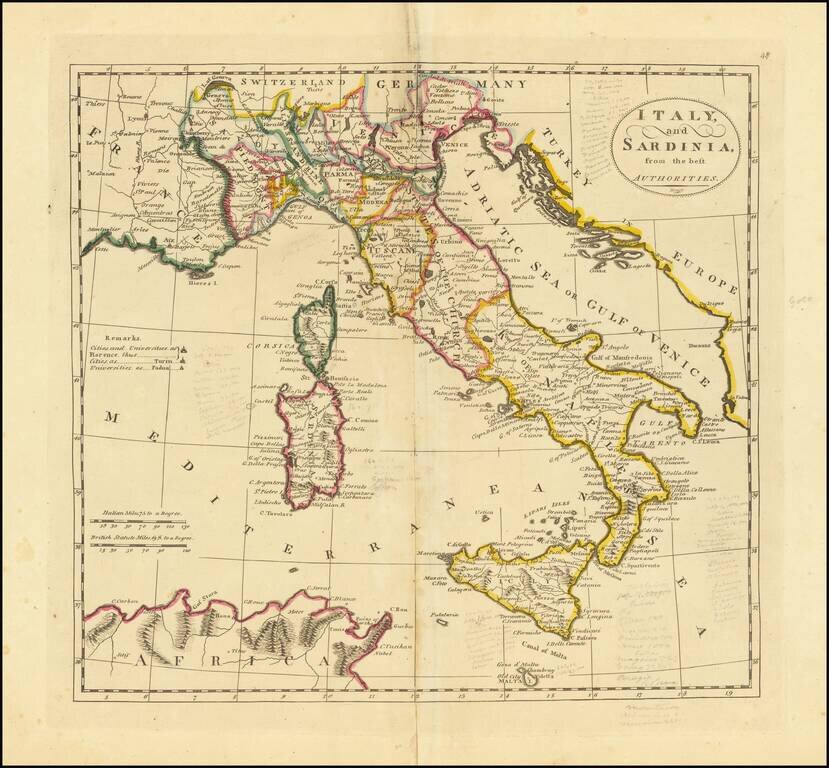
Interesting map of Italy, Sicily, Corsica and Sardinia, from the 1814 edition of Matthew Carey's General Atlas.
If you are a student, write to us in telegram: @antiquemaps and indicate what material you need and for what work you need a map in high detail. We are ready to provide material on special terms. For students only!


