
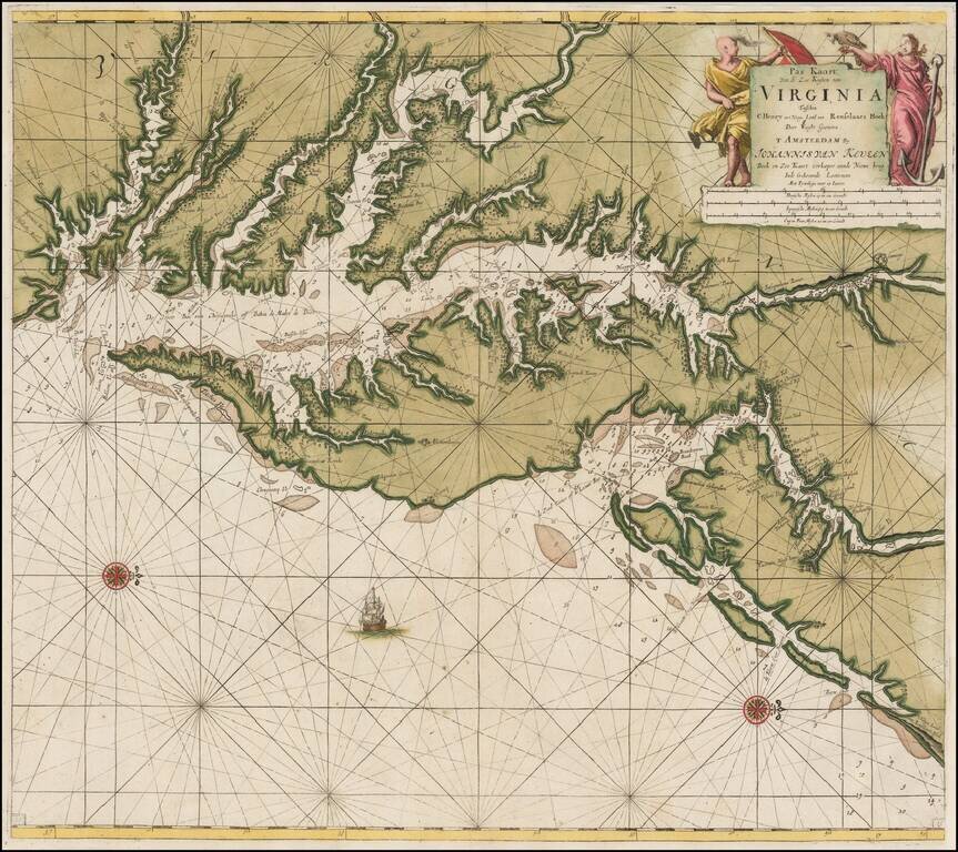
Antique Sea Chart of the Chesapeake Region Published By The Leading Chartmaker of the Dutch East India Company Attractive and highly detailed map of the Chesapeake region, extending south to Cape Henry and north to southern New Jersey and the...
![d'Engelze Volkplanting in Virginie door Iohan Smith Bezogt en verder uytgeset [John Smith Map of Virginia, Maryland, Pennsylvania, New Jersey, etc.]](/map/small/61141.jpg)
Scarce map of the region from the Chesapeake to Long Island, intended to illustrate the Dutch Translation of Smith's Account of Virginia. The map is loosely based upon John Smith's map, extending from the Chesapeake to Long Island, and including a...

John Senex's edition of the Augustine Hermann Map of the Chesapeake. An antique map of the Chesapeake Bay from John Senex's edition of Christopher Browne's seminal map. Includes the Delaware Bay, Maryland and parts of Pennsylvania and New Jersey,...
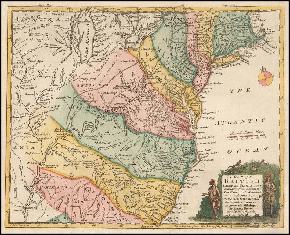
Nice example of this early map of the British Colonies, issued one year prior to the seminal map of John Mitchell. The map is based largely upon the work of D'Anville. The map is quite remarkable for the time period, showing several early Western...

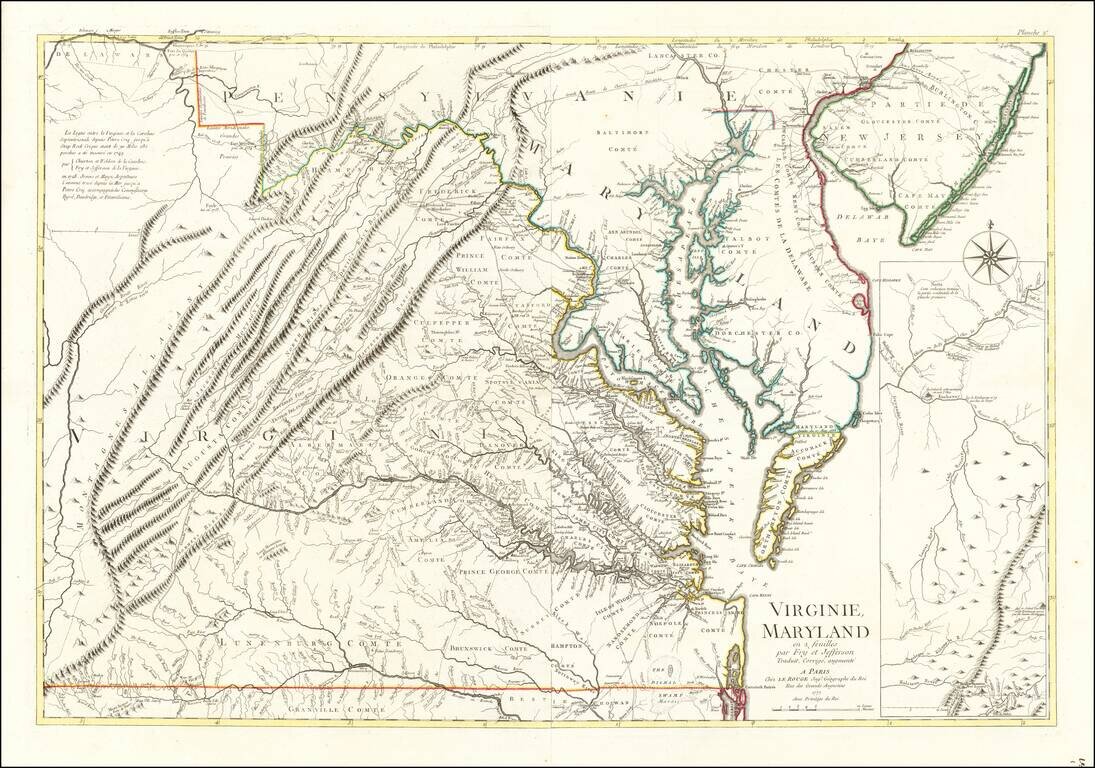
The Survey of the Mason Dixon Line. Detailed regional map of the Chesapeake and contiguous parts of Maryland, Virginia, Delaware, New Jersey and Pennsylvania, showing the results of Mason & Dixon's survey of the boundaries between Pennsylvania...

A nice example of the 1775 edition of Fry & Jefferson's map of Virginia and Maryland, widely regarded as the most important and influential 18th century map of Virginia and Maryland. Originally prepared by Joshua Fry of William & Mary and...
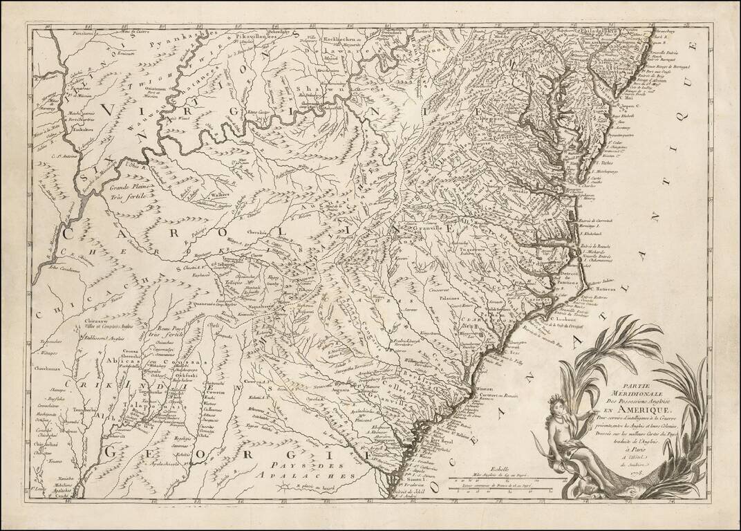
Rare Revolutionary War period map of Virginia & Maryland, published by Le Rouge. Le Rouge's 2 sheet edition is based upon the Fry Jefferson map, but covers only Virginia, Maryland & Delaware, plus the southern portions of New Jersey and...
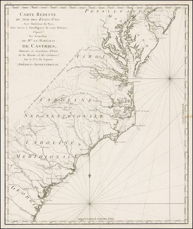
One of the Earliest Regional Maps of The Southern Theater of War Published in Paris. Rare separately published map of the Southern British Colonies, shown at a time when the French were just beginning to actively join the American Rebel cause in...
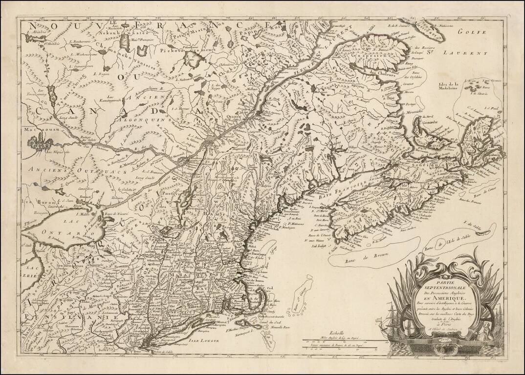
One of the Earliest Regional Maps of The Northern Theater of the Revolutionary War Published in Paris. Rare separately published map of the Northern British Colonies, shown at a time when the French were just beginning to actively join the American...

A Legendary American Rarity: The First State of the Churchman Map of the Chesapeake, One of the Only Maps Published in America During the Revolution. Rare, separately-issued American map of the Delmarva Peninsula, Chesapeake Bay, and Delaware Bay,...
![Observations sur la Virginie [with the map:] A Map of the country between Albermarle Sound, and Lake Erie, comprehending the whole of Virginia, Maryland, Delaware, and Pensylvania, with parts of several other of the United States of America. Engraved for](/map/small/51828.jpg)
First Published Edition of Jefferson's Notes on Virginia, with the Only Map Attributed to Thomas Jefferson. Engraved folding map, folding table. [4], viii, 190, [6], 197-387, 288-290, [5, errata] pages of French text (i.e., complete). 8vo, 8 x 4.75...
Scarce Revolutionary War period of the Southeastern United States, from Le Boucher's Histoire de la Derniere Guerre, entre La Grande-Bretagne, et les Etas-Unis de l'Amerique, published in Paris in 1787. The map provides a nice treatment of the region...
![Notes on the State of Virginia [with the map:] A Map of the country between Albemarle Sound, and Lake Erie, comprehending the whole of Virginia, Maryland, Delaware, and Pensylvania, with parts of several other of the United States of America. Engraved for](/map/small/55181.jpg)
Engraved folding map, folding table. Title, advertisement and contents leaf, 382 pages of English text (i.e., complete). 8vo, 8 x 4.75 inches, contemporary calf, rebacked to style. First English Edition of Jefferson's Notes on Virginia, with the Only...

Thomas Jefferson's Map of Virginia Thomas Jefferson's rare and important map of the Mid Atlantic region, engraved from a manuscript draft drawn by Jefferson in 1786, while serving as a United States Minister in Paris. The map was prepared to...

Nice example of the single sheet version of the seminal Fry-Jefferson map of Virginia and Maryland, engraved by Elisabeth Haussard and published in Paris by Robert De Vaugondy for the Atlas Universel. A well executed reduction of Joshua Fry and Peter...
![A Map of the most Inhabited part of Virginia containing the whole Province of Maryland . . . Drawn by Joshua Fry & Peter Jefferson in 1775 [Extremely Rare Final State]](/map/small/44778.jpg)
The Rarest Fry-Jefferson -- Recorded by Malone in only 2 surviving examples. Extremely rare example of the final state of the Fry & Jefferson's map of Virginia and Maryland, widely regarded as the most important and influential 18th century map...